
2018 EPAC Season
Moderator: S2k Moderators
Forum rules

The posts in this forum are NOT official forecasts and should not be used as such. They are just the opinion of the poster and may or may not be backed by sound meteorological data. They are NOT endorsed by any professional institution or STORM2K. For official information, please refer to products from the National Hurricane Center and National Weather Service.
-
cycloneye

- Admin

- Posts: 149508
- Age: 69
- Joined: Thu Oct 10, 2002 10:54 am
- Location: San Juan, Puerto Rico
Re: 2018 EPAC Season
18z GFS has the second system tracking to Oaxaca,Mexico as a hurricane.
0 likes
Visit the Caribbean-Central America Weather Thread where you can find at first post web cams,radars
and observations from Caribbean basin members Click Here
and observations from Caribbean basin members Click Here
-
cycloneye
- Admin
- Posts: 149508
- Age: 69
- Joined: Thu Oct 10, 2002 10:54 am
- Location: San Juan, Puerto Rico
Re: 2018 EPAC Season: 5 PM PDT TWO: 40%-90%
40%-90%
Tropical Weather Outlook
NWS National Hurricane Center Miami FL
500 PM PDT Sun Jun 3 2018
For the eastern North Pacific...east of 140 degrees west longitude:
Widespread but disorganized showers and thunderstorms are associated
with a trough of low pressure located a few hundred miles south of
the southern coast of Mexico. Environmental conditions are
expected to be conducive for development of this system, and a
tropical depression is expected to form in the next few days while
it moves slowly west-northwestward.
* Formation chance through 48 hours...medium...40 percent.
* Formation chance through 5 days...high...90 percent.
$$
Forecaster Landsea
1 likes
Visit the Caribbean-Central America Weather Thread where you can find at first post web cams,radars
and observations from Caribbean basin members Click Here
and observations from Caribbean basin members Click Here
-
galaxy401

- Category 5

- Posts: 2446
- Age: 30
- Joined: Sat Aug 25, 2012 9:04 pm
- Location: Casa Grande, Arizona
Re: 2018 EPAC Season
Surprised it's not an Invest yet.
0 likes
Got my eyes on moving right into Hurricane Alley: Florida.
-
cycloneye
- Admin
- Posts: 149508
- Age: 69
- Joined: Thu Oct 10, 2002 10:54 am
- Location: San Juan, Puerto Rico
Re: 2018 EPAC Season
galaxy401 wrote:Surprised it's not an Invest yet.
I guess they have not pinpointed a low pressure to begin the best track.
0 likes
Visit the Caribbean-Central America Weather Thread where you can find at first post web cams,radars
and observations from Caribbean basin members Click Here
and observations from Caribbean basin members Click Here
-
Yellow Evan

- Professional-Met

- Posts: 16240
- Age: 27
- Joined: Fri Jul 15, 2011 12:48 pm
- Location: Henderson, Nevada/Honolulu, HI
- Contact:

-
cycloneye
- Admin
- Posts: 149508
- Age: 69
- Joined: Thu Oct 10, 2002 10:54 am
- Location: San Juan, Puerto Rico
Re: 2018 EPAC Season
GFS with a new run is stronger.At 00z has a Cat 4.

1 likes
Visit the Caribbean-Central America Weather Thread where you can find at first post web cams,radars
and observations from Caribbean basin members Click Here
and observations from Caribbean basin members Click Here
-
Kingarabian

- S2K Supporter

- Posts: 16366
- Joined: Sat Aug 08, 2009 3:06 am
- Location: Honolulu, Hawaii
Re: 2018 EPAC Season
922mb on the high resolution GFS. Hopefully there are no troughs to pick it up as the GFS keeps it a cat 4 close to Baja California.
1 likes
RIP Kobe Bryant
-
cycloneye
- Admin
- Posts: 149508
- Age: 69
- Joined: Thu Oct 10, 2002 10:54 am
- Location: San Juan, Puerto Rico
Re: 2018 EPAC Season
Kingarabian wrote:922mb on the high resolution GFS. Hopefully there are no troughs to pick it up as the GFS keeps it a cat 4 close to Baja California.
Moves over Socorro Island.
0 likes
Visit the Caribbean-Central America Weather Thread where you can find at first post web cams,radars
and observations from Caribbean basin members Click Here
and observations from Caribbean basin members Click Here
-
hurricanes1234
- Category 5
- Posts: 2908
- Joined: Sat Jul 28, 2012 6:19 pm
- Location: Trinidad and Tobago
Re: 2018 EPAC Season
Update out very early ... increased to 60%/90%.
1. A trough of low pressure located a few hundred miles south of the southern coast of Mexico continues to produce a large area of disorganized cloudiness and showers. Environmental conditions are expected to be conducive for development of this system, and a tropical depression is likely to form within the next two to three days while it moves slowly west-northwestward. * Formation chance through 48 hours...medium...60 percent. * Formation chance through 5 days...high...90 percent.
1 likes
PLEASE NOTE: With the exception of information from weather agencies that I may copy and paste here, my posts will NEVER be official, since I am NOT a meteorologist. They are solely my amateur opinion, and may or may not be accurate. Therefore, please DO NOT use them as official details, particularly when making important decisions. Thank you.
-
Yellow Evan
- Professional-Met
- Posts: 16240
- Age: 27
- Joined: Fri Jul 15, 2011 12:48 pm
- Location: Henderson, Nevada/Honolulu, HI
- Contact:
Re: 2018 EPAC Season
Kingarabian wrote:922mb on the high resolution GFS. Hopefully there are no troughs to pick it up as the GFS keeps it a cat 4 close to Baja California.
SST's aren't anywhere near warm enough to support a hurricane up there anyhow quite yet.
0 likes
-
cycloneye
- Admin
- Posts: 149508
- Age: 69
- Joined: Thu Oct 10, 2002 10:54 am
- Location: San Juan, Puerto Rico
Re: 2018 EPAC Season
06z GFS has the first system up to cat 4 and as it weakens,it moves to Baja California while the second system makes landfall near Acapulco as a Hurricane.
0 likes
Visit the Caribbean-Central America Weather Thread where you can find at first post web cams,radars
and observations from Caribbean basin members Click Here
and observations from Caribbean basin members Click Here
-
cycloneye
- Admin
- Posts: 149508
- Age: 69
- Joined: Thu Oct 10, 2002 10:54 am
- Location: San Juan, Puerto Rico
Re: 2018 EPAC Season
Tropical Weather Outlook
NWS National Hurricane Center Miami FL
500 AM PDT Mon Jun 4 2018
For the eastern North Pacific...east of 140 degrees west longitude:
A trough of low pressure located about 500 hundred miles south of
the southern coast of Mexico continues to produce a large area of
disorganized cloudiness and showers. Environmental conditions are
conducive for development of this system, and a tropical depression
is likely to form within the next two to three days while it moves
slowly west-northwestward.
* Formation chance through 48 hours...medium...60 percent.
* Formation chance through 5 days...high...90 percent.
$$
Forecaster Cangialosi
0 likes
Visit the Caribbean-Central America Weather Thread where you can find at first post web cams,radars
and observations from Caribbean basin members Click Here
and observations from Caribbean basin members Click Here
-
cycloneye
- Admin
- Posts: 149508
- Age: 69
- Joined: Thu Oct 10, 2002 10:54 am
- Location: San Juan, Puerto Rico
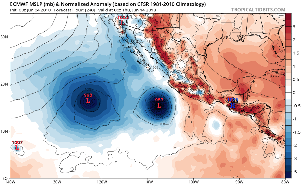
Re: 2018 EPAC Season
0 likes
Visit the Caribbean-Central America Weather Thread where you can find at first post web cams,radars
and observations from Caribbean basin members Click Here
and observations from Caribbean basin members Click Here
-
gatorcane

- S2K Supporter
- Posts: 23708
- Age: 48
- Joined: Sun Mar 13, 2005 3:54 pm
- Location: Boca Raton, FL
Re: 2018 EPAC Season: INVEST 91E is up
00Z ECMWF looking pretty strong on the system behind 91E. Also has another one behind that system. Busy EPAC for the next couple of weeks it looks like.
1 likes
-
cycloneye
- Admin
- Posts: 149508
- Age: 69
- Joined: Thu Oct 10, 2002 10:54 am
- Location: San Juan, Puerto Rico
Re: 2018 EPAC Season: INVEST 91E is up
Yes,92E is in the bullpen ready to go up in the next few days as there is consensus on all the models to have development.There are differences on intensity and on the track but that is expected being mid range.
0 likes
Visit the Caribbean-Central America Weather Thread where you can find at first post web cams,radars
and observations from Caribbean basin members Click Here
and observations from Caribbean basin members Click Here
-
TheStormExpert
Re: 2018 EPAC Season: INVEST 91E is up
I still don’t completely understand how the East Pacific like clockwork can just turn on overnight almost each and every season come late May-early June. Meanwhile the Atlantic just slowly and steadily picks things up as you progress through the summer.
0 likes
-
cycloneye
- Admin
- Posts: 149508
- Age: 69
- Joined: Thu Oct 10, 2002 10:54 am
- Location: San Juan, Puerto Rico
Re: 2018 EPAC Season
Reply by Eric Blake to Michael Ventrice.
@EricBlake12
It’s funny how the main cckw isn’t even leading the activity- EPac will get a TC first, with maybe a second one a direct result
https://twitter.com/EricBlake12/status/1003645233123479553
@EricBlake12
It’s funny how the main cckw isn’t even leading the activity- EPac will get a TC first, with maybe a second one a direct result
https://twitter.com/EricBlake12/status/1003645233123479553
0 likes
Visit the Caribbean-Central America Weather Thread where you can find at first post web cams,radars
and observations from Caribbean basin members Click Here
and observations from Caribbean basin members Click Here
-
Yellow Evan
- Professional-Met
- Posts: 16240
- Age: 27
- Joined: Fri Jul 15, 2011 12:48 pm
- Location: Henderson, Nevada/Honolulu, HI
- Contact:
Re: 2018 EPAC Season: INVEST 91E is up
TheStormExpert wrote:I still don’t completely understand how the East Pacific like clockwork can just turn on overnight almost each and every season come late May-early June. Meanwhile the Atlantic just slowly and steadily picks things up as you progress through the summer.
No SAL, generally warmer waters in the central pacific equatorial region than off the coast of South America, and a monsoon trough that more often lingers in the EPAC than the ATL, and warmer waters off the coast of Mexico than Africa.
0 likes
-
cycloneye
- Admin
- Posts: 149508
- Age: 69
- Joined: Thu Oct 10, 2002 10:54 am
- Location: San Juan, Puerto Rico
Re: 2018 EPAC Season
Two majors in June. 12z GFS bottoms second system to 928 mbs. Does anyone has stats about how many times two majors formed in June?

0 likes
Visit the Caribbean-Central America Weather Thread where you can find at first post web cams,radars
and observations from Caribbean basin members Click Here
and observations from Caribbean basin members Click Here
-
Yellow Evan
- Professional-Met
- Posts: 16240
- Age: 27
- Joined: Fri Jul 15, 2011 12:48 pm
- Location: Henderson, Nevada/Honolulu, HI
- Contact:
Re: 2018 EPAC Season
cycloneye wrote:Two majors in June. 12z GFS bottoms second system to 928 mbs. Does anyone has stats about how many times two majors formed in June?
https://i.imgur.com/8SZMepj.png
2010 oddly enough is the only instance IIRC. Probably the strangest season in EPAC history.
1 likes
Who is online
Users browsing this forum: Google Adsense [Bot], Old-TimeCane and 256 guests