2023 Global Model Runs Discussion (Out thru day 16)
Moderator: S2k Moderators
Forum rules

The posts in this forum are NOT official forecasts and should not be used as such. They are just the opinion of the poster and may or may not be backed by sound meteorological data. They are NOT endorsed by any professional institution or STORM2K. For official information, please refer to products from the National Hurricane Center and National Weather Service.
-
OuterBanker
- S2K Supporter

- Posts: 1761
- Joined: Wed Feb 26, 2003 10:53 am
- Location: Nags Head, NC
- Contact:
Re: 2023 Global Model Runs Discussion (Out thru day 16)
With today's GFS runs I thought that the GFS had finally entered rehab. It dropped all the sub 970 systems. But I see that it is still persistent in forming a west Carib system, just not as strong. No other model is predicting it, still.
0 likes

Re: 2023 Global Model Runs Discussion (Out thru day 16)
I’m thinking we could have a lot of recurves if those warm MDR temps continue.
2 likes
-
USTropics
- Professional-Met

- Posts: 2740
- Joined: Sun Aug 12, 2007 3:45 am
- Location: Florida State University
Re: 2023 Global Model Runs Discussion (Out thru day 16)
To the surprise of no one many, the latest GFS run has dropped the WCARIB system. It's been trending towards the wave axis crossing CA before development occurs over the past several runs:

6 likes
Re: 2023 Global Model Runs Discussion (Out thru day 16)
USTropics wrote:To the surprise ofno onemany, the latest GFS run has dropped the WCARIB system. It's been trending towards the wave axis crossing CA before development occurs over the past several runs:
https://i.imgur.com/iAxRE0z.gif
GFS streak: 12Z June 5th, 2023-18Z June 11th, 2023 RIP
It was 26 runs old.
It had a pretty long life though not near a record breaker. This streak will always be remembered for its tenacity.
3 likes
Personal Forecast Disclaimer:
The posts in this forum are NOT official forecasts and should not be used as such. They are just the opinion of the poster and may or may not be backed by sound meteorological data. They are NOT endorsed by any professional institution or storm2k.org. For official information, please refer to the NHC and NWS products.
The posts in this forum are NOT official forecasts and should not be used as such. They are just the opinion of the poster and may or may not be backed by sound meteorological data. They are NOT endorsed by any professional institution or storm2k.org. For official information, please refer to the NHC and NWS products.
-
Hypercane_Kyle

- Category 5

- Posts: 3465
- Joined: Sat Mar 07, 2015 7:58 pm
- Location: Cape Canaveral, FL
Re: 2023 Global Model Runs Discussion (Out thru day 16)
GFS showing development around 40W in about 9 days.
Probably nothing, but shows that early-season activity in the MDR is possible with the extraordinarily anomalous warm SSTs.
Probably nothing, but shows that early-season activity in the MDR is possible with the extraordinarily anomalous warm SSTs.
1 likes
My posts are my own personal opinion, defer to the National Hurricane Center (NHC) and other NOAA products for decision making during hurricane season.
Re: 2023 Global Model Runs Discussion (Out thru day 16)
The GFS WCAR system is back TS into Belize.
2 likes
Re: 2023 Global Model Runs Discussion (Out thru day 16)
6z's gfs is showing the epac and MDR systems both, as well as yet another, different, system in the west Caribbean (days later than the last one it did.) The MDR is a maybe system too, probably sloppy if anything.
I still find it amazing the GFS just seems to be consistently overreacting to Venezuela, particularly right around Pico El Turmal just east of Lake Maracaibo. Any slight disturbance just gets amplified to extremes whenever it gets near there on the GFS. It happened last year, and it's happening this year. I really wish I knew why that is.
I still find it amazing the GFS just seems to be consistently overreacting to Venezuela, particularly right around Pico El Turmal just east of Lake Maracaibo. Any slight disturbance just gets amplified to extremes whenever it gets near there on the GFS. It happened last year, and it's happening this year. I really wish I knew why that is.
0 likes

Re: 2023 Global Model Runs Discussion (Out thru day 16)
Well the GFS was right about a west Caribbean hurricane last summer it just was off by 3 months.
Classic that it drops the storm in the 18-20th time frane amd now showing something about a week later.
That said, it looks like the EPAC is going to to get some action soon.
Classic that it drops the storm in the 18-20th time frane amd now showing something about a week later.
That said, it looks like the EPAC is going to to get some action soon.
0 likes

Re: 2023 Global Model Runs Discussion (Out thru day 16)
GFS now showing development in the western Caribbean within 120h
0 likes
-
Category5Kaiju

- Category 5
- Posts: 4346
- Joined: Thu Dec 24, 2020 12:45 pm
- Location: Seattle during the summer, Phoenix during the winter
Re: 2023 Global Model Runs Discussion (Out thru day 16)
The 00Z Euro seems to really like that potential MDR system around the June 20th timeframe
0 likes
Unless explicitly stated, all information in my posts is based on my own opinions and observations. Tropical storms and hurricanes can be extremely dangerous. Refer to an accredited weather research agency or meteorologist if you need to make serious decisions regarding an approaching storm.
Re: 2023 Global Model Runs Discussion (Out thru day 16)
Category5Kaiju wrote:The 00Z Euro seems to really like that potential MDR system around the June 20th timeframe
06z gfs also showing a sheared ts hitting south fl next tue once again. Typical early season storm
0 likes
Re: 2023 Global Model Runs Discussion (Out thru day 16)
Ianswfl wrote:Category5Kaiju wrote:The 00Z Euro seems to really like that potential MDR system around the June 20th timeframe
06z gfs also showing a sheared ts hitting south fl next tue once again. Typical early season storm
For those who don't realize it, that is from the same entity that lead to the 26 GFS run streak of a W Caribbean TC genesis within 6/18-20, which at the time was still during forecast week two. There have been several runs since that streak ended that have had a 6/18-20 formation there, which is now within week #1. This is one of them.
0 likes
Personal Forecast Disclaimer:
The posts in this forum are NOT official forecasts and should not be used as such. They are just the opinion of the poster and may or may not be backed by sound meteorological data. They are NOT endorsed by any professional institution or storm2k.org. For official information, please refer to the NHC and NWS products.
The posts in this forum are NOT official forecasts and should not be used as such. They are just the opinion of the poster and may or may not be backed by sound meteorological data. They are NOT endorsed by any professional institution or storm2k.org. For official information, please refer to the NHC and NWS products.
-
wxman57

- Moderator-Pro Met

- Posts: 23175
- Age: 68
- Joined: Sat Jun 21, 2003 8:06 pm
- Location: Houston, TX (southwest)
Re: 2023 Global Model Runs Discussion (Out thru day 16)
GFS is still all alone in forecasting a west Caribbean storm in 5-6 days. It's upper air pattern does not match the EC, CMC, or ICON. Other models do not indicate any low-level vorticity moving offshore Venezuela/Colombia. I think the GFS is still wrong.
1 likes

-
SFLcane

- S2K Supporter
- Posts: 10281
- Age: 48
- Joined: Sat Jun 05, 2010 1:44 pm
- Location: Lake Worth Florida
Re: 2023 Global Model Runs Discussion (Out thru day 16)
Fun is just starting. If these conditions come to pass with a TUTT placement similar to 2004 with the right steering look out.
3 likes
-
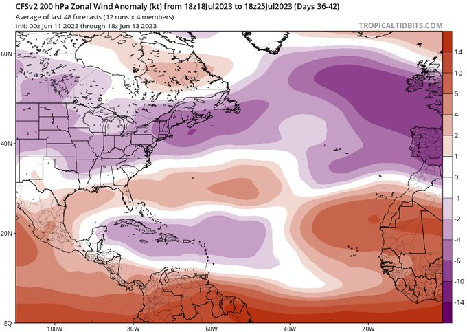
WeatherBoy2000
- Category 1

- Posts: 463
- Joined: Mon Apr 10, 2023 9:29 am
Re: 2023 Global Model Runs Discussion (Out thru day 16)
SFLcane wrote:
Fun is just starting. If these conditions come to pass with a TUTT placement similar to 2004 with the right steering look out.
https://i.postimg.cc/htk95jkh/cfs33.png
If development were to occur in the mdr this month, it could be a sign pointing towards a more active season down the line. Early mdr development in June through early July is unusual and correlates quite well with active seasons. Development of this wave could help further back up the case that we're looking at a more active season than usually expected with a robust El Nino.
0 likes
-
wxman57
- Moderator-Pro Met
- Posts: 23175
- Age: 68
- Joined: Sat Jun 21, 2003 8:06 pm
- Location: Houston, TX (southwest)
Re: 2023 Global Model Runs Discussion (Out thru day 16)
Looks like any development near the NE Caribbean around the 23rd would have a clear path to recurve east of the U.S. This feature that the models are seeing is still over Africa. Wind shear will not be in its favor as it tracks westward.
0 likes
-
SFLcane
- S2K Supporter
- Posts: 10281
- Age: 48
- Joined: Sat Jun 05, 2010 1:44 pm
- Location: Lake Worth Florida
Re: 2023 Global Model Runs Discussion (Out thru day 16)
wxman57 wrote:Looks like any development near the NE Caribbean around the 23rd would have a clear path to recurve east of the U.S. This feature that the models are seeing is still over Africa. Wind shear will not be in its favor as it tracks westward.
Conditions are as favorable as they can get across the mdr for june.
https://twitter.com/AndyHazelton/status/1669017665447534592
2 likes
Re: 2023 Global Model Runs Discussion (Out thru day 16)
The12Z Euro is getting a bit stronger with the MDR system.
1 likes
Who is online
Users browsing this forum: No registered users and 267 guests