New large wave behind Bill east of Lesser Antilles

This is the general tropical discussion area. Anyone can take their shot at predicting a storms path.

Moderator: S2k Moderators

Forum rules

The posts in this forum are NOT official forecasts and should not be used as such. They are just the opinion of the poster and may or may not be backed by sound meteorological data. They are NOT endorsed by any professional institution or STORM2K. For official information, please refer to products from the National Hurricane Center and National Weather Service.

Help Support Storm2K
Message
Author
jinftl
Category 5
Category 5
Posts: 4312
Joined: Tue Aug 31, 2004 4:47 pm
Location: fort lauderdale, fl

Re: New large wave behind Bill east of Lesser Antilles

#261 Postby jinftl » Sun Aug 23, 2009 7:04 pm

Note the lack of the qualifier "if any" that is sometimes added to "development, if any, will be slow to occur".

Subtle....but interesting

cycloneye wrote:NHC mentions this wave again.


TROPICAL WEATHER OUTLOOK
NWS TPC/NATIONAL HURRICANE CENTER MIAMI FL
800 PM EDT SUN AUG 23 2009

FOR THE NORTH ATLANTIC...CARIBBEAN SEA AND THE GULF OF MEXICO...

THE NATIONAL HURRICANE CENTER IS ISSUING ADVISORIES ON HURRICANE
BILL...LOCATED ABOUT 230 MILES WEST OF CAPE RACE NEWFOUNDLAND.

SHOWERS AND THUNDERSTORMS HAVE INCREASED OVER THE PAST SEVERAL HOURS
IN ASSOCIATION WITH A TROPICAL WAVE INTERACTING WITH AN UPPER-LEVEL
LOW ABOUT 600 MILES EAST OF THE LEEWARD ISLANDS. ANY DEVELOPMENT OF
THIS SYSTEM WILL BE SLOW TO OCCUR OVER THE NEXT COUPLE OF DAYS AS
IT MOVES TOWARD THE WEST-NORTHWEST AT 20 TO 25 MPH. THERE IS A LOW
CHANCE...LESS THAN 30 PERCENT...OF THIS SYSTEM BECOMING A TROPICAL
CYCLONE DURING THE NEXT 48 HOURS.

ELSEWHERE...TROPICAL CYCLONE FORMATION IS NOT EXPECTED DURING THE
NEXT 48 HOURS.

$$
FORECASTER BRENNAN

Image
0 likes   

User avatar
KWT
Category 5
Category 5
Posts: 31415
Joined: Tue Aug 17, 2004 11:02 am
Location: UK!!!

#262 Postby KWT » Sun Aug 23, 2009 7:07 pm

It says "Any development" though which is pretty much the same thing just worded a little different.
0 likes   

User avatar
tailgater
S2K Supporter
S2K Supporter
Posts: 3339
Joined: Sun Jul 11, 2004 9:13 pm
Location: St. Amant La.

Re: New large wave behind Bill east of Lesser Antilles

#263 Postby tailgater » Sun Aug 23, 2009 8:11 pm

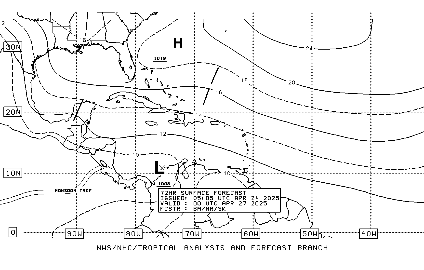
Latest TPC forecast. Don't they usally predict which way they think systems will go beyond 72hrs.
Image
0 likes   

User avatar
HURAKAN
Professional-Met
Professional-Met
Posts: 46086
Age: 38
Joined: Thu May 20, 2004 4:34 pm
Location: Key West, FL
Contact:

#264 Postby HURAKAN » Sun Aug 23, 2009 8:18 pm

Image

At least the islands will get some rain
0 likes   

User avatar
Blown Away
S2K Supporter
S2K Supporter
Posts: 10152
Joined: Wed May 26, 2004 6:17 am

Re: New large wave behind Bill east of Lesser Antilles

#265 Postby Blown Away » Sun Aug 23, 2009 8:40 pm

Discussion Snippet:
AREA FORECAST DISCUSSION
NATIONAL WEATHER SERVICE MELBOURNE FL
158 PM EDT SUN AUG 23 2009

.DISCUSSION...


MONDAY...BASE OF ERN CONUS EXTENDING INTO THE DEEP SOUTH WILL BEGIN
TO FILL MONDAY AS THE DLM BERMUDA RIDGE BEGINS TO BUILD WWD FROM THE
ATLC. THIS WILL CAUSE H50 HGHTS TO RISE AND SFC WINDS TO BACK FROM
SW TO SOUTH AND SE DURING THE DAY. HIGHER MEAN MOISTURE WHICH HAD
BEEN SHUNTED SEWD TODAY WILL MOVE BACK WWD/NWD AS WELL...SO EXPECT
HIGHER POPS SOUTH/EAST...AND HAVE TRENDED AS SUCH - 60 FOR THE FAR
SE TRENDING DOWN TO 25-30 FOR THE NWRN CWA.

ALTHOUGH SWELL HGHTS WILL DIMINISH MONDAY...THERE WILL STILL BE A
LINGERING LONG PERIOD SWELL WHICH WILL ENHANCE THE LOCAL RIP CURRENT
THREAT...SO SWIMMERS WILL STILL NEED TO REMAIN ALERT.

MON NIGHT-TUES NIGHT...UPPER HIGH RETREATS INTO THE ATLANTIC AS
TROUGHING SETTLES OVER THE SOUTHEAST AND FLORIDA. RESIDUAL MOISTURE
FROM DISSIPATING FRONTAL BOUNDARY STILL ENOUGH TO KEEP 30 POP
EVERYWHERE EXCEPT WESTERN AREAS WHERE MOISTURE RIBBON THINNER.
MOISTURE STILL LINGERING AROUND TUESDAY AND WITH DAYTIME HEATING AND
SOUTHERLY FLOW WILL KEEP 30/40 POP AREAWIDE. PROGS STILL SHOWING
EASTERLY WAVE APPROACHING THE BAHAMA ISLANDS AND SUBSISTENCE AHEAD
OF THE WAVE MOVING OVERTOP THE ISLANDS BUT NOT IMPACTING FLORIDA
EAST COAST POPS JUST YET.

WED-SAT (PREV)...A DEEP E/NE FLOW WILL EXIST OVER THE AREA THROUGH
MUCH OF THE MID TO LATE WEEK AS AN EASTERLY WAVE MOVES FROM THE
CENTRAL ATLANTIC INTO THE BAHAMAS. DRIER AND MORE SUBSIDENT AIR WILL
EXIST ON THE WEST SIDE OF THIS WAVE AND OVER OUR AREA WHICH WILL
PROVIDE FOR SLIGHTLY BELOW NORMAL POPS AROUND 30% ON WED AND THURS.
MODELS THEN HAVE THE WAVE DEVELOPING INTO A CLOSED LOW EAST OF THE
FLORIDA PENINSULA DURING FRI AND THEN LIFT IT NORTH OVER THE WESTERN
ATLANTIC.
THIS WILL ALLOW FOR SOME MOISTURE RETURN FROM THE SOUTH
WITH RAIN CHANCES INCREASING TO MORE NORMAL VALUES SAT. NO MAJOR
TEMPERATURE CHANGES EXPECTED WITH VALUES REMAINING NEAR NORMAL.


Looks like whatever develops, it will stay east of Florida.
0 likes   

User avatar
Blown Away
S2K Supporter
S2K Supporter
Posts: 10152
Joined: Wed May 26, 2004 6:17 am

Re: Area to watch for possible development - East Coast/Bahamas

#266 Postby Blown Away » Sun Aug 23, 2009 8:54 pm

Discussion Snippet:
AREA FORECAST DISCUSSION
NATIONAL WEATHER SERVICE MELBOURNE FL
158 PM EDT SUN AUG 23 2009

.DISCUSSION...


MONDAY...BASE OF ERN CONUS EXTENDING INTO THE DEEP SOUTH WILL BEGIN
TO FILL MONDAY AS THE DLM BERMUDA RIDGE BEGINS TO BUILD WWD FROM THE
ATLC. THIS WILL CAUSE H50 HGHTS TO RISE AND SFC WINDS TO BACK FROM
SW TO SOUTH AND SE DURING THE DAY. HIGHER MEAN MOISTURE WHICH HAD
BEEN SHUNTED SEWD TODAY WILL MOVE BACK WWD/NWD AS WELL...SO EXPECT
HIGHER POPS SOUTH/EAST...AND HAVE TRENDED AS SUCH - 60 FOR THE FAR
SE TRENDING DOWN TO 25-30 FOR THE NWRN CWA.

ALTHOUGH SWELL HGHTS WILL DIMINISH MONDAY...THERE WILL STILL BE A
LINGERING LONG PERIOD SWELL WHICH WILL ENHANCE THE LOCAL RIP CURRENT
THREAT...SO SWIMMERS WILL STILL NEED TO REMAIN ALERT.

MON NIGHT-TUES NIGHT...UPPER HIGH RETREATS INTO THE ATLANTIC AS
TROUGHING SETTLES OVER THE SOUTHEAST AND FLORIDA. RESIDUAL MOISTURE
FROM DISSIPATING FRONTAL BOUNDARY STILL ENOUGH TO KEEP 30 POP
EVERYWHERE EXCEPT WESTERN AREAS WHERE MOISTURE RIBBON THINNER.
MOISTURE STILL LINGERING AROUND TUESDAY AND WITH DAYTIME HEATING AND
SOUTHERLY FLOW WILL KEEP 30/40 POP AREAWIDE. PROGS STILL SHOWING
EASTERLY WAVE APPROACHING THE BAHAMA ISLANDS AND SUBSISTENCE AHEAD
OF THE WAVE MOVING OVERTOP THE ISLANDS BUT NOT IMPACTING FLORIDA
EAST COAST POPS JUST YET.

WED-SAT (PREV)...A DEEP E/NE FLOW WILL EXIST OVER THE AREA THROUGH
MUCH OF THE MID TO LATE WEEK AS AN EASTERLY WAVE MOVES FROM THE
CENTRAL ATLANTIC INTO THE BAHAMAS. DRIER AND MORE SUBSIDENT AIR WILL
EXIST ON THE WEST SIDE OF THIS WAVE AND OVER OUR AREA WHICH WILL
PROVIDE FOR SLIGHTLY BELOW NORMAL POPS AROUND 30% ON WED AND THURS.
MODELS THEN HAVE THE WAVE DEVELOPING INTO A CLOSED LOW EAST OF THE
FLORIDA PENINSULA DURING FRI AND THEN LIFT IT NORTH OVER THE WESTERN
ATLANTIC.
THIS WILL ALLOW FOR SOME MOISTURE RETURN FROM THE SOUTH
WITH RAIN CHANCES INCREASING TO MORE NORMAL VALUES SAT. NO MAJOR
TEMPERATURE CHANGES EXPECTED WITH VALUES REMAINING NEAR NORMAL.


Looks like whatever develops, it will stay east of Florida.
0 likes   

Derek Ortt

Re:

#267 Postby Derek Ortt » Sun Aug 23, 2009 8:58 pm

KWT wrote:Yeah Derek this one is rather uncertain, though the GFS does briefly have a closed low, as did the 0z ECM. I suspect the models don't have a very good grasp on this system yet, since there really isn't a lot to really go on just yet.


or more likely, the system never develops
0 likes   

User avatar
cycloneye
Admin
Admin
Posts: 145601
Age: 68
Joined: Thu Oct 10, 2002 10:54 am
Location: San Juan, Puerto Rico

Re: Area to watch for possible development - East Coast/Bahamas

#268 Postby cycloneye » Sun Aug 23, 2009 9:01 pm

AFD from NWS San Juan about possible TC development.

AREA FORECAST DISCUSSION...UPDATED
NATIONAL WEATHER SERVICE SAN JUAN PR
939 PM AST SUN AUG 23 2009

.SYNOPSIS...UPPER LOW NEAR 23N 58W WILL SETTLE NORTH OF THE
ISLANDS ON MON. MEANWHILE...TROPICAL WAVE ALONG 51W IS EXPECTED TO
SPLIT OFF AND MOVE NW AS A SURFACE TROUGH ACROSS THE WATERS NORTH
OF PR ON TUE.

&&

.DISCUSSION...TUTT LOW NEAR 23N 58W THIS EVENING CONITNUES TO
RETROGRESS TOWARD THE LOCAL AREA. SATELLITE AND RADAR TRENDS SHOW
AN INCREASE IN SHRA/TSRA ACTIVITY NE OF THE NRN LEEWARD ISLANDS.
ANTICIPATE A GRADUAL INCREASE IN SHRA ACTIVITY ACROSS THE ERN
THIRD OF PR AND THE USVI OVERNIGHT AND EARLY TOMORROW MORNING AS
MID LEVELS DESTABILIZE.

MID-LYR INSTABILITY FCST TO INCREASE TOMORROW AFTERNOON AS TUTT
LOW SETTLES NORTH OVER THE AREA. MOISTURE IS ALSO FCST TO STEADILY
INCREASE THROUGH THE DAY AND WITH THE IMPROVING DYNAMICS ALOFT IT
SHOULD RESULT IN A MORE ACTIVE DAY THAN TODAY. SOME LOCALIZED
FLOODING IS POSSIBLE.

TUESDAY LOOKS TO BE MUCH WETTER AS MOISTURE INCREASES TO ABOUT
160% OF NORMAL AS TROPICAL WAVE ALONG 51W GETS CLOSER TO THE AREA.
ALTHOUGH UPPER LEVEL WINDS DO NOT APPEAR CONDUCIVE FOR TC
DEVELOPMENT AT THE PRESENT TIME...INTERACTION OF THE WAVE WITH THE
TUTT LOW OVR THE AREA SHOULD RESULT IN NRMS SHRA/TSRA WITH THE
POTENTIAL FOR HEAVY RAINS AND FLASH FLOODING. GLOBAL MODELS AND
THEIR INDIVIUDAL ENSEMBLE MEMBERS SHOW FURTHER DEVELOPMENT OF THIS
WAVE AS IT MOVES NW OF PR ON WED. SEE LATEST TROPICAL WX OUTLOOK
FROM NHC FOR MORE DETAILS ON THIS WAVE.

GLOBAL MODELS SHOW
ENVIRONMENT BECOMING MORE CONDUCIVE FOR DEVELOPMENT BEYOND 48 HRS
AS IT MOVES NW OF PR ON WED. OPERATIONAL CMC/GFS AND ECMWF MODELS
AND THEIR INDIVIDUAL ENSEMBLE MEMBERS ALL ARE CLUSTERED INDICATING
DEVELOPMENT OF THIS WAVE INTO A TROPICAL CYCLONE NORTH OF THE
BAHAMAS DURING THE MIDDLE PART OF THE WEEK.
0 likes   

Aric Dunn
Category 5
Category 5
Posts: 21238
Age: 42
Joined: Sun Sep 19, 2004 9:58 pm
Location: Ready for the Chase.
Contact:

#269 Postby Aric Dunn » Sun Aug 23, 2009 9:01 pm

so there are two threads on the same wave.. why?

also i see the convection increased today as was anticipated.. now lets see if a surface feature can develop and the tutt move into a more favorable position..
0 likes   

User avatar
brunota2003
S2K Supporter
S2K Supporter
Posts: 9476
Age: 34
Joined: Sat Jul 30, 2005 9:56 pm
Location: Stanton, KY...formerly Havelock, NC
Contact:

#270 Postby brunota2003 » Sun Aug 23, 2009 9:09 pm

It better stay away from Florida and just not develop period...I got a flight to Orlando on the 28th, then my gf and I fly out the 30th to go meet my parents, and then she has to fly back to Orlando after that...I only have 10 days of predeployment leave, I dont need a wrench in the system >>
0 likes   

Aric Dunn
Category 5
Category 5
Posts: 21238
Age: 42
Joined: Sun Sep 19, 2004 9:58 pm
Location: Ready for the Chase.
Contact:

#271 Postby Aric Dunn » Sun Aug 23, 2009 9:14 pm

really why is there two threads on the same wave..
0 likes   

User avatar
Blown Away
S2K Supporter
S2K Supporter
Posts: 10152
Joined: Wed May 26, 2004 6:17 am

Re:

#272 Postby Blown Away » Sun Aug 23, 2009 9:18 pm

Aric Dunn wrote:so there are two threads on the same wave.. why?

also i see the convection increased today as was anticipated.. now lets see if a surface feature can develop and the tutt move into a more favorable position..


I posted here first and then realized it was more appropriate to post on the other thread. I can delete my post if it would make it less confusing.
0 likes   

User avatar
cycloneye
Admin
Admin
Posts: 145601
Age: 68
Joined: Thu Oct 10, 2002 10:54 am
Location: San Juan, Puerto Rico

Re: Area to watch for possible development - East Coast/Bahamas

#273 Postby cycloneye » Sun Aug 23, 2009 9:20 pm

I am not HURAKAN but he would tell you that the thread was made for TC development from any source,a trough split,tail end of front or tropical wave :)
0 likes   

Aric Dunn
Category 5
Category 5
Posts: 21238
Age: 42
Joined: Sun Sep 19, 2004 9:58 pm
Location: Ready for the Chase.
Contact:

Re: Re:

#274 Postby Aric Dunn » Sun Aug 23, 2009 9:21 pm

Blown_away wrote:
Aric Dunn wrote:so there are two threads on the same wave.. why?

also i see the convection increased today as was anticipated.. now lets see if a surface feature can develop and the tutt move into a more favorable position..


I posted here first and then realized it was more appropriate to post on the other thread. I can delete my post if it would make it less confusing.


well one of the threads should be locked... since they are both talking about the same thing..
0 likes   

Aric Dunn
Category 5
Category 5
Posts: 21238
Age: 42
Joined: Sun Sep 19, 2004 9:58 pm
Location: Ready for the Chase.
Contact:

Re: Area to watch for possible development - East Coast/Bahamas

#275 Postby Aric Dunn » Sun Aug 23, 2009 9:23 pm

cycloneye wrote:I am not HURAKAN but he would tell you that the thread was made for TC development from any source,a trough split,tail end of front or tropical wave :)

Thats fine and all .. but the other thread should be locked .. since its about the same thing.. development near the bahamas from the models.. :cheesy: well at least thats where the other thread has gone too .. lol
0 likes   

User avatar
HURAKAN
Professional-Met
Professional-Met
Posts: 46086
Age: 38
Joined: Thu May 20, 2004 4:34 pm
Location: Key West, FL
Contact:

#276 Postby HURAKAN » Sun Aug 23, 2009 9:31 pm

Image

Image

This morning when the thread was created the consensus was that the tropical wave to cause any development over the Western Atlantic was the one over the eastern Caribbean. Now it has shifted to the wave east of the islands and the confusion was created. I have no problem in locking or merging this thread. It's also titled "east coast/bahamas" because of the possibility of the trough over the east coast to develop.
0 likes   

Aric Dunn
Category 5
Category 5
Posts: 21238
Age: 42
Joined: Sun Sep 19, 2004 9:58 pm
Location: Ready for the Chase.
Contact:

Re:

#277 Postby Aric Dunn » Sun Aug 23, 2009 9:44 pm

HURAKAN wrote:
This morning when the thread was created the consensus was that the tropical wave to cause any development over the Western Atlantic was the one over the eastern Caribbean. Now it has shifted to the wave east of the islands and the confusion was created. I have no problem in locking or merging this thread. It's also titled "east coast/bahamas" because of the possibility of the trough over the east coast to develop.


do what you think would work best..
0 likes   

Dean4Storms
S2K Supporter
S2K Supporter
Posts: 6358
Age: 62
Joined: Sun Aug 31, 2003 1:01 pm
Location: Miramar Bch. FL

#278 Postby Dean4Storms » Sun Aug 23, 2009 9:45 pm

This one, if it develops has all the makings of one of those pick your model of choice for track and intensity. I'm betting this one gives us all some long debates and differences!
0 likes   

Aric Dunn
Category 5
Category 5
Posts: 21238
Age: 42
Joined: Sun Sep 19, 2004 9:58 pm
Location: Ready for the Chase.
Contact:

Re:

#279 Postby Aric Dunn » Sun Aug 23, 2009 9:51 pm

Dean4Storms wrote:This one, if it develops has all the makings of one of those pick your model of choice for track and intensity. I'm betting this one gives us all some long debates and differences!


lol .. so its seems

as none of the models agree on a track ..

fair game at this point.... gfs stalls it and dissipates it .. Euro brings it to the florida coast then does some crazy north 90 degree turn.. the cmc is just well the cmc.,, nogaps is barely showing anything .. its going to be interesting ..
0 likes   

User avatar
HURAKAN
Professional-Met
Professional-Met
Posts: 46086
Age: 38
Joined: Thu May 20, 2004 4:34 pm
Location: Key West, FL
Contact:

#280 Postby HURAKAN » Sun Aug 23, 2009 9:54 pm

I merged both threads, I think it's better than locking one and losing the information in it. Time will tell if anything happens because at the moment a powerful ULL dominates.
0 likes   


Return to “Talkin' Tropics”

Who is online

Users browsing this forum: Stratton23 and 70 guests