
weeniepatrol wrote:https://twitter.com/webberweather/status/1407067489545068545
Wow, the ensembles are showing that new wave developing potentially as early as 4-5 days out. Maybe a lemon in a few days if other models jump on board?
Moderator: S2k Moderators

weeniepatrol wrote:https://twitter.com/webberweather/status/1407067489545068545


BobHarlem wrote:i'm not so sure the tagged wave is the same thing the GFS is developing, 0z shows it moving that wave more north, and then the GFS comes more from another area to the west. Either way, the Euro/CMC/Icon do not develop it in the west Caribbean really at all, and seem to concentrate more in the East Pacific. 7 days out and nothing on the Euro has me skeptical.
aspen wrote:weeniepatrol wrote:https://twitter.com/webberweather/status/1407067489545068545
Wow, the ensembles are showing that new wave developing potentially as early as 4-5 days out. Maybe a lemon in a few days if other models jump on board?
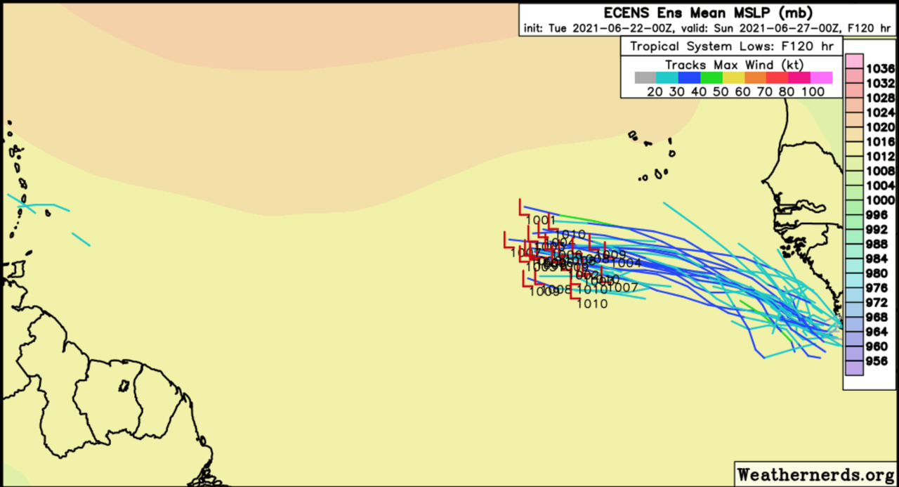
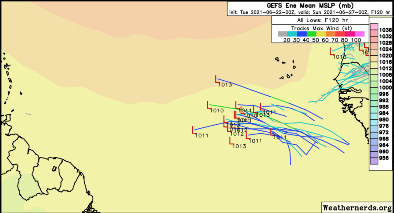


Kingarabian wrote:For the next 5-7 days the ensembles are bullish in closing off a low and maybe intensifying into a TD/weak TS but nothing more. In about 10 days though, 3-5 members have classic Caribbean cruisers and showing hurricane strength. Will be interesting to see if this wave can maintain itself until it reaches the WCaribbean.

Shell Mound wrote:aspen wrote:weeniepatrol wrote:https://twitter.com/webberweather/status/1407067489545068545
Wow, the ensembles are showing that new wave developing potentially as early as 4-5 days out. Maybe a lemon in a few days if other models jump on board?
The latest (00Z) EPS ensembles are even more bullish within the next three to five days. Additionally, the 00Z GEFS suite is in decent agreement with the EPS:
https://i.postimg.cc/L8ngtK9t/Ska-rmavbild-2021-06-22-kl-11-22-59.png
https://i.postimg.cc/7L1H7m21/Ska-rmavbild-2021-06-22-kl-11-24-17.png
https://twitter.com/Souza101Matt/status/1407081171071164416


aspen wrote:The 12z Euro shows a TD in the Gulf hitting Texas at the end of the run. I think it might be from moisture from the EPac and not from the currently marked wave.

Kingarabian wrote:For the next 5-7 days the ensembles are bullish in closing off a low and maybe intensifying into a TD/weak TS but nothing more. In about 10 days though, 3-5 members have classic Caribbean cruisers and showing hurricane strength. Will be interesting to see if this wave can maintain itself until it reaches the WCaribbean.
Shell Mound wrote:Kingarabian wrote:For the next 5-7 days the ensembles are bullish in closing off a low and maybe intensifying into a TD/weak TS but nothing more. In about 10 days though, 3-5 members have classic Caribbean cruisers and showing hurricane strength. Will be interesting to see if this wave can maintain itself until it reaches the WCaribbean.
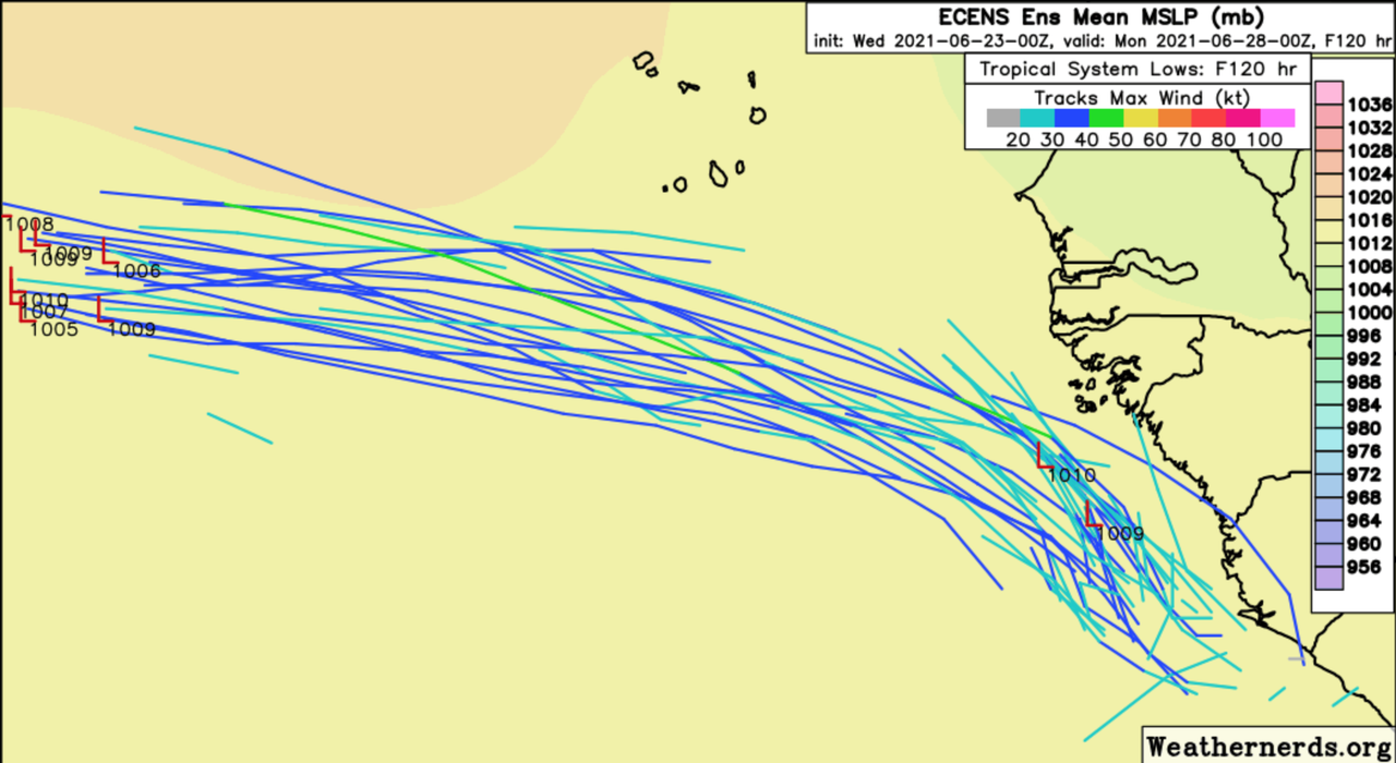
The 00Z EPS is the most bullish suite yet, showing a possible TS in just two days, close to West Africa. No TS has formed in the MDR east of 40°W prior to July.
SFLcane wrote:Shell Mound wrote:Kingarabian wrote:For the next 5-7 days the ensembles are bullish in closing off a low and maybe intensifying into a TD/weak TS but nothing more. In about 10 days though, 3-5 members have classic Caribbean cruisers and showing hurricane strength. Will be interesting to see if this wave can maintain itself until it reaches the WCaribbean.
The 00Z EPS is the most bullish suite yet, showing a possible TS in just two days, close to West Africa. No TS has formed in the MDR east of 40°W prior to July.
It has a few short lived TCs.

Users browsing this forum: Ntxw, WaveBreaking and 326 guests
