


Sent from my motorola razr plus 2023 using Tapatalk
Moderator: S2k Moderators


caneman wrote:HurricaneBelle wrote:psyclone wrote:It sure seems like the east gulf has had a hot hand in recent years. My hood just got another 4" dump yesterday. We need a break after this month...what a difference a year makes after a freakishly dry July/August last year..
Yeah this decade alone we've had Eta, Elsa, Ian, Idalia, Debby and one or two I'm probably forgetting.
Irma

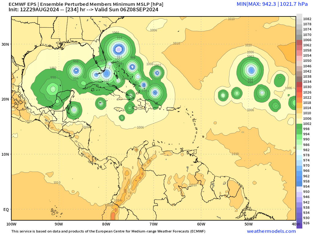
skyline385 wrote:12z EPS was a pretty ridiculous run
https://i.imgur.com/nBsZxXy.gif
https://i.imgur.com/98GNB1B.png


SouthFLTropics wrote:While the 12 EPS is impressive with the number of members it has, the spread on it by the time it reaches 25 north is considerably wide. Almost 1100 nautical miles apart. Consensus is threatening at the moment, but we won't get a more locked in idea until we get an exact center to track.
skyline385 wrote:12z EPS was a pretty ridiculous run
https://i.imgur.com/nBsZxXy.gif
https://i.imgur.com/98GNB1B.png


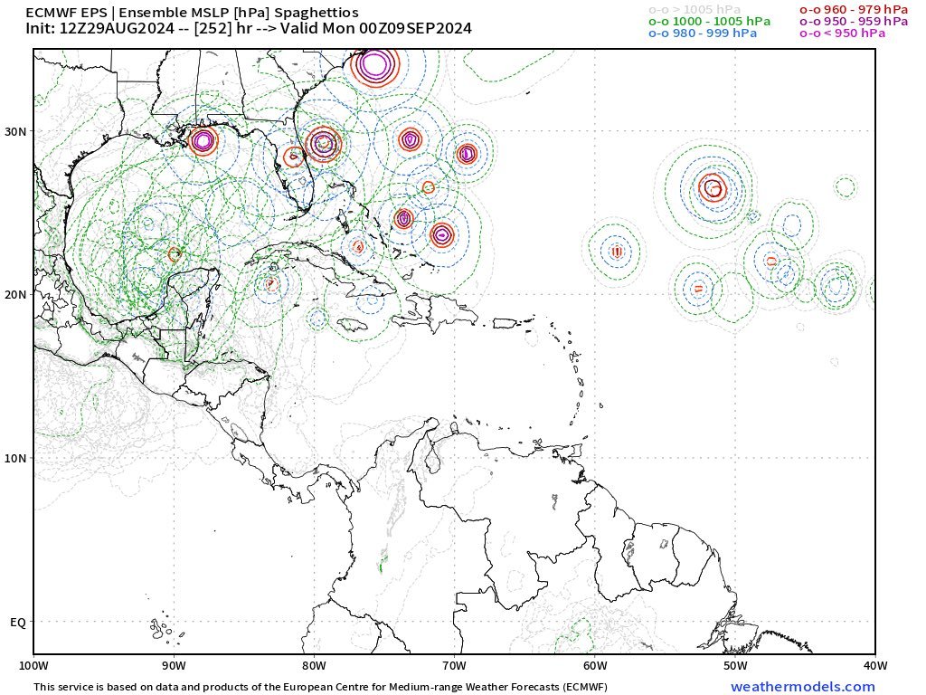
BobHarlem wrote:12z Euro Ensembles
https://i.imgur.com/tKgiA7Y.gif
HurricaneBelle wrote:caneman wrote:HurricaneBelle wrote:
Yeah this decade alone we've had Eta, Elsa, Ian, Idalia, Debby and one or two I'm probably forgetting.
Irma
Irma was 2017, which was not in this decade

BobHarlem wrote:12z Euro Ensembles
https://i.imgur.com/tKgiA7Y.gif

Iceresistance wrote:BobHarlem wrote:12z Euro Ensembles
https://i.imgur.com/tKgiA7Y.gif
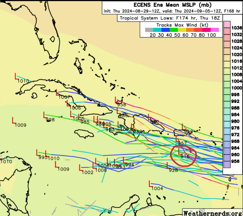
I am not sure if you noticed this, but I have noticed a exceptionally strong member of 916 mb in the Western Caribbean from the 12z Euro-ENS, that is stronger than Beryl from July!
https://s11.gifyu.com/images/SoUUx.png
https://s11.gifyu.com/images/SoUUx.png
Stratton23 wrote:Yikes that 12z Euro AIFS is something else


zal0phus wrote:This reminds me of an old-timey hurricane season somehow. Activity is slow in the early phases, but historic after historic storm starts rolling in at the end of August. Curious how this will play out
Kazmit wrote:zal0phus wrote:This reminds me of an old-timey hurricane season somehow. Activity is slow in the early phases, but historic after historic storm starts rolling in at the end of August. Curious how this will play out
I get what you mean. It seems like the last 15 years or so have had more quantity-over-quality kind of seasons. This season has pretty much no slop.
Users browsing this forum: Google Adsense [Bot] and 192 guests


