2021 Indicators: SST's / SAL / MSLP / Shear / Steering / Instability / Sat Images

This is the general tropical discussion area. Anyone can take their shot at predicting a storms path.

Moderator: S2k Moderators

Forum rules

The posts in this forum are NOT official forecasts and should not be used as such. They are just the opinion of the poster and may or may not be backed by sound meteorological data. They are NOT endorsed by any professional institution or STORM2K. For official information, please refer to products from the National Hurricane Center and National Weather Service.

Help Support Storm2K
Message
Author
User avatar
Iceresistance
Category 5
Category 5
Posts: 9288
Age: 21
Joined: Sat Oct 10, 2020 9:45 am
Location: Tecumseh, OK/Norman, OK

Re: 2021 Indicators: SST's / SAL / MSLP / Shear / Steering / Instability / Sat Images

#2821 Postby Iceresistance » Mon Aug 23, 2021 8:20 pm

tolakram wrote:
Iceresistance wrote:
tolakram wrote:

My guess is some long term pattern we don't yet understand. I haven't reviewed all the past years, I'm wondering if we had a similar stretch of western based seasons.


Most of the powerful storms in 2005 & 2020 were western-based . . .

2005
https://s9.gifyu.com/images/1745px-2005_Atlantic_hurricane_season_summary_map.png

2020
https://s9.gifyu.com/images/1745px-2020_Atlantic_hurricane_season_summary_map.png


Right, but why? There's a narrative of later that we aren't getting long tracking CV storms like we used to. Is this really true?


Maybe the SAL in the MDR is lasting longer & liming powerful hurricanes there, but there is generally less dry air usually west of 60°W & it allows stronger storms to develop there . . . That is what I also noticed lately . . .
0 likes   
Bill 2015 & Beta 2020

Winter 2020-2021 :cold:

All observations are in Tecumseh, OK unless otherwise noted.

Winter posts are focused mainly for Oklahoma & Texas.

Take any of my forecasts with a grain of salt, refer to the NWS, SPC, and NHC for official information

Never say Never with weather! Because ANYTHING is possible!

User avatar
aspen
Category 5
Category 5
Posts: 8818
Joined: Sat Oct 12, 2019 7:10 pm
Location: Connecticut, USA

Re: 2021 Indicators: SST's / SAL / MSLP / Shear / Steering / Instability / Sat Images

#2822 Postby aspen » Mon Aug 23, 2021 8:48 pm

tolakram wrote:
Iceresistance wrote:
tolakram wrote:

My guess is some long term pattern we don't yet understand. I haven't reviewed all the past years, I'm wondering if we had a similar stretch of western based seasons.


Most of the powerful storms in 2005 & 2020 were western-based . . .

2005
https://s9.gifyu.com/images/1745px-2005_Atlantic_hurricane_season_summary_map.png

2020
https://s9.gifyu.com/images/1745px-2020_Atlantic_hurricane_season_summary_map.png


Right, but why? There's a narrative of later that we aren't getting long tracking CV storms like we used to. Is this really true?

Apparently in the most recent EU climate report, one of the effects of continued warming at the current rate over the next 50 years or so would actually be an increase in dry air over the tropical Atlantic, so quite ironically, modern anthropogenic climate change might be part of the reason. 2020 also had a WAM that was so active, it turned out to be a detriment to eastern TC activity; I don’t know if 2005 had something similar. As far as I know, 2017 had an active WAM but it wasn’t quite at the levels of 2020, allowing for waves to consolidate quicker and actually take advantage of the near record warm MDR.

If climate change is having any impact on the strength of the West African Monsoon, it could potentially lead to more La Niña seasons with lackluster MDRs, and more warm ENSO years with enhanced activity like 2018 and 2019. This is based on an incredibly small sample size of just the last half dozen seasons, so this speculation could easily be proven false by seasons in the next decade or so.

It seems like the recipe for a season that favors long-tracking MDR hurricanes (Ivan, Dean, Irma, etc) is:
—An active but not hyperactive West African Monsoon
—A well-defined +AMO pattern with significantly above-average SSTs across much of the MDR
—An ITCZ that is at normal latitude or offset a bit to the south; too far north will send waves over cool waters
—No El Niño; cool ENSO is the most favorable, but sometimes other factors can offset the potentially negative impacts of a weak warm ENSO (2018/19)
—Rather strong ridging in August and September that would prevent early recurves
7 likes   
Irene '11 Sandy '12 Hermine '16 5/15/2018 Derecho Fay '20 Isaias '20 Elsa '21 Henri '21 Ida '21

I am only a meteorology enthusiast who knows a decent amount about tropical cyclones. Look to the professional mets, the NHC, or your local weather office for the best information.

Chris90
Category 2
Category 2
Posts: 646
Age: 35
Joined: Thu Jun 01, 2017 9:36 pm

Re: 2021 Indicators: SST's / SAL / MSLP / Shear / Steering / Instability / Sat Images

#2823 Postby Chris90 » Mon Aug 23, 2021 9:02 pm

Storms peaking in the western part of the basin is what is going to tend to be more typical just because the western portion of the basin has the highest heat content and the 26C isotherm extends much further north in the western portion thanks to the Gulf Stream. Storms like Lorenzo peaking at Cat 5 way to the east is anomalous in any season, even if it had occurred during a MDR heavy season. 2017 is considered a heavy MDR season, but even Ophelia was anomalous peaking as a major as far to the east as she did. Irma, Maria, and Jose got classified in the MDR, but it was really only Irma that took off the minute she exited Africa, and all of them didn’t reach peak until they got further west by the Antilles. I wouldn’t consider MDR activity or a lack thereof as a particularly useful indicator for anything but ACE.
7 likes   
Solar Aquarian
Lunar Cancerian
:uarrow: Sagittarian

User avatar
CyclonicFury
Category 5
Category 5
Posts: 2025
Age: 26
Joined: Sun Jul 02, 2017 12:32 pm
Location: NC
Contact:

Re: 2021 Indicators: SST's / SAL / MSLP / Shear / Steering / Instability / Sat Images

#2824 Postby CyclonicFury » Mon Aug 23, 2021 9:13 pm

It honestly seems like in recent years we haven't really seen a decrease in MDR activity, but more of a time shift in when the activity occurred. We've seen at least one MDR hurricane every year since 2015, with 2017 having Irma, Jose and Maria, 2018 having Florence, 2019 having Lorenzo and 2020 having Teddy. It wasn't too uncommon to have years without MDR hurricanes in the 2000s, as 2001, 2002, even 2005 to an extent, and 2007 all had lackluster MDR activity.

We've seen MDR development in July a lot in recent years, including 2013, 2014, 2017, 2018, 2020 and 2021. We've also seen some anomalous systems in the MDR in October in recent years, like TS Nadine in 2018 and TD 15 in 2019, both of which set records for unusually far east formations in the MDR so late in the season. What is fascinating, however, is the recent lack of MDR hurricanes during the month of August. There has not been a single TC to attain hurricane status in the MDR east of the Lesser Antilles during the month of August since Irma in 2017, which became a hurricane on August 31. There has been two July MDR hurricanes since 2018 (Beryl and Elsa), but none during the month of August during that time. September has generally been much more favorable for MDR development, but by that time, TCs are much more likely to recurve. In Septembers since 2017, we've seen Jose (Category 4), Maria (Category 5), Florence (Category 4 just north of 20N), Helene (high-end Category 2), Jerry (Category 2), Lorenzo (Category 4 in its MDR peak), and Teddy (Category 4).

I wouldn't be surprised if this continues and September has at least 1-2 hurricanes in the MDR, even though the season has been mostly west-based so far.
11 likes   
NCSU B.S. in Meteorology Class of 2021. Tropical weather blogger at http://www.cyclonicfury.com. My forecasts and thoughts are NOT official, for official forecasts please consult the National Hurricane Center.

User avatar
Category5Kaiju
Category 5
Category 5
Posts: 4097
Joined: Thu Dec 24, 2020 12:45 pm
Location: Seattle

Re: 2021 Indicators: SST's / SAL / MSLP / Shear / Steering / Instability / Sat Images

#2825 Postby Category5Kaiju » Mon Aug 23, 2021 9:25 pm

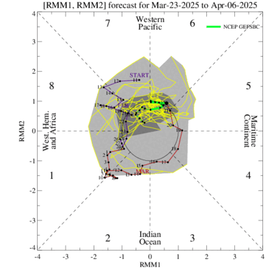
CyclonicFury wrote:It honestly seems like in recent years we haven't really seen a decrease in MDR activity, but more of a time shift in when the activity occurred. We've seen at least one MDR hurricane every year since 2015, with 2017 having Irma, Jose and Maria, 2018 having Florence, 2019 having Lorenzo and 2020 having Teddy. It wasn't too uncommon to have years without MDR hurricanes in the 2000s, as 2001, 2002, even 2005 to an extent, and 2007 all had lackluster MDR activity.

We've seen MDR development in July a lot in recent years, including 2013, 2014, 2017, 2018, 2020 and 2021. We've also seen some anomalous systems in the MDR in October in recent years, like TS Nadine in 2018 and TD 15 in 2019, both of which set records for unusually far east formations in the MDR so late in the season. What is fascinating, however, is the recent lack of MDR hurricanes during the month of August. There has not been a single TC to attain hurricane status in the MDR east of the Lesser Antilles during the month of August since Irma in 2017, which became a hurricane on August 31. There has been two July MDR hurricanes since 2018 (Beryl and Elsa), but none during the month of August during that time. September has generally been much more favorable for MDR development, but by that time, TCs are much more likely to recurve. In Septembers since 2017, we've seen Jose (Category 4), Maria (Category 5), Florence (Category 4 just north of 20N), Helene (high-end Category 2), Jerry (Category 2), Lorenzo (Category 4 in its MDR peak), and Teddy (Category 4).

I wouldn't be surprised if this continues and September has at least 1-2 hurricanes in the MDR, even though the season has been mostly west-based so far.


Interestingly, it really does seem like recent years are more back-loaded, with the peak of the season being more toward the mid-to-latter part of September or so rather than early-to-mid September. However, looking back to the start of the active era, it actually is not very uncommon to see the season's strongest storm in latter September or afterwards rather than toward the start of the month or earlier. 1995, 1998, 2000, 2001, 2005, 2011, 2012, 2014, 2015, 2016, 2017, 2018, and 2020 all featured their strongest (most intense) storms after mid-September, and I wouldn't be surprised to see 2021 do the same with such a recent group of years that displayed this sort of behavior.
1 likes   
Unless explicitly stated, all info in my posts is based on my own opinions and observations. Tropical storms and hurricanes can be extremely dangerous. Do not think you can beat Mother Nature. Refer to an accredited weather research agency or meteorologist if you need to make serious decisions regarding an approaching storm.

User avatar
WiscoWx02
Category 1
Category 1
Posts: 391
Joined: Sat Jul 31, 2021 8:09 pm

Re: 2021 Indicators: SST's / SAL / MSLP / Shear / Steering / Instability / Sat Images

#2826 Postby WiscoWx02 » Mon Aug 23, 2021 10:30 pm

Image

Well that dry spell didn't last long at all :lol: Another up close one it looks like but models have been showing that for days so not surprising. The two areas closer to Africa probably won't develop till they get to the subtropics. My expectations for the MDR are lowering this year in the past week or two but as everyone has been discussing, that means about as much as a flake of snow falling in the heart of an Alaskan winter.

Interesting fact that came up today in response to this tweet by Adrian Linares as well.
 https://twitter.com/stormmaster17/status/1429838334369705992


Figure this puts a nice cherry on top for the discussion that MDR activity really doesn't mean zilch at the end of the day if the waves can survive further west like they've been doing this year so far.
6 likes   

User avatar
Category5Kaiju
Category 5
Category 5
Posts: 4097
Joined: Thu Dec 24, 2020 12:45 pm
Location: Seattle

Re: 2021 Indicators: SST's / SAL / MSLP / Shear / Steering / Instability / Sat Images

#2827 Postby Category5Kaiju » Tue Aug 24, 2021 7:41 am

It's also interesting to note that of the 4 recorded Cat 5 CONUS landfalls, Andrew was the only one that formed and originated in the MDR. 1935, Camille, and Michael were homegrown; while n=4 is a very small sample size to look at, perhaps there's something about starting near land and blowing up that proves more durable and advantageous for a storm to make landfall at such strength in the CONUS as opposed to being a long tracker?
0 likes   
Unless explicitly stated, all info in my posts is based on my own opinions and observations. Tropical storms and hurricanes can be extremely dangerous. Do not think you can beat Mother Nature. Refer to an accredited weather research agency or meteorologist if you need to make serious decisions regarding an approaching storm.

User avatar
cheezyWXguy
Category 5
Category 5
Posts: 6108
Joined: Mon Feb 13, 2006 12:29 am
Location: Dallas, TX

Re: 2021 Indicators: SST's / SAL / MSLP / Shear / Steering / Instability / Sat Images

#2828 Postby cheezyWXguy » Tue Aug 24, 2021 8:23 am

Category5Kaiju wrote:It's also interesting to note that of the 4 recorded Cat 5 CONUS landfalls, Andrew was the only one that formed and originated in the MDR. 1935, Camille, and Michael were homegrown; while n=4 is a very small sample size to look at, perhaps there's something about starting near land and blowing up that proves more durable and advantageous for a storm to make landfall at such strength in the CONUS as opposed to being a long tracker?

Since cat5 is kind of an arbitrary distinction and such a small sample size, would the pattern still maintain if we considered all US majors, or US majors that strengthened up to landfall?
0 likes   

User avatar
SFLcane
S2K Supporter
S2K Supporter
Posts: 10163
Age: 47
Joined: Sat Jun 05, 2010 1:44 pm
Location: Lake Worth Florida

Re: 2021 Indicators: SST's / SAL / MSLP / Shear / Steering / Instability / Sat Images

#2829 Postby SFLcane » Tue Aug 24, 2021 8:26 am

It’s a “fishy” kinda world this season.

 https://twitter.com/webberweather/status/1430156524727541760


2 likes   

User avatar
aspen
Category 5
Category 5
Posts: 8818
Joined: Sat Oct 12, 2019 7:10 pm
Location: Connecticut, USA

Re: 2021 Indicators: SST's / SAL / MSLP / Shear / Steering / Instability / Sat Images

#2830 Postby aspen » Tue Aug 24, 2021 8:33 am

SFLcane wrote:It’s a “fishy” kinda world this season.

https://twitter.com/webberweather/status/1430156524727541760

Whatever happened to the strong ridging forecast for ASO? This is quite a 360 from only a few weeks back.
2 likes   
Irene '11 Sandy '12 Hermine '16 5/15/2018 Derecho Fay '20 Isaias '20 Elsa '21 Henri '21 Ida '21

I am only a meteorology enthusiast who knows a decent amount about tropical cyclones. Look to the professional mets, the NHC, or your local weather office for the best information.

User avatar
SFLcane
S2K Supporter
S2K Supporter
Posts: 10163
Age: 47
Joined: Sat Jun 05, 2010 1:44 pm
Location: Lake Worth Florida

Re: 2021 Indicators: SST's / SAL / MSLP / Shear / Steering / Instability / Sat Images

#2831 Postby SFLcane » Tue Aug 24, 2021 8:37 am

aspen wrote:
SFLcane wrote:It’s a “fishy” kinda world this season.

https://twitter.com/webberweather/status/1430156524727541760

Whatever happened to the strong ridging forecast for ASO? This is quite a 360 from only a few weeks back.


subseasonal variations always happen in the seasonal mean. definitely one of those.
2 likes   

User avatar
WiscoWx02
Category 1
Category 1
Posts: 391
Joined: Sat Jul 31, 2021 8:09 pm

Re: 2021 Indicators: SST's / SAL / MSLP / Shear / Steering / Instability / Sat Images

#2832 Postby WiscoWx02 » Tue Aug 24, 2021 8:38 am

Speaking of Eric Webb, I recall him posting a tweet regarding the MJO cycle and steering patterns back in July, where the data showed Phases 3+4 being the most favorable for west based tracks. With that in mind.....well.....here's what the GFS is predicting as of right now. I love when models are right obviously but in this regard, I hope the GFS is wrong.

Image
1 likes   

AutoPenalti
Category 5
Category 5
Posts: 4030
Age: 29
Joined: Mon Aug 17, 2015 4:16 pm
Location: Ft. Lauderdale, Florida

Re: 2021 Indicators: SST's / SAL / MSLP / Shear / Steering / Instability / Sat Images

#2833 Postby AutoPenalti » Tue Aug 24, 2021 8:47 am

aspen wrote:
SFLcane wrote:It’s a “fishy” kinda world this season.

https://twitter.com/webberweather/status/1430156524727541760

Whatever happened to the strong ridging forecast for ASO? This is quite a 360 from only a few weeks back.

It's temporary I think. The seasonal mean would still favor western tracks.
1 likes   
The posts in this forum are NOT official forecasts and should not be used as such. They are just the opinion of the poster and may or may not be backed by sound meteorological data. They are NOT endorsed by any professional institution or STORM2K. For official information, please refer to products from the NHC and NWS.


Model Runs Cheat Sheet:
GFS (5:30 AM/PM, 11:30 AM/PM)
HWRF, GFDL, UKMET, NAVGEM (6:30-8:00 AM/PM, 12:30-2:00 AM/PM)
ECMWF (1:45 AM/PM)

TCVN
is a weighted averaged

User avatar
cycloneye
Admin
Admin
Posts: 145327
Age: 68
Joined: Thu Oct 10, 2002 10:54 am
Location: San Juan, Puerto Rico

Re: 2021 Indicators: SST's / SAL / MSLP / Shear / Steering / Instability / Sat Images

#2834 Postby cycloneye » Tue Aug 24, 2021 8:49 am

SFLcane wrote:It’s a “fishy” kinda world this season.

https://twitter.com/webberweather/statu ... 4727541760


Great for us in the islands but anyway will be watching closer developments near the Caribbean.
1 likes   
Visit the Caribbean-Central America Weather Thread where you can find at first post web cams,radars
and observations from Caribbean basin members Click Here

User avatar
SFLcane
S2K Supporter
S2K Supporter
Posts: 10163
Age: 47
Joined: Sat Jun 05, 2010 1:44 pm
Location: Lake Worth Florida

Re: 2021 Indicators: SST's / SAL / MSLP / Shear / Steering / Instability / Sat Images

#2835 Postby SFLcane » Tue Aug 24, 2021 8:50 am

Fish parade coming.. 2010 2.0

High-latitude ridging but troughing underneath

Image
Last edited by SFLcane on Tue Aug 24, 2021 8:52 am, edited 1 time in total.
1 likes   

tolakram
Admin
Admin
Posts: 20009
Age: 62
Joined: Sun Aug 27, 2006 8:23 pm
Location: Florence, KY (name is Mark)

Re: 2021 Indicators: SST's / SAL / MSLP / Shear / Steering / Instability / Sat Images

#2836 Postby tolakram » Tue Aug 24, 2021 8:51 am

SFLcane wrote:It’s a “fishy” kinda world this season.

https://twitter.com/webberweather/status/1430156524727541760


Just a few days ago it was a ridgy kind of season. I think the only thing that can be said about all these weather tweets, regardless of source, is they're a hot mess.
9 likes   
M a r k
- - - - -
Join us in chat: Storm2K Chatroom Invite. Android and IOS apps also available.

The posts in this forum are NOT official forecasts and should not be used as such. Posts are NOT endorsed by any professional institution or STORM2K.org. For official information and forecasts, please refer to NHC and NWS products.

User avatar
Steve
S2K Supporter
S2K Supporter
Posts: 9621
Joined: Sat Apr 05, 2003 11:41 pm
Location: Not a state-caster

Re: 2021 Indicators: SST's / SAL / MSLP / Shear / Steering / Instability / Sat Images

#2837 Postby Steve » Tue Aug 24, 2021 8:54 am

AutoPenalti wrote:
aspen wrote:
SFLcane wrote:It’s a “fishy” kinda world this season.

https://twitter.com/webberweather/status/1430156524727541760

Whatever happened to the strong ridging forecast for ASO? This is quite a 360 from only a few weeks back.

It's temporary I think. The seasonal mean would still favor western tracks.


Yeah, he says for "early September" with the -NAO in Week 2.
0 likes   

AlphaToOmega
Category 5
Category 5
Posts: 1448
Joined: Sat Jun 26, 2021 10:51 am
Location: Somewhere in Massachusetts

Re: 2021 Indicators: SST's / SAL / MSLP / Shear / Steering / Instability / Sat Images

#2838 Postby AlphaToOmega » Tue Aug 24, 2021 8:56 am

Image
Image
Image
Image
Image
Image
0 likes   

User avatar
Category5Kaiju
Category 5
Category 5
Posts: 4097
Joined: Thu Dec 24, 2020 12:45 pm
Location: Seattle

Re: 2021 Indicators: SST's / SAL / MSLP / Shear / Steering / Instability / Sat Images

#2839 Postby Category5Kaiju » Tue Aug 24, 2021 9:00 am

I mean, the predicted trough is nothing I personally find surprising. In a given season, you should expect a decent number of storms to head on off to sea, and a decent number of storms that impact land. For instance, in 2004, while anomalous ridging was prevalent, we still had a powerful Cat 4 fish storm, Karl, happen.
1 likes   
Unless explicitly stated, all info in my posts is based on my own opinions and observations. Tropical storms and hurricanes can be extremely dangerous. Do not think you can beat Mother Nature. Refer to an accredited weather research agency or meteorologist if you need to make serious decisions regarding an approaching storm.

IcyTundra
Category 5
Category 5
Posts: 1205
Joined: Mon Jun 07, 2021 9:32 pm
Location: Dickinson, Texas

Re: 2021 Indicators: SST's / SAL / MSLP / Shear / Steering / Instability / Sat Images

#2840 Postby IcyTundra » Tue Aug 24, 2021 9:00 am

SFLcane wrote:Fish parade coming.. 2010 2.0

High-latitude ridging but troughing underneath

https://i.postimg.cc/7hNJXRrf/8501882-A-A1-FD-4-CEA-9-B10-54909-A34-C31-F.png


We can only hope still have to watch out for the homegrown systems though.
0 likes   


Return to “Talkin' Tropics”

Who is online

Users browsing this forum: No registered users and 29 guests