Caribbean development? (Is invest 92L)
Moderator: S2k Moderators
Forum rules

The posts in this forum are NOT official forecasts and should not be used as such. They are just the opinion of the poster and may or may not be backed by sound meteorological data. They are NOT endorsed by any professional institution or STORM2K. For official information, please refer to products from the National Hurricane Center and National Weather Service.
-
Wx_Warrior
- Category 5

- Posts: 2718
- Joined: Thu Aug 03, 2006 3:58 pm
- Location: Beaumont, TX

-
Wx_Warrior
- Category 5
- Posts: 2718
- Joined: Thu Aug 03, 2006 3:58 pm
- Location: Beaumont, TX
Re: Caribbean development?-Code Yellow
Tad further south and a smidgen weaker than NAM 18z, but that's splitting hairs.
0 likes
-
srainhoutx

- S2K Supporter

- Posts: 6919
- Age: 68
- Joined: Sun Jan 14, 2007 11:34 am
- Location: Haywood County, NC
- Contact:
Re: Caribbean development?-Code Yellow
I suspect late Thursday/early Friday we will have an Invest. This will take a little time to fully separate from the ITCZ IMO. Poor wxman57 will have to work this weekend... 
0 likes
Carla/Alicia/Jerry(In The Eye)/Michelle/Charley/Ivan/Dennis/Katrina/Rita/Wilma/Ike/Harvey
Member: National Weather Association
Wx Infinity Forums
http://wxinfinity.com/index.php
Facebook.com/WeatherInfinity
Twitter @WeatherInfinity
Member: National Weather Association
Wx Infinity Forums
http://wxinfinity.com/index.php
Facebook.com/WeatherInfinity
Twitter @WeatherInfinity
-
Ivanhater

- Storm2k Moderator

- Posts: 11221
- Age: 39
- Joined: Fri Jul 01, 2005 8:25 am
- Location: Pensacola
Re:
Weatherfreak000 wrote:Now I think it may be decent chance of saying we are looking at the J storm before the 10th. Unbelievable.
At this rate, I can truly believe we can make it to hyperactivity this season.
It's going to have to beat the system behind Igor to become Julia. Most likely this one would be called Karl.
Pretty insane we are even having this conversation about what system will beat out the other to become the J or K storm. Season bust what?
0 likes
Michael


That is some storm starting to crank at the end of the run...
loop:
http://www.nco.ncep.noaa.gov/pmb/nwprod ... loop.shtml
loop:
http://www.nco.ncep.noaa.gov/pmb/nwprod ... loop.shtml
0 likes


Re: Caribbean development?-Code Yellow
The location and timing of this system reminds me of another system, which happened to develop on this day 22 years ago. 

http://weather.unisys.com/hurricane/atl ... /track.gif
http://weather.unisys.com/hurricane/atl ... /track.gif
0 likes
-
Wx_Warrior
- Category 5
- Posts: 2718
- Joined: Thu Aug 03, 2006 3:58 pm
- Location: Beaumont, TX
-
South Texas Storms

- Professional-Met

- Posts: 4261
- Joined: Thu Jun 24, 2010 12:28 am
- Location: Houston, TX
Re: Caribbean development?-Code Yellow
Big O wrote:The location and timing of this system reminds me of another system, which happened to develop on this day 22 years ago.
http://weather.unisys.com/hurricane/atl ... /track.gif
oh yeah gilbert was a bad one. even though it made landfall in mexico, it spawned tornadoes all the way up in san antonio.
0 likes
-
Bailey1777
- S2K Supporter
- Posts: 962
- Joined: Mon Jul 31, 2006 6:23 pm
- Location: Houston, Texas
Re: Caribbean development?-Code Yellow
so what general area should we be watching right now and do we see any signs of anything going on right now?
0 likes
Re: Caribbean development?-Code Yellow
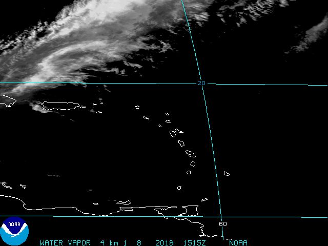
latest IR2/radar strongly suggest the LLC may be forming about 60-70 miles E/ESE of barbados...
0 likes
-
greg_kfdm_tv
- Professional-Met
- Posts: 110
- Joined: Fri Aug 29, 2003 8:50 pm
- Location: Beaumont, Texas
- Contact:
-
FireBird
- Tropical Storm

- Posts: 133
- Joined: Tue Jul 22, 2008 1:44 pm
- Location: NorthWest Trinidad, SE Caribbean
Re: Caribbean development?-Code Yellow
I know we're all trying to pull together data, and with slow movement, we're kinda eyeballing it. But is there any way of getting a better fix on co-ordinates? Any ship data?
0 likes
-
cycloneye

- Admin

- Posts: 149583
- Age: 69
- Joined: Thu Oct 10, 2002 10:54 am
- Location: San Juan, Puerto Rico
Re:
greg_kfdm_tv wrote:Agreed....the area to watch is just east-southeast of Barbados. Thunderstorms are increasing and becoming more concentrated. It looks likely to me that we will see at least a depression forming in the next 36 hours.
It would take that long to form?
0 likes
Visit the Caribbean-Central America Weather Thread where you can find at first post web cams,radars
and observations from Caribbean basin members Click Here
and observations from Caribbean basin members Click Here
-
greg_kfdm_tv
- Professional-Met
- Posts: 110
- Joined: Fri Aug 29, 2003 8:50 pm
- Location: Beaumont, Texas
- Contact:
-
Wx_Warrior
- Category 5
- Posts: 2718
- Joined: Thu Aug 03, 2006 3:58 pm
- Location: Beaumont, TX

Who is online
Users browsing this forum: cajungal, Yellow Evan and 162 guests