Top hurricane sat photos of all time...
Moderator: S2k Moderators
Forum rules
The posts in this forum are NOT official forecasts and should not be used as such. They are just the opinion of the poster and may or may not be backed by sound meteorological data. They are NOT endorsed by any professional institution or STORM2K. For official information, please refer to products from the National Hurricane Center and National Weather Service.
-
tatertawt24
- Category 1

- Posts: 309
- Joined: Wed Oct 24, 2012 12:57 pm
Re: Top hurricane sat photos of all time...

4 likes
Personal Forecast Disclaimer:
The posts in this forum are NOT official forecast and should not be used as such. They are just the opinion of the poster and may or may not be backed by sound meteorological data. They are NOT endorsed by any professional institution or storm2k.org. For official information, please refer to the NHC and NWS products.
The posts in this forum are NOT official forecast and should not be used as such. They are just the opinion of the poster and may or may not be backed by sound meteorological data. They are NOT endorsed by any professional institution or storm2k.org. For official information, please refer to the NHC and NWS products.
-
supercane4867
- Category 5

- Posts: 4966
- Joined: Wed Nov 14, 2012 10:43 am
Re: Top hurricane sat photos of all time...
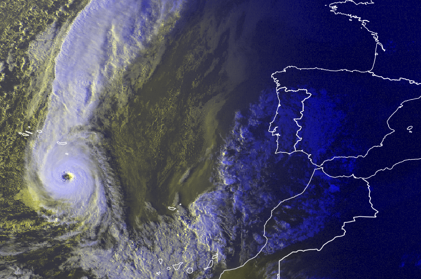
I think a major hurricane off the Azores is worthy to join this list.

10 likes
- mrbagyo
- Category 5

- Posts: 3963
- Age: 33
- Joined: Thu Apr 12, 2012 9:18 am
- Location: 14.13N 120.98E
- Contact:
Re: Top hurricane sat photos of all time...
Exactly 32 years ago - Super Typhoon Dot at peak intensity.
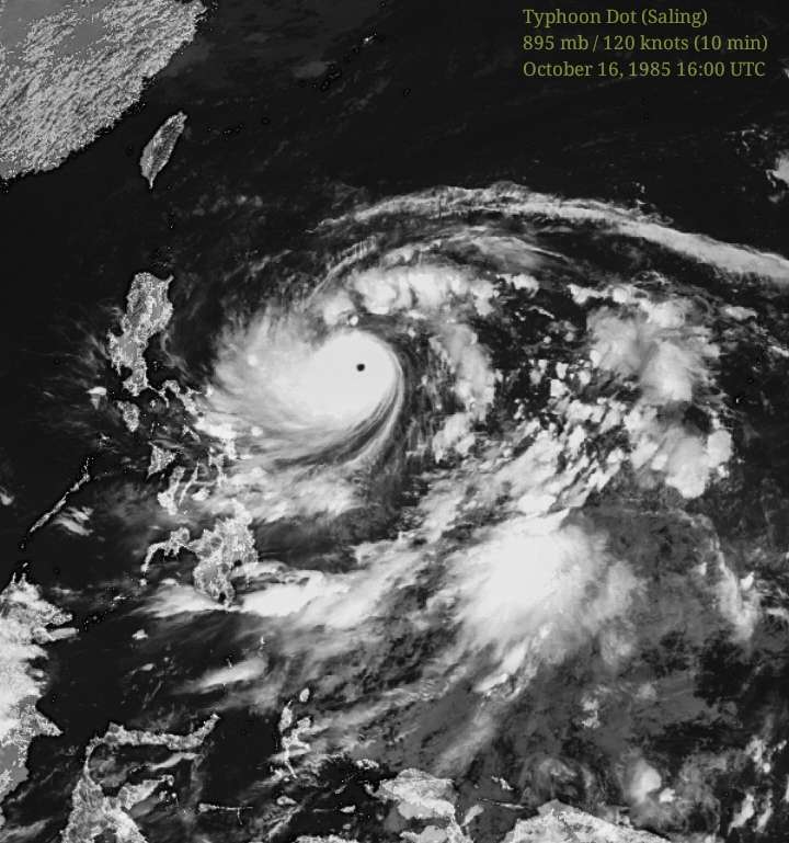
Image© Digital Typhoon (enhanced with Lightroom)

Image© Digital Typhoon (enhanced with Lightroom)
0 likes
The posts in this forum are NOT official forecast and should not be used as such. They are just the opinion of the poster and may or may not be backed by sound meteorological data. They are NOT endorsed by any professional institution or storm2k.org. For official information, please refer to RSMC, NHC and NWS products.
-
euro6208
Re: Top hurricane sat photos of all time...
Wow how time flies. Already 7 years since Super Typhoon Megi hit the Philippines on the 18th. One of only a few typhoons to have recon flights and the findings are incredible. 200 mph winds found but is not acknowledge by any agency for some reason.


0 likes
- 1900hurricane
- Category 5

- Posts: 6063
- Age: 34
- Joined: Fri Feb 06, 2015 12:04 pm
- Location: Houston, TX
- Contact:
Re: Top hurricane sat photos of all time
0 likes
Contract Meteorologist. TAMU & MSST. Fiercely authentic, one of a kind. We are all given free will, so choose a life meant to be lived. We are the Masters of our own Stories.
Opinions expressed are mine alone.
Follow me on Twitter at @1900hurricane : Read blogs at https://1900hurricane.wordpress.com/
Opinions expressed are mine alone.
Follow me on Twitter at @1900hurricane : Read blogs at https://1900hurricane.wordpress.com/
- mrbagyo
- Category 5

- Posts: 3963
- Age: 33
- Joined: Thu Apr 12, 2012 9:18 am
- Location: 14.13N 120.98E
- Contact:
Re: Top hurricane sat photos of all time...
Could we see a repeat of this in the next several days?
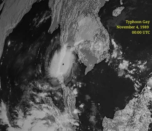
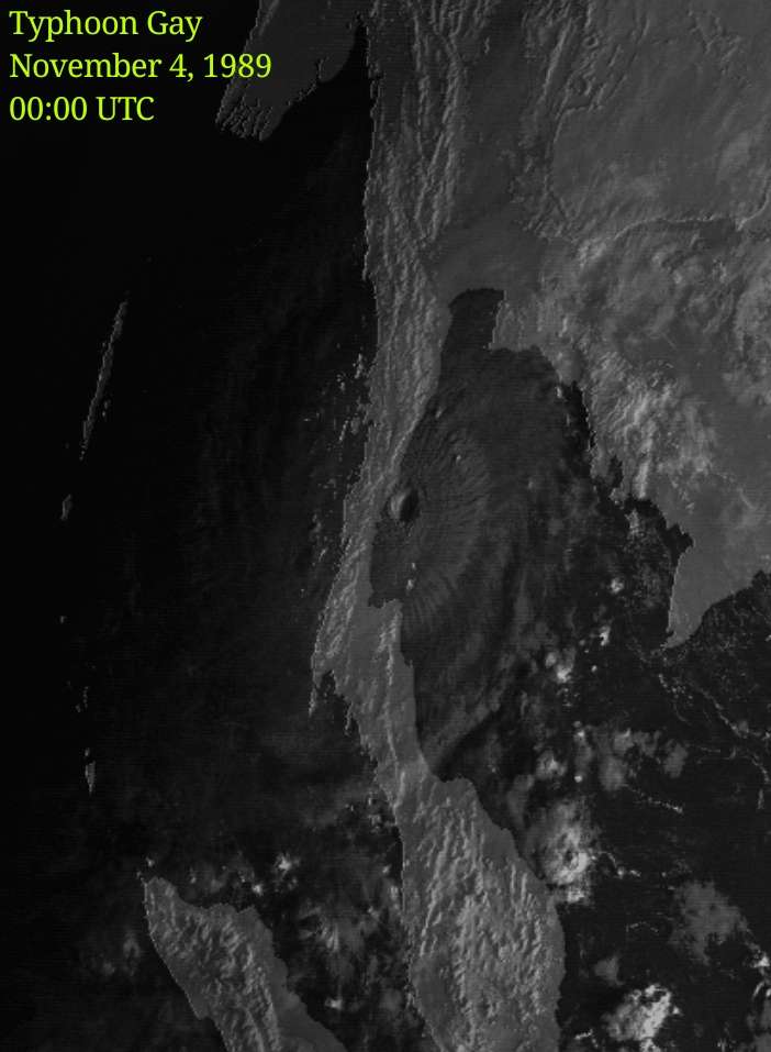
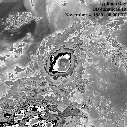


2 likes
The posts in this forum are NOT official forecast and should not be used as such. They are just the opinion of the poster and may or may not be backed by sound meteorological data. They are NOT endorsed by any professional institution or storm2k.org. For official information, please refer to RSMC, NHC and NWS products.
- mrbagyo
- Category 5

- Posts: 3963
- Age: 33
- Joined: Thu Apr 12, 2012 9:18 am
- Location: 14.13N 120.98E
- Contact:
Re: Top hurricane sat photos of all time...
11 years ago,
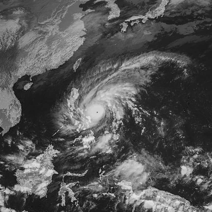
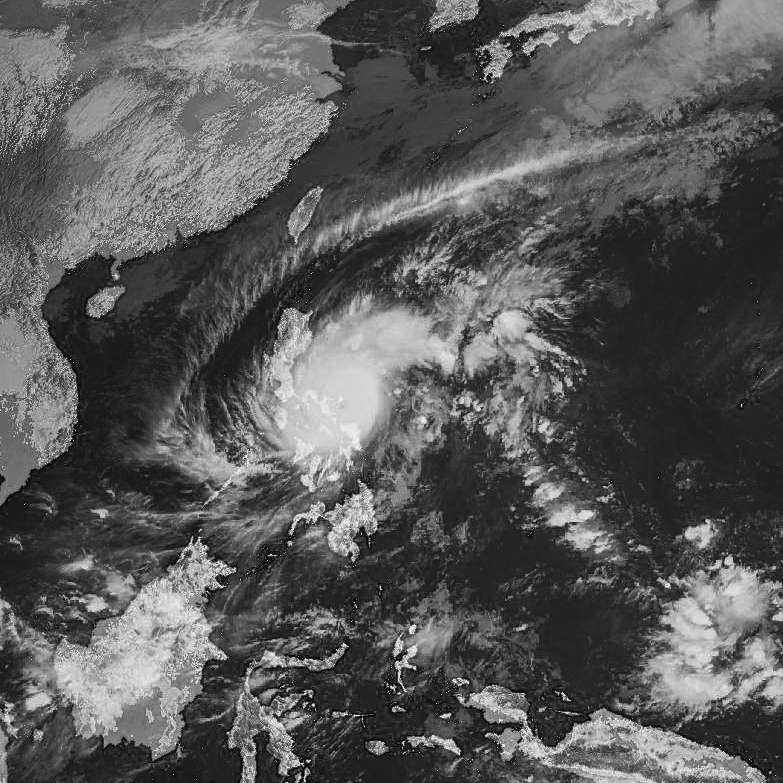
DURIAN during EWRC
After several hours - this thing became a demon.

...unleashing death and devastation in the whole Bicol Peninsula. Durian killed at least 1000 people - majority of which are concentrated in Padang, Legazpi and Sto. Domingo - mostly due to Lahar flow from Mayon Volcano.
Typhoon Durian still holds the national wind gust record in the Philippines @ 320kph recorded in Virac, Catanduanes. It has become the benchmark of the Bicolanos when it comes to the strength of a typhoon
Just like Hurricane Maria, Durian is a Category 4 cyclone that finished ERC just before landfall.


DURIAN during EWRC
After several hours - this thing became a demon.

...unleashing death and devastation in the whole Bicol Peninsula. Durian killed at least 1000 people - majority of which are concentrated in Padang, Legazpi and Sto. Domingo - mostly due to Lahar flow from Mayon Volcano.
Typhoon Durian still holds the national wind gust record in the Philippines @ 320kph recorded in Virac, Catanduanes. It has become the benchmark of the Bicolanos when it comes to the strength of a typhoon
Just like Hurricane Maria, Durian is a Category 4 cyclone that finished ERC just before landfall.
0 likes
The posts in this forum are NOT official forecast and should not be used as such. They are just the opinion of the poster and may or may not be backed by sound meteorological data. They are NOT endorsed by any professional institution or storm2k.org. For official information, please refer to RSMC, NHC and NWS products.
Re: Top hurricane sat photos of all time...
In my opinion, the satellite picture of Hurricane Jose (taken on September 9 by Sentinel-2A) is one of the most impressive hurricane images of the 2017 Atlantic hurricane season which just ended. It was the first time I have ever seen the eye of a tropical cyclone with such an incredible amount of detail. At 16:47 UTC, Jose was a category 4 hurricane with winds of around 125 knots and a pressure of 945 mb.
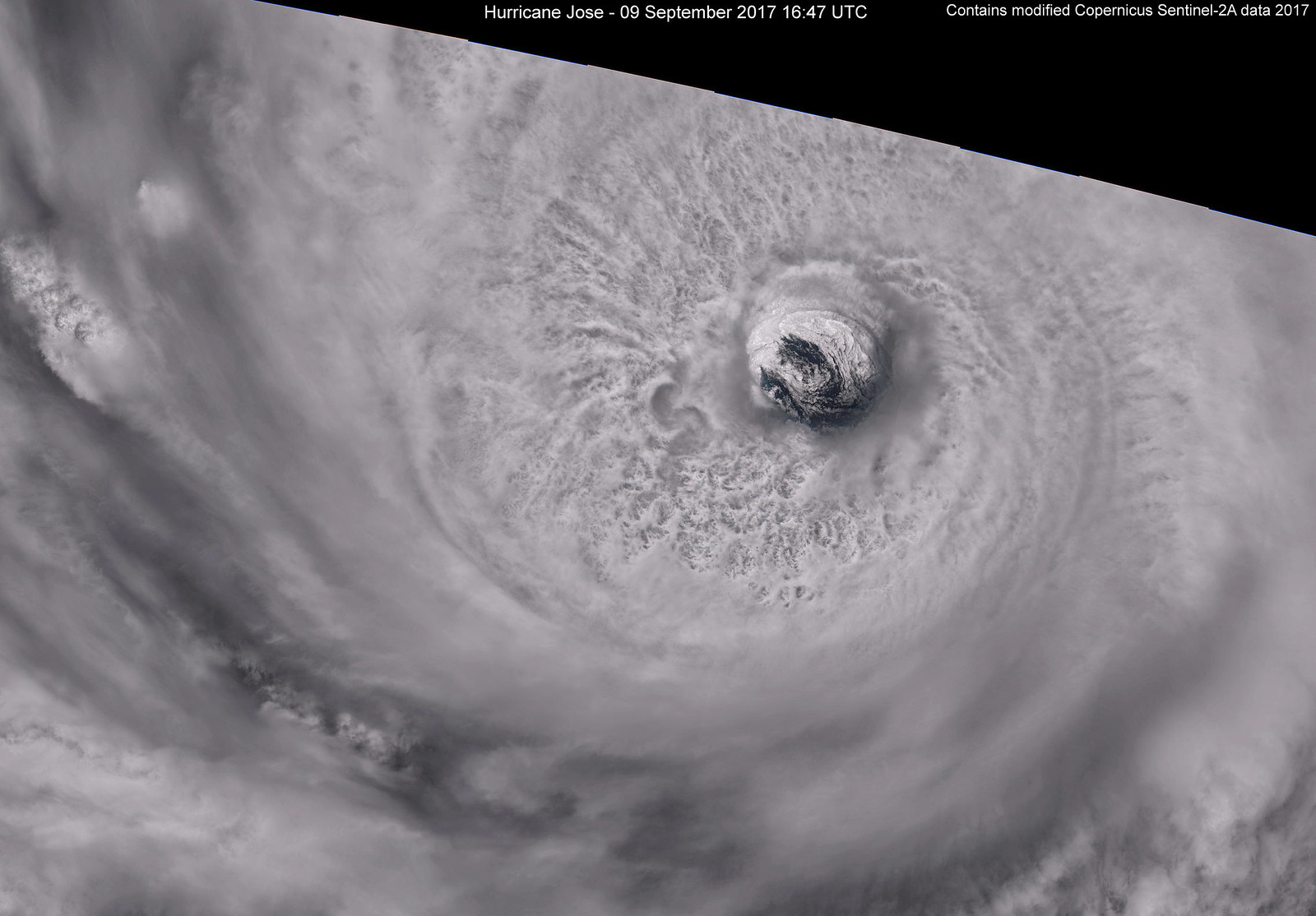
Link to a larger version (7954 x 5539). (Due to hardware limitations, I am currently not able to create a full-resolution image which would be around 30000 x 20000)
A closer look at the eye with lots of intense convection surrounding it:
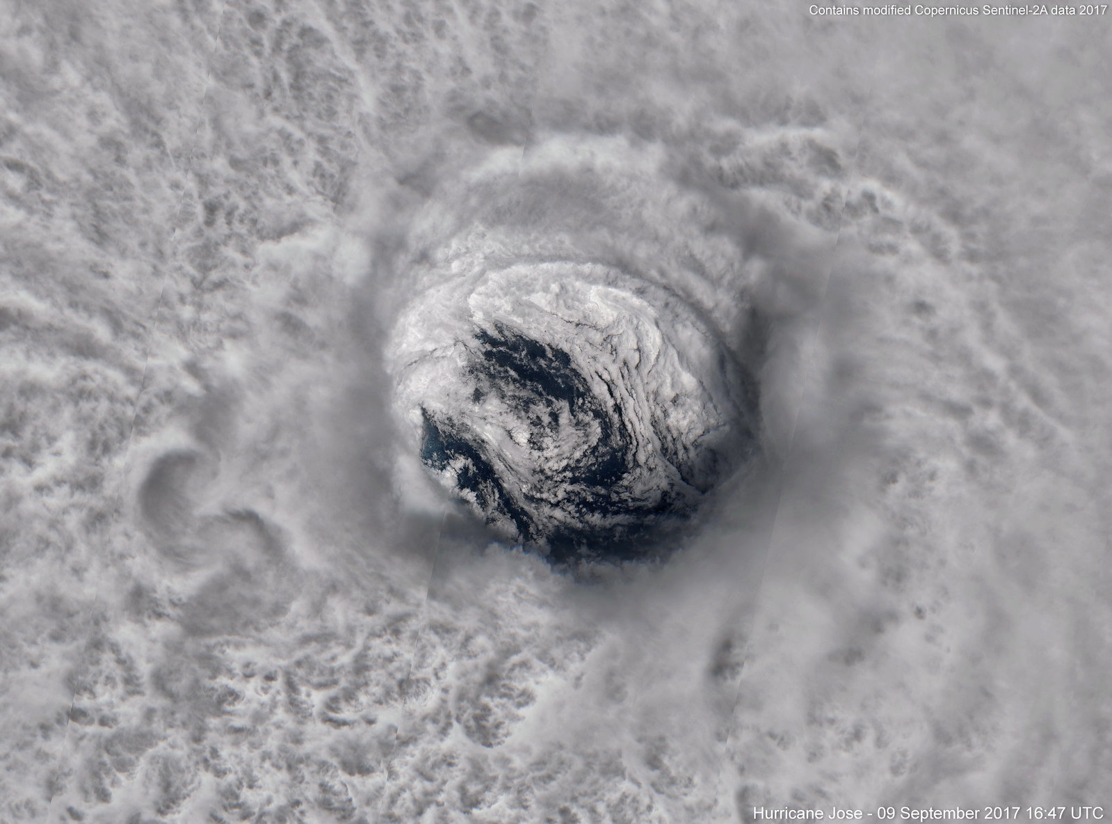
Link to the full resolution version (10 m per pixel) with a size of 8185 x 6057.
A full-frame shot of the eye. Most of the fine details are already visible in this image:
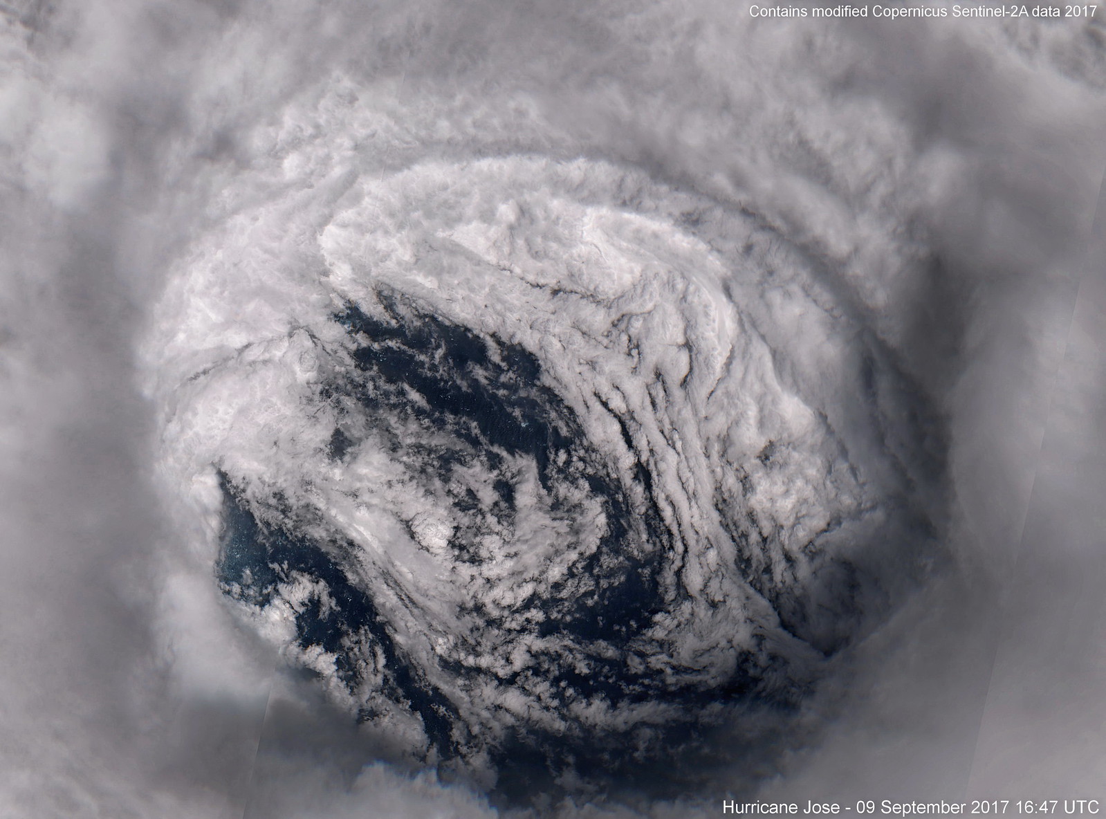
Link to the full resolution version (10 m per pixel) with a size of 3764 x 2786.
Below you can see some of the incredible details I have never seen before on hurricane satellite images. This part of the ocean surface has been under Jose's inner eyewall just a few minutes before the image was taken (the storm was moving NW):
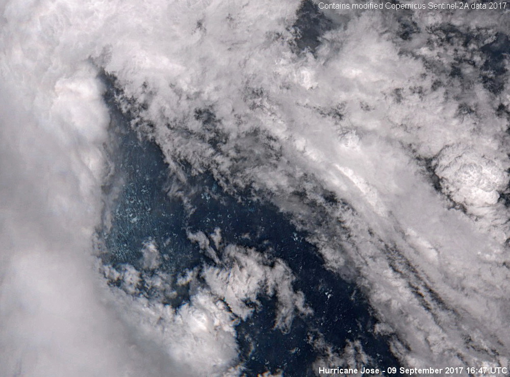
The large waves in the north-eastern part of the eye are looking quite different:

Unfortunately, Sentinel-2 rarely captures such stunning tropical cyclone imagery since it has a revisit time of five days and only covers areas close to land. However, there is a second beast of the 2017 Atlantic hurricane season that got captured by Sentinel-2: Hurricane Maria - even at category 5 intensity!
I'm currently processing the data of Maria and will post the images here or maybe even create a new thread for Sentinel-2 (and Landsat 8) images only. Needless to say, I've become quite fascinated by this kind of ultra-high resolution hurricane imagery

Link to a larger version (7954 x 5539). (Due to hardware limitations, I am currently not able to create a full-resolution image which would be around 30000 x 20000)
A closer look at the eye with lots of intense convection surrounding it:

Link to the full resolution version (10 m per pixel) with a size of 8185 x 6057.
A full-frame shot of the eye. Most of the fine details are already visible in this image:

Link to the full resolution version (10 m per pixel) with a size of 3764 x 2786.
Below you can see some of the incredible details I have never seen before on hurricane satellite images. This part of the ocean surface has been under Jose's inner eyewall just a few minutes before the image was taken (the storm was moving NW):

The large waves in the north-eastern part of the eye are looking quite different:

Unfortunately, Sentinel-2 rarely captures such stunning tropical cyclone imagery since it has a revisit time of five days and only covers areas close to land. However, there is a second beast of the 2017 Atlantic hurricane season that got captured by Sentinel-2: Hurricane Maria - even at category 5 intensity!
I'm currently processing the data of Maria and will post the images here or maybe even create a new thread for Sentinel-2 (and Landsat 8) images only. Needless to say, I've become quite fascinated by this kind of ultra-high resolution hurricane imagery
11 likes
-
Shell Mound
- Category 5

- Posts: 2432
- Age: 33
- Joined: Thu Sep 07, 2017 3:39 pm
- Location: St. Petersburg, FL → Scandinavia
Re: Top hurricane sat photos of all time...
0 likes
CVW / MiamiensisWx / Shell Mound
The posts in this forum are NOT official forecasts and should not be used as such. They are just the opinion of the poster and may or may not be backed by sound meteorological data. They are NOT endorsed by any professional institution or STORM2K. For official information, please refer to products from the NHC and NWS.
-
Digital-TC-Chaser
Re: Top hurricane sat photos of all time...
SUPER TYPHOON NINA/SISANG

http://www.typhoon2000.ph/Nina87/Nina_Ir.jpg
http://www.typhoon2000.ph/Nina87/Nina_BD2.jpg
A beast to rival most Super-Typhoons

http://www.typhoon2000.ph/Nina87/Nina_Ir.jpg
http://www.typhoon2000.ph/Nina87/Nina_BD2.jpg
A beast to rival most Super-Typhoons
0 likes
-
J_J99
- Tropical Depression

- Posts: 68
- Age: 26
- Joined: Wed Mar 09, 2016 9:43 pm
- Location: Cincinnati, OH
Re: Top hurricane sat photos of all time...


Irma September 5th 2017
1 likes
The following post is NOT an official forecast and should not be used as such. It is just the opinion of the poster and may or may not be backed by sound meteorological data. It is NOT endorsed by any professional institution including storm2k.org For Official Information please refer to the NHC and NWS products.
- 1900hurricane
- Category 5

- Posts: 6063
- Age: 34
- Joined: Fri Feb 06, 2015 12:04 pm
- Location: Houston, TX
- Contact:
Re: Top hurricane sat photos of all time...
How about some exceptionally clear eyes? The first is from pre-annular Isabel '03, at peak intensity.

This one is from Super Typhoon Gordon '89.

I wouldn't be surprised if each were a bit stronger than their 145 kt and 140 kt (respectively) peak intensities listed in best track.

This one is from Super Typhoon Gordon '89.

I wouldn't be surprised if each were a bit stronger than their 145 kt and 140 kt (respectively) peak intensities listed in best track.
1 likes
Contract Meteorologist. TAMU & MSST. Fiercely authentic, one of a kind. We are all given free will, so choose a life meant to be lived. We are the Masters of our own Stories.
Opinions expressed are mine alone.
Follow me on Twitter at @1900hurricane : Read blogs at https://1900hurricane.wordpress.com/
Opinions expressed are mine alone.
Follow me on Twitter at @1900hurricane : Read blogs at https://1900hurricane.wordpress.com/
- mrbagyo
- Category 5

- Posts: 3963
- Age: 33
- Joined: Thu Apr 12, 2012 9:18 am
- Location: 14.13N 120.98E
- Contact:
Re: Top hurricane sat photos of all time...
Gordon maintained a full CMG ring for almost 24 hours leading up to its Luzon Landfall. Its symmetry is on the same league of Joan, Ivan, Zeb, Megi, Meranti.
1 likes
The posts in this forum are NOT official forecast and should not be used as such. They are just the opinion of the poster and may or may not be backed by sound meteorological data. They are NOT endorsed by any professional institution or storm2k.org. For official information, please refer to RSMC, NHC and NWS products.
- 1900hurricane
- Category 5

- Posts: 6063
- Age: 34
- Joined: Fri Feb 06, 2015 12:04 pm
- Location: Houston, TX
- Contact:
Re: Top hurricane sat photos of all time...
Not to mention a very impressive microwave presentation.


1 likes
Contract Meteorologist. TAMU & MSST. Fiercely authentic, one of a kind. We are all given free will, so choose a life meant to be lived. We are the Masters of our own Stories.
Opinions expressed are mine alone.
Follow me on Twitter at @1900hurricane : Read blogs at https://1900hurricane.wordpress.com/
Opinions expressed are mine alone.
Follow me on Twitter at @1900hurricane : Read blogs at https://1900hurricane.wordpress.com/
Re: Top hurricane sat photos of all time...
Here's another set of very interesting images captured by the Sentinel-2 satellite. They show Hurricane Maria at category five intensity passing south of Saint Kitts and Nevis on September 19, 2017. The NHC estimated Maria's winds to be 140 knots and the pressure to be 927 mb at the time these images were taken (shortly before 15:00 UTC).
Unfortunately, the CDO was not completely captured by the relatively narrow swath width of Sentinel-2:
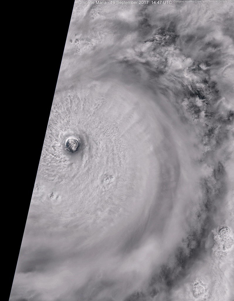
Link to a larger version (6488x8304).
The eye had a diameter of around 10 nautical miles (which by the way can be nicely calculated with these images since every pixel is exactly 10 metres), and this is just on the threshold of a pinhole eye.
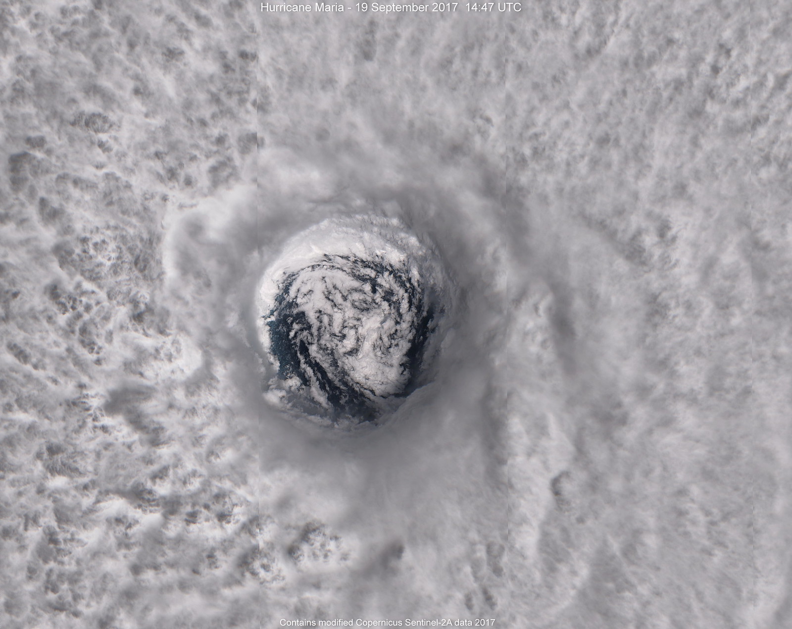
Link to the full-resolution version (7872x6248).
A close-up of the borderline pinhole eye:
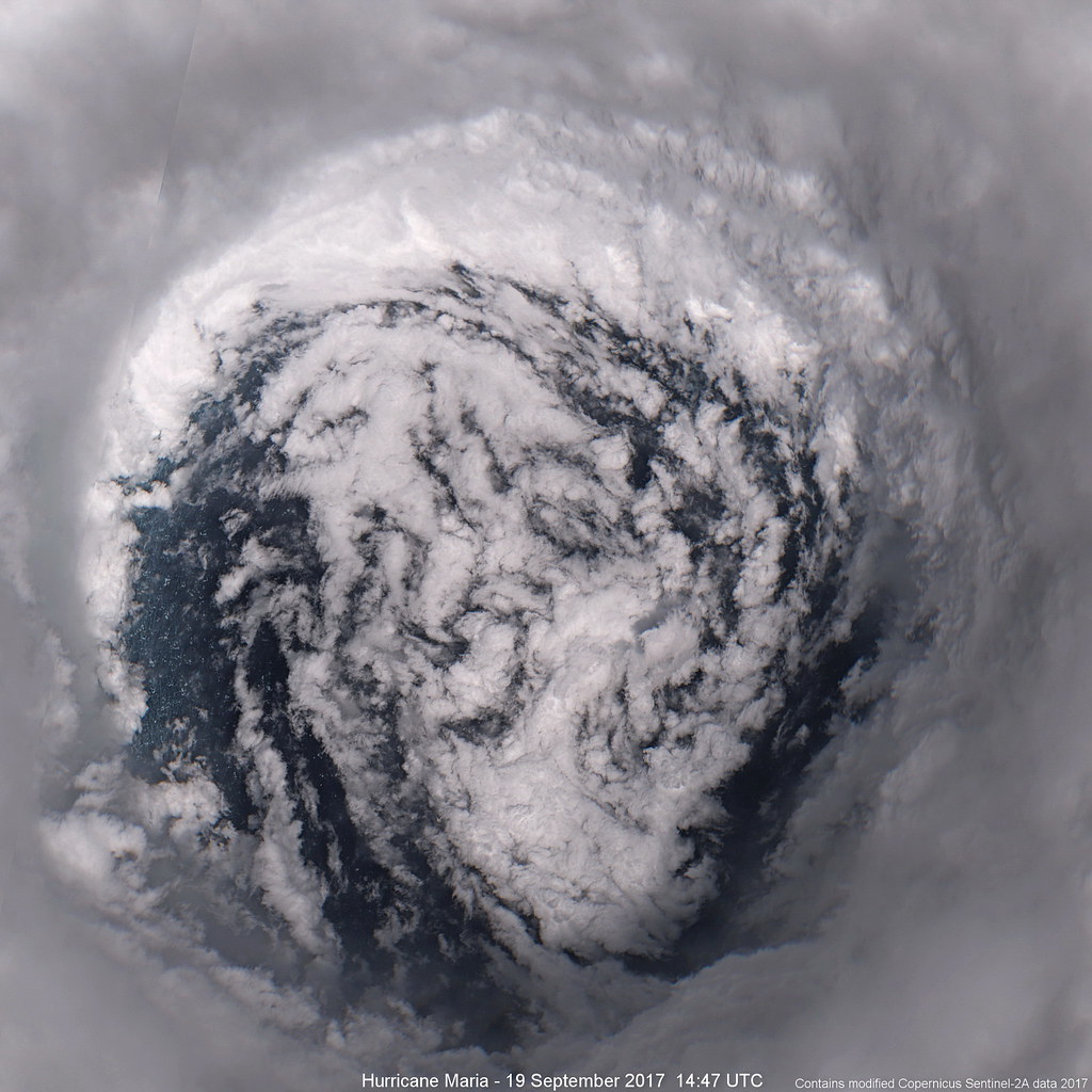
Link to the full-resolution version (2380x2380).
The violent state of the ocean surface inside the eye is clearly visible in this maximum-resolution image:
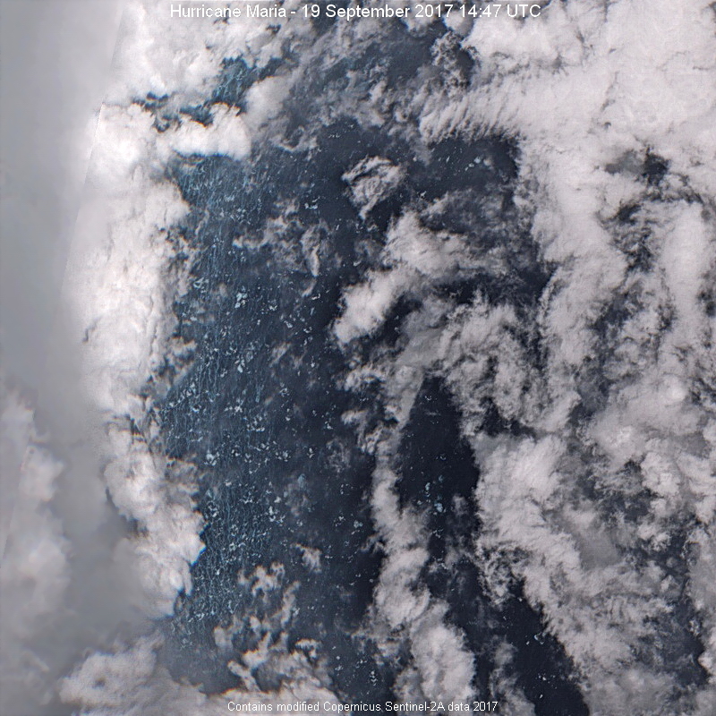
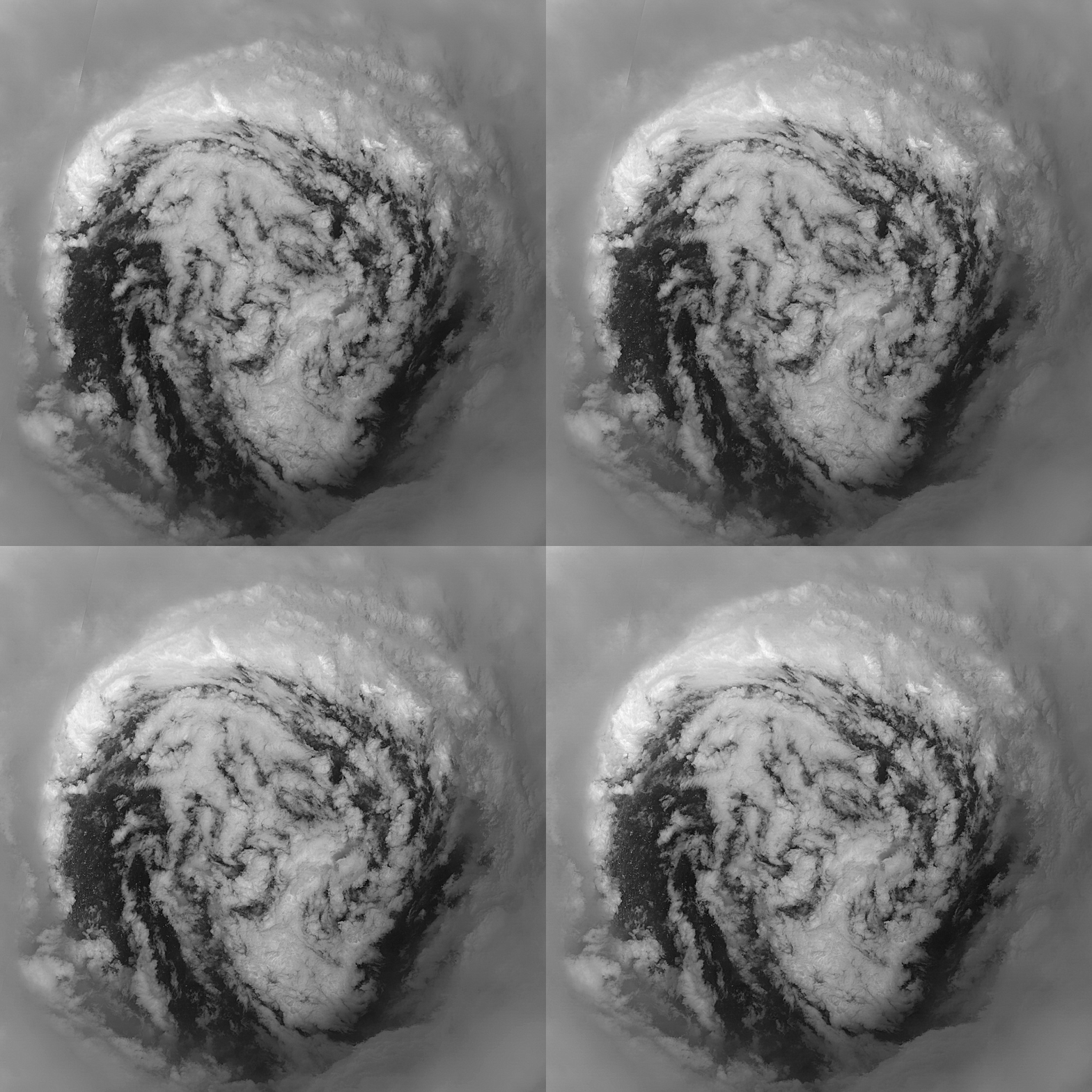
RGB images like these are created by combining the three different visible bands of the Sentinel-2 satellite (red, green and blue) into one single image. However, these bands are not recorded at exactly the same time but with a time difference of around one second. This small temporal difference is enough to create an interesting 3D "wiggle effect" when the bands are animated in quick succession. I first found out about this interesting effect in an excellent blog post by Pierre Markuse.
You can actually even see the anti-clockwise rotation of the storm:
Unfortunately, the CDO was not completely captured by the relatively narrow swath width of Sentinel-2:

Link to a larger version (6488x8304).
The eye had a diameter of around 10 nautical miles (which by the way can be nicely calculated with these images since every pixel is exactly 10 metres), and this is just on the threshold of a pinhole eye.

Link to the full-resolution version (7872x6248).
A close-up of the borderline pinhole eye:

Link to the full-resolution version (2380x2380).
The violent state of the ocean surface inside the eye is clearly visible in this maximum-resolution image:

RGB images like these are created by combining the three different visible bands of the Sentinel-2 satellite (red, green and blue) into one single image. However, these bands are not recorded at exactly the same time but with a time difference of around one second. This small temporal difference is enough to create an interesting 3D "wiggle effect" when the bands are animated in quick succession. I first found out about this interesting effect in an excellent blog post by Pierre Markuse.
You can actually even see the anti-clockwise rotation of the storm:

11 likes
- doomhaMwx
- Category 5

- Posts: 2487
- Age: 27
- Joined: Tue Apr 18, 2017 4:01 am
- Location: Baguio/Benguet, Philippines
- Contact:
Re: Top hurricane sat photos of all time...
Tropical Cyclone Sagar over the western Gulf of Aden.
Not as powerful as the other TCs in this thread, but for a TC to have such an impressive structure/presentation in this part of the world, where they are very rare, makes it worthy in here IMO.

Day/Night Visible Imagery VIIRS
05-18-2018 10:28am UTC
Not as powerful as the other TCs in this thread, but for a TC to have such an impressive structure/presentation in this part of the world, where they are very rare, makes it worthy in here IMO.

Day/Night Visible Imagery VIIRS
05-18-2018 10:28am UTC
4 likes
-
euro6208
- StormChaser75
- Tropical Storm

- Posts: 101
- Age: 24
- Joined: Sat Feb 06, 2016 4:23 pm
- Location: Corpus Christi TX
- Contact:
Re: Top hurricane sat photos of all time...
Here are some images of TS Sagar and Cyclone Mekunu.
Sagar


Mekunu


Radar of Mekunu at landfall from Salalah,Oman.

Sagar


Mekunu


Radar of Mekunu at landfall from Salalah,Oman.

3 likes
- 1900hurricane
- Category 5

- Posts: 6063
- Age: 34
- Joined: Fri Feb 06, 2015 12:04 pm
- Location: Houston, TX
- Contact:
Re: Top hurricane sat photos of all time...
supercane4867 wrote:"Super Typhoon Maria" in the North Atlantic ocean
Did someone say Super Typhoon Maria?

(Yeah, I know it's not technically rated a super typhoon yet, give it a few hours for JTWC to catch up)
6 likes
Contract Meteorologist. TAMU & MSST. Fiercely authentic, one of a kind. We are all given free will, so choose a life meant to be lived. We are the Masters of our own Stories.
Opinions expressed are mine alone.
Follow me on Twitter at @1900hurricane : Read blogs at https://1900hurricane.wordpress.com/
Opinions expressed are mine alone.
Follow me on Twitter at @1900hurricane : Read blogs at https://1900hurricane.wordpress.com/
Who is online
Users browsing this forum: No registered users and 89 guests

