#3028 Postby aspen » Fri Sep 11, 2020 6:06 pm
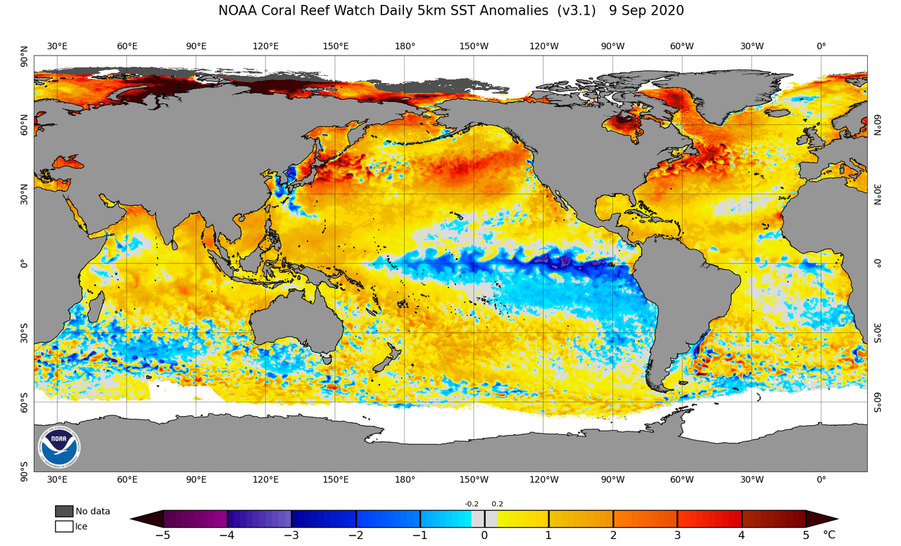
I’m starting to think 30 named storms is not out of the question. TD-19 is set to become the fifth named storm this September, with 95L likely to follow, and there’s still another two weeks left of the month. Not to mention that October could be very active as well. It’s looking more likely that 2020 will tie or even break the record for the most named TCs in September (8), and October probably won’t be a slouch either. 3 more storms after 95L/Teddy (9 total in September), 5 in October, and 2 in November-December would get us to 29/Theta. If October 2020 decides to challenge the record number of named storms in that month (also 8), that’ll be enough to break 30/Iota.
It’s absolutely insane that a 30 NS season, breaking 2005’s total storm count, is even on the table at all. While 2020 probably won’t break its record number of majors, I could see it getting close to 2005 and 2010 in terms of hurricanes.
2 likes
Irene '11 Sandy '12 Hermine '16 5/15/2018 Derecho Fay '20 Isaias '20 Elsa '21 Henri '21 Ida '21
I am only a meteorology enthusiast who knows a decent amount about tropical cyclones. Look to the professional mets, the NHC, or your local weather office for the best information.