


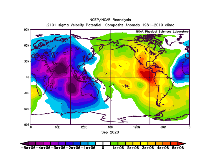
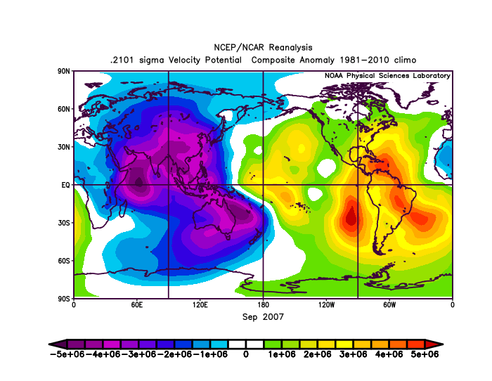
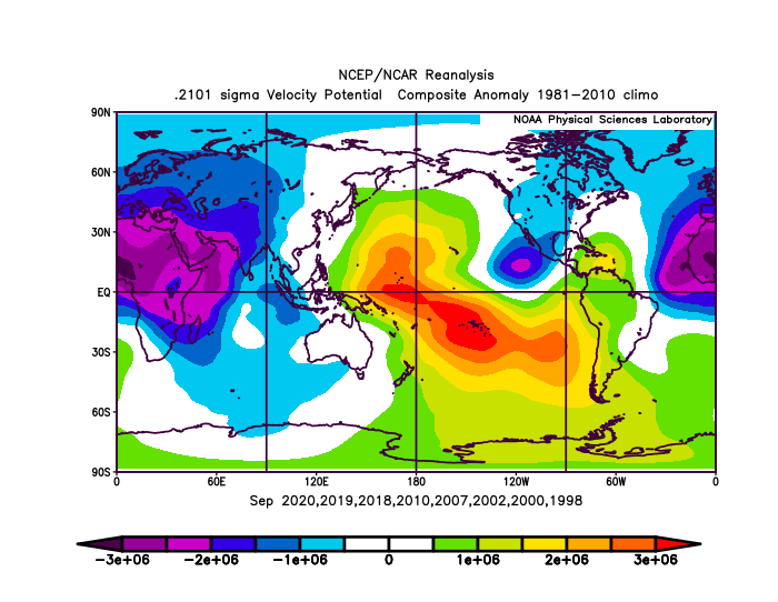
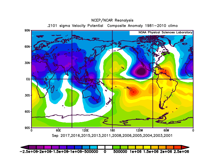
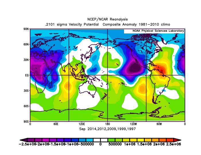
AlphaToOmega wrote:I split every September from 1997 to 2020 into three categories: above-average, average, and below-average. An above-average September features seven or more storms. An average September features four to six storms. A below-average September features three or fewer storms.
Above-average September:
https://i.postimg.cc/PJZHfjnx/Rj7-B2kvd7j.png
Average September:
https://i.postimg.cc/sfZs4pGr/Do-X64-Ub-Xc2.png
Below-average September:
https://i.postimg.cc/sDdy6v5Z/KM5-C8-Ar-X20.png
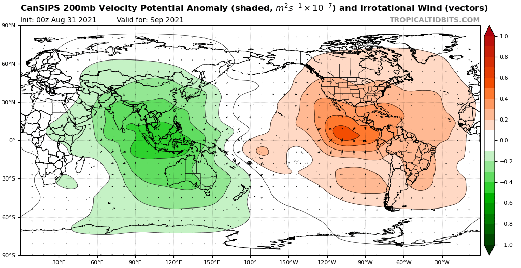
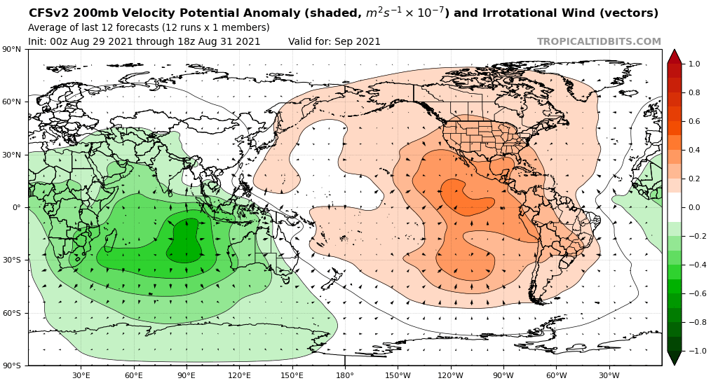
There is one key difference between the above-average Septembers, the average Septembers, and the below-average Septembers: the VP anomalies in the Indian Ocean. For above-average Septembers, VP anomalies in the Indian Ocean are consistently negative. For average Septembers, VP anomalies in the Indian Ocean are negative in some parts and positive in other parts. For below-average Septembers, VP anomalies in the Indian Ocean are consistently positive. What will September 2021 likely feature?
https://i.postimg.cc/prjmvSZB/cansips-chi200-global-1.png
https://i.postimg.cc/FFkd0f4J/cfs-mon-01-chi200-global-1.png
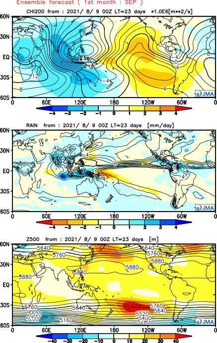
https://i.postimg.cc/JzHN1YGF/Y202108-D0900-gl0.png
This matches with an above-average September (seven or more storms) signature. The CanSIPS, CFSv2, and JMA would all have to bust in a major way for September 2021 to have fewer than seven storms.
The thing is, there aren't many model signals for storms to form in the near future. 91L only has a 30% chance of development. After that, the GEFS and EPS aren't really showing that much activity other than a potential MDR storm or two after Day 10. It seems unlikely IMO that we'll see 6 storms after September 10, but it can't be ruled out. There's more to how active a month is than velocity potential. I do think we'll see a few more storms (and potentially hurricanes) form this month, but I just don't see TC spam like 2020. There's a reason the Atlantic has only had 10 named storms in September once, despite having a similar VP pattern to 2020 in many years.


