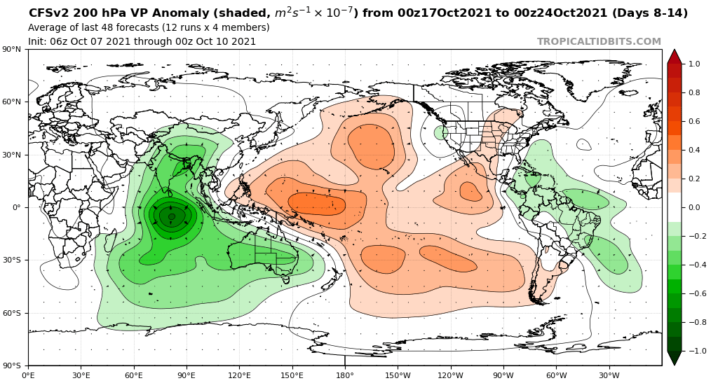
2021 Indicators: SST's / SAL / MSLP / Shear / Steering / Instability / Sat Images

This is the general tropical discussion area. Anyone can take their shot at predicting a storms path.

Moderator: S2k Moderators

Forum rules

The posts in this forum are NOT official forecasts and should not be used as such. They are just the opinion of the poster and may or may not be backed by sound meteorological data. They are NOT endorsed by any professional institution or STORM2K. For official information, please refer to products from the National Hurricane Center and National Weather Service.

Help Support Storm2K
Message
Author
User avatar
Steve
S2K Supporter
S2K Supporter
Posts: 8610
Joined: Sat Apr 05, 2003 11:41 pm
Location: Not a state-caster

Re: 2021 Indicators: SST's / SAL / MSLP / Shear / Steering / Instability / Sat Images

#3881 Postby Steve » Sat Oct 09, 2021 10:48 pm

Category5Kaiju wrote:At least according to the recent GFS run, I sincerely think that a model-not-catching the MJO/CCKW bias may be why the Atlantic does not see anything significant form in the next 16 days; after Pamela, the EPAC falls silent, while the WPAC is somewhat active but does not produce any major typhoons. Yeah, something’s fishy here.


Bet.
1 likes   

User avatar
chaser1
S2K Supporter
S2K Supporter
Posts: 4751
Age: 63
Joined: Sat Oct 15, 2005 5:59 pm
Location: Longwood, Fl

Re: 2021 Indicators: SST's / SAL / MSLP / Shear / Steering / Instability / Sat Images

#3882 Postby chaser1 » Sat Oct 09, 2021 11:10 pm

Ubuntwo wrote:CFS height anomalies in early November, around the time the western basin should be favored for development. This pattern favors a track buried into Central America or recurving through the Greater Antilles.
https://i.imgur.com/Y4vMs1R.png
Very intense upper level winds mean nothing is forming within the Gulf. As soon as SFL gets its first dry season front it will be in the clear. No hints of that (yet) in the models.


Season will likely end following the first cold-front that fully sweeps the Caribbean. I don't see THAT horizon approaching anytime soon. Until then, models will continue to show nada (right up to the point when they suddenly light up like the 4th of July).
10 likes   
Personal Forecast Disclaimer:
The posts in this forum are NOT official forecast and should not be used as such. They are just the opinion of the poster and may or may not be backed by sound meteorological data. They are NOT endorsed by any professional institution or storm2k.org. For official information, please refer to the NHC and NWS products.


User avatar
Ubuntwo
Category 5
Category 5
Posts: 1089
Age: 30
Joined: Thu Oct 05, 2017 10:41 pm

Re: 2021 Indicators: SST's / SAL / MSLP / Shear / Steering / Instability / Sat Images

#3883 Postby Ubuntwo » Sun Oct 10, 2021 2:28 am

chaser1 wrote:Season will likely end following the first cold-front that fully sweeps the Caribbean. I don't see THAT horizon approaching anytime soon. Until then, models will continue to show nada (right up to the point when they suddenly light up like the 4th of July).

Well put IMO. Models are not depicting the season-ending front just as they are not depicting development. Tropical cyclone formation lead time is generally just a few days. Plenty of waves sneaking across the MDR.
2 likes   
Kendall -> SLO -> PBC

Memorable Storms: Katrina (for its Florida landfall...) Wilma Matthew Irma

User avatar
Category5Kaiju
Category 5
Category 5
Posts: 3438
Age: 22
Joined: Thu Dec 24, 2020 12:45 pm
Location: Seattle

Re: 2021 Indicators: SST's / SAL / MSLP / Shear / Steering / Instability / Sat Images

#3884 Postby Category5Kaiju » Sun Oct 10, 2021 7:18 am

chaser1 wrote:
Ubuntwo wrote:CFS height anomalies in early November, around the time the western basin should be favored for development. This pattern favors a track buried into Central America or recurving through the Greater Antilles.
https://i.imgur.com/Y4vMs1R.png
Very intense upper level winds mean nothing is forming within the Gulf. As soon as SFL gets its first dry season front it will be in the clear. No hints of that (yet) in the models.


Season will likely end following the first cold-front that fully sweeps the Caribbean. I don't see THAT horizon approaching anytime soon. Until then, models will continue to show nada (right up to the point when they suddenly light up like the 4th of July).


All the more reason to believe that the models may just be having a hard time understanding that after the favorable CCKW passes the EPAC then it'll likely be the Atlantic that wakes up next. For them to not show the season-ending front but also show no significant activity pick up in the next weeks or so is just bizarre.
0 likes   
Unless explicitly stated, all information covered in my posts is based on my opinions and observations. Please refer to a professional meteorologist or an accredited weather research agency otherwise, especially if serious decisions must be made in the event of a potentially life-threatening tropical storm or hurricane.

AlphaToOmega
Category 5
Category 5
Posts: 1448
Joined: Sat Jun 26, 2021 10:51 am
Location: Somewhere in Massachusetts

Re: 2021 Indicators: SST's / SAL / MSLP / Shear / Steering / Instability / Sat Images

#3885 Postby AlphaToOmega » Sun Oct 10, 2021 8:27 am

Big middle finger for those wising for an impact-free October

Image
1 likes   

User avatar
boca
Category 5
Category 5
Posts: 6306
Age: 59
Joined: Mon Dec 15, 2003 8:49 am
Location: Boca Raton,FL

Re: 2021 Indicators: SST's / SAL / MSLP / Shear / Steering / Instability / Sat Images

#3886 Postby boca » Sun Oct 10, 2021 8:48 am

AlphaToOmega wrote:Big middle finger for those wising for an impact-free October

https://i.postimg.cc/v8kDGD8c/21102100-1000.gif


Do you have a link to the site?
0 likes   

AlphaToOmega
Category 5
Category 5
Posts: 1448
Joined: Sat Jun 26, 2021 10:51 am
Location: Somewhere in Massachusetts

Re: 2021 Indicators: SST's / SAL / MSLP / Shear / Steering / Instability / Sat Images

#3887 Postby AlphaToOmega » Sun Oct 10, 2021 8:50 am

boca wrote:
AlphaToOmega wrote:Big middle finger for those wising for an impact-free October

https://i.postimg.cc/v8kDGD8c/21102100-1000.gif


Do you have a link to the site?


weatheronline.co.uk
0 likes   

User avatar
Category5Kaiju
Category 5
Category 5
Posts: 3438
Age: 22
Joined: Thu Dec 24, 2020 12:45 pm
Location: Seattle

Re: 2021 Indicators: SST's / SAL / MSLP / Shear / Steering / Instability / Sat Images

#3888 Postby Category5Kaiju » Sun Oct 10, 2021 9:04 am

CFS I will give credit to in the sense that it has consistently shown activity in the Atlantic after mid-month.
0 likes   
Unless explicitly stated, all information covered in my posts is based on my opinions and observations. Please refer to a professional meteorologist or an accredited weather research agency otherwise, especially if serious decisions must be made in the event of a potentially life-threatening tropical storm or hurricane.

User avatar
wxman57
Moderator-Pro Met
Moderator-Pro Met
Posts: 22506
Age: 66
Joined: Sat Jun 21, 2003 8:06 pm
Location: Houston, TX (southwest)

Re: 2021 Indicators: SST's / SAL / MSLP / Shear / Steering / Instability / Sat Images

#3889 Postby wxman57 » Sun Oct 10, 2021 9:05 am

Using the seasonal CFS model for predicting TC development is not advised. Very high wind shear now dominates the Gulf and East U.S. Coast. That shear now includes all of Florida, and it may remain through the next couple of weeks. The only shot at additional development would be in the Caribbean or in the subtropics. This is no 2020...
3 likes   

User avatar
Category5Kaiju
Category 5
Category 5
Posts: 3438
Age: 22
Joined: Thu Dec 24, 2020 12:45 pm
Location: Seattle

Re: 2021 Indicators: SST's / SAL / MSLP / Shear / Steering / Instability / Sat Images

#3890 Postby Category5Kaiju » Sun Oct 10, 2021 9:28 am

Ok, so here's what I will do: I will post the timelines of all cool neutral/La Nina years since the active era's start in 1995 for easy reference. Getting copious October/November activity is not normal (2020 especially), but seeing a few major hurricanes during that timeframe is pretty typical. The two major exceptions that I see are 2007 and 2010 (2017 if you do not count Ophelia as it was not a W Atlantic storm as well perhaps). We'll see what 2021 does, although my gut is telling me that the CCKW's favorable phase should spark some activity later this month, with a decent chance of seeing something in the WCAR then pretty plausible. If not, then I would be surprised, not going to lie.

1995
Image

1996
Image

1998
Image

1999
Image

2000
Image

2001
Image

2005
Image

2007
Image

2008
Image

2010
Image

2011
Image

2012
Image

2016
Image

2017
Image

2020
Image
3 likes   
Unless explicitly stated, all information covered in my posts is based on my opinions and observations. Please refer to a professional meteorologist or an accredited weather research agency otherwise, especially if serious decisions must be made in the event of a potentially life-threatening tropical storm or hurricane.

User avatar
toad strangler
S2K Supporter
S2K Supporter
Posts: 4178
Joined: Sun Jul 28, 2013 3:09 pm
Location: Earth
Contact:

Re: 2021 Indicators: SST's / SAL / MSLP / Shear / Steering / Instability / Sat Images

#3891 Postby toad strangler » Sun Oct 10, 2021 9:55 am

wxman57 wrote:Using the seasonal CFS model for predicting TC development is not advised. Very high wind shear now dominates the Gulf and East U.S. Coast. That shear now includes all of Florida, and it may remain through the next couple of weeks. The only shot at additional development would be in the Caribbean or in the subtropics. This is no 2020...


A couple a weeks gets us very close to the threshold of no more CONUS 'cane landfalls per climo sans 1985
0 likes   

AlphaToOmega
Category 5
Category 5
Posts: 1448
Joined: Sat Jun 26, 2021 10:51 am
Location: Somewhere in Massachusetts

Re: 2021 Indicators: SST's / SAL / MSLP / Shear / Steering / Instability / Sat Images

#3892 Postby AlphaToOmega » Sun Oct 10, 2021 10:02 am

Category5Kaiju wrote:Ok, so here's what I will do: I will post the timelines of all cool neutral/La Nina years since the active era's start in 1995 for easy reference. Getting copious October/November activity is not normal (2020 especially), but seeing a few major hurricanes during that timeframe is pretty typical. The two major exceptions that I see are 2007 and 2010 (2017 if you do not count Ophelia as it was not a W Atlantic storm as well perhaps). We'll see what 2021 does, although my gut is telling me that the CCKW's favorable phase should spark some activity later this month, with a decent chance of seeing something in the WCAR then pretty plausible. If not, then I would be surprised, not going to lie.

1995
https://upload.wikimedia.org/wikipedia/en/timeline/o5mwgk64clkn0nx3ojs1vrhi9pxkfu4.png

1996
https://upload.wikimedia.org/wikipedia/en/timeline/9466c4b5b4756bd8f9d95e75416d7821.png

1998
https://upload.wikimedia.org/wikipedia/en/timeline/3xyvhneu7hmxyc4f52xjn38is10ymmd.png

1999
https://upload.wikimedia.org/wikipedia/en/timeline/70c4220e451c4ba743c542d4ce7f2791.png

2000
https://upload.wikimedia.org/wikipedia/en/timeline/f82aedaca98bef461759f6eb2a0f2c14.png

2001
https://upload.wikimedia.org/wikipedia/en/timeline/i94gc6qz0cn42l21ubvtg9zkuu9fygq.png

2005
https://upload.wikimedia.org/wikipedia/en/timeline/nrdwfc8w8kzpqzdw0rk8k88inxlutma.png

2007
https://upload.wikimedia.org/wikipedia/en/timeline/iis13x5mxnkn0bkpid2e8rmxki367jn.png

2008
https://upload.wikimedia.org/wikipedia/en/timeline/86d1j6u8v5qap56wd1799ueol477d6l.png

2010
https://upload.wikimedia.org/wikipedia/en/timeline/e0b2vkmbrlrjdz5iny3o56v71o5nvi1.png

2011
https://upload.wikimedia.org/wikipedia/en/timeline/5eecd1b32cb9cf9e143ca516fde004dd.png

2012
https://upload.wikimedia.org/wikipedia/en/timeline/b7fu0g5mlk5cv3x53ayzuasb9fvz1ta.png

2016
https://upload.wikimedia.org/wikipedia/en/timeline/7dkigbe4n7spafr8j6tf6i5odpwbxtr.png

2017
https://upload.wikimedia.org/wikipedia/en/timeline/mvwjzaf4ej35o3er04lw403v0bwz5rt.png

2020
https://upload.wikimedia.org/wikipedia/en/timeline/aq63elp2btahkf9mikk4ukb93uzkk1l.png


2012 was warm-neutral during ASO.
0 likes   

AlphaToOmega
Category 5
Category 5
Posts: 1448
Joined: Sat Jun 26, 2021 10:51 am
Location: Somewhere in Massachusetts

Re: 2021 Indicators: SST's / SAL / MSLP / Shear / Steering / Instability / Sat Images

#3893 Postby AlphaToOmega » Sun Oct 10, 2021 10:08 am

Image

Don't you love it when models ignore very obvious signals? It always gives me a chuckle.
Last edited by AlphaToOmega on Sun Oct 10, 2021 10:23 am, edited 1 time in total.
1 likes   

User avatar
WiscoWx02
Category 1
Category 1
Posts: 345
Age: 22
Joined: Sat Jul 31, 2021 8:09 pm
Location: Minnesota

Re: 2021 Indicators: SST's / SAL / MSLP / Shear / Steering / Instability / Sat Images

#3894 Postby WiscoWx02 » Sun Oct 10, 2021 10:19 am

Signal appears to be weakening for the MJO passing through the Atlantic. Not surprising at all in my opinion. Sure, almost every hurricane season that had a La Nina developing produced one major in the Caribbean Sea during October or November, but there is always an exception. There may not be one yet, but that doesn't mean one won't show up. In fact, one is almost destined to show up sooner or later based on probability. I think this year will be the exception to two things, that a La Nina almost guarantees a major hurricane later in the season, and all seasons that see a MDR storm by early July will end as hyperactive.
0 likes   

AlphaToOmega
Category 5
Category 5
Posts: 1448
Joined: Sat Jun 26, 2021 10:51 am
Location: Somewhere in Massachusetts

Re: 2021 Indicators: SST's / SAL / MSLP / Shear / Steering / Instability / Sat Images

#3895 Postby AlphaToOmega » Sun Oct 10, 2021 10:29 am

Quite a potent -VP signal in this Indian Ocean as well as a -VP cell south of the Caribbean
This seems like this sort of setup screaming for a major hurricane
Climatology is also favoring activity during this month
We do not leave the peak of hurricane season until November 1
Image
0 likes   

User avatar
aspen
Category 5
Category 5
Posts: 8061
Joined: Sat Oct 12, 2019 7:10 pm
Location: Connecticut, USA

Re: 2021 Indicators: SST's / SAL / MSLP / Shear / Steering / Instability / Sat Images

#3896 Postby aspen » Sun Oct 10, 2021 10:29 am

wxman57 wrote:Using the seasonal CFS model for predicting TC development is not advised. Very high wind shear now dominates the Gulf and East U.S. Coast. That shear now includes all of Florida, and it may remain through the next couple of weeks. The only shot at additional development would be in the Caribbean or in the subtropics. This is no 2020...

IMO, if anything from the Caribbean does threaten the CONUS, it’ll be more like Eta than Zeta — much weaker than its peak in the WCar and probably just a TS.
0 likes   
Irene '11 Sandy '12 Hermine '16 5/15/2018 Derecho Fay '20 Isaias '20 Elsa '21 Henri '21 Ida '21

I am only a meteorology enthusiast who knows a decent amount about tropical cyclones. Look to the professional mets, the NHC, or your local weather office for the best information.

User avatar
Category5Kaiju
Category 5
Category 5
Posts: 3438
Age: 22
Joined: Thu Dec 24, 2020 12:45 pm
Location: Seattle

Re: 2021 Indicators: SST's / SAL / MSLP / Shear / Steering / Instability / Sat Images

#3897 Postby Category5Kaiju » Sun Oct 10, 2021 10:33 am

If for whatever reason this season does not produce any majors going forward (especially in the West Atlantic), then I think we're going to need to do some heavy, extensive, retrospective research and studies on what happened, or what went wrong, or why it turned out to be an "exception." Because clearly you would think that the above average sst anomalies and the past behavior of the season to rumble into action with each favorable CCKW pass would suggest otherwise (not to mention a triple negative, solid -ENSO, -PMM, -PDO phase of the Pacific).
0 likes   
Unless explicitly stated, all information covered in my posts is based on my opinions and observations. Please refer to a professional meteorologist or an accredited weather research agency otherwise, especially if serious decisions must be made in the event of a potentially life-threatening tropical storm or hurricane.

AlphaToOmega
Category 5
Category 5
Posts: 1448
Joined: Sat Jun 26, 2021 10:51 am
Location: Somewhere in Massachusetts

Re: 2021 Indicators: SST's / SAL / MSLP / Shear / Steering / Instability / Sat Images

#3898 Postby AlphaToOmega » Sun Oct 10, 2021 10:39 am

This gives me a chuckle
Image
Image
0 likes   

User avatar
Category5Kaiju
Category 5
Category 5
Posts: 3438
Age: 22
Joined: Thu Dec 24, 2020 12:45 pm
Location: Seattle

Re: 2021 Indicators: SST's / SAL / MSLP / Shear / Steering / Instability / Sat Images

#3899 Postby Category5Kaiju » Sun Oct 10, 2021 10:49 am

0 likes   
Unless explicitly stated, all information covered in my posts is based on my opinions and observations. Please refer to a professional meteorologist or an accredited weather research agency otherwise, especially if serious decisions must be made in the event of a potentially life-threatening tropical storm or hurricane.

LarryWx
Category 5
Category 5
Posts: 5793
Joined: Sun Sep 07, 2003 2:04 pm
Location: GA

Re: 2021 Indicators: SST's / SAL / MSLP / Shear / Steering / Instability / Sat Images

#3900 Postby LarryWx » Sun Oct 10, 2021 11:20 am

Category5Kaiju wrote:
chaser1 wrote:
Ubuntwo wrote:CFS height anomalies in early November, around the time the western basin should be favored for development. This pattern favors a track buried into Central America or recurving through the Greater Antilles.
https://i.imgur.com/Y4vMs1R.png
Very intense upper level winds mean nothing is forming within the Gulf. As soon as SFL gets its first dry season front it will be in the clear. No hints of that (yet) in the models.


Season will likely end following the first cold-front that fully sweeps the Caribbean. I don't see THAT horizon approaching anytime soon. Until then, models will continue to show nada (right up to the point when they suddenly light up like the 4th of July).


All the more reason to believe that the models may just be having a hard time understanding that after the favorable CCKW passes the EPAC then it'll likely be the Atlantic that wakes up next. For them to not show the season-ending front but also show no significant activity pick up in the next weeks or so is just bizarre.


Why does there need to be a “season-ending front” to likely end a season for all practical purposes? From where did this concept originate? Please provide links to credible sources on this idea.

Anyway, there’s a good reason for the models thread to be very quiet. There’s been and still is very limited activity on the two week models/ensembles. This takes us through 10/25, which is past the end of the climo secondary/final peak of the season. Thus, the outlook for future big threats to land masses is improving a good bit from day to day. Not over, but improving, especially for Conus.

Yes, due to global warming, the active part of seasons is likely ending a bit later (and starting a bit earlier) on average. But regardless, once past around 10/21, the threat to even S FL goes down markedly per historical stats. As I posted before, the period 10/17-21 may actually be the highest 5 day threat period of the entire season climo wise to south FL in terms of frequency of TCs being there or very closeby per past seasons. But once just past that period, the threat drops off rapidly leaving only a few outliers.
Last edited by LarryWx on Sun Oct 10, 2021 11:33 am, edited 1 time in total.
0 likes   
Personal Forecast Disclaimer:
The posts in this forum are NOT official forecasts and should not be used as such. They are just the opinion of the poster and may or may not be backed by sound meteorological data. They are NOT endorsed by any professional institution or storm2k.org. For official information, please refer to the NHC and NWS products.


Return to “Talkin' Tropics”

Who is online

Users browsing this forum: butch, Cpv17, cycloneye, Google Adsense [Bot], HurakaYoshi, jgh, kassi, Killjoy12, lilbump3000, MetroMike, NONAME, skyline385, Wampadawg, Zonacane and 89 guests