drezee wrote:obs from Barbados should be interesting
Nothing special at barbados pressure is high 1015 hpa, and no veering, but very moist air in vicinity...
http://weather.noaa.gov/weather/current/TBPB.htmlCurrent Weather Conditions:
Grantley Adams, Barbados
(TBPB) 13-04N 059-29W 56M
--------------------------------------------------------------------------------
Conditions at Jul 02, 2008 - 09:00 AM EDTJul 02, 2008 - 08:00 AM CDTJul 02, 2008 - 07:00 AM MDTJul 02, 2008 - 06:00 AM PDTJul 02, 2008 - 05:00 AM ADTJul 02, 2008 - 04:00 AM HDT
2008.07.02 1300 UTC
Wind from the E (080 degrees) at 14 MPH (12 KT)
Visibility greater than 7 mile(s)
Sky conditions mostly cloudy
Weather Cumulonimbus clouds observed
Temperature 78 F (26 C)
Dew Point 77 F (25 C)
Relative Humidity 94%
Pressure (altimeter) 29.97 in. Hg (1015 hPa)
ob TBPB 021300Z 08012KT 9999 SCT012CB BKN014 26/25 Q1015
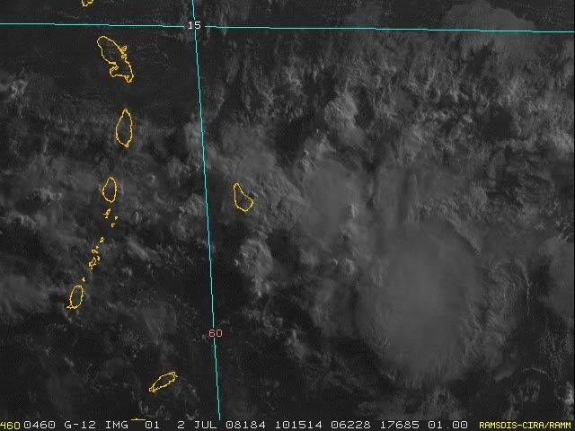
http://www.ssd.noaa.gov/goes/east/carb/wv-l.jpgNothing special at barbados pressure is high 1015 hpa, and no veering, but very moist air in vicinity...
http://weather.noaa.gov/weather/current/TBPB.htmlCurrent Weather Conditions:
Grantley Adams, Barbados
(TBPB) 13-04N 059-29W 56M
--------------------------------------------------------------------------------
Conditions at Jul 02, 2008 - 09:00 AM EDTJul 02, 2008 - 08:00 AM CDTJul 02, 2008 - 07:00 AM MDTJul 02, 2008 - 06:00 AM PDTJul 02, 2008 - 05:00 AM ADTJul 02, 2008 - 04:00 AM HDT
2008.07.02 1300 UTC
Wind from the E (080 degrees) at 14 MPH (12 KT)
Visibility greater than 7 mile(s)
Sky conditions mostly cloudy
Weather Cumulonimbus clouds observed
Temperature 78 F (26 C)
Dew Point 77 F (25 C)
Relative Humidity 94%
Pressure (altimeter) 29.97 in. Hg (1015 hPa)
ob TBPB 021300Z 08012KT 9999 SCT012CB BKN014 26/25 Q1015
http://www.ssd.noaa.gov/goes/east/carb/wv-l.jpg


