Low Pressure in the Central Atlantic (Is Invest 91L)
Moderator: S2k Moderators
Forum rules

The posts in this forum are NOT official forecasts and should not be used as such. They are just the opinion of the poster and may or may not be backed by sound meteorological data. They are NOT endorsed by any professional institution or STORM2K. For official information, please refer to products from the National Hurricane Center and National Weather Service.

Re: Low Pressure in the Central Atlantic
90% of the time they recurve in the Bahamas unless you have a building high off the mid Atlantic building southward.They all seem to recurve year after year so when I see a storm coming in from the east I think recurve.
1 likes
-
ScottNAtlanta

- Category 5

- Posts: 2535
- Joined: Sat May 25, 2013 3:11 pm
- Location: Atlanta, GA
Re: Low Pressure in the Central Atlantic
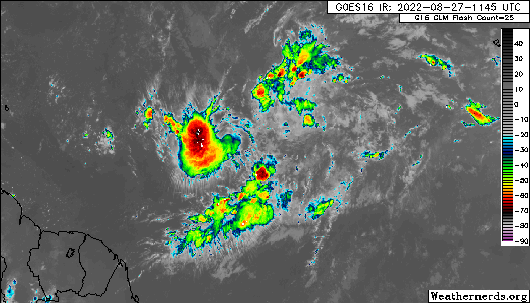
I will say this has sure covered some distance since yesterday. It is almost 20 degrees further west longitude.
0 likes
The posts in this forum are NOT official forecast and should not be used as such. They are just the opinion of the poster and may or may not be backed by sound meteorological data. They are NOT endorsed by any professional institution or storm2k.org. For official information, please refer to the NHC and NWS products.
-
ScottNAtlanta
- Category 5
- Posts: 2535
- Joined: Sat May 25, 2013 3:11 pm
- Location: Atlanta, GA
Re: Low Pressure in the Central Atlantic
boca wrote:90% of the time they recurve in the Bahamas unless you have a building high off the mid Atlantic building southward.They all seem to recurve year after year so when I see a storm coming in from the east I think recurve.
Unless it has been shunted to the west, and that is never a good sign when that happens
0 likes
The posts in this forum are NOT official forecast and should not be used as such. They are just the opinion of the poster and may or may not be backed by sound meteorological data. They are NOT endorsed by any professional institution or storm2k.org. For official information, please refer to the NHC and NWS products.
-
cycloneye

- Admin

- Posts: 149572
- Age: 69
- Joined: Thu Oct 10, 2002 10:54 am
- Location: San Juan, Puerto Rico
Re: Low Pressure in the Central Atlantic
Important news here. Gonzo will be flying on Sunday.
WEATHER RECONNAISSANCE FLIGHTS
CARCAH, NATIONAL HURRICANE CENTER, MIAMI, FL.
1020 AM EDT SAT 27 AUGUST 2022
SUBJECT: TROPICAL CYCLONE PLAN OF THE DAY (TCPOD)
VALID 28/1100Z TO 29/1100Z AUGUST 2022
TCPOD NUMBER.....22-093
I. ATLANTIC REQUIREMENTS
1. NEGATIVE RECONNAISSANCE REQUIREMENTS.
2. OUTLOOK FOR SUCCEEDING DAY.....NEGATIVE.
3. REMARK: THE NOAA 49 G-IV WILL CONDUCT AN 7.5-HOUR RESEARCH
MISSION TOMORROW OVER THE CENTRAL ATLANTIC, DEPARTING TBPB
AT 28/1500Z.
10 likes
Visit the Caribbean-Central America Weather Thread where you can find at first post web cams,radars
and observations from Caribbean basin members Click Here
and observations from Caribbean basin members Click Here
-
AutoPenalti
- Category 5
- Posts: 4091
- Age: 29
- Joined: Mon Aug 17, 2015 4:16 pm
- Location: Ft. Lauderdale, Florida
Re: Low Pressure in the Central Atlantic
I would say by the middle of next week we will likely begin trend watching, G-IV will be out there and new data will be in pretty much every 12 hours.tolakram wrote:SFLcane wrote:Taking a closer look at the euro data from what i see the ridge is clearly protecting Florida in this case hence recurves on the eps. Path of least resistance is NE away from Florida. Could meander in the Bahamas like Dorian.
https://i.postimg.cc/SRfrJX1b/EFE3-F495-8278-469-C-9-AEB-9-ED893-B480-D1.jpg
I feel like the chance to hit Florida is always pretty low, but looking at past storms in this area at this timeframe, and even a week from now, we've had storms supposed to recurve go into the gulf, storms headed for the gulf suddenly recurve, and storms supposed to hit Florida stall or recurve slowly. The upper air forecasts past 5 days are just not reliable, so it's pure fantasy at this point. My bet IF this gets into the Bahamas is that it will be a nail biter until the last few days, similar to Dorian.
1 likes
The posts in this forum are NOT official forecasts and should not be used as such. They are just the opinion of the poster and may or may not be backed by sound meteorological data. They are NOT endorsed by any professional institution or STORM2K. For official information, please refer to products from the NHC and NWS.
Model Runs Cheat Sheet:
GFS (5:30 AM/PM, 11:30 AM/PM)
HWRF, GFDL, UKMET, NAVGEM (6:30-8:00 AM/PM, 12:30-2:00 AM/PM)
ECMWF (1:45 AM/PM)
TCVN is a weighted averaged

Re: Low Pressure in the Central Atlantic
boca wrote:90% of the time they recurve in the Bahamas unless you have a building high off the mid Atlantic building southward.They all seem to recurve year after year so when I see a storm coming in from the east I think recurve.
90% is a bit too high and may not be appropriate to use this season in my opinion, when there hasn't been a deep trough pattern in the middle or western Atlantic so far which is what makes them recurve with certainty well away from the US.

Edit: EPS is forecasting a strong Bermuda ridge in the 5-10 day range, which I don't doubt much when is in that range and not past its 10 day range.

0 likes
-
SFLcane

- S2K Supporter

- Posts: 10281
- Age: 48
- Joined: Sat Jun 05, 2010 1:44 pm
- Location: Lake Worth Florida
Re: Low Pressure in the Central Atlantic
Long range steering is always obviously subject to change but I think there might be drifting or erratic movement in the Bahamas
0 likes
-
skyline385

- Category 5
- Posts: 2728
- Age: 35
- Joined: Wed Aug 26, 2020 11:15 pm
- Location: Houston TX
Re: Low Pressure in the Central Atlantic
NDG wrote:boca wrote:90% of the time they recurve in the Bahamas unless you have a building high off the mid Atlantic building southward.They all seem to recurve year after year so when I see a storm coming in from the east I think recurve.
90% is a bit too high and may not be appropriate to use this season in my opinion, when there hasn't been a deep trough pattern in the middle or western Atlantic so far which is what makes them recurve with certainty well away from the US.
https://i.imgur.com/idDVMl1.gif
Edit: EPS is forecasting a strong Bermuda ridge in the 5-10 day range, which I don't doubt much when is in that range and not past its 10 day range.
https://i.imgur.com/saKIKqG.gif
The actual number is also not even close to 90%, its less than 50% for September. Most systems either slam into SFL or slip through into the Gulf.

2 likes
-
toad strangler

- S2K Supporter
- Posts: 4546
- Joined: Sun Jul 28, 2013 3:09 pm
- Location: Earth
- Contact:
Re: Low Pressure in the Central Atlantic
NDG wrote:boca wrote:90% of the time they recurve in the Bahamas unless you have a building high off the mid Atlantic building southward.They all seem to recurve year after year so when I see a storm coming in from the east I think recurve.
90% is a bit too high and may not be appropriate to use this season in my opinion, when there hasn't been a deep trough pattern in the middle or western Atlantic so far which is what makes them recurve with certainty well away from the US.
https://i.imgur.com/idDVMl1.gif
Edit: EPS is forecasting a strong Bermuda ridge in the 5-10 day range, which I don't doubt much when is in that range and not past its 10 day range.
https://i.imgur.com/saKIKqG.gif
FL is in the midst of the 2nd longest streak since 1850 without a strike from the East. This is why many think it’s a rare event. Historically, it is not.
0 likes
My Weather Station
https://www.wunderground.com/dashboard/pws/KFLPORTS603
https://www.wunderground.com/dashboard/pws/KFLPORTS603
-
SFLcane
- S2K Supporter
- Posts: 10281
- Age: 48
- Joined: Sat Jun 05, 2010 1:44 pm
- Location: Lake Worth Florida
Re: Low Pressure in the Central Atlantic
NDG wrote:boca wrote:90% of the time they recurve in the Bahamas unless you have a building high off the mid Atlantic building southward.They all seem to recurve year after year so when I see a storm coming in from the east I think recurve.
90% is a bit too high and may not be appropriate to use this season in my opinion, when there hasn't been a deep trough pattern in the middle or western Atlantic so far which is what makes them recurve with certainty well away from the US.
https://i.imgur.com/idDVMl1.gif
Edit: EPS is forecasting a strong Bermuda ridge in the 5-10 day range, which I don't doubt much when is in that range and not past its 10 day range.
https://i.imgur.com/saKIKqG.gif
I see what your saying but it ends up blocking the storm actually from what I can see.
0 likes
-
NotSparta

- Professional-Met

- Posts: 1677
- Age: 24
- Joined: Fri Aug 18, 2017 8:24 am
- Location: Naples, FL
- Contact:
Re: Low Pressure in the Central Atlantic
ScottNAtlanta wrote:I will say this has sure covered some distance since yesterday. It is almost 20 degrees further west longitude.
The SW part of the gyre became dominant so the NHC shifted the x there instead of the wave around the CV islands
0 likes
This post was probably an opinion of mine, and in no way is official. Please refer to http://www.hurricanes.gov for official tropical analysis and advisories.
My website, with lots of tropical wx graphics, including satellite and recon: http://cyclonicwx.com
My website, with lots of tropical wx graphics, including satellite and recon: http://cyclonicwx.com
Re: Low Pressure in the Central Atlantic
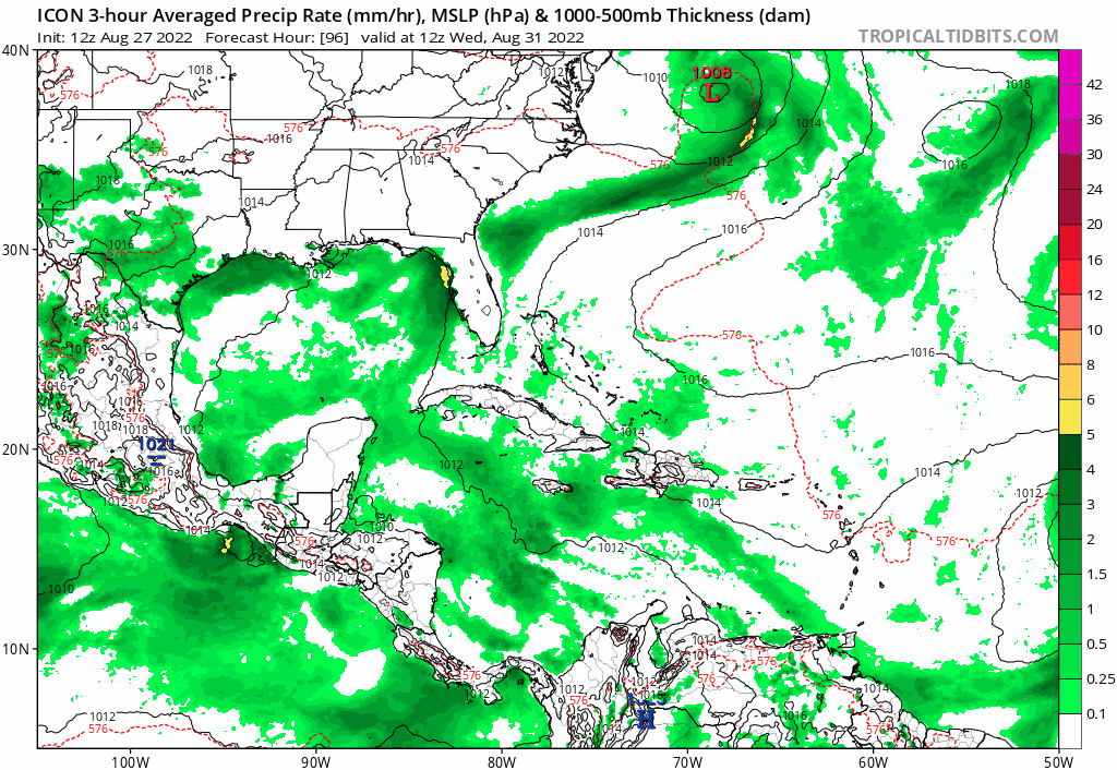
This looks like a prime season disturbance that persists yet struggles until it finds a pocket of favorability and takes off.
1 likes
-
Spacecoast

- Category 2

- Posts: 773
- Joined: Thu Aug 31, 2017 2:03 pm
Re: Low Pressure in the Central Atlantic
Does this 0Z EPS show significant # of members south through FL straits, or am I misinterpreting??

0 likes
-
skyline385
- Category 5
- Posts: 2728
- Age: 35
- Joined: Wed Aug 26, 2020 11:15 pm
- Location: Houston TX
Re: Low Pressure in the Central Atlantic
Spacecoast wrote:Does this 0Z EPS show significant # of members south through FL straits, or am I misinterpreting??
https://i.ibb.co/6m4ZfLL/eps-mslpa-Norm-watl-fh168-318.gif
Looks like most recurve out

1 likes
Re: Low Pressure in the Central Atlantic
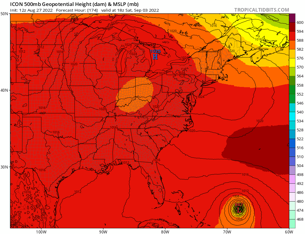
The 12z icon gets the coffee shakes with trying to find a center, but eventually settles on an area on the northwest side on Wednesday
0 likes
-
SFLcane
- S2K Supporter
- Posts: 10281
- Age: 48
- Joined: Sat Jun 05, 2010 1:44 pm
- Location: Lake Worth Florida
Re: Low Pressure in the Central Atlantic
skyline385 wrote:Spacecoast wrote:Does this 0Z EPS show significant # of members south through FL straits, or am I misinterpreting??
https://i.ibb.co/6m4ZfLL/eps-mslpa-Norm-watl-fh168-318.gif
Looks like most recurve out
https://i.imgur.com/DPJDp0l.png
Of course the path of least resistance is to the NE the ridge or should say “ Florida shield “ is blocking the westward movement at the end. That’s why I said some erratic or drifting is likely possible in the Bahamas.
Last edited by SFLcane on Sat Aug 27, 2022 10:37 am, edited 1 time in total.
0 likes
Re: Low Pressure in the Central Atlantic
SFLcane wrote:NDG wrote:boca wrote:90% of the time they recurve in the Bahamas unless you have a building high off the mid Atlantic building southward.They all seem to recurve year after year so when I see a storm coming in from the east I think recurve.
90% is a bit too high and may not be appropriate to use this season in my opinion, when there hasn't been a deep trough pattern in the middle or western Atlantic so far which is what makes them recurve with certainty well away from the US.
https://i.imgur.com/idDVMl1.gif
Edit: EPS is forecasting a strong Bermuda ridge in the 5-10 day range, which I don't doubt much when is in that range and not past its 10 day range.
https://i.imgur.com/saKIKqG.gif
I see what your saying but it ends up blocking the storm actually from what I can see.
My point is forget about going OTS by the looks of the EPS's 5-10 day range which most times is more correct than incorrect.
1 likes
Who is online
Users browsing this forum: Ulf and 155 guests