2022 Indicators (SSTs/SAL/MSLP/Shear/Steering/Instability) and >Day 16 Models

This is the general tropical discussion area. Anyone can take their shot at predicting a storms path.

Moderator: S2k Moderators

Forum rules

The posts in this forum are NOT official forecasts and should not be used as such. They are just the opinion of the poster and may or may not be backed by sound meteorological data. They are NOT endorsed by any professional institution or STORM2K. For official information, please refer to products from the National Hurricane Center and National Weather Service.

Help Support Storm2K
Message
Author
AlphaToOmega
Category 5
Category 5
Posts: 1448
Joined: Sat Jun 26, 2021 10:51 am
Location: Somewhere in Massachusetts

Re: 2022 indicators: SSTs / SAL / MSLP / shear / steering / instability / images

#421 Postby AlphaToOmega » Mon Apr 18, 2022 6:45 pm

I doubt 2022 is going to be an MDR-based season. The current projected pattern for ASO 2022 is one with a +AMO, -PDO, +AMM, -ENSO, and no Atlantic Nino; the years that follow this pattern are 1998, 2001, 2005, 2010, 2011, and 2020. 1998 had 3 major hurricanes; 2001 had 4; 2005 had 7; 2010 had 5; 2011 had 4; 2020 had 7. That is a total of 30 major hurricanes all from active seasons, but there are surprisingly few that became hurricanes in the MDR.

  1. 1998: Out of the 3 major hurricanes that formed, only Georges became one in the MDR.
  2. 2001: This season had 4 major hurricanes, but none of them became major hurricanes in the MDR.
  3. 2005: Despite being an active season with 7 major hurricanes, none of them became major hurricanes in the MDR.
  4. 2010: 2 (Igor and Julia) out of the 5 major hurricanes achieved that intensity in the MDR.
  5. 2011: None of the 4 major hurricanes became major hurricanes in the MDR.
  6. 2020: Only Teddy became a major hurricane in the MDR out of the 7 in this season.

Overall, only 4 major hurricanes out of the 30 listed achieved Category III strength in the MDR, which is only about 13.3% of the major hurricanes that formed during these seasons. Some of these seasons had warm MDRs (2005 and 2020) but could not achieve making 2 major hurricanes within the MDR. Also, for a season with a near record-breaking MDR, 2010 definitely fell short; 2017 had a cooler MDR than 2010 (as well as a +PDO, which 2010 did not have), but it had 3 major hurricanes achieve that intensity in the MDR. Honestly, the projected pattern for ASO 2022 is not conducive for an MDR-based season.
Last edited by AlphaToOmega on Tue Apr 19, 2022 6:29 am, edited 2 times in total.
0 likes   

User avatar
Category5Kaiju
Category 5
Category 5
Posts: 4095
Joined: Thu Dec 24, 2020 12:45 pm
Location: Seattle

Re: 2022 indicators: SSTs / SAL / MSLP / shear / steering / instability / images

#422 Postby Category5Kaiju » Mon Apr 18, 2022 7:01 pm

AlphaToOmega wrote:I doubt 2022 is going to be an MDR-based season. The current projected pattern for ASO 2022 is one with a +AMO, -PDO, +AMM, -ENSO, and no Atlantic Nino; the years that follow this pattern are 1998, 2001, 2005, 2010, 2011, and 2020. 1998 had 3 major hurricanes; 2001 had 4; 2005 had 7; 2010 had 5; 2011 had 4; 2020 had 7. That is a total of 30 major hurricanes all from active seasons, but there are surprisingly few that became hurricanes in the MDR.

  1. 1998: Out of the 3 major hurricanes that formed, only Bonnie became one in the MDR.
  2. 2001: This season had 4 major hurricanes, but none of them became major hurricanes in the MDR.
  3. 2005: Despite being an active season with 7 major hurricanes, none of them became major hurricanes in the MDR.
  4. 2010: 2 (Igor and Julia) out of the 5 major hurricanes achieved that intensity in the MDR.
  5. 2011: None of the 4 major hurricanes became major hurricanes in the MDR.
  6. 2020: Only Teddy became a major hurricane in the MDR out of the 7 in this season.

Overall, only 4 major hurricanes out of the 30 listed achieved Category III strength in the MDR, which is only about 13.3% of the major hurricanes that formed during these seasons. Some of these seasons had warm MDRs (2005 and 2020) but could not achieve making 2 major hurricanes within the MDR. Also, for a season with a near record-breaking MDR, 2010 definitely fell short; 2017 had a cooler MDR than 2010 (as well as a +PDO, which 2017 did not have), but it had 3 major hurricanes achieve that intensity in the MDR. Honestly, the projected pattern for ASO 2022 is not conducive for an MDR-based season.


Hang on a second, 1998 also had Georges, which did become a major hurricane in the MDR. Also, I feel like there are most definitely caveats to your analog years (don't get me wrong, I understand the logic behind how you came up with them). One major caveat is that this year, while -ENSO, is a third year La Nina (unlike the other six years you have mentioned), and as a result, this could have some impact on MDR activity in ways that we have yet to see. I definitely feel that whether or not we get intense MDR activity may not be as simple as stating that all of those seasons had +AMO, -PDO, +AMM, -ENSO, and no Atlantic Nino. There are definitely more factors at play here.
1 likes   
Unless explicitly stated, all info in my posts is based on my own opinions and observations. Tropical storms and hurricanes can be extremely dangerous. Do not think you can beat Mother Nature. Refer to an accredited weather research agency or meteorologist if you need to make serious decisions regarding an approaching storm.

AlphaToOmega
Category 5
Category 5
Posts: 1448
Joined: Sat Jun 26, 2021 10:51 am
Location: Somewhere in Massachusetts

Re: 2022 indicators: SSTs / SAL / MSLP / shear / steering / instability / images

#423 Postby AlphaToOmega » Mon Apr 18, 2022 7:25 pm

Category5Kaiju wrote:
AlphaToOmega wrote:I doubt 2022 is going to be an MDR-based season. The current projected pattern for ASO 2022 is one with a +AMO, -PDO, +AMM, -ENSO, and no Atlantic Nino; the years that follow this pattern are 1998, 2001, 2005, 2010, 2011, and 2020. 1998 had 3 major hurricanes; 2001 had 4; 2005 had 7; 2010 had 5; 2011 had 4; 2020 had 7. That is a total of 30 major hurricanes all from active seasons, but there are surprisingly few that became hurricanes in the MDR.

  1. 1998: Out of the 3 major hurricanes that formed, only Bonnie became one in the MDR.
  2. 2001: This season had 4 major hurricanes, but none of them became major hurricanes in the MDR.
  3. 2005: Despite being an active season with 7 major hurricanes, none of them became major hurricanes in the MDR.
  4. 2010: 2 (Igor and Julia) out of the 5 major hurricanes achieved that intensity in the MDR.
  5. 2011: None of the 4 major hurricanes became major hurricanes in the MDR.
  6. 2020: Only Teddy became a major hurricane in the MDR out of the 7 in this season.

Overall, only 4 major hurricanes out of the 30 listed achieved Category III strength in the MDR, which is only about 13.3% of the major hurricanes that formed during these seasons. Some of these seasons had warm MDRs (2005 and 2020) but could not achieve making 2 major hurricanes within the MDR. Also, for a season with a near record-breaking MDR, 2010 definitely fell short; 2017 had a cooler MDR than 2010 (as well as a +PDO, which 2017 did not have), but it had 3 major hurricanes achieve that intensity in the MDR. Honestly, the projected pattern for ASO 2022 is not conducive for an MDR-based season.


Hang on a second, 1998 also had Georges, which did become a major hurricane in the MDR. Also, I feel like there are most definitely caveats to your analog years (don't get me wrong, I understand the logic behind how you came up with them). One major caveat is that this year, while -ENSO, is a third year La Nina (unlike the other six years you have mentioned), and as a result, this could have some impact on MDR activity in ways that we have yet to see. I definitely feel that whether or not we get intense MDR activity may not be as simple as stating that all of those seasons had +AMO, -PDO, +AMM, -ENSO, and no Atlantic Nino. There are definitely more factors at play here.


I meant to write Georges. Bonnie did not become a major hurricane until it reached the Western Atlantic lol :D

However, there are other potential analog years that suggest more of a west-based season rather than an MDR-based season. Currently, Nino 3.4 SSTAs are -0.9 C, and the years since 1982 with Nino 3.4 SSTAs at or below -0.9 C during April are 1985, 1988, 1989, 1999, 2000, 2008, and 2011. Of the 25 major hurricanes that formed during that time period, only Helene (1988), Gabrielle (1989), Hugo (1989), Gert (1999), Isaac (2000), Bertha (2008), and Ike (2008) achieved Category III status in the MDR, which is 28%. Assuming 5 major hurricanes form this year (which is my forecast), that would mean 1.4 major hurricanes (rounded to 1) would achieve that in the MDR.

As for third year La Ninas, there is 1956 (debatable), 1975, 1985 (debatable), and 2000. Of the 10 major hurricanes that formed during that time period, only 1, Issac (2000), achieved major hurricane intensity in the MDR, which is 10%. Things really seem to be more favorable for a west-based season than an MDR season.
1 likes   

User avatar
NotSparta
Professional-Met
Professional-Met
Posts: 1668
Age: 23
Joined: Fri Aug 18, 2017 8:24 am
Location: Naples, FL
Contact:

Re: 2022 indicators: SSTs / SAL / MSLP / shear / steering / instability / images

#424 Postby NotSparta » Mon Apr 18, 2022 7:40 pm

You know we're in for a rather strong -NAO when it looks like you have a bowling ball stalled out in the middle of the Atlantic

Image
9 likes   
This post was probably an opinion of mine, and in no way is official. Please refer to http://www.hurricanes.gov for official tropical analysis and advisories.

My website, with lots of tropical wx graphics, including satellite and recon: http://cyclonicwx.com

User avatar
Category5Kaiju
Category 5
Category 5
Posts: 4095
Joined: Thu Dec 24, 2020 12:45 pm
Location: Seattle

Re: 2022 indicators: SSTs / SAL / MSLP / shear / steering / instability / images

#425 Postby Category5Kaiju » Mon Apr 18, 2022 7:52 pm

NotSparta wrote:You know we're in for a rather strong -NAO when it looks like you have a bowling ball stalled out in the middle of the Atlantic

https://i.imgur.com/wk3IA78.png


Indeed. Wow, if that verifies and sustains itself in terms of the sst anomalies then I think that could be a big warning sign for what may to come later this season.

Image
5 likes   
Unless explicitly stated, all info in my posts is based on my own opinions and observations. Tropical storms and hurricanes can be extremely dangerous. Do not think you can beat Mother Nature. Refer to an accredited weather research agency or meteorologist if you need to make serious decisions regarding an approaching storm.

User avatar
NotSparta
Professional-Met
Professional-Met
Posts: 1668
Age: 23
Joined: Fri Aug 18, 2017 8:24 am
Location: Naples, FL
Contact:

Re: 2022 indicators: SSTs / SAL / MSLP / shear / steering / instability / images

#426 Postby NotSparta » Mon Apr 18, 2022 7:55 pm

Category5Kaiju wrote:
NotSparta wrote:You know we're in for a rather strong -NAO when it looks like you have a bowling ball stalled out in the middle of the Atlantic

https://i.imgur.com/wk3IA78.png


Indeed. Wow, if that verifies and sustains itself in terms of the sst anomalies then I think that could be a big warning sign for what may to come later this season.

https://images.schoolspecialty.com/images/1284377_A_ecommfullsize.jpg


Yeah if it isn't short lived it definitely wouldn't be a good sign. More than a couple weeks and people will be adjusting their seasonal predictions on the poll
1 likes   
This post was probably an opinion of mine, and in no way is official. Please refer to http://www.hurricanes.gov for official tropical analysis and advisories.

My website, with lots of tropical wx graphics, including satellite and recon: http://cyclonicwx.com

User avatar
DorkyMcDorkface
Category 3
Category 3
Posts: 888
Age: 27
Joined: Mon Sep 30, 2019 1:32 pm
Location: Mid-Atlantic

Re: 2022 indicators: SSTs / SAL / MSLP / shear / steering / instability / images

#427 Postby DorkyMcDorkface » Mon Apr 18, 2022 8:08 pm

NotSparta wrote:
Category5Kaiju wrote:
NotSparta wrote:You know we're in for a rather strong -NAO when it looks like you have a bowling ball stalled out in the middle of the Atlantic

https://i.imgur.com/wk3IA78.png


Indeed. Wow, if that verifies and sustains itself in terms of the sst anomalies then I think that could be a big warning sign for what may to come later this season.

https://images.schoolspecialty.com/images/1284377_A_ecommfullsize.jpg


Yeah if it isn't short lived it definitely wouldn't be a good sign. More than a couple weeks and people will be adjusting their seasonal predictions on the poll

Not that it means much as you have to account for decreasing accuracy the further out in time you go due to ensemble smoothing but the latest 46-day EPS run (which was released this afternoon) is keeping the -NAO into mid May it appears.
Image
5 likes   
Please note the thougths expressed by this account are solely those of the user and are from a hobbyist perspective. For more comprehensive analysis, consult an actual professional meteorologist or meteorology agency.


Floyd 1999 | Isabel 2003 | Hanna 2008 | Irene 2011 | Sandy 2012 | Isaias 2020

User avatar
JetFuel_SE
Category 1
Category 1
Posts: 282
Age: 25
Joined: Thu Apr 30, 2020 3:57 pm

Re: 2022 indicators: SSTs / SAL / MSLP / shear / steering / instability / images

#428 Postby JetFuel_SE » Tue Apr 19, 2022 6:49 am

Category5Kaiju wrote:
skyline385 wrote:Slightly different take from Philip

https://twitter.com/philklotzbach/statu ... 7107191811

Except 1988 and 1989, all others had a large number of majors.


Even then, 1988 had Gilbert and Joan while 1989 had Hugo. In other words, both of those years featured their fair share of very damaging and powerful storms despite being in a -AMO period!

1988 actually looked quite +AMO-ish at this time of the year.
Image
1 likes   

User avatar
Category5Kaiju
Category 5
Category 5
Posts: 4095
Joined: Thu Dec 24, 2020 12:45 pm
Location: Seattle

Re: 2022 indicators: SSTs / SAL / MSLP / shear / steering / instability / images

#429 Postby Category5Kaiju » Tue Apr 19, 2022 7:49 am

JetFuel_SE wrote:
Category5Kaiju wrote:
skyline385 wrote:Slightly different take from Philip

https://twitter.com/philklotzbach/statu ... 7107191811

Except 1988 and 1989, all others had a large number of majors.


Even then, 1988 had Gilbert and Joan while 1989 had Hugo. In other words, both of those years featured their fair share of very damaging and powerful storms despite being in a -AMO period!

1988 actually looked quite +AMO-ish at this time of the year.
https://coralreefwatch.noaa.gov/data/5km/v3.1_op/image/daily/ssta/png/1988/04/ct5km_ssta_v3.1_global_19880419.png


Compare that with this, it is honestly amazing to see how cold the Gulf and subtropics were back then.

Image
3 likes   
Unless explicitly stated, all info in my posts is based on my own opinions and observations. Tropical storms and hurricanes can be extremely dangerous. Do not think you can beat Mother Nature. Refer to an accredited weather research agency or meteorologist if you need to make serious decisions regarding an approaching storm.

User avatar
aspen
Category 5
Category 5
Posts: 8818
Joined: Sat Oct 12, 2019 7:10 pm
Location: Connecticut, USA

Re: 2022 indicators: SSTs / SAL / MSLP / shear / steering / instability / images

#430 Postby aspen » Tue Apr 19, 2022 9:16 am

NotSparta wrote:You know we're in for a rather strong -NAO when it looks like you have a bowling ball stalled out in the middle of the Atlantic

https://i.imgur.com/wk3IA78.png

How do the NAO and changes in trade winds result in warming or cooling of ocean temperatures?
0 likes   
Irene '11 Sandy '12 Hermine '16 5/15/2018 Derecho Fay '20 Isaias '20 Elsa '21 Henri '21 Ida '21

I am only a meteorology enthusiast who knows a decent amount about tropical cyclones. Look to the professional mets, the NHC, or your local weather office for the best information.

User avatar
SFLcane
S2K Supporter
S2K Supporter
Posts: 10163
Age: 47
Joined: Sat Jun 05, 2010 1:44 pm
Location: Lake Worth Florida

Re: 2022 indicators: SSTs / SAL / MSLP / shear / steering / instability / images

#431 Postby SFLcane » Tue Apr 19, 2022 9:59 am

GFS long-range brings the trades over the mdr roaring back in early may. Atleast over the mdr
0 likes   

Shell Mound
Category 5
Category 5
Posts: 2434
Age: 32
Joined: Thu Sep 07, 2017 3:39 pm
Location: St. Petersburg, FL → Scandinavia

Re: 2022 indicators: SSTs / SAL / MSLP / shear / steering / instability / images

#432 Postby Shell Mound » Tue Apr 19, 2022 10:20 am

SFLcane wrote:GFS long-range brings the trades over the mdr roaring back in early may. Atleast over the mdr

The GFS shows a solid -NAO through the end of its latest run, in line with its previous runs, which would suggest a warming MDR through the first week of May. Trades in general are suppressed over the MDR through the end of the latest run, as the -NAO continually reinforces lower-than-average MSLP and hence relaxed trades over the area. Both the GEFS and EPS means depict this scenario as well as those of their operational suites. If anything, the trend reflects a stouter and more persistent -NAO through early May vs. earlier runs. So at this point I think we will see continued and robust warming of the MDR through at least the first week of May, if not farther.
1 likes   
CVW / MiamiensisWx / Shell Mound
The posts in this forum are NOT official forecasts and should not be used as such. They are just the opinion of the poster and may or may not be backed by sound meteorological data. They are NOT endorsed by any professional institution or STORM2K. For official information, please refer to products from the NHC and NWS.

User avatar
NotSparta
Professional-Met
Professional-Met
Posts: 1668
Age: 23
Joined: Fri Aug 18, 2017 8:24 am
Location: Naples, FL
Contact:

Re: 2022 indicators: SSTs / SAL / MSLP / shear / steering / instability / images

#433 Postby NotSparta » Tue Apr 19, 2022 10:27 am

aspen wrote:
NotSparta wrote:You know we're in for a rather strong -NAO when it looks like you have a bowling ball stalled out in the middle of the Atlantic

https://i.imgur.com/wk3IA78.png

How do the NAO and changes in trade winds result in warming or cooling of ocean temperatures?


-NAO weakens the subtropical ridge, and thus the trades, which generally warms the ocean in the tropics.
1 likes   
This post was probably an opinion of mine, and in no way is official. Please refer to http://www.hurricanes.gov for official tropical analysis and advisories.

My website, with lots of tropical wx graphics, including satellite and recon: http://cyclonicwx.com

User avatar
Category5Kaiju
Category 5
Category 5
Posts: 4095
Joined: Thu Dec 24, 2020 12:45 pm
Location: Seattle

Re: 2022 indicators: SSTs / SAL / MSLP / shear / steering / instability / images

#434 Postby Category5Kaiju » Wed Apr 20, 2022 8:16 am

So I recently was just thinking, and I have a question to ask: I understand how many of us trackers are curious to see how active the MDR could get this season, but couldn't one be able to sort of gauge MDR activity with precipitation anomaly maps? In other words, the wetter the MDR, the more active it could be (and also a higher chance of seeing at least several strong MDR storms?) Or are there more caveats to doing this that I am not seeing, ultimately making it an inefficient or bad idea?
0 likes   
Unless explicitly stated, all info in my posts is based on my own opinions and observations. Tropical storms and hurricanes can be extremely dangerous. Do not think you can beat Mother Nature. Refer to an accredited weather research agency or meteorologist if you need to make serious decisions regarding an approaching storm.

Shell Mound
Category 5
Category 5
Posts: 2434
Age: 32
Joined: Thu Sep 07, 2017 3:39 pm
Location: St. Petersburg, FL → Scandinavia

Re: 2022 indicators: SSTs / SAL / MSLP / shear / steering / instability / images

#435 Postby Shell Mound » Wed Apr 20, 2022 8:21 am

Image
Image

This is about as classically -NAO as one can get and is ideal for significant warming over the entire MDR through the first days of May, at the very least.
2 likes   
CVW / MiamiensisWx / Shell Mound
The posts in this forum are NOT official forecasts and should not be used as such. They are just the opinion of the poster and may or may not be backed by sound meteorological data. They are NOT endorsed by any professional institution or STORM2K. For official information, please refer to products from the NHC and NWS.

AlphaToOmega
Category 5
Category 5
Posts: 1448
Joined: Sat Jun 26, 2021 10:51 am
Location: Somewhere in Massachusetts

Re: 2022 indicators: SSTs / SAL / MSLP / shear / steering / instability / images

#436 Postby AlphaToOmega » Wed Apr 20, 2022 8:24 am

Category5Kaiju wrote:So I recently was just thinking, and I have a question to ask: I understand how many of us trackers are curious to see how active the MDR could get this season, but couldn't one be able to sort of gauge MDR activity with precipitation anomaly maps? In other words, the wetter the MDR, the more active it could be (and also a higher chance of seeing at least several strong MDR storms?) Or are there more caveats to doing this that I am not seeing, ultimately making it an inefficient or bad idea?


Two things:

1) Precipitation anomaly forecasts are not always accurate

2) They do not always point to where systems existed. Looking at this map, you would expected 2017 to have a lackluster MDR:

Image
4 likes   

User avatar
wxman57
Moderator-Pro Met
Moderator-Pro Met
Posts: 22978
Age: 67
Joined: Sat Jun 21, 2003 8:06 pm
Location: Houston, TX (southwest)

Re: 2022 indicators: SSTs / SAL / MSLP / shear / steering / instability / images

#437 Postby wxman57 » Wed Apr 20, 2022 8:29 am

New IRI/CPC Nino 3.4 forecast for April is out. All models shifted significantly cooler for peak season (La Nina):

https://iri.columbia.edu/our-expertise/climate/forecasts/enso/current/?enso_tab=enso-sst_table
8 likes   

User avatar
SFLcane
S2K Supporter
S2K Supporter
Posts: 10163
Age: 47
Joined: Sat Jun 05, 2010 1:44 pm
Location: Lake Worth Florida

Re: 2022 indicators: SSTs / SAL / MSLP / shear / steering / instability / images

#438 Postby SFLcane » Wed Apr 20, 2022 8:37 am

wxman57 wrote:New IRI/CPC Nino 3.4 forecast for April is out. All models shifted significantly cooler for peak season (La Nina):

https://iri.columbia.edu/our-expertise/climate/forecasts/enso/current/?enso_tab=enso-sst_table


Any adjustments to your seasonal numbers?
0 likes   

Shell Mound
Category 5
Category 5
Posts: 2434
Age: 32
Joined: Thu Sep 07, 2017 3:39 pm
Location: St. Petersburg, FL → Scandinavia

Re: 2022 indicators: SSTs / SAL / MSLP / shear / steering / instability / images

#439 Postby Shell Mound » Wed Apr 20, 2022 9:07 am

aspen wrote:
skyline385 wrote:
cycloneye wrote:Nothing new but is confirmation of what is going to happen on ASO.

https://twitter.com/philklotzbach/status/1516540367474110470

Some of those ENSO predictions are pretty crazy. I went and checked the ONI for seasons which had ENSO below -1.0 consistently from JAS to OND:

1988 - 2xCat 4, 1xCat 5 (Gilbert)
1998 - 1xCat 3, 1xCat 4 (Georges, almost Cat 5), 1xCat 5 (Mitch)
1999 - 5xCat 4
2010 - 1xCat 3, 4xCat 4

This season is not looking good especially when you look at Gilbert and Mitch.

1988, 1998, and 2010 are not good comparisons to 2022 because all three were La Ninas following El Niño events (1987, 1997, and 2009). 1999 was a double-dip Nina, and 2022 looks to be a triple-dip.

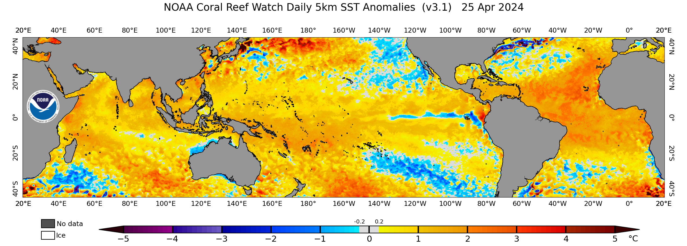
Bear in mind that 2022 may not behave like previous “triple-dip” Niñas due to the effects of climate change. Since 1950 there have been the following “triple-dip” Niñas and cool-neutral ENSO episodes that followed consecutive Niñas: 1956, 1975, 1985, and 2000. 2000’s TC tracks were notably different vs. those of the other three years. 1956, 1975, and 1985 featured tight clusters of hurricanes a) between LA and the FL Panhandle and b) off the Eastern Seaboard, between the CONUS and Bermuda. By contrast, 2000’s clusters occurred significantly farther east, a) over the west coast of peninsular FL and b) well to the east of Bermuda. 2000 occurred in a warmer climate vs. the other years (1950s–‘80s), and the climate in 2022 is even warmer than in 2000. Warmer climates tend to yield stronger subtropical ridges (Hadley cells) that expand poleward, implying stronger blocking.

Image

2000’s hurricanes tended to curve poleward around 85°W and 55°W, respectively—about 5° farther east than the clusters in the other three years. To account for post-2000 warming, shift 2000’s inflection points yet 5° more to the east, and you end up with solutions that are similar to 2004’s. 2004’s hurricanes curved around 80°W and 50°W, respectively. Just as 2000 exhibited a greater tendency toward mid-latitude blocking compared to the other three years, so 2004 featured even more of a pronounced blocking tendency, up to and including the infamous “ridge-bridge,” than 2000 did, resulting in tracks that converged on peninsular FL (Charley, Frances, and Jeanne) and the open Atlantic (Danielle, Karl, and Lisa):

Image

Add the likelihood that ASO of 2022 will feature a -PDO/-ENSO, and the correlation with strong blocking only grows—basically an enhanced 2004, like the EC:

Image
Image
Image

Basically, this kind of setup—with a -PDO/-ENSO (or at least cool neutral)/-IOD + climate change—might well increase the risk of hurricanes on peninsular FL.
1 likes   
CVW / MiamiensisWx / Shell Mound
The posts in this forum are NOT official forecasts and should not be used as such. They are just the opinion of the poster and may or may not be backed by sound meteorological data. They are NOT endorsed by any professional institution or STORM2K. For official information, please refer to products from the NHC and NWS.

User avatar
DorkyMcDorkface
Category 3
Category 3
Posts: 888
Age: 27
Joined: Mon Sep 30, 2019 1:32 pm
Location: Mid-Atlantic

Re: 2022 indicators: SSTs / SAL / MSLP / shear / steering / instability / images

#440 Postby DorkyMcDorkface » Wed Apr 20, 2022 9:16 am

Caladesi wrote:https://i.ibb.co/z4yNnhb/2022-NAO-2.png
https://i.ibb.co/ZJrCvxF/2022-NAO-1.png

This is about as classically -NAO as one can get and is ideal for significant warming over the entire MDR through the first days of May, at the very least.

GFS appears to be showing not just relaxed trades, but a brief period of actual raw westerlies on the regular zonal wind hovmoller. Now that's impressive.
Image
5 likes   

Please note the thougths expressed by this account are solely those of the user and are from a hobbyist perspective. For more comprehensive analysis, consult an actual professional meteorologist or meteorology agency.


Floyd 1999 | Isabel 2003 | Hanna 2008 | Irene 2011 | Sandy 2012 | Isaias 2020


Return to “Talkin' Tropics”

Who is online

Users browsing this forum: Kingarabian and 43 guests