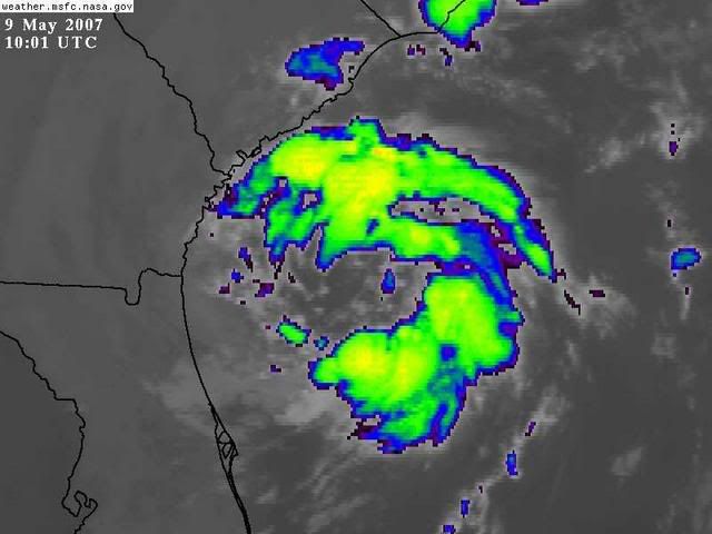
SUBTROPICAL STORM ANDREA, Analysis, Sat Pics, Models Thread

This is the general tropical discussion area. Anyone can take their shot at predicting a storms path.

Moderator: S2k Moderators

Forum rules

The posts in this forum are NOT official forecasts and should not be used as such. They are just the opinion of the poster and may or may not be backed by sound meteorological data. They are NOT endorsed by any professional institution or STORM2K. For official information, please refer to products from the National Hurricane Center and National Weather Service.

Help Support Storm2K
Message
Author
User avatar
drezee
S2K Supporter
S2K Supporter
Posts: 3664
Joined: Mon Jun 09, 2003 12:49 pm
Location: FL

#421 Postby drezee » Wed May 09, 2007 12:17 pm

wxman57 wrote:
HURAKAN wrote:LOOKS WORSE NOW THAT IT DID IN THE MORNING:

12:15 UTC (8:15 AM EDT)
http://i40.photobucket.com/albums/e244/ ... TORM21.jpg

16:40 UTC (12:40 EDT)
http://i40.photobucket.com/albums/e244/ ... ANDREA.jpg


You are correct. Convection has diminished considerably since this morning (and it wasn't too good then,either). Winds appear to be dropping. The NHC killed it by calling it Andrea. Looking at the latest buoy reports encircling the storm, I'm seeing more 20-30 kt winds now. Don't see any more 35kts or higher. IF there are any TS-force winds left, they're not covering a large area.


HA HA HA! The deed is done now! First one out of the way...this one counts...at least for NOAA...not for Dr. Gray!
0 likes   

User avatar
HURAKAN
Professional-Met
Professional-Met
Posts: 46086
Age: 38
Joined: Thu May 20, 2004 4:34 pm
Location: Key West, FL
Contact:

#422 Postby HURAKAN » Wed May 09, 2007 12:21 pm

ONCE AGAIN:

THIS MORNING:
Image

NOW:
Image

I think she may be allergic to smoke!!! or dry air!!!
0 likes   

User avatar
Damar91
Category 2
Category 2
Posts: 551
Joined: Wed Aug 24, 2005 1:06 pm
Location: Coral Springs, FL

#423 Postby Damar91 » Wed May 09, 2007 12:22 pm

Yeah, she's looking pretty sick right now......
0 likes   

User avatar
Tampa Bay Hurricane
Category 5
Category 5
Posts: 5597
Age: 37
Joined: Fri Jul 22, 2005 7:54 pm
Location: St. Petersburg, FL

#424 Postby Tampa Bay Hurricane » Wed May 09, 2007 12:23 pm

No Andrea!! Don't die on me!!!
Please please develop more rain
for Florida and Georgia

If we don't get your rain we
won't see rain until June!!!
We will have to wait another
month for rain and the fires
will rage on

Andrea is our last hope before June
for the fires
because the rainy season is still one month
away...

Come on Andrea please pick up good moisture
I am wish--casting Andrea to grow in rain!!!!!!!!!!
0 likes   

User avatar
cycloneye
Admin
Admin
Posts: 146093
Age: 69
Joined: Thu Oct 10, 2002 10:54 am
Location: San Juan, Puerto Rico

#425 Postby cycloneye » Wed May 09, 2007 12:23 pm

HA HA HA! The deed is done now! First one out of the way...this one counts...at least for NOAA...not for Dr. Gray!


Why not for Dr Gray?
0 likes   
Visit the Caribbean-Central America Weather Thread where you can find at first post web cams,radars
and observations from Caribbean basin members Click Here

User avatar
HURAKAN
Professional-Met
Professional-Met
Posts: 46086
Age: 38
Joined: Thu May 20, 2004 4:34 pm
Location: Key West, FL
Contact:

#426 Postby HURAKAN » Wed May 09, 2007 12:36 pm

Image

We have started even before the official start of the EPAC season. How about that!!!
0 likes   

cpdaman
Category 5
Category 5
Posts: 3131
Joined: Sat Jun 10, 2006 11:44 am
Location: SPB county (gulf stream)

#427 Postby cpdaman » Wed May 09, 2007 12:37 pm

bouys indicate weakening (rising everywhere) and visible/water vapor confirm this also looks like a NW drift to me
0 likes   

User avatar
MortisFL
Category 1
Category 1
Posts: 391
Age: 42
Joined: Mon Jul 21, 2003 9:01 am
Location: Sarasota, FL
Contact:

#428 Postby MortisFL » Wed May 09, 2007 12:38 pm

HURAKAN wrote:Image

We have started even before the official start of the EPAC season. How about that!!!


Nice graphic
0 likes   

User avatar
HURAKAN
Professional-Met
Professional-Met
Posts: 46086
Age: 38
Joined: Thu May 20, 2004 4:34 pm
Location: Key West, FL
Contact:

#429 Postby HURAKAN » Wed May 09, 2007 12:45 pm

MortisFL wrote:
HURAKAN wrote:ATL-EPAC SCOREBOARD 2007

We have started even before the official start of the EPAC season. How about that!!!


Nice graphic


Thanks, I try!!!
0 likes   

User avatar
Thunder44
Category 5
Category 5
Posts: 5922
Age: 44
Joined: Mon Jun 09, 2003 7:53 pm
Location: New York City

#430 Postby Thunder44 » Wed May 09, 2007 12:50 pm

It's seems to be have been fighting off some dry air on the west side since this morning. Cloud tops have warmed somewhat, but not that much east side, which is the strongest. It's certainly not strenghtening, but I don't see any rapid rises in the buoys either. I would give it through tonight for convection to pulse back up before declaring it dead.
0 likes   

User avatar
skysummit
S2K Supporter
S2K Supporter
Posts: 5305
Age: 49
Joined: Tue Aug 31, 2004 11:09 pm
Location: Ponchatoula, LA
Contact:

#431 Postby skysummit » Wed May 09, 2007 12:58 pm

SUBTROPICAL STORM ANDREA INTERMEDIATE ADVISORY NUMBER 1A
NWS TPC/NATIONAL HURRICANE CENTER MIAMI FL AL012007
200 PM EDT WED MAY 09 2007

...POORLY-ORGANIZED SUBTROPICAL STORM MEANDERING OFF THE SOUTHEAST
U.S. COAST...

A TROPICAL STORM WATCH REMAINS IN EFFECT ALONG THE SOUTHEAST COAST
OF THE UNITED STATES FROM ALTAMAHA SOUND GEORGIA SOUTHWARD TO
FLAGLER BEACH FLORIDA. A TROPICAL STORM WATCH MEANS THAT TROPICAL
STORM CONDITIONS ARE POSSIBLE WITHIN THE WATCH AREA...GENERALLY
WITHIN THE NEXT 36 HOURS.

FOR STORM INFORMATION SPECIFIC TO YOUR AREA...INCLUDING POSSIBLE
INLAND WATCHES AND WARNINGS...PLEASE MONITOR PRODUCTS ISSUED
BY YOUR LOCAL WEATHER OFFICE.

AT 200 PM EDT...1800Z...THE CENTER OF SUBTROPICAL STORM ANDREA WAS
ESTIMATED NEAR LATITUDE 30.9 NORTH...LONGITUDE 80.0 WEST OR ABOUT
100 MILES...160 KM...SOUTHEAST OF SAVANNAH GEORGIA AND ABOUT 135
MILES ...220 KM...NORTH-NORTHEAST OF DAYTONA BEACH FLORIDA.

ANDREA IS MOVING ERRATICALLY...BUT GENERALLY TOWARD THE WEST NEAR 3
MPH. A CONTINUED SLOW MOTION AND A GRADUAL TURN TOWARD THE
SOUTHWEST ARE EXPECTED DURING THE NEXT 24 HOURS. ON THIS
TRACK...THE CENTER OF ANDREA IS EXPECTED TO REMAIN JUST OFFSHORE OF
THE U.S. COAST THROUGH AT LEAST THURSDAY MORNING.

MAXIMUM SUSTAINED WINDS ARE NEAR 45 MPH...75 KM/HR...WITH HIGHER
GUSTS. LITTLE CHANGE IN STRENGTH IS FORECAST DURING THE NEXT 24
HOURS.

WINDS OF TROPICAL STORM FORCE EXTEND OUTWARD UP TO 115 MILES...185
KM...MAINLY TO THE EAST OF THE CENTER.

THE ESTIMATED MINIMUM CENTRAL PRESSURE IS 1003 MB...29.62 INCHES.

SINCE THE HEAVIEST RAINS ASSOCIATED WITH ANDREA ARE EXPECTED TO
REMAIN OFFSHORE DURING THE NEXT 24 HOURS... ANDREA IS NOT EXPECTED
TO PRODUCE SIGNIFICANT RAINFALL OVER ANY LAND AREAS THROUGH AT
LEAST THURSDAY MORNING.

REPEATING THE 200 PM EDT POSITION...30.9 N...80.0 W. MOVEMENT
TOWARD...WEST NEAR 3 MPH. MAXIMUM SUSTAINED WINDS...45 MPH.
MINIMUM CENTRAL PRESSURE...1003 MB.

THE NEXT ADVISORY WILL BE ISSUED BY THE NATIONAL HURRICANE CENTER AT
500 PM EDT.

$$
FORECASTER KNABB
0 likes   

User avatar
Evil Jeremy
S2K Supporter
S2K Supporter
Posts: 5463
Age: 32
Joined: Mon Apr 10, 2006 2:10 pm
Location: Los Angeles, CA

#432 Postby Evil Jeremy » Wed May 09, 2007 12:59 pm

aw, man! i was just about to post that! oh well lol.
0 likes   
Frances 04 / Jeanne 04 / Katrina 05 / Wilma 05 / Fay 08 / Debby 12 / Andrea 13 / Colin 16 / Hermine 16 / Matthew 16 / Irma 17

JonathanBelles
Professional-Met
Professional-Met
Posts: 11430
Age: 35
Joined: Sat Dec 24, 2005 9:00 pm
Location: School: Florida State University (Tallahassee, FL) Home: St. Petersburg, Florida
Contact:

#433 Postby JonathanBelles » Wed May 09, 2007 1:01 pm

Why is andrea going to stall near the coast and then move SE? is there a High out there that I am not seeing/
0 likes   

User avatar
drezee
S2K Supporter
S2K Supporter
Posts: 3664
Joined: Mon Jun 09, 2003 12:49 pm
Location: FL

#434 Postby drezee » Wed May 09, 2007 1:10 pm

cycloneye wrote:
HA HA HA! The deed is done now! First one out of the way...this one counts...at least for NOAA...not for Dr. Gray!


Why not for Dr Gray?


Colorado State's numbers only includes purely tropical systems. For example, they did not include STS Nicole from 2004.


They only counted 15 and the NHC had 16.


http://typhoon.atmos.colostate.edu/Fore ... 4/dec2004/

http://www.nhc.noaa.gov/2004atlan.shtml
0 likes   

User avatar
HURAKAN
Professional-Met
Professional-Met
Posts: 46086
Age: 38
Joined: Thu May 20, 2004 4:34 pm
Location: Key West, FL
Contact:

#435 Postby HURAKAN » Wed May 09, 2007 1:14 pm

Image

Andrea is not alone in May in this part of the Atlantic.
0 likes   

User avatar
drezee
S2K Supporter
S2K Supporter
Posts: 3664
Joined: Mon Jun 09, 2003 12:49 pm
Location: FL

#436 Postby drezee » Wed May 09, 2007 1:17 pm

0 likes   

User avatar
Jevo
S2K Supporter
S2K Supporter
Posts: 1729
Age: 47
Joined: Tue Aug 03, 2004 8:45 pm
Location: The Flemish Cap
Contact:

#437 Postby Jevo » Wed May 09, 2007 1:23 pm

CrazyC83 wrote:Right now I am sensing an around-and-out track...slowly inching towards NE Florida, possibly making landfall, then the oncoming front turns it back into the Atlantic, racing it out to sea...


Ah the jedi meteorological sense.....

The Force is strong in this one
0 likes   
Disclaimer: 50% of the time I have no clue of what I am talking about. Chances are I am taking a less than educated guess that sounds good because 10 years ago I stole Mike Watkins book 'The Hurricane and its Impact'. For official information please direct yourself to the NHC and their cadre of weather geniuses.

User avatar
punkyg
Category 2
Category 2
Posts: 770
Joined: Mon Apr 23, 2007 7:37 pm
Location: sanford florida

#438 Postby punkyg » Wed May 09, 2007 1:23 pm

http://www.nrlmry.navy.mil/tc-bin/tc_ho ... =yes&ATCF_
BASIN=al&BASIN=ATL&NAV=tc&ATCF_YR=2007&ATCF_FILE=/data/www/atcf_web/public_html/i
mage_archives/2007/al012007.07050912.gif&CURRENT=20070509.1815.goes12.x.vis1km_high.01LANDREA.
40kts-1003mb-309N-800W.100pc.jpg&AGE=Latest&CURRENT_ATCF=al012007.07050912.
gif&ATCF_NAME=al012007&ATCF_DIR=/data/www/atcf_web/public_html/image_archives/2007&YEAR=2007&YR=07&ACTION=
Latest_Photos&ARCHIVE=active&MO=MAY&STORM_NAME=01L.ANDREA&STYLE=tables&AREA=indian/winds&DISPLAY=
Latest&PRODUCT=vis&DIR=/TC/tc07/ATL/01L.ANDREA/vis/geo/1km_zoom&TYPE=vis&PROD=geo&SUB_PRODUCT
=geo&SUB_SUB_PRODUCT=1km_zoom&SIZE=full
In the picture do you think the convection is starting to cover the storm's center :?:
Last edited by punkyg on Wed May 09, 2007 1:42 pm, edited 3 times in total.
0 likes   

User avatar
HURAKAN
Professional-Met
Professional-Met
Posts: 46086
Age: 38
Joined: Thu May 20, 2004 4:34 pm
Location: Key West, FL
Contact:

#439 Postby HURAKAN » Wed May 09, 2007 1:26 pm

Image

Rainband over the SE coast.
0 likes   

User avatar
chris_fit
Category 5
Category 5
Posts: 3249
Age: 42
Joined: Wed Sep 10, 2003 11:58 pm
Location: Tampa Bay Area, FL

#440 Postby chris_fit » Wed May 09, 2007 1:28 pm

In the picture do you think the convection is starting to over the storm's center :?:


Ughh please fix your LINK
0 likes   


Return to “Talkin' Tropics”

Who is online

Users browsing this forum: 7cardinal, AxaltaRacing24, Cpv17, dl20415, DunedinDave, Heretoserve, IsabelaWeather, islandgirl45, LAF92, pepecool20, riapal, Stratton23, Ulf and 140 guests