So basically everyone from Bermuda to Nicaragua be on alert.
Tropical Wave in Bay of Campeche (Is Invest 91L)
Moderator: S2k Moderators
Forum rules

The posts in this forum are NOT official forecasts and should not be used as such. They are just the opinion of the poster and may or may not be backed by sound meteorological data. They are NOT endorsed by any professional institution or STORM2K. For official information, please refer to products from the National Hurricane Center and National Weather Service.
-
DunedinDave
- Category 1

- Posts: 269
- Joined: Fri Aug 25, 2023 10:31 am
Re: Tropical Wave in Central Atlantic (0/40)
So basically everyone from Bermuda to Nicaragua be on alert.
1 likes
-
chris_fit

- Category 5

- Posts: 3261
- Age: 43
- Joined: Wed Sep 10, 2003 11:58 pm
- Location: Tampa Bay Area, FL
Re: Tropical Wave in Central Atlantic (0/40)
Hope I'm wrong but Charley and Ian vibes with this one. Very similar initial position and guidance.
0 likes
-
Category5Kaiju

- Category 5
- Posts: 4345
- Joined: Thu Dec 24, 2020 12:45 pm
- Location: Seattle during the summer, Phoenix during the winter
Re: Tropical Wave in Central Atlantic (0/40)
Ubuntwo wrote:SFLcane wrote:Ubuntwo wrote:I disagree as the high latitude ITCZ, prevalence of SAL, and reversed upper level winds off Africa the basin was struggling with are more in line with an exaggerated August climo.
eh, conus pattern i meant. Both GFS/EURO want to remove that East Coast ridge all together.
Gotcha. A trough dipping down into the Gulf/SE region isn't too out of season for early Sept... Irma, Dorian, Idalia just for a few recent cases were all tugged north around this time of year. Now early August as with Charley? Nuts.
Ivan in 2004 too was a classic example of a powerful September Caribbean system being tugged northward. Outside of that, there are indeed many other examples of recurving September storms (Igor, Floyd, etc.)
0 likes
Unless explicitly stated, all information in my posts is based on my own opinions and observations. Tropical storms and hurricanes can be extremely dangerous. Refer to an accredited weather research agency or meteorologist if you need to make serious decisions regarding an approaching storm.
-
Ivanhater

- Storm2k Moderator

- Posts: 11222
- Age: 39
- Joined: Fri Jul 01, 2005 8:25 am
- Location: Pensacola
Re: Tropical Wave in Central Atlantic (0/40)
This is looking very ominous for the Gulf Coast 
1 likes
Michael

Re: Tropical Wave in Central Atlantic (0/40)
Ivanhater wrote:This is looking very ominous for the Gulf Coast
Yeah, at this point the US Gulf Coast probably has to hope that the system doesn't develop due to taking forever to sort out its internal dynamics, or developing too late and not entering the Gulf (though such a scenario will still be damaging outside of CONUS). But if the 12z models suite showed us anything, it's that the system can take its sweet time until Western Caribbean and still have a high ceiling.
1 likes
TC naming lists: retirements and intensity
Most aggressive Advisory #1's in North Atlantic (cr. kevin for starting the list)
Most aggressive Advisory #1's in North Atlantic (cr. kevin for starting the list)
-
cycloneye

- Admin

- Posts: 149691
- Age: 69
- Joined: Thu Oct 10, 2002 10:54 am
- Location: San Juan, Puerto Rico
Re: Tropical Wave in Central Atlantic (0/40)
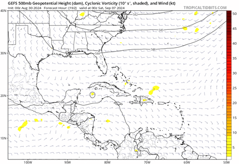
Around 51W there is more convection than the 47W turning but is dmin.

1 likes
Visit the Caribbean-Central America Weather Thread where you can find at first post web cams,radars
and observations from Caribbean basin members Click Here
and observations from Caribbean basin members Click Here
-
TomballEd
- Category 5
- Posts: 1318
- Age: 62
- Joined: Wed Aug 16, 2023 4:52 pm
- Location: Spring/Klein area, not Tomball
Re: Tropical Wave in Central Atlantic (0/40)
Ivanhater wrote:This is looking very ominous for the Gulf Coast
Ensemble mid level heights suggest Central and Eastern Gulf at highest risk. Storms that move a bit faster than the ensemble means and comes in a bit S could still menace Texas and Mexico, but this looks like SE Louisiana and points E.
Huge caveat, 8 or 12 days away the ensembles may have shifted one way or the other, or ECUSA or W. GOMEX could wind up in danger.
2 likes

Re: Tropical Wave in Central Atlantic (0/40)
cycloneye wrote:Around 51W there is more convection than the 47W turning but is dmin.
https://i.imgur.com/BM7wNrd.gif
This convection has spawned a little area of mid level/500mb spin. GFS and the Euro caught it on the latest runs. Is expected to persist overnight and die out going into Sunday. If convection does not move to the east, late development/no development becomes more likely.
0 likes
Kendall -> SLO -> PBC
Memorable Storms: Katrina (for its Florida landfall...) Wilma Matthew Irma
Memorable Storms: Katrina (for its Florida landfall...) Wilma Matthew Irma
-
Iceresistance

- Category 5
- Posts: 9605
- Age: 22
- Joined: Sat Oct 10, 2020 9:45 am
- Location: Tecumseh, OK/Norman, OK
Re: Tropical Wave in Central Atlantic (0/40)
A 906 mb member has been discovered on the 12z EPS related to this TW.

https://s11.gifyu.com/images/SooQ9.png
https://s11.gifyu.com/images/SooQ9.png
5 likes
Bill 2015 & Beta 2020
Winter 2020-2021
All observations are in Tecumseh, OK unless otherwise noted.
Winter posts are focused mainly for Oklahoma & Texas.
Take any of my forecasts with a grain of salt, refer to the NWS, SPC, and NHC for official information
Never say Never with weather! Because ANYTHING is possible!
Winter 2020-2021
All observations are in Tecumseh, OK unless otherwise noted.
Winter posts are focused mainly for Oklahoma & Texas.
Take any of my forecasts with a grain of salt, refer to the NWS, SPC, and NHC for official information
Never say Never with weather! Because ANYTHING is possible!


Re: Tropical Wave in Central Atlantic (0/40)
Iceresistance wrote:A 906 mb member has been discovered on the 12z EPS related to this TW.
MarioProtVI wrote:One of the ensembles has a whopping 909 Cat 5 slamming the Yucatán in 204h…
https://media.discordapp.net/attachments/1158173473861025862/1279154729800433766/eps_slp_qpf_e10_atlantic_204.png?ex=66d3692d&is=66d217ad&hm=75bf4b247bbdb602fde5bade7232d53f2b6f6c8f998fcf14d32192132efc4ad4&
I believe this might be your member
1 likes
Once I see the REDS and GREENS Converge on a Base Velocity. ... I'm There!!
This is NOT an Official Forecast....Just my Opinion. For official information, please refer to the NHC and NWS products.
HIGHLIGHTS : '13 El Reno Tornado : 2013 Storm Chaser Tour, Joaquin; SC flood event, Matthew '16, Lowcountry Snow storm Jan '18
This is NOT an Official Forecast....Just my Opinion. For official information, please refer to the NHC and NWS products.
HIGHLIGHTS : '13 El Reno Tornado : 2013 Storm Chaser Tour, Joaquin; SC flood event, Matthew '16, Lowcountry Snow storm Jan '18
-
AnnularCane

- S2K Supporter

- Posts: 2964
- Joined: Thu Jun 08, 2006 9:18 am
- Location: Wytheville, VA
Re: Tropical Wave in Central Atlantic (0/40)
AutoPenalti wrote:SFLcane wrote:Lots of 505 ERRORS today on S2K.
Server overload with the latest models? Lol
I haven't had any errors but I did notice it was a bit slow earlier. Maybe the server hasn't seen this level of activity in a while?
0 likes
"But it never rained rain. It never snowed snow. And it never blew just wind. It rained things like soup and juice. It snowed mashed potatoes and green peas. And sometimes the wind blew in storms of hamburgers." -- Judi Barrett, Cloudy with a Chance of Meatballs
-
DunedinDave
- Category 1
- Posts: 269
- Joined: Fri Aug 25, 2023 10:31 am
Re: Tropical Wave in Central Atlantic (0/40)
chris_fit wrote:Hope I'm wrong but Charley and Ian vibes with this one. Very similar initial position and guidance.
Same. I feel like this one may move a little more west than those two based on the latest and euro and GfS but still too early to tell.
2 likes
-
ConvergenceZone
.gif)
- Category 5
- Posts: 5241
- Joined: Fri Jul 29, 2005 1:40 am
- Location: Northern California
Re: Tropical Wave in Central Atlantic (0/40)
What does it usually take to get an invest going out of a tropical wave? Just curious.
0 likes

Re: Tropical Wave in Central Atlantic (0/40)
ConvergenceZone wrote:What does it usually take to get an invest going out of a tropical wave? Just curious.
Usually they'd tag them pretty early but now it seems like they need to reach 60% in the 5-7 day before they're tagged
1 likes
The above post is not official and should not be used as such. It is the opinion of the poster and may or may not be backed by sound meteorological data. It is not endorsed by any professional institution or storm2k.org. For official information, please refer to the NHC and NWS products.
Re: Tropical Wave in Central Atlantic (0/40)
Hammy wrote:ConvergenceZone wrote:What does it usually take to get an invest going out of a tropical wave? Just curious.
Usually they'd tag them pretty early but now it seems like they need to reach 60% in the 5-7 day before they're tagged
I've noticed the same thing.
0 likes
-
SouthFLTropics

- Category 5
- Posts: 4258
- Age: 50
- Joined: Thu Aug 14, 2003 8:04 am
- Location: Port St. Lucie, Florida
Re: Tropical Wave in Central Atlantic (0/40)
It would appear that the 18z GFS is going to go to the Eastern GOM and possibly slide up and over the peninsula. The system developing off the eastern seaboard plays a huge role in eroding the ridge.
1 likes
Fourth Generation Florida Native
Personal Storm History: David 79, Andrew 92, Erin 95, Floyd 99, Irene 99, Frances 04, Jeanne 04, Wilma 05, Matthew 16, Irma 17, Ian 22, Nicole 22, Milton 24
Personal Storm History: David 79, Andrew 92, Erin 95, Floyd 99, Irene 99, Frances 04, Jeanne 04, Wilma 05, Matthew 16, Irma 17, Ian 22, Nicole 22, Milton 24
-
toad strangler

- S2K Supporter
- Posts: 4546
- Joined: Sun Jul 28, 2013 3:09 pm
- Location: Earth
- Contact:
Re: Tropical Wave in Central Atlantic (0/40)
Looks like another classic 18z Happy Hour GFS OP ramping up
Now at the 9 day mark just S of western Cuba.
Now at the 9 day mark just S of western Cuba.
0 likes
My Weather Station
https://www.wunderground.com/dashboard/pws/KFLPORTS603
https://www.wunderground.com/dashboard/pws/KFLPORTS603
-
SouthFLTropics
- Category 5
- Posts: 4258
- Age: 50
- Joined: Thu Aug 14, 2003 8:04 am
- Location: Port St. Lucie, Florida
Re: Tropical Wave in Central Atlantic (0/40)
SouthFLTropics wrote:It would appear that the 18z GFS is going to go to the Eastern GOM and possibly slide up and over the peninsula. The system developing off the eastern seaboard plays a huge role in eroding the ridge.
Then again, I could be wrong. It looks like it moves out and the ridge starts filling back in. Very complicated setup with multiple players on the board.
0 likes
Fourth Generation Florida Native
Personal Storm History: David 79, Andrew 92, Erin 95, Floyd 99, Irene 99, Frances 04, Jeanne 04, Wilma 05, Matthew 16, Irma 17, Ian 22, Nicole 22, Milton 24
Personal Storm History: David 79, Andrew 92, Erin 95, Floyd 99, Irene 99, Frances 04, Jeanne 04, Wilma 05, Matthew 16, Irma 17, Ian 22, Nicole 22, Milton 24
-
toad strangler
- S2K Supporter
- Posts: 4546
- Joined: Sun Jul 28, 2013 3:09 pm
- Location: Earth
- Contact:
Re: Tropical Wave in Central Atlantic (0/40)
SouthFLTropics wrote:SouthFLTropics wrote:It would appear that the 18z GFS is going to go to the Eastern GOM and possibly slide up and over the peninsula. The system developing off the eastern seaboard plays a huge role in eroding the ridge.
Then again, I could be wrong. It looks like it moves out and the ridge starts filling back in. Very complicated setup with multiple players on the board.
18z GFS OP hits the very NE tip of the Yucatán similar to the 12z Euro OP. Difference is it keep sliding west instead of turning north. This is past 240 hours now, So take with a grain of salt. Take the whole run with the grain of salt for that matter being there is no cohesive system yet. Just commenting on verbatim Run of this individual model.
0 likes
My Weather Station
https://www.wunderground.com/dashboard/pws/KFLPORTS603
https://www.wunderground.com/dashboard/pws/KFLPORTS603
-
Frank P
- S2K Supporter
- Posts: 2779
- Joined: Fri Aug 29, 2003 10:52 am
- Location: Biloxi Beach, Ms
- Contact:
Re: Tropical Wave in Central Atlantic (0/40)
18z EURO looks way west at h258 will it repeat the 06z? actually more west then 06z
0 likes
Who is online
Users browsing this forum: JoshwaDone and 192 guests