Invest 96L=Tropical Wave in Southern Caribbean

This is the general tropical discussion area. Anyone can take their shot at predicting a storms path.

Moderator: S2k Moderators

Forum rules

The posts in this forum are NOT official forecasts and should not be used as such. They are just the opinion of the poster and may or may not be backed by sound meteorological data. They are NOT endorsed by any professional institution or STORM2K. For official information, please refer to products from the National Hurricane Center and National Weather Service.

Help Support Storm2K
Message
Author
Aric Dunn
Category 5
Category 5
Posts: 21238
Age: 42
Joined: Sun Sep 19, 2004 9:58 pm
Location: Ready for the Chase.
Contact:

Re: Invest 96L=Low/Tropical Wave East of Windwards

#441 Postby Aric Dunn » Fri Jul 06, 2007 12:17 pm

SouthFloridawx wrote:
Regit wrote:I'll echo miamicanes' sentiments. You can feel free to start a thread about spelling and grammar in the OT section.

Any future off topic posts in this thread will be deleted.


By the way... awsom grammer and speeling u got ther Regit. :wink:

Looking at the Latest Visible, you can see a hint of a circulation... However it does appear to have that classic inverted V shape to it now. Perhaps with more convection the circulation can get going again... But it's definitely loosing that westerly component to the circulation.

http://www.ssd.noaa.gov/goes/flt/t1/loop-vis.html

i still see small but still defined LLC..

http://www.ssd.noaa.gov/goes/flt/t1/loop-rgb.html
0 likes   

User avatar
skysummit
S2K Supporter
S2K Supporter
Posts: 5305
Age: 49
Joined: Tue Aug 31, 2004 11:09 pm
Location: Ponchatoula, LA
Contact:

Re: Invest 96L=Low/Tropical Wave East of Windwards

#442 Postby skysummit » Fri Jul 06, 2007 12:20 pm

I do also Aric. It's there, but it's very small. Looks like it may be trying to pull in some moisture from the ITCZ. As long as it continues to ride that small area of moisture, it'll continue to rotate. The only problem with that is it'll also ride the coastline of S.A., if not run right into it :)
0 likes   

User avatar
T-man
Tropical Storm
Tropical Storm
Posts: 240
Joined: Mon Jul 04, 2005 10:57 am
Location: Lafitte, LA

#443 Postby T-man » Fri Jul 06, 2007 12:28 pm

I was gonna ask, (oops, I meant going!) do you guys think it is still in the ITCZ or what? I mean, it really hasn't gained much latitude in the last few days. I still think it will just make it through the gap between the islands and the continent.
0 likes   

Aric Dunn
Category 5
Category 5
Posts: 21238
Age: 42
Joined: Sun Sep 19, 2004 9:58 pm
Location: Ready for the Chase.
Contact:

Re:

#444 Postby Aric Dunn » Fri Jul 06, 2007 12:30 pm

T-man wrote:I was gonna ask, (oops, I meant going!) do you guys think it is still in the ITCZ or what? I mean, it really hasn't gained much latitude in the last few days. I still think it will just make it through the gap between the islands and the continent.


yeah its far enough north..

and not sure if thats the itcz completly or not.. NHC has the ITCZ farther south .. i think it may make thru the islands with the circ still in tacked
0 likes   

User avatar
SouthFloridawx
S2K Supporter
S2K Supporter
Posts: 8346
Age: 46
Joined: Tue Jul 26, 2005 1:16 am
Location: Sarasota, FL
Contact:

Re: Invest 96L=Low/Tropical Wave East of Windwards

#445 Postby SouthFloridawx » Fri Jul 06, 2007 12:38 pm

Aric Dunn wrote:
SouthFloridawx wrote:
Regit wrote:I'll echo miamicanes' sentiments. You can feel free to start a thread about spelling and grammar in the OT section.

Any future off topic posts in this thread will be deleted.


By the way... awsom grammer and speeling u got ther Regit. :wink:

Looking at the Latest Visible, you can see a hint of a circulation... However it does appear to have that classic inverted V shape to it now. Perhaps with more convection the circulation can get going again... But it's definitely loosing that westerly component to the circulation.

http://www.ssd.noaa.gov/goes/flt/t1/loop-vis.html

i still see small but still defined LLC..

http://www.ssd.noaa.gov/goes/flt/t1/loop-rgb.html


[img]Image[/img]
0 likes   

User avatar
Tampa Bay Hurricane
Category 5
Category 5
Posts: 5597
Age: 37
Joined: Fri Jul 22, 2005 7:54 pm
Location: St. Petersburg, FL

#446 Postby Tampa Bay Hurricane » Fri Jul 06, 2007 12:54 pm

I think 96L has some potential to become a tropical depression
why?
high heat content waters
less shear
high to build over the NW caribbean reducing shear

there is a chance dry air could kill it prior to this.
So we will have to wait and see.
0 likes   

User avatar
NDG
S2K Supporter
S2K Supporter
Posts: 15455
Joined: Sun Jul 09, 2006 10:14 pm
Location: Orlando, FL

Re: Invest 96L=Low/Tropical Wave East of Windwards

#447 Postby NDG » Fri Jul 06, 2007 12:56 pm

I believe that the ITCZ is much farther north than what the NHC has it at, notice all of the SE winds to the wsw of 96L merging w/NE winds, happening very close to the weak low, might be a reason why the southern circulation of the low is so limited.
0 likes   

Aric Dunn
Category 5
Category 5
Posts: 21238
Age: 42
Joined: Sun Sep 19, 2004 9:58 pm
Location: Ready for the Chase.
Contact:

Re: Invest 96L=Low/Tropical Wave East of Windwards

#448 Postby Aric Dunn » Fri Jul 06, 2007 1:36 pm

SouthFloridawx wrote:
Regit wrote:I'll echo miamicanes' sentiments. You can feel free to start a thread about spelling and grammar in the OT section.

Any future off topic posts in this thread will be deleted.


By the way... awsom grammer and speeling u got ther Regit. :wink:

Looking at the Latest Visible, you can see a hint of a circulation... However it does appear to have that classic inverted V shape to it now. Perhaps with more convection the circulation can get going again... But it's definitely loosing that westerly component to the circulation.

http://www.ssd.noaa.gov/goes/flt/t1/loop-vis.html

i still see small but still defined LLC..

http://www.ssd.noaa.gov/goes/flt/t1/loop-rgb.html


[img]Image[/img][/quote]


im not sure what that is supposed to be.. but thats not what happening :P
0 likes   

User avatar
SouthFloridawx
S2K Supporter
S2K Supporter
Posts: 8346
Age: 46
Joined: Tue Jul 26, 2005 1:16 am
Location: Sarasota, FL
Contact:

Re: Invest 96L=Low/Tropical Wave East of Windwards

#449 Postby SouthFloridawx » Fri Jul 06, 2007 2:05 pm

Aric your shenanigans have gone too far. It may have been a circulation but it has really opened up this afternoon...

It is possible down the road after this "Open Wave" regenerates some convective activity. Although it was interesting to watch, for the next day or two this is all you will be watching from this wave. Perhaps in a bout 3 days or so we'll see a big flare up from an upper level disturbance schedule to be to the nw of the system.
http://moe.met.fsu.edu/cgi-bin/gfstc2.cgi?time=2007070606&field=300mb+Vorticity&hour=096hr


Image

As you can see from this loop... any convection from this wave is going to be minimal at best.

http://hadar.cira.colostate.edu/ramsdis/online/trop_ge_wv_ls_0.html

Image

Now I'm not saying that it doesn't bear watching, because of course in the month of July we have to monitor all of the waves that come across the Atlantic.

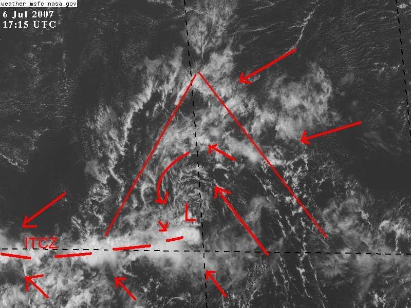
There is no way you can classify this as a closed low pressure though... it is so obvious from satellite that it is now in fact an open wave, as mentioned by the NHC.

It may have had a low level circulation today, but slowly as it has lost convection, it is and will be completely an open wave by tomorrow morning. You can see on this happening on a satellite loop of the system. Unless by some stroke of luck, miracle or finger of god, we'll see it regenerate overnight.

Bye bye for now 96L... We'll see you later in the week known as 97L or even maybe 98L, depending on if there is any other Invests before, it interacts with the Upper Level disturbance and generates into another area of low pressure into the NW Caribbean.

Either way... no offense and no big deal, YET... :eek:

Also see here...

http://hadar.cira.colostate.edu/ramsdis/online/trop_ge_storm_relative_0.html

You can clearly see there is no westerly component to the circulation on the southern side....
0 likes   

User avatar
NDG
S2K Supporter
S2K Supporter
Posts: 15455
Joined: Sun Jul 09, 2006 10:14 pm
Location: Orlando, FL

Re: Invest 96L=Low/Tropical Wave East of Windwards

#450 Postby NDG » Fri Jul 06, 2007 2:20 pm

While it is taking little by little the looks of a classical inverted V shaped tropical wave, the low pressure is still visible, being that it is still close to the ITCZ is making it difficult to have a full circulation on its SW & southern quadrant.

Image
0 likes   

User avatar
Aquawind
Category 5
Category 5
Posts: 6714
Age: 62
Joined: Mon Jun 16, 2003 10:41 pm
Location: Salisbury, NC
Contact:

Re: Invest 96L=Low/Tropical Wave East of Windwards

#451 Postby Aquawind » Fri Jul 06, 2007 2:53 pm

We should have an action packed season if little waves lke 96L keep on coming of the African coast. Even if they wait intil the Caribbean to organize. If this thing pops with that dry air to the north it's going to get scary come prime time actually.
0 likes   

User avatar
SouthFloridawx
S2K Supporter
S2K Supporter
Posts: 8346
Age: 46
Joined: Tue Jul 26, 2005 1:16 am
Location: Sarasota, FL
Contact:

Re: Invest 96L=Low/Tropical Wave East of Windwards

#452 Postby SouthFloridawx » Fri Jul 06, 2007 2:56 pm

NDG wrote:While it is taking little by little the looks of a classical inverted V shaped tropical wave, the low pressure is still visible, being that it is still close to the ITCZ is making it difficult to have a full circulation on its SW & southern quadrant.

http://i20.photobucket.com/albums/b245/ ... -5-072.jpg


That's exactly what I'm trying to say in so many words...

THE AREA OF LOW PRESSURE LOCATED ABOUT 450 MILES EAST OF THE
SOUTHERN WINDWARD ISLANDS IS DEGENERATING INTO A TROPICAL WAVE.
ENVIRONMENTAL CONDITIONS ARE NOT FAVORABLE FOR DEVELOPMENT AS THIS
SYSTEM MOVES WESTWARD.

ELSEWHERE...TROPICAL CYCLONE FORMATION IS NOT EXPECTED DURING THE
NEXT 48 HOURS.

$$
FORECASTER BROWN
0 likes   

User avatar
wxman57
Moderator-Pro Met
Moderator-Pro Met
Posts: 22991
Age: 67
Joined: Sat Jun 21, 2003 8:06 pm
Location: Houston, TX (southwest)

Re: Invest 96L=Low/Tropical Wave East of Windwards

#453 Postby wxman57 » Fri Jul 06, 2007 3:46 pm

"He really is dead, Jim!"

Just another weak tropical wave along the ITCZ. Chance of development slim to none. It'll be moving inland into South America over the weekend.

Image
0 likes   

User avatar
NDG
S2K Supporter
S2K Supporter
Posts: 15455
Joined: Sun Jul 09, 2006 10:14 pm
Location: Orlando, FL

Re: Invest 96L=Low/Tropical Wave East of Windwards

#454 Postby NDG » Fri Jul 06, 2007 4:08 pm

Well, I guess the NHC changed their mind about dropping the LOW pressure center out of the tropical wave on their 18z surface analysis, the whole thing is complex, while I agree with wxman57's ITCZ axis I don't agree that he has dropped the Low, while I agree with the NHC LOW center representation I don't agree that they do not show the ITCZ axis, ;)

Image
0 likes   

User avatar
NDG
S2K Supporter
S2K Supporter
Posts: 15455
Joined: Sun Jul 09, 2006 10:14 pm
Location: Orlando, FL

Re: Invest 96L=Low/Tropical Wave East of Windwards

#455 Postby NDG » Fri Jul 06, 2007 4:27 pm

Are they looking at the right sat floater for 96L, it has about as much convection as it has had all day, if not more, not there is a lot any way.

ABNT20 KNHC 062120
TWOAT
TROPICAL WEATHER OUTLOOK
NWS TPC/NATIONAL HURRICANE CENTER MIAMI FL
530 PM EDT FRI JUL 6 2007


AN AREA OF LOW PRESSURE IS LOCATED ABOUT 350 MILES EAST OF THE
SOUTHERN WINDWARD ISLANDS AND IS MOVING WESTWARD AT 10 TO 15 MPH.
ASSOCIATED SHOWER ACTIVITY HAS MOSTLY DISSIPATED AND ENVIRONMENTAL
CONDITIONS REMAIN UNFAVORABLE FOR DEVELOPMENT.


$$
FORECASTER RHOME
0 likes   

User avatar
Nimbus
Category 5
Category 5
Posts: 5329
Joined: Mon Jul 19, 2004 10:54 am

Re: Invest 96L=Low/Tropical Wave East of Windwards

#456 Postby Nimbus » Fri Jul 06, 2007 4:36 pm

Some posters have suggested that 96L may be headed for the NW caribbean? With the track thus far running almost due west wouldn't it be more likely to skirt the north coast of South America like Earl's remnants did in 2004?
0 likes   

TheRingo
Tropical Storm
Tropical Storm
Posts: 170
Joined: Sat Aug 26, 2006 4:46 pm

Re: Invest 96L=Low/Tropical Wave East of Windwards

#457 Postby TheRingo » Fri Jul 06, 2007 5:01 pm

Nimbus wrote:Some posters have suggested that 96L may be headed for the NW caribbean? With the track thus far running almost due west wouldn't it be more likely to skirt the north coast of South America like Earl's remnants did in 2004?


72hr surface forecast shows it going in the caribbean without the low.

Image
0 likes   

Cyclone1
Category 5
Category 5
Posts: 2739
Age: 33
Joined: Tue Jun 12, 2007 12:03 pm
Location: Florida

Re: Invest 96L=Low/Tropical Wave East of Windwards

#458 Postby Cyclone1 » Fri Jul 06, 2007 5:03 pm

Nimbus wrote:Some posters have suggested that 96L may be headed for the NW caribbean? With the track thus far running almost due west wouldn't it be more likely to skirt the north coast of South America like Earl's remnants did in 2004?

Image

Into the Caribbean it goes!
0 likes   

miamicanes177
Category 5
Category 5
Posts: 1131
Joined: Tue Aug 01, 2006 10:53 pm

#459 Postby miamicanes177 » Fri Jul 06, 2007 5:10 pm

This is the best it has looked in a day. It's certainly way premature to call it dead.
0 likes   

User avatar
jrod
Military Member
Military Member
Posts: 546
Joined: Fri Jun 17, 2005 1:22 pm
Location: jacksonville, fl

#460 Postby jrod » Fri Jul 06, 2007 5:17 pm

As i posted yesterday, it is dead for now and not likely to ever develop.
0 likes   


Return to “Talkin' Tropics”

Who is online

Users browsing this forum: redingtonbeach and 46 guests