Invest 90L: East Atlantic-Discussions,Analysis,Sat Pics
Moderator: S2k Moderators
Forum rules
The posts in this forum are NOT official forecasts and should not be used as such. They are just the opinion of the poster and may or may not be backed by sound meteorological data. They are NOT endorsed by any professional institution or STORM2K. For official information, please refer to products from the National Hurricane Center and National Weather Service.
- astrosbaseball22
- Tropical Storm

- Posts: 122
- Age: 32
- Joined: Wed Aug 01, 2007 5:48 pm
- Contact:
Re: Invest 90L in East Atlantic: Discussions,Analysis,Sat Pics
we would of been in the cone for rita on the saturday it turned into TD17 so i know IF texas is in the cone it would be sat-sun next week!
but we have to wait for a TD first
but we have to wait for a TD first
0 likes
- HurricaneMaster_PR
- Category 2

- Posts: 795
- Joined: Tue Jul 22, 2003 6:23 pm
- Location: San Juan, Puerto Rico
Re: Invest 90L in East Atlantic: Discussions,Analysis,Sat Pics
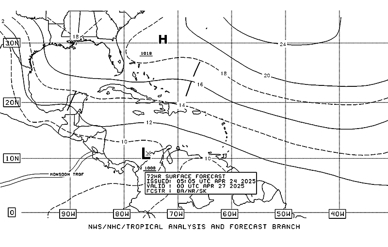
TAFB Surface Analysis Forecast (72 hours)


0 likes
-
MiamiensisWx
Re: Invest 90L in East Atlantic: Discussions,Analysis,Sat Pics
OT: coincidentially, tomorrow is the third anniversary of one very infamous storm in Florida...
http://en.wikipedia.org/wiki/Hurricane_Charley
We're entering the period where you can clearly see the increase in activity - look at the number of upcoming historical anniversaries:
Hurricane Donna (1960)
Hurricane Isabel (2003)
1926 Great Miami Hurricane
San Felipe Segundo-Okeechobee Hurricane (1928)
Hurricane Floyd (1999)
Hurricane Andrew (1992)
Hurricane Hugo (1989)
Hurricane Camille (1969)
Hurricane David (1979)
There are many more on that list. Katrina's anniversary is coming, too...
Last edited by MiamiensisWx on Sun Aug 12, 2007 9:44 am, edited 2 times in total.
0 likes
- windstorm99
- S2K Supporter

- Posts: 1578
- Age: 48
- Joined: Sat May 26, 2007 8:10 am
- Location: Miami, Florida
- Contact:
Re: Invest 90L in East Atlantic: Discussions,Analysis,Sat Pics
MiamiensisWx wrote:OT: coincidentially, tomorrow is the third anniversary of one very infamous storm in Florida...
http://en.wikipedia.org/wiki/Hurricane_Charley
Thats not the only one coming with Hurricane Andrew-august 24-1992
0 likes
- astrosbaseball22
- Tropical Storm

- Posts: 122
- Age: 32
- Joined: Wed Aug 01, 2007 5:48 pm
- Contact:
Re: Invest 90L in East Atlantic: Discussions,Analysis,Sat Pics
HurricaneMaster_PR wrote:TAFB Surface Analysis Forecast (72 hours)
so NHC would likley have a path like this
0 likes
- Extremeweatherguy
- Category 5

- Posts: 11095
- Joined: Mon Oct 10, 2005 8:13 pm
- Location: Florida
Re:
KatDaddy wrote:One thing that for sure should Invest 90 grow into a powerful tropical cyclcone as some models show I do not want any part of it. Its a very long way out and difficult to tell if this will become a GOM threat or EC threat.
KatDaddy i'm with you on wanting no part of this one (IF) it gets into the GOM,but regardless of weather the GOM,SE coast or a combination of both being a potential target it's gonna get pretty interesting around here come late in the week and heading into the weekend. Once 90L is upgraded i think come midweek the national media will be all over it, and depending on where the NHC's 5 day forecast track is pointing i think the local will start to get crazy starting this weekend.
0 likes
-
tracyswfla
- S2K Supporter

- Posts: 792
- Joined: Tue May 18, 2004 1:19 pm
- Location: Rochester, NY
Re: Invest 90L in East Atlantic: Discussions,Analysis,Sat Pics
Bane wrote:nice graphics!
ditto
0 likes
-
Aric Dunn
- Category 5

- Posts: 21238
- Age: 43
- Joined: Sun Sep 19, 2004 9:58 pm
- Location: Ready for the Chase.
- Contact:
I would be surprised if it was not upgraded to a Td this evening it has maintained sufficient convection
http://oiswww.eumetsat.org/SDDI/cgi/lis ... 5#controls
http://oiswww.eumetsat.org/SDDI/cgi/lis ... 5#controls
Last edited by Aric Dunn on Sun Aug 12, 2007 9:49 am, edited 1 time in total.
0 likes
- windstorm99
- S2K Supporter

- Posts: 1578
- Age: 48
- Joined: Sat May 26, 2007 8:10 am
- Location: Miami, Florida
- Contact:
Re: Invest 90L in East Atlantic: Discussions,Analysis,Sat Pics
For those that missed Jeff Masters thoughts on 90L...
What the computer models say
Watching the computer model runs for 90L is not for the faint of heart. All the major models except the NOGAPS develop the system into a tropical storm or hurricane that tracks westward over the Atlantic, reaching the lesser Antilles Islands as early as Thursday night, August 16. There are four possible scenarios to consider:
1) A strong trough of low pressure is forecast to move off the East Coast of the U.S. at that time, and this trough may deflect 90L northwards so that it misses the Lesser Antilles Islands, and then recurves harmlessly out to sea.
2) In keeping with the steering pattern we've observed since late July, the trough is expected to rapidly move onward, allowing a ridge of high pressure to build in. If the trough is not strong enough to recurve 90L out to sea, the storm will be forced to the west once more and eventually hit the East Coast of the U.S. This is the solution of last night's ECMWF model.
3) 90L will be far enough south and next weekend's trough will be weak enough that 90L will plow through the Caribbean, and not be deflected north of the Lesser Antilles Islands. The storm would eventually track into the Gulf of Mexico. This is the solution preferred by this morning's GFS model.
4) 90L will never develop, or will never become more than a weak tropical storm, due to unfavorable wind shear, dry air, or other factors. This is the solution of the NOGAPS model.
Of the four scenarios, I believe #2 or #3 are most likely to occur--90L will develop into a tropical storm or hurricane that will affect the Caribbean and/or U.S. East Coast. Residents throughout the Caribbean and U.S. should anticipate the possibility that 90L may become a hurricane--and possibly a major hurricane--that will not recurve. If you plan on being in the Lesser Antilles Islands Thursday August 16 - Sunday August 19, keep in mind there is a heightened risk of a tropical storm or hurricane during that period. Be prepared to adjust your travel plans
0 likes
-
Aric Dunn
- Category 5

- Posts: 21238
- Age: 43
- Joined: Sun Sep 19, 2004 9:58 pm
- Location: Ready for the Chase.
- Contact:
Re: INVEST 90L in E Atlantic: 12:00 UTC Tropical Models Posted
MiamiensisWx wrote:The posts in this forum are NOT official forecast and should not be used as such. They are just the opinion of the poster and may or may not be backed by sound meteorological data. They are NOT endorsed by any professional institution or storm2k.org. For official information, please refer to the NHC and NWS products.
Personally, I think 90L has maintained sufficient convection and organization to be classified as a TD. Undoubtedly, there is a closed low-level circulation, and the system has displayed some "banding" signatures. Look at the EUMETSAT IR loop. There are some uncertainities because of insufficient additional obs, so I supported the TPC's initial conservative attitude. I think the system has passed the "hurdles" - it deserves a classification today, IMO. I do think we could see our next tropical system by tonight or tomorrow morning.
Additionally, there is a strong directional mid to upper-level SW flow over the Leeward Islands - it is associated with the interaction between the Florida upper low and western Atlantic trough. This trend would present a hostile obstacle to any TC approaching the islands, but I see some indications the East Coast trough could be deamplifying and weakening over the next 36 hours. The upper-level easterly steering flow should become more dominant (in accordance with these obs and model guidance) - look at the latest shortwave loop.
http://www.ssd.noaa.gov/goes/east/tatl/loop-ir2.html
You can clearly spot the building anticyclone over the region, so shear should decrease over the next few days as 90L approaches the islands. The main issue deals with the possible LLC relocations; the rate of development; and whether the East Coast trough lingers over the area, which would allow a possible northward jog - the possible presence of a low could enhance this movement, too.
On another note, you can extrapolate the system's forward motion based on the low to mid-level steering currents. It looks (based on my personal observations) like 90L could maintain an average forward motion greater than 12 mph through the next three or four days. I don't see any perturbances which could inhibit this steady movement, so I think it is a reasonable estimate. That movement would place the system further west than initially indicated by some models. The islands could be under the gun sooner than we think - I think you should closely monitor this system.
good analysis
0 likes
-
tracyswfla
- S2K Supporter

- Posts: 792
- Joined: Tue May 18, 2004 1:19 pm
- Location: Rochester, NY
Re:
skysummit wrote:Well, I don't think he'll have much of a problem with moisture...plus, what's that behind 90L !?!?
Chugga chugga chooo chooo!

0 likes
-
Aric Dunn
- Category 5

- Posts: 21238
- Age: 43
- Joined: Sun Sep 19, 2004 9:58 pm
- Location: Ready for the Chase.
- Contact:
here is a ninteresting loop you can see 90L, flossie, westpac.. but its really weird to look at
http://www.meteo.psu.edu/~gadomski/SAT_ ... m16ir.html
http://www.meteo.psu.edu/~gadomski/SAT_ ... m16ir.html
0 likes
-
Aric Dunn
- Category 5

- Posts: 21238
- Age: 43
- Joined: Sun Sep 19, 2004 9:58 pm
- Location: Ready for the Chase.
- Contact:
Re: Invest 90L in East Atlantic: 11;30 AM EDT TWO Shortly
not sure if anyone posted this
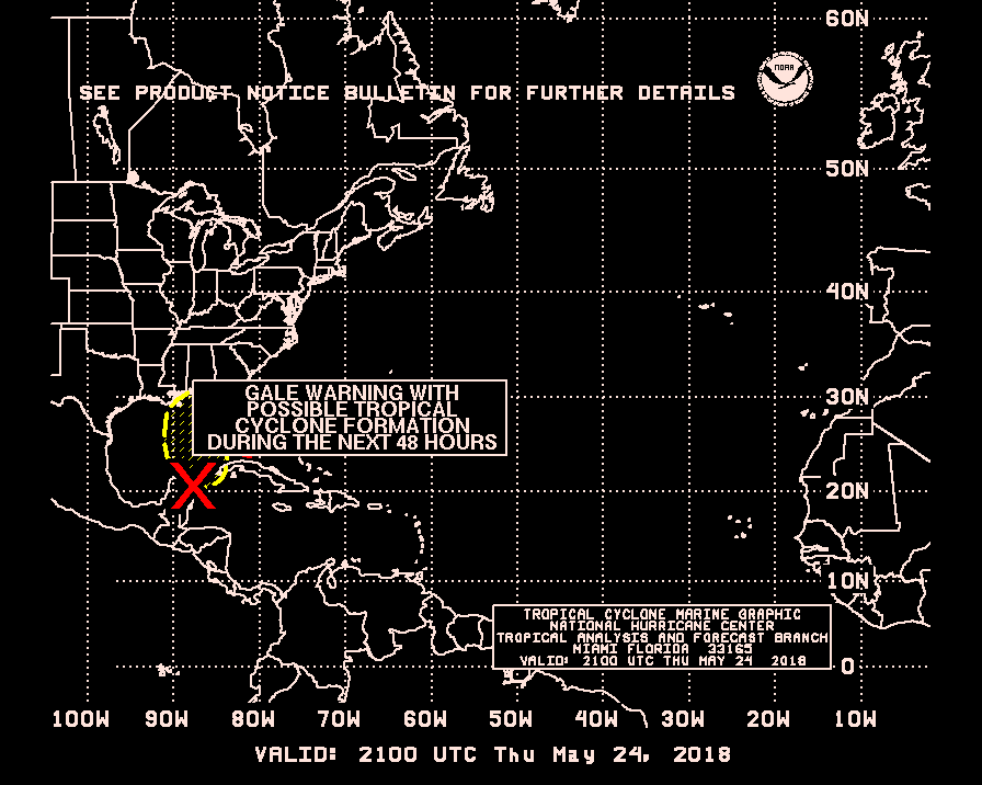
but its a TCFA

finally 20 minutes later the large one loads

but its a TCFA

finally 20 minutes later the large one loads

Last edited by Aric Dunn on Sun Aug 12, 2007 10:03 am, edited 1 time in total.
0 likes
- skysummit
- S2K Supporter

- Posts: 5305
- Age: 50
- Joined: Tue Aug 31, 2004 11:09 pm
- Location: Ponchatoula, LA
- Contact:
Re:
Aric Dunn wrote:here is a ninteresting loop you can see 90L, flossie, westpac.. but its really weird to look at
http://www.meteo.psu.edu/~gadomski/SAT_ ... m16ir.html
Yea, especially with that large UFO sitting over the northpole.
0 likes
Who is online
Users browsing this forum: dexterlabio and 208 guests


