xtyphooncyclonex wrote:Ok. Thanks for the clarification though. This ENSO stuff is quite complicated though, yet I'm interested in it. I don't know as much about the ONI. So which means if our first trimonthly would be AMJ, it would be April as when the El Niño threshold began. And when do you think the El Niño will most likely be declared?
I can't say for sure when CPC will pull the trigger. My guess has always been May or June. If we continue to warm and get to near moderate status (in the past CPC often upgrades when it has around 0.7-1C with definitive conclusion an event will keep going they do it, they don't always wait for ONI like in 2009 which was MJJ but came out in August however CPC pulled the trigger in July likely realizing ONI had a good chance of appearing above 0.5C. Interest in ENSO within this board has definitely improved over the years and has really kicked off the past few years.
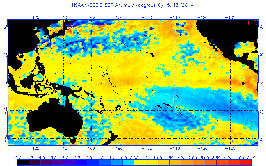
About ONI, a lot of ENSO is averaging out long spans as it is a seasonal phenomenon that takes a lot of time to progress. For instance we've gone through several downs for this event, but the net result in the end for this year so far has been gradual warming of the tropical Pacific since February, regardless of what the "noise" has done. While April did not produce wall to wall readings of 0.5C if May comes above that and June above 1C the three months would average out greater than 0.5C just for example. Meaning the event tried to get going in April and continued beyond thus it began within that trimonthly period as it was a process.