Most models do develop 17L after 55w. Which is not a good thing for landfall. Some take it south of Florida and some take it through Florida. That's not the real point right now. The problem is if it develops after around 50w-55w with the pattern setting up. Somebody is in trouble.

Elsewhere in the tropics
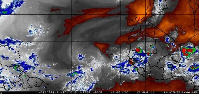
A tropical wave near 14°N 34°W, about 500 miles west-southwest of the Cape Verde Islands off the coast of Africa, is moving westward near 15 - 20 mph. This wave has little heavy thunderstorm activity associated with it due to dry air, but an impressive amount of large-scale spin is obvious in visible satellite loops. This wave is expected to arrive in the Lesser Antilles Islands by Saturday. Three of our four reliable models for predicting tropical storm genesis predict that this wave could develop into a tropical depression sometime Friday through Sunday. A west-northwest track through the Northeast Caribbean bringing the storm near Puerto Rico by Sunday or Monday is favored by most of the models.
Jeff Masters