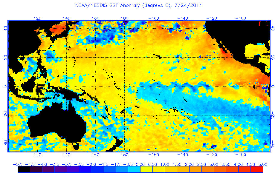
ENSO Updates (2007 thru 2023)

This is the general tropical discussion area. Anyone can take their shot at predicting a storms path.

Moderator: S2k Moderators

Forum rules

The posts in this forum are NOT official forecasts and should not be used as such. They are just the opinion of the poster and may or may not be backed by sound meteorological data. They are NOT endorsed by any professional institution or STORM2K. For official information, please refer to products from the National Hurricane Center and National Weather Service.

Help Support Storm2K
Message
Author
LarryWx
S2K Supporter
S2K Supporter
Posts: 6304
Joined: Sun Sep 07, 2003 2:04 pm
Location: GA

Re: Re:

#5041 Postby LarryWx » Wed Jul 23, 2014 7:11 pm

South Texas Storms wrote:
LarryWx wrote:The volatility showing up on the Levi Cowan satellite based Nino 3.4 SST anomaly graph continues as it has dropped all of the way down to -0.217 as of 6Z today:


http://www.tropicaltidbits.com/analysis/nino34.png


What are your thoughts on the SOI forecast through early August? I really enjoy your analysis on it based on the Euro forecast as it's usually pretty accurate.


Thanks.

SOI projections per my interpretation of 0Z 7/23 Euro:

Increased volatility again with no clearcut trend:

7/24: 0 to +5
Drops to -teens 7/27.
Rises to +20's 7/29-30
Drops to -teens 8/2

Based on this, July as a whole would end up near the -1 to -2 range. So, July looks to be another pretty neutral month and it gives no indication of an oncoming El Nino as of yet. Looking ahead further through ~8/8 per the 0Z 7/23 Euro ensemble mean, there still is no indication of anything too solidly and consistently negative as of then.
0 likes   
Personal Forecast Disclaimer:
The posts in this forum are NOT official forecasts and should not be used as such. They are just the opinion of the poster and may or may not be backed by sound meteorological data. They are NOT endorsed by any professional institution or storm2k.org. For official information, please refer to the NHC and NWS products.

User avatar
gigabite
S2K Supporter
S2K Supporter
Posts: 916
Age: 72
Joined: Wed May 05, 2004 4:09 pm
Location: Naples, Florida

Re: Re:

#5042 Postby gigabite » Wed Jul 23, 2014 8:10 pm

Ntxw wrote:
gigabite wrote:Evidently El Niño amplitude varies. I think that maybe the ESNO phenomena is recycling. It might be 4 years or more of neutral.
https://www.vsp.ucar.edu/cgc/20thCelebr ... tavas-.pdf


I think 4 years more is a little too much. It would be an unprecedented gap that's never seen before between ENSO events nonetheless El Nino. The earth has to release the heat energy eventually from the ocean, it's a constant push for balance an example would be in my earlier post about some of the strongest, longest Nina's are immediately after the big Nino's. If it does not happen this year (though I still believe we will get the Nino) it will within the next 2.


Thank you for your reply,

Referring to:
Image
Please note the trend line of negative SOI (southern element) for half of a cycle is headed into a unprecedented positive (cooling) range. -8 is a precursor to El Niño. It looks like it will take a couple of years to get there, and then a couple to get out. Then there is the chart of the forecasts for El Niño. It is totally blown-out. Then there is the fact that the sum of aphelion and perihelion greater than average this year. That in it self will nudge things cooler.

Over the long term the negative SOI does not seem all that well defined. I have been watching the correlation to the metric I use wither from a .8 to a .04. This seems to be a threshold event to me, well for an anomaly that has anomalies. I expect that the correlation would improve by 2017 after this perturbation.
0 likes   

User avatar
'CaneFreak
Category 5
Category 5
Posts: 1486
Joined: Mon Jun 05, 2006 10:50 am
Location: New Bern, NC

Re: ENSO Updates

#5043 Postby 'CaneFreak » Wed Jul 23, 2014 11:07 pm

I suggest you do some research. Read some papers that have been done on the topic. That's your best bet.

PM me if you need some literature. I will see what I can dig up for you.

gigabite wrote:
'CaneFreak wrote:That pocket of 1 degree Celsius above normal water in the West Pacific at approximately 150-200 meters in depth is looking more and more like the begins of yet another downwelling phase of the Kelvin Wave. We shall see.

http://www.cpc.ncep.noaa.gov/products/a ... eq_anm.gif


I thought that Kelvin Waves were akin to Outbound Long Wave Radiation. Please enlighten me!!!
0 likes   

User avatar
'CaneFreak
Category 5
Category 5
Posts: 1486
Joined: Mon Jun 05, 2006 10:50 am
Location: New Bern, NC

Re: Re:

#5044 Postby 'CaneFreak » Wed Jul 23, 2014 11:15 pm

SOI is only one of many tools that are used for ENSO. I wouldn't waste so much time looking into correlations. If it is a weak or moderate Nino, the SOI signal is going to get lost in the background noise.

gigabite wrote:
Ntxw wrote:
gigabite wrote:Evidently El Niño amplitude varies. I think that maybe the ESNO phenomena is recycling. It might be 4 years or more of neutral.
https://www.vsp.ucar.edu/cgc/20thCelebr ... tavas-.pdf


I think 4 years more is a little too much. It would be an unprecedented gap that's never seen before between ENSO events nonetheless El Nino. The earth has to release the heat energy eventually from the ocean, it's a constant push for balance an example would be in my earlier post about some of the strongest, longest Nina's are immediately after the big Nino's. If it does not happen this year (though I still believe we will get the Nino) it will within the next 2.


Thank you for your reply,

Referring to:
Image
Please note the trend line of negative SOI (southern element) for half of a cycle is headed into a unprecedented positive (cooling) range. -8 is a precursor to El Niño. It looks like it will take a couple of years to get there, and then a couple to get out. Then there is the chart of the forecasts for El Niño. It is totally blown-out. Then there is the fact that the sum of aphelion and perihelion greater than average this year. That in it self will nudge things cooler.

Over the long term the negative SOI does not seem all that well defined. I have been watching the correlation to the metric I use wither from a .8 to a .04. This seems to be a threshold event to me, well for an anomaly that has anomalies. I expect that the correlation would improve by 2017 after this perturbation.
0 likes   

LarryWx
S2K Supporter
S2K Supporter
Posts: 6304
Joined: Sun Sep 07, 2003 2:04 pm
Location: GA

Re: Re:

#5045 Postby LarryWx » Wed Jul 23, 2014 11:53 pm

'CaneFreak wrote:SOI is only one of many tools that are used for ENSO. I wouldn't waste so much time looking into correlations. If it is a weak or moderate Nino, the SOI signal is going to get lost in the background noise.


CaneFreak,
Whereas the SOI is typically more strongly negative overall with a strong Nino than with a moderate or weak one, the history of monthly SOI's shows that there still is a good correlation between a moderate or weak Nino and negative SOI's (moderate more negative than weak on average, which is intuitive). So, I'd say that it doesn't get lost in the background noise in most cases though there may be an exception or two. Sometimes, it doesn't really show until the fall for especially weak ones. Maybe this year will end up like that.

http://www.longpaddock.qld.gov.au/seaso ... 89Base.txt
0 likes   
Personal Forecast Disclaimer:
The posts in this forum are NOT official forecasts and should not be used as such. They are just the opinion of the poster and may or may not be backed by sound meteorological data. They are NOT endorsed by any professional institution or storm2k.org. For official information, please refer to the NHC and NWS products.

User avatar
'CaneFreak
Category 5
Category 5
Posts: 1486
Joined: Mon Jun 05, 2006 10:50 am
Location: New Bern, NC

Re: Re:

#5046 Postby 'CaneFreak » Thu Jul 24, 2014 9:40 am

Hi there,

What I meant was not to get too caught up in the actual numbers because they don't always line up. You may or may not get the negative 8 with every El Nino. Sick and tired of people trying to boil meteorology down to a stupid index. There is much more to it than that.

LarryWx wrote:
'CaneFreak wrote:SOI is only one of many tools that are used for ENSO. I wouldn't waste so much time looking into correlations. If it is a weak or moderate Nino, the SOI signal is going to get lost in the background noise.


CaneFreak,
Whereas the SOI is typically more strongly negative overall with a strong Nino than with a moderate or weak one, the history of monthly SOI's shows that there still is a good correlation between a moderate or weak Nino and negative SOI's (moderate more negative than weak on average, which is intuitive). So, I'd say that it doesn't get lost in the background noise in most cases though there may be an exception or two. Sometimes, it doesn't really show until the fall for especially weak ones. Maybe this year will end up like that.

http://www.longpaddock.qld.gov.au/seaso ... 89Base.txt
0 likes   

User avatar
cycloneye
Admin
Admin
Posts: 145296
Age: 68
Joined: Thu Oct 10, 2002 10:54 am
Location: San Juan, Puerto Rico

Re: ENSO Updates: Nino 3.4 goes down to negative

#5047 Postby cycloneye » Thu Jul 24, 2014 10:54 am

For El Nino to come those blues have to go and be suplanted by the yellows and oranges .Will a strong Kelvin Wave move thru the Pacific soon to warm bigtime the equatorial Pacific? That strong one in March was that made the very large warm pool at the sub-surface that is right now vanishing.

Image

Image
0 likes   
Visit the Caribbean-Central America Weather Thread where you can find at first post web cams,radars
and observations from Caribbean basin members Click Here

Frank2
Category 5
Category 5
Posts: 4061
Joined: Mon Jul 25, 2005 12:47 pm

Re: ENSO Updates: Nino 3.4 goes down to negative

#5048 Postby Frank2 » Thu Jul 24, 2014 12:22 pm

Academic and research meteorologists are finding that the prediction of an El Nino event (strength and timing) is not and easy thing to do - like many other things in nature, some are based on season, and others happen when it's time for them to happen and do not appear to be caused by one particular thing or another - scientists don't like inherent thinking, however : )

Frank
0 likes   

LarryWx
S2K Supporter
S2K Supporter
Posts: 6304
Joined: Sun Sep 07, 2003 2:04 pm
Location: GA

Re: Re:

#5049 Postby LarryWx » Thu Jul 24, 2014 12:37 pm

'CaneFreak wrote:Hi there,

What I meant was not to get too caught up in the actual numbers because they don't always line up. You may or may not get the negative 8 with every El Nino. Sick and tired of people trying to boil meteorology down to a stupid index. There is much more to it than that.


CaneFreak,
I understand the general idea of not getting caught up with a single index, but all 39 Ninos since the late 1800's did, indeed, have at least one month that was sub -8 from the preceding June through met. winter. I can also tell you from looking at the SOI monthly history that there have actually been at least two sub -8 calendar months for almost all of the 39 El Ninos (i.e., very few exceptions, even for weak Ninos) from the preceding June through the following met. winter. Granted, these two sub -8 months in some cases didn't start til met. fall (like 2009-10, 1986-7, 1969-70, 1939-40, 1913-4, and 1900-1; the last 4 of these 6 were weak Ninos) or in one case not til winter (1958-9, a weak Nino). There were only two that had only one sub -8 month from the preceding June, onward (both of these sub -8's were in winter): 1968-9 (borderline weak to moderate) and 1930-1 (which was actually strong). As mentioned, NONE didn't have at least one sub -8 month from the preceding June through met. winter.

So, out of 39 Ninos since the last 1800's, all 39 (100%) had at least one sub -8 month from June through met. winter, 37 (95%) had two sub -8 months from June through met. winter, 36 (92%) had that first June or later sub -8 by met. fall, and 30 (77%) had that first June or later sub -8 in met. summer. So, only 3 of the 39 Ninos (8%) had to wait til winter for the first June or later sub -8.
Based on stats like these, I do feel that looking for sub -8 months or at least following the progress of the 30 day SOI's in general is of significant value.


****Edit: What about non-Ninos? I count 99 non-Nino fall/winters of the 138 from 1876-7 through 2013-4. Of those 99, only 19 (19%) had two or more months that were sub -8 from June through met. winter. Compare that 19% with 95% for Ninos. So, "false positives" do occur. However, their frequency is only 1/5 vs. that for actual Ninos.

Monthly SOI's since 1876:

http://www.longpaddock.qld.gov.au/seaso ... 89Base.txt
0 likes   
Personal Forecast Disclaimer:
The posts in this forum are NOT official forecasts and should not be used as such. They are just the opinion of the poster and may or may not be backed by sound meteorological data. They are NOT endorsed by any professional institution or storm2k.org. For official information, please refer to the NHC and NWS products.

User avatar
'CaneFreak
Category 5
Category 5
Posts: 1486
Joined: Mon Jun 05, 2006 10:50 am
Location: New Bern, NC

Re: Re:

#5050 Postby 'CaneFreak » Thu Jul 24, 2014 4:00 pm

Thanks for the response and good luck with your future endeavors. I personally don't like using the SOI because it is just too noisy. The stats may be there but the atmosphere doesn't respond to stats. It is a set of physical processes that drives these El Ninos, not mechanical ones like trying to predict the value of an index over time. SOI doesn't drive the El Nino, the El Nino drives the SOI. If people would start learning the science instead of trying to predict indicies, we would be much better off I think.

LarryWx wrote:
'CaneFreak wrote:Hi there,

What I meant was not to get too caught up in the actual numbers because they don't always line up. You may or may not get the negative 8 with every El Nino. Sick and tired of people trying to boil meteorology down to a stupid index. There is much more to it than that.


CaneFreak,
I understand the general idea of not getting caught up with a single index, but all 39 Ninos since the late 1800's did, indeed, have at least one month that was sub -8 from the preceding June through met. winter. I can also tell you from looking at the SOI monthly history that there have actually been at least two sub -8 calendar months for almost all of the 39 El Ninos (i.e., very few exceptions, even for weak Ninos) from the preceding June through the following met. winter. Granted, these two sub -8 months in some cases didn't start til met. fall (like 2009-10, 1986-7, 1969-70, 1939-40, 1913-4, and 1900-1; the last 4 of these 6 were weak Ninos) or in one case not til winter (1958-9, a weak Nino). There were only two that had only one sub -8 month from the preceding June, onward (both of these sub -8's were in winter): 1968-9 (borderline weak to moderate) and 1930-1 (which was actually strong). As mentioned, NONE didn't have at least one sub -8 month from the preceding June through met. winter.

So, out of 39 Ninos since the last 1800's, all 39 (100%) had at least one sub -8 month from June through met. winter, 37 (95%) had two sub -8 months from June through met. winter, 36 (92%) had that first June or later sub -8 by met. fall, and 30 (77%) had that first June or later sub -8 in met. summer. So, only 3 of the 39 Ninos (8%) had to wait til winter for the first June or later sub -8.
Based on stats like these, I do feel that looking for sub -8 months or at least following the progress of the 30 day SOI's in general is of significant value.


****Edit: What about non-Ninos? I count 99 non-Nino fall/winters of the 138 from 1876-7 through 2013-4. Of those 99, only 19 (19%) had two or more months that were sub -8 from June through met. winter. Compare that 19% with 95% for Ninos. So, "false positives" do occur. However, their frequency is only 1/5 vs. that for actual Ninos.

Monthly SOI's since 1876:

http://www.longpaddock.qld.gov.au/seaso ... 89Base.txt
0 likes   

User avatar
NDG
S2K Supporter
S2K Supporter
Posts: 15446
Joined: Sun Jul 09, 2006 10:14 pm
Location: Orlando, FL

Re: Re:

#5051 Postby NDG » Thu Jul 24, 2014 4:28 pm

LarryWx wrote:
'CaneFreak wrote:SOI is only one of many tools that are used for ENSO. I wouldn't waste so much time looking into correlations. If it is a weak or moderate Nino, the SOI signal is going to get lost in the background noise.


CaneFreak,
Whereas the SOI is typically more strongly negative overall with a strong Nino than with a moderate or weak one, the history of monthly SOI's shows that there still is a good correlation between a moderate or weak Nino and negative SOI's (moderate more negative than weak on average, which is intuitive). So, I'd say that it doesn't get lost in the background noise in most cases though there may be an exception or two. Sometimes, it doesn't really show until the fall for especially weak ones. Maybe this year will end up like that.

http://www.longpaddock.qld.gov.au/seaso ... 89Base.txt


I was one of the ones pointing out back in early June when some people were forecasting for a strong El Niño event to happen this year, I was ponting out that the SOI was not showing such an event to happen any time soon, if at all. There is a correlation between -SOI and strong El Niño events. When some were comparing Niño 3.4 temps to '97 back in April and May which were very close to each other, the SOI did not match to that same period during '97.
0 likes   

LarryWx
S2K Supporter
S2K Supporter
Posts: 6304
Joined: Sun Sep 07, 2003 2:04 pm
Location: GA

Re: Re:

#5052 Postby LarryWx » Thu Jul 24, 2014 5:50 pm

'CaneFreak wrote:Thanks for the response and good luck with your future endeavors. I personally don't like using the SOI because it is just too noisy. The stats may be there but the atmosphere doesn't respond to stats. It is a set of physical processes that drives these El Ninos, not mechanical ones like trying to predict the value of an index over time. SOI doesn't drive the El Nino, the El Nino drives the SOI. If people would start learning the science instead of trying to predict indicies, we would be much better off I think.


CaneFreak,
You're welcome. I think that they sort of drive each other. Regardless, I have seen some evidence that the SOI can be a leading indicator to some extent, especially early in the Nino development and as regards how strong the Nino peak will be. Regarding the process, when pressure is low at Tahiti and high at Darwin, low level winds tend to be more anomalously westerly from Darwin to Tahiti (either slower then normal trades or actual westerlies). This tends to lead to warming of the SST's in the Nino regions. But there is also a bit of a chicken/egg situation here since warmer SST's (like at Tahiti) can lead to lower pressures. Anyway, that's the science related to the SOI in a nutshell. I understand the science pretty well.
0 likes   
Personal Forecast Disclaimer:
The posts in this forum are NOT official forecasts and should not be used as such. They are just the opinion of the poster and may or may not be backed by sound meteorological data. They are NOT endorsed by any professional institution or storm2k.org. For official information, please refer to the NHC and NWS products.

User avatar
'CaneFreak
Category 5
Category 5
Posts: 1486
Joined: Mon Jun 05, 2006 10:50 am
Location: New Bern, NC

Re: Re:

#5053 Postby 'CaneFreak » Thu Jul 24, 2014 9:31 pm

Yes. That is the science of it in a nutshell. Look, all I am saying is westerly low level winds between Darwin and Tahiti are only one part of the total package. The real trouble is we have these other factors that also must be considered on interseasonal time scales that often interact with and change the SOI and this often clouds the signal. Again, the SOI is not to be used as a sole indicator for ENSO. That's all I am saying. It must be used in conjunction with other variables and indicators. If it were only the SOI that determined whether we had a Nino or not, we would not be having trouble predicting whether or not an El Nino was coming this year. Thanks for the good discussion and debate.

LarryWx wrote:
'CaneFreak wrote:Thanks for the response and good luck with your future endeavors. I personally don't like using the SOI because it is just too noisy. The stats may be there but the atmosphere doesn't respond to stats. It is a set of physical processes that drives these El Ninos, not mechanical ones like trying to predict the value of an index over time. SOI doesn't drive the El Nino, the El Nino drives the SOI. If people would start learning the science instead of trying to predict indicies, we would be much better off I think.


CaneFreak,
You're welcome. I think that they sort of drive each other. Regardless, I have seen some evidence that the SOI can be a leading indicator to some extent, especially early in the Nino development and as regards how strong the Nino peak will be. Regarding the process, when pressure is low at Tahiti and high at Darwin, low level winds tend to be more anomalously westerly from Darwin to Tahiti (either slower then normal trades or actual westerlies). This tends to lead to warming of the SST's in the Nino regions. But there is also a bit of a chicken/egg situation here since warmer SST's (like at Tahiti) can lead to lower pressures. Anyway, that's the science related to the SOI in a nutshell. I understand the science pretty well.
0 likes   

User avatar
'CaneFreak
Category 5
Category 5
Posts: 1486
Joined: Mon Jun 05, 2006 10:50 am
Location: New Bern, NC

Re: ENSO Updates: Nino 3.4 goes down to negative

#5054 Postby 'CaneFreak » Thu Jul 24, 2014 9:39 pm

I think the hope for a strong Nino that ends the drought in the Desert Southwest has all but vanished. I think we will at least see a decent downwelling Kelvin wave very soon and this may be the kick start that is needed to get the weak or moderate El Nino that we see later this fall into this winter.

cycloneye wrote:For El Nino to come those blues have to go and be supplanted by the yellows and oranges. Will a strong Kelvin Wave move thru the Pacific soon to warm big time the equatorial Pacific? That strong one in March was that made the very large warm pool at the sub-surface that is right now vanishing.

http://oi59.tinypic.com/243qpa8.jpg

http://oi58.tinypic.com/301lglw.jpg
0 likes   

User avatar
NDG
S2K Supporter
S2K Supporter
Posts: 15446
Joined: Sun Jul 09, 2006 10:14 pm
Location: Orlando, FL

Re:

#5055 Postby NDG » Fri Jul 25, 2014 7:02 am

LarryWx wrote:The volatility showing up on the Levi Cowan satellite based Nino 3.4 SST anomaly graph continues as it has dropped all of the way down to -0.217 as of 6Z today:


http://www.tropicaltidbits.com/analysis/nino34.png


NOAA's NESDIS agrees with CDA's Nino 3.4 Index of being cool neutral currently, incredible, lol.

Image
0 likes   

LarryWx
S2K Supporter
S2K Supporter
Posts: 6304
Joined: Sun Sep 07, 2003 2:04 pm
Location: GA

#5056 Postby LarryWx » Fri Jul 25, 2014 8:10 am

Yes, the satellite photo just posted is showing a slight negative now in 3.4, which is consistent with Cowan as you noted. However, the TAO buoy based map suggests about +0.3 C (though there are still some missing buoys). NOAA has been going much closer to TAO than these more volatile satellite based maps. I'm guessing they'll stay positive and probably close to the +0.2 to +0.3 C range in Monday's weekly update. Also, keep in mind that this satellite pic is a recent snapshot whereas the Monday release is based on the whole calendar week averaged out, which would incorporate a warmer earlier week per Cowan. Actually, even Cowan looks to average near +0.1 C for the calendar week.
0 likes   
Personal Forecast Disclaimer:
The posts in this forum are NOT official forecasts and should not be used as such. They are just the opinion of the poster and may or may not be backed by sound meteorological data. They are NOT endorsed by any professional institution or storm2k.org. For official information, please refer to the NHC and NWS products.

User avatar
NDG
S2K Supporter
S2K Supporter
Posts: 15446
Joined: Sun Jul 09, 2006 10:14 pm
Location: Orlando, FL

Re: ENSO Updates

#5057 Postby NDG » Fri Jul 25, 2014 11:07 am

:uarrow: I on the other hand would not be surprised if it drops down closer to 0 deg C.
0 likes   

User avatar
Ntxw
Storm2k Moderator
Storm2k Moderator
Posts: 22784
Joined: Wed Oct 21, 2009 6:34 pm
Location: DFW, Texas

Re: ENSO Updates

#5058 Postby Ntxw » Sat Jul 26, 2014 10:48 am

I would agree anything between 0 to 0.2C is valid, it's all pretty close. Nino 3.4 for the past several months has been the most difficult region to warm up when comparing it to it's counterparts in the east.

Anyway, sub-surface beginning of a new Oceanic Kelvin Wave? There's been raw westerlies (not just weaker trade anomalies) between 120E and just west of the dateline (likely due to the MJO and WPAC typhoon activity)

Image

Also surprisingly, the MJO has been hanging around in the Pacific.
0 likes   
The above post and any post by Ntxw is NOT an official forecast and should not be used as such. It is just the opinion of the poster and may or may not be backed by sound meteorological data. It is NOT endorsed by any professional institution including Storm2k. For official information, please refer to NWS products.

  Help support Storm2K!
Help Support Storm2K

User avatar
'CaneFreak
Category 5
Category 5
Posts: 1486
Joined: Mon Jun 05, 2006 10:50 am
Location: New Bern, NC

Re: ENSO Updates

#5059 Postby 'CaneFreak » Sat Jul 26, 2014 2:02 pm

Yep. Sure looks like it. Thanks for sharing. Also, thanks for sharing that info in regards to the westerlies. Some stations down in Micronesia have been reporting low level westerlies here recently. Is that 1 Celsius above average I see in those sub surface waters of the WestPac? :)

Ntxw wrote:I would agree anything between 0 to 0.2C is valid, it's all pretty close. Nino 3.4 for the past several months has been the most difficult region to warm up when comparing it to it's counterparts in the east.

Anyway, sub-surface beginning of a new Oceanic Kelvin Wave? There's been raw westerlies (not just weaker trade anomalies) between 120E and just west of the dateline (likely due to the MJO and WPAC typhoon activity)

Image

Also surprisingly, the MJO has been hanging around in the Pacific.
0 likes   

User avatar
xtyphooncyclonex
Category 5
Category 5
Posts: 3861
Age: 23
Joined: Sat Dec 08, 2012 9:07 am
Location: Cebu City
Contact:

#5060 Postby xtyphooncyclonex » Sun Jul 27, 2014 12:22 am

I just noticed something, something that may mean an El Niño would occur. Don't be fooled by the cooling you see now, it was predicted months ago consistently by the CFSv2 model. The warm massive pool you saw months ago has nearly dissipated, yes that is true. But what is happening now is a likely warm phase or downwelling over the West part of the CPAC and a part of the previous record-breaking warm pool is growing in size, and is connecting with another warmer pool to the west. That may push the cool pool to the east to surface, and therefore should see another cooling over Niño 3 and 1+2 and may be mistaken for a Modoki El Niño. Afterwards, there would be a big, long round of warming that would lead to a declaration of the 2014-15 El Niño event and would start and end late. That is based on the prediction of the model that showed cooling for these months, and is also showing a moderate to strong El Niño. The SOI for the past 3 to 4 weeks (30-day) has been consistently negative, and that may also be an evidence of the atmosphere starting to cooperate and coincide with the possible El Niño. I could also see a chance of a longer event. However, I am not WANTING an El Niño to occur.

The posts in this forum are NOT official forecast and should not be used as such. They are just the opinion of the poster and may or may not be backed by sound meteorological data. They are NOT endorsed by any professional institution or storm2k.org. For official information, please refer to the CPC/NOAA and BOM products.
0 likes   
REMINDER: My opinions that I, or any other NON Pro-Met in this forum, are unofficial. Please do not take my opinions as an official forecast and warning. I am NOT a meteorologist. Following my forecasts blindly may lead to false alarm, danger and risk if official forecasts from agencies are ignored.


Return to “Talkin' Tropics”

Who is online

Users browsing this forum: Kingarabian and 40 guests