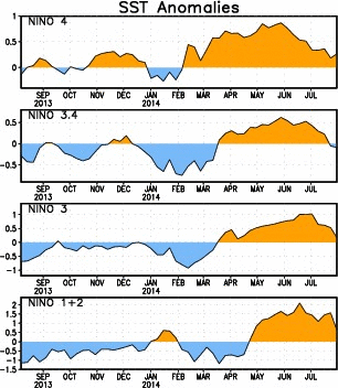
Looks like region 1+2 is taking a nosedive to join the other regions that are all below nino threshold at this time.
Although we are having El Ninoish conditions in Southern California right now, I think this whole thing is going to fade to neutral by October, possibly even earlier.
https://imageshack.com/i/iqwMvkj6j