Western Caribbean / SW Gulf Development??
Moderator: S2k Moderators
Forum rules

The posts in this forum are NOT official forecasts and should not be used as such. They are just the opinion of the poster and may or may not be backed by sound meteorological data. They are NOT endorsed by any professional institution or STORM2K. For official information, please refer to products from the National Hurricane Center and National Weather Service.

-
wxman57

- Moderator-Pro Met

- Posts: 23122
- Age: 68
- Joined: Sat Jun 21, 2003 8:06 pm
- Location: Houston, TX (southwest)
Re:
Emmett_Brown wrote:I dont think we will be seeing development in the next 48 hours. Shear has increased quite a bit:
http://cimss.ssec.wisc.edu/tropic/real- ... g8sht.html
Just 10 kts or less and decreasing in its path across the BoC by late tomorrow though. That's where we have to watch for possible development. Most likely, it would continue tracking westward into Mexico. Development chances aren't high, but one could argue that they're significantly higher than for that one area by the Cape Verde Islands that the NHC has circled. And this area of storms could possibly affect someone in the near future.
0 likes
-
IvanSurvivor
- Tropical Storm

- Posts: 152
- Joined: Wed Aug 20, 2008 12:12 am
- Location: Pensacola Florida (Warrington)
-
Blown Away

- S2K Supporter

- Posts: 10253
- Joined: Wed May 26, 2004 6:17 am
Re: Western Caribbean / SW Gulf Development??

Low in BOC in 24 hours and inland by 48 hours.
0 likes
-
CourierPR

- Category 5

- Posts: 1336
- Age: 71
- Joined: Tue Aug 31, 2004 7:53 pm
- Location: Pompano Beach, Florida
Re: Western Caribbean / SW Gulf Development??
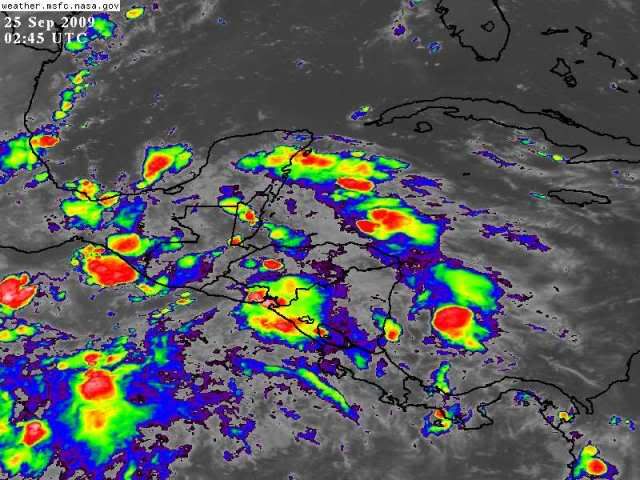
I see the low on that map. I am, however, puzzled by the persistent convection in the western Caribbean that has remained in place since Wednesday. What is going on?
0 likes
-
IvanSurvivor
- Tropical Storm
- Posts: 152
- Joined: Wed Aug 20, 2008 12:12 am
- Location: Pensacola Florida (Warrington)
-
Derek Ortt

Re: Western Caribbean / SW Gulf Development??
Okay we'll wake you.
SSSHH!
Current Weather Conditions:
Ciudad Del Carmen , Mexico
(MMCE) 18-39N 091-48W
--------------------------------------------------------------------------------
Conditions at Sep 24, 2009 - 04:45 PM EDTSep 24, 2009 - 03:45 PM CDTSep 24, 2009 - 02:45 PM MDTSep 24, 2009 - 01:45 PM PDTSep 24, 2009 - 12:45 PM ADTSep 24, 2009 - 11:45 AM HDT
2009.09.24 2045 UTC
Wind from the N (360 degrees) at 12 MPH (10 KT)
Visibility 10 mile(s)
Sky conditions mostly cloudy
Temperature 84 F (29 C)
Dew Point 77 F (25 C)
Relative Humidity 79%
Pressure (altimeter) 29.72 in. Hg (1006 hPa)
Pressure tendency 0.05 inches (1.8 hPa) lower than three hours ago
Last edited by tailgater on Thu Sep 24, 2009 4:18 pm, edited 1 time in total.
0 likes
-
IvanSurvivor
- Tropical Storm
- Posts: 152
- Joined: Wed Aug 20, 2008 12:12 am
- Location: Pensacola Florida (Warrington)
Re:
Derek Ortt wrote:again, 1009 is way way way too high for anything to develop in this area this time of year
wake me up when there is a 1003mb pressure. I'll take a mild interest in the system then
I'll let you know when it's time to wakey, wakey! Just Kidding. I don't know anything about the science behind tropical weather and actually just found the buoy info today. I've experienced it many, many times here in the panhandle, but never taken the time to try and understand the ins and outs of a tropical system.
0 likes
-
Emmett_Brown

- Category 5
- Posts: 1433
- Joined: Wed Aug 24, 2005 9:10 pm
- Location: Sarasota FL
Re: Re:
wxman57 wrote:Emmett_Brown wrote:I dont think we will be seeing development in the next 48 hours. Shear has increased quite a bit:
http://cimss.ssec.wisc.edu/tropic/real- ... g8sht.html
Just 10 kts or less and decreasing in its path across the BoC by late tomorrow though. That's where we have to watch for possible development. Most likely, it would continue tracking westward into Mexico. Development chances aren't high, but one could argue that they're significantly higher than for that one area by the Cape Verde Islands that the NHC has circled. And this area of storms could possibly affect someone in the near future.
Wx, if development were to occur over the BOC, could the steering possibly take it toward the NE GOM? Here is the 12z GFS 500mb for 12z Monday:
http://www.nco.ncep.noaa.gov/pmb/nwprod ... 0_096l.gif
0 likes
-
wxman57
- Moderator-Pro Met
- Posts: 23122
- Age: 68
- Joined: Sat Jun 21, 2003 8:06 pm
- Location: Houston, TX (southwest)
Re: Re:
Emmett_Brown wrote:
Wx, if development were to occur over the BOC, could the steering possibly take it toward the NE GOM? Here is the 12z GFS 500mb for 12z Monday:
http://www.nco.ncep.noaa.gov/pmb/nwprod ... 0_096l.gif
Probably not to the northeast. Most likely just west into Mexico.
0 likes

-
jconsor
- Professional-Met

- Posts: 571
- Joined: Mon Jun 30, 2008 9:31 pm
- Location: Jerusalem, Israel
- Contact:
Re: Western Caribbean / SW Gulf Development??
The current system in the Bay of Campeche is heading west and most of the convection is already on the EPac side, so I would put development chances as an Atlantic tropical cyclone as very low. Shear is also expected to remain high for the next few days across the Caribbean.
We need to watch the Caribbean again beginning mid-late next week. Most of the models agree that an upper level high will set up over the western Caribbean. At the same time, a strong cold front will be pushing into the Florida Straits and the southeast Gulf of Mexico by mid-late next week, which could provide enhanced spin to get a tropical cyclone going. The 00Z ECMWF has a weak tropical cyclone forming between Nicaragua and Jamaica by next Thu-Fri.
We need to watch the Caribbean again beginning mid-late next week. Most of the models agree that an upper level high will set up over the western Caribbean. At the same time, a strong cold front will be pushing into the Florida Straits and the southeast Gulf of Mexico by mid-late next week, which could provide enhanced spin to get a tropical cyclone going. The 00Z ECMWF has a weak tropical cyclone forming between Nicaragua and Jamaica by next Thu-Fri.
0 likes
-
Blown Away
- S2K Supporter
- Posts: 10253
- Joined: Wed May 26, 2004 6:17 am
Re: Western Caribbean / SW Gulf Development??
jconsor wrote:The current system in the Bay of Campeche is heading west and most of the convection is already on the EPac side, so I would put development chances as an Atlantic tropical cyclone as very low. Shear is also expected to remain high for the next few days across the Caribbean.
We need to watch the Caribbean again beginning mid-late next week. Most of the models agree that an upper level high will set up over the western Caribbean. At the same time, a strong cold front will be pushing into the Florida Straits and the southeast Gulf of Mexico by mid-late next week, which could provide enhanced spin to get a tropical cyclone going. The 00Z ECMWF has a weak tropical cyclone forming between Nicaragua and Jamaica by next Thu-Fri.
Lots of showers down there. Any potential TC developing between Nicaragua and Jamica this time of the year gets my attention because it will be in the area of Hebert Box #2 for South Florida.
http://www.hurricanecity.com/hebertbox.htm
0 likes
-
IvanSurvivor
- Tropical Storm
- Posts: 152
- Joined: Wed Aug 20, 2008 12:12 am
- Location: Pensacola Florida (Warrington)
Re: Western Caribbean / SW Gulf Development??
jconsor wrote:The current system in the Bay of Campeche is heading west and most of the convection is already on the EPac side, so I would put development chances as an Atlantic tropical cyclone as very low. Shear is also expected to remain high for the next few days across the Caribbean.
We need to watch the Caribbean again beginning mid-late next week. Most of the models agree that an upper level high will set up over the western Caribbean. At the same time, a strong cold front will be pushing into the Florida Straits and the southeast Gulf of Mexico by mid-late next week, which could provide enhanced spin to get a tropical cyclone going. The 00Z ECMWF has a weak tropical cyclone forming between Nicaragua and Jamaica by next Thu-Fri.
Could the blob of convection just on the east side of the Leewards (that's been there a while) be part of that or is it something totally separate to watch for?
0 likes
-
IvanSurvivor
- Tropical Storm
- Posts: 152
- Joined: Wed Aug 20, 2008 12:12 am
- Location: Pensacola Florida (Warrington)
Trying to learn how to read wind map...
Looking at the blob just east of the Lesser Antilles, could someone tell me what are the highest winds they see from that area. I went to the buoy info first then looked at the satellite wind map. There is a small area that looks 20-30 kts. Just wondering if I am looking at that correctly and what else I could learn from that type of map.
http://www.ndbc.noaa.gov/rmd.shtml
0 likes
-
Nederlander
- S2K Supporter
- Posts: 1252
- Joined: Sat Jul 19, 2008 4:28 pm
- Location: Conroe, TX
Re: Western Caribbean / SW Gulf Development??
Blown_away wrote:
Lots of showers down there. Any potential TC developing between Nicaragua and Jamica this time of the year gets my attention because it will be in the area of Hebert Box #2 for South Florida.
http://www.hurricanecity.com/hebertbox.htm
Correct me if I am wrong, but if I remember correctly, you are looking at the Hebert Box/Florida correlation incorrectly. It doesnt mean that a system passing through the Hebert Box is historically more likely to hit Florida. Rather it means that historically storms that have hit Florida have passed through a Hebert Box. Is this correct ?
0 likes
-
CourierPR
- Category 5
- Posts: 1336
- Age: 71
- Joined: Tue Aug 31, 2004 7:53 pm
- Location: Pompano Beach, Florida
Re: Western Caribbean / SW Gulf Development??
This seems to be what the 384 hour GFS model, posted by Gatorcane in another thread, was latching onto days ago.jconsor wrote:The current system in the Bay of Campeche is heading west and most of the convection is already on the EPac side, so I would put development chances as an Atlantic tropical cyclone as very low. Shear is also expected to remain high for the next few days across the Caribbean.
We need to watch the Caribbean again beginning mid-late next week. Most of the models agree that an upper level high will set up over the western Caribbean. At the same time, a strong cold front will be pushing into the Florida Straits and the southeast Gulf of Mexico by mid-late next week, which could provide enhanced spin to get a tropical cyclone going. The 00Z ECMWF has a weak tropical cyclone forming between Nicaragua and Jamaica by next Thu-Fri.
0 likes
Re: Western Caribbean / SW Gulf Development??
Fairly sharp trough shown here, but as others have said, it should conitue generally westward.

0 likes
Re: Western Caribbean / SW Gulf Development??
The 2009 factor continues to stifle any development.
0 likes
Who is online
Users browsing this forum: Hurricanehink and 58 guests