Gulf of Mexico Disturbance--PGI37L

This is the general tropical discussion area. Anyone can take their shot at predicting a storms path.

Moderator: S2k Moderators

Forum rules

The posts in this forum are NOT official forecasts and should not be used as such. They are just the opinion of the poster and may or may not be backed by sound meteorological data. They are NOT endorsed by any professional institution or STORM2K. For official information, please refer to products from the National Hurricane Center and National Weather Service.

Help Support Storm2K
Message
Author
poof121
Category 1
Category 1
Posts: 316
Age: 44
Joined: Tue Sep 11, 2007 11:33 am
Location: Laurel, MD

Re: Gulf of Mexico Homebrew early next week?

#61 Postby poof121 » Sun Aug 22, 2010 2:19 pm

lrak wrote:http://wwwghcc.msfc.nasa.gov/cgi-bin/get-goes?satellite=GOES-E%20CONUS&lat=27&lon=-83&info=vis&zoom=1&width=1024&height=768&type=Animation&quality=92&numframes=10

http://radar.weather.gov/radar.php?prod ... W&loop=yes


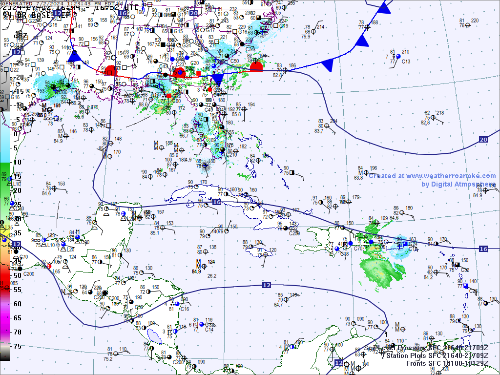
whats going on here, there are west winds and a little rotation beginning?

http://wwwghcc.msfc.nasa.gov/cgi-bin/ge ... mframes=10

http://radar.weather.gov/radar.php?prod ... x&loop=yes

or here

NOLA long range http://radar.weather.gov/radar.php?prod ... x&loop=yes


seems like lots of inflow based on radar and satellite.


Looks like an outflow boundary on the last frame of the second satellite link you posted on the far north side of the convection. But there definitely seems to be something going on here.
0 likes   

User avatar
TexWx
Category 1
Category 1
Posts: 370
Joined: Tue Aug 22, 2006 11:00 pm
Location: Pearland, Texas
Contact:

Re: Gulf of Mexico Homebrew early next week?

#62 Postby TexWx » Sun Aug 22, 2010 2:41 pm

0 likes   

poof121
Category 1
Category 1
Posts: 316
Age: 44
Joined: Tue Sep 11, 2007 11:33 am
Location: Laurel, MD

Re: Gulf of Mexico Homebrew early next week?

#63 Postby poof121 » Sun Aug 22, 2010 3:36 pm

Pressure dropping, even at stations with dropping temperatures... Hmmmm....

http://www.ndbc.noaa.gov/radial_search.php?lat1=29.5N&lon1=87.5W&uom=E&dist=200&ot=A&time=1
0 likes   

User avatar
Portastorm
Storm2k Moderator
Storm2k Moderator
Posts: 9914
Age: 63
Joined: Fri Jul 11, 2003 9:16 am
Location: Round Rock, TX
Contact:

Re: Gulf of Mexico Homebrew early next week?

#64 Postby Portastorm » Sun Aug 22, 2010 3:38 pm

Could be diurnal trend. Doesn't barometric pressure fall every afternoon as part of a cycle?
0 likes   

poof121
Category 1
Category 1
Posts: 316
Age: 44
Joined: Tue Sep 11, 2007 11:33 am
Location: Laurel, MD

Re: Gulf of Mexico Homebrew early next week?

#65 Postby poof121 » Sun Aug 22, 2010 3:41 pm

Portastorm wrote:Could be diurnal trend. Doesn't barometric pressure fall every afternoon as part of a cycle?


The pressure falls because the temperature goes up. But, at Slidell, the temp dropped, and so did the pressure.

http://www.weather.gov/data/obhistory/KASD.html
0 likes   

Sanibel
Category 5
Category 5
Posts: 10375
Joined: Mon Aug 30, 2004 11:06 pm
Location: Offshore SW Florida

Re: Gulf of Mexico Homebrew early next week?

#66 Postby Sanibel » Sun Aug 22, 2010 3:43 pm

There's some convection in the Gulf off a lingering front.
0 likes   

poof121
Category 1
Category 1
Posts: 316
Age: 44
Joined: Tue Sep 11, 2007 11:33 am
Location: Laurel, MD

Re: Gulf of Mexico Homebrew early next week?

#67 Postby poof121 » Sun Aug 22, 2010 3:46 pm

This is probably what the models have been hinting at. Let's see if something can consolidate. It'll need to persist overnight, something similar happened yesterday, but that convection fizzled.
0 likes   

User avatar
Portastorm
Storm2k Moderator
Storm2k Moderator
Posts: 9914
Age: 63
Joined: Fri Jul 11, 2003 9:16 am
Location: Round Rock, TX
Contact:

Re: Gulf of Mexico Homebrew early next week?

#68 Postby Portastorm » Sun Aug 22, 2010 3:47 pm

poof121 wrote:
Portastorm wrote:Could be diurnal trend. Doesn't barometric pressure fall every afternoon as part of a cycle?


The pressure falls because the temperature goes up. But, at Slidell, the temp dropped, and so did the pressure.

http://www.weather.gov/data/obhistory/KASD.html


I'm not sure about that. The diurnal trends of barometric pressure are based on atmopsheric tides and not temperature. I have seen plenty of examples in Texas during winter where barometric pressure rises while temps fall due to high pressure ridging coming down from northern areas.
0 likes   

poof121
Category 1
Category 1
Posts: 316
Age: 44
Joined: Tue Sep 11, 2007 11:33 am
Location: Laurel, MD

Re: Gulf of Mexico Homebrew early next week?

#69 Postby poof121 » Sun Aug 22, 2010 3:51 pm

Portastorm wrote:
poof121 wrote:
Portastorm wrote:Could be diurnal trend. Doesn't barometric pressure fall every afternoon as part of a cycle?


The pressure falls because the temperature goes up. But, at Slidell, the temp dropped, and so did the pressure.

http://www.weather.gov/data/obhistory/KASD.html


I'm not sure about that. The diurnal trends of barometric pressure are based on atmopsheric tides and not temperature. I have seen plenty of examples in Texas during winter where barometric pressure rises while temps fall due to high pressure ridging coming down from northern areas.


Okay, I stand corrected.

http://en.wikipedia.org/wiki/Atmospheric_pressure#Local_atmospheric_pressure_variation
0 likes   

User avatar
Portastorm
Storm2k Moderator
Storm2k Moderator
Posts: 9914
Age: 63
Joined: Fri Jul 11, 2003 9:16 am
Location: Round Rock, TX
Contact:

Re: Gulf of Mexico Homebrew early next week?

#70 Postby Portastorm » Sun Aug 22, 2010 3:56 pm

Hey poof121, I'm really not trying to be difficult here! :lol: Like you, just trying to figure out what's going on in the Gulf.

Here's the latest surface analysis in the Gulf:

Image
0 likes   

poof121
Category 1
Category 1
Posts: 316
Age: 44
Joined: Tue Sep 11, 2007 11:33 am
Location: Laurel, MD

Re: Gulf of Mexico Homebrew early next week?

#71 Postby poof121 » Sun Aug 22, 2010 4:03 pm

I know. You just taught me something. :D
0 likes   

User avatar
ColinDelia
S2K Supporter
S2K Supporter
Posts: 918
Joined: Mon Aug 29, 2005 5:52 am
Location: The Beach, FL

Re: Gulf of Mexico Homebrew early next week?

#72 Postby ColinDelia » Sun Aug 22, 2010 4:17 pm

Here's another surface analysis if you like a bigger chart

Image
0 likes   

rockyman
Category 5
Category 5
Posts: 1967
Joined: Thu Jun 26, 2003 12:24 pm
Location: Dauphin Island, AL

#73 Postby rockyman » Sun Aug 22, 2010 5:19 pm

...DISCUSSION...

GULF OF MEXICO...
SE SURFACE FLOW IS PRODUCING ISOLATED MODERATE CONVECTION NEAR
TAMPICO MEXICO FROM 21N-24N BETWEEN 96W-100W. A 1016 MB HIGH IS
CENTERED OVER THE CENTRAL GULF OF MEXICO NEAR 25N89W. 10 KT
ANTICYCLONIC SURFACE FLOW IS NOTED OVER THE GULF. SCATTERED
MODERATE TO ISOLATED STRONG CONVECTION IS OVER THE NE GULF ALONG
THE COAST OF N FLORIDA FROM 25N-29N BETWEEN 83W-89W. MOSTLY FAIR
WEATHER IS OVER THE REMAINDER OF THE GULF. IN THE UPPER LEVELS
...AN UPPER LEVEL HIGH IS CENTERED OVER S LOUISIANA NEAR 30N91W.
AN UPPER LEVEL LOW IS CENTERED OVER CENTRAL MEXICO NEAR 20N101W.
SIGNIFICANT UPPER LEVEL MOISTURE IS OVER THE BAY OF CAMPECHE...
AND OVER FLORIDA AND THE E GULF. EXPECT...THE SURFACE HIGH AND
CONVECTION TO MOVE W OVER THE NEXT 24 HOURS.
0 likes   

User avatar
ronjon
Category 5
Category 5
Posts: 4823
Joined: Fri Aug 19, 2005 5:17 pm
Location: Hernando Beach, FL

Re: Gulf of Mexico--Disturbed Weather

#74 Postby ronjon » Sun Aug 22, 2010 5:40 pm

Convection is starting to get that look - something to keep a close eye on.

http://www.ssd.noaa.gov/goes/east/gmex/loop-vis.html
0 likes   

flwxwatcher
Category 4
Category 4
Posts: 926
Joined: Wed May 16, 2007 3:35 pm
Location: Central Florida

Re: Gulf of Mexico--Disturbed Weather

#75 Postby flwxwatcher » Sun Aug 22, 2010 6:33 pm

Interesting ...


AREA FORECAST DISCUSSION...UPDATED
NATIONAL WEATHER SERVICE PEACHTREE CITY GA
145 PM EDT SUN AUG 22 2010

SYNOPSIS

AMPLIFYING UPPER ATMOSPHERIC PATTERN BRINGING ABOUT SOME LONG
OVERDUE LARGE SCALE SYNOPTIC CHANGES. DEEPENING UPPER TROUGH ACROSS
THE NE U.S. AND AMPLIFYING UPPER RIDGE CENTRAL U.S. COMBINING TO
FINALLY PUSH A COLD FRONT INTO THE SE U.S. THIS FRONT PROMISES TO AT
LEAST TEMPORARILY BRING A REDUCTION OF TSRA TO THE CWA DURING THE
FIRST HALF OF THIS WEEK AS WELL AS LOWER DEWPOINTS. MEANWHILE... THE
REMNANTS OF T.D. NO. 5 WERE WEAKLY EVIDENT IN EC GA. THIS WEAK
CIRCULATION CENTER WILL BE PUSHED S-SW BACK INTO THE GULF DURING THE
MID AND LATER PART OF THE WEEK...AND COULD BE POISED TO BRING
SCT-NMRS SHRA/TSRA BACK TO THE CWA TOWARD THE END OF THE WEEK.
0 likes   

Flyinman
S2K Supporter
S2K Supporter
Posts: 265
Joined: Thu Aug 16, 2007 3:03 pm
Location: The Woodlands, Texas

Re: Gulf of Mexico--Disturbed Weather

#76 Postby Flyinman » Sun Aug 22, 2010 6:52 pm

One of our local met's mentioned last week we may have a Low moving in by Wednesday. Now we do not even have a chance of rain but a couple of front's are mentioned. Where is the area of disturbed weather predicted to move?
0 likes   

User avatar
srainhoutx
S2K Supporter
S2K Supporter
Posts: 6919
Age: 67
Joined: Sun Jan 14, 2007 11:34 am
Location: Haywood County, NC
Contact:

Re: Gulf of Mexico--Disturbed Weather

#77 Postby srainhoutx » Sun Aug 22, 2010 6:52 pm

Image
0 likes   
Carla/Alicia/Jerry(In The Eye)/Michelle/Charley/Ivan/Dennis/Katrina/Rita/Wilma/Ike/Harvey

Member: National Weather Association
Wx Infinity Forums
http://wxinfinity.com/index.php

Facebook.com/WeatherInfinity
Twitter @WeatherInfinity

rockyman
Category 5
Category 5
Posts: 1967
Joined: Thu Jun 26, 2003 12:24 pm
Location: Dauphin Island, AL

#78 Postby rockyman » Sun Aug 22, 2010 6:57 pm

There's a tropical wave moving through the Bahamas...toward south Florida...I wonder if this wave could help trigger some development in the Gulf in a couple of days?

2pm Discussion:
A TROPICAL WAVE IS N OF HISPANIOLA FROM 28N67W TO 19N73W MOVING
W AT 15 KT. THIS WAVE IS BELOW AN UPPER LEVEL LOW CENTERED NEAR
24N74W. SCATTERED MODERATE CONVECTION IS FROM 24N-27N BETWEEN
67W-70W.

8pm Discussion:
TROPICAL WAVE IS ACROSS THE SE BAHAMAS ALONG 28N69W TO JUST W OF
HAITI NEAR 18N74W MOVING NW NEAR 15 KT. THIS WAVE IS EMBEDDED
WITHIN AN AREA OF ENHANCED MOISTURE EVIDENT IN TOTAL
PRECIPITABLE WATER IMAGERY. BROAD CYCLONIC FLOW IS ALSO ABOUT
THE WAVE AXIS CONFIRMED BY AN ASCAT SCATTEROMETER PASS FROM
EARLIER TODAY. THIS WAVE IS UNDERNEATH AN UPPER LEVEL CYCLONIC
CIRCULATION SUPPORTING ISOLATED MODERATE CONVECTION WITHIN 130
NM MAINLY E OF THE AXIS.
0 likes   

User avatar
KatDaddy
Category 5
Category 5
Posts: 2815
Joined: Mon Oct 21, 2002 6:23 pm
Location: League City, Texas

#79 Postby KatDaddy » Sun Aug 22, 2010 7:11 pm

The GOM looks interesting this evening. Great outflow over the NE GOM but will it go poof overnight.
0 likes   
The following post is NOT an official forecast and should not be used as such. It is just the opinion of the poster and may or may not be backed by sound meteorological data. It is NOT endorsed by any professional institution including storm2k.org For Official Information please refer to the NHC and NWS products.

User avatar
KatDaddy
Category 5
Category 5
Posts: 2815
Joined: Mon Oct 21, 2002 6:23 pm
Location: League City, Texas

#80 Postby KatDaddy » Sun Aug 22, 2010 7:24 pm

Nothing at the surface with W to WNW winds off the FLA Coast.
0 likes   
The following post is NOT an official forecast and should not be used as such. It is just the opinion of the poster and may or may not be backed by sound meteorological data. It is NOT endorsed by any professional institution including storm2k.org For Official Information please refer to the NHC and NWS products.


Return to “Talkin' Tropics”

Who is online

Users browsing this forum: Ian2401, REDHurricane, Sciencerocks, StormWeather and 47 guests