Area in the Northwestern Caribbean Sea
Moderator: S2k Moderators
Forum rules

The posts in this forum are NOT official forecasts and should not be used as such. They are just the opinion of the poster and may or may not be backed by sound meteorological data. They are NOT endorsed by any professional institution or STORM2K. For official information, please refer to products from the National Hurricane Center and National Weather Service.
-
SFLcane

- S2K Supporter

- Posts: 10281
- Age: 48
- Joined: Sat Jun 05, 2010 1:44 pm
- Location: Lake Worth Florida
Re: Disturbed weather ESE of the Windward Islands
If something forms it could get drawn north.
0 likes
-
AutoPenalti
- Category 5

- Posts: 4091
- Age: 29
- Joined: Mon Aug 17, 2015 4:16 pm
- Location: Ft. Lauderdale, Florida
Re: Disturbed weather ESE of the Windward Islands
Rounds the ridge. yikes.
1 likes
The posts in this forum are NOT official forecasts and should not be used as such. They are just the opinion of the poster and may or may not be backed by sound meteorological data. They are NOT endorsed by any professional institution or STORM2K. For official information, please refer to products from the NHC and NWS.
Model Runs Cheat Sheet:
GFS (5:30 AM/PM, 11:30 AM/PM)
HWRF, GFDL, UKMET, NAVGEM (6:30-8:00 AM/PM, 12:30-2:00 AM/PM)
ECMWF (1:45 AM/PM)
TCVN is a weighted averaged

Re: Disturbed weather ESE of the Windward Islands
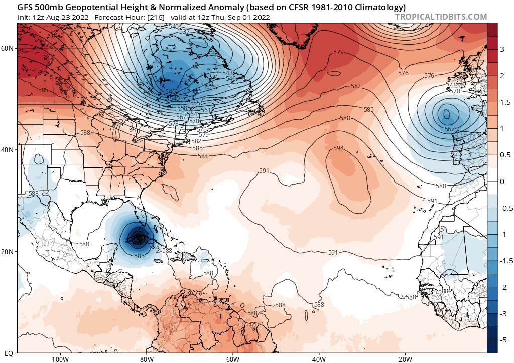
GFS ensembles 12z are roughly 15 out of 31 ensemble members creating *something*. Quite a few barely would qualify as a TD but I've counted them due to having 1 closed isobar like I did earlier. There are some runs that develop a hurricane like the 12z OP, though those runs are right at the top end of the guidance.
Those that do have a TS, there is probably two main camps, one that develops it and takes it northward quite quickly, the other goes more westwards before drawing northwards if it gets strong enough.
Those that do have a TS, there is probably two main camps, one that develops it and takes it northward quite quickly, the other goes more westwards before drawing northwards if it gets strong enough.
0 likes
Personal Forecast Disclaimer:
The posts in this forum are NOT official forecast and should not be used as such. They are just the opinion of the poster and may or may not be backed by sound meteorological data. They are NOT endorsed by any professional institution or storm2k.org. For official information, please refer to the NHC and NWS products
The posts in this forum are NOT official forecast and should not be used as such. They are just the opinion of the poster and may or may not be backed by sound meteorological data. They are NOT endorsed by any professional institution or storm2k.org. For official information, please refer to the NHC and NWS products
-
Clearcloudz

- Category 2

- Posts: 540
- Joined: Sun Jun 10, 2018 1:46 pm
- Location: Rosenberg TX

-
cycloneye

- Admin

- Posts: 149121
- Age: 69
- Joined: Thu Oct 10, 2002 10:54 am
- Location: San Juan, Puerto Rico
Re: Disturbed weather ESE of the Windward Islands (2 PM TWO=0/20)
East of The Windward Islands:
A large area of disturbed weather has formed centered several
hundred miles east-southeast of the Windward Islands. While this
system is currently disorganized, environmental conditions could
become more conducive for development in a few days when the system
approaches the Windward Islands or southeastern Caribbean Sea.
* Formation chance through 48 hours...low...near 0 percent.
* Formation chance through 5 days...low...20 percent

2 likes
Visit the Caribbean-Central America Weather Thread where you can find at first post web cams,radars
and observations from Caribbean basin members Click Here
and observations from Caribbean basin members Click Here
-
ElectricStorm

- Category 5
- Posts: 5125
- Age: 24
- Joined: Tue Aug 13, 2019 11:23 pm
- Location: Norman, OK
Re: Disturbed weather ESE of the Windward Islands (2 PM TWO=0/20)
Yeah this will have a chance to do something, might have less trouble developing than the waves further E as it's already past the TUTT.
2 likes
B.S Meteorology, University of Oklahoma '25
Please refer to the NHC, NWS, or SPC for official information.
Please refer to the NHC, NWS, or SPC for official information.
-
Clearcloudz
- Category 2
- Posts: 540
- Joined: Sun Jun 10, 2018 1:46 pm
- Location: Rosenberg TX

-
SouthFLTropics

- Category 5
- Posts: 4258
- Age: 50
- Joined: Thu Aug 14, 2003 8:04 am
- Location: Port St. Lucie, Florida
Re: Disturbed weather ESE of the Windward Islands (2 PM TWO=0/20)

0 likes
Fourth Generation Florida Native
Personal Storm History: David 79, Andrew 92, Erin 95, Floyd 99, Irene 99, Frances 04, Jeanne 04, Wilma 05, Matthew 16, Irma 17, Ian 22, Nicole 22, Milton 24
Personal Storm History: David 79, Andrew 92, Erin 95, Floyd 99, Irene 99, Frances 04, Jeanne 04, Wilma 05, Matthew 16, Irma 17, Ian 22, Nicole 22, Milton 24
-
cycloneye
- Admin
- Posts: 149121
- Age: 69
- Joined: Thu Oct 10, 2002 10:54 am
- Location: San Juan, Puerto Rico
Re: Disturbed weather ESE of the Windward Islands (2 PM TWO=0/20)

0 likes
Visit the Caribbean-Central America Weather Thread where you can find at first post web cams,radars
and observations from Caribbean basin members Click Here
and observations from Caribbean basin members Click Here


Re: Disturbed weather ESE of the Windward Islands (2 PM TWO=0/20)
Not expecting it to hold on the models for much longer...doubt the next gfs run will even show it. Very little consistent model output on it so not really concerned about it yet.
0 likes
-
tropicwatch

- Category 5
- Posts: 3426
- Age: 62
- Joined: Sat Jun 02, 2007 10:01 am
- Location: Panama City Florida
- Contact:
Re: Disturbed weather ESE of the Windward Islands (2 PM TWO=0/20)
It does have some 925mb and 850mb vorticity.
Last edited by tropicwatch on Tue Aug 23, 2022 1:21 pm, edited 1 time in total.
0 likes
Tropicwatch
Agnes 72', Eloise 75, Elena 85', Kate 85', Charley 86', Florence 88', Beryl 94', Dean 95', Erin 95', Opal 95', Earl 98', Georges 98', Ivan 2004', Arlene 2005', Dennis 2005', Ida 2009' Debby 2012' Irma 2017' Michael 2018'
Agnes 72', Eloise 75, Elena 85', Kate 85', Charley 86', Florence 88', Beryl 94', Dean 95', Erin 95', Opal 95', Earl 98', Georges 98', Ivan 2004', Arlene 2005', Dennis 2005', Ida 2009' Debby 2012' Irma 2017' Michael 2018'
-
cycloneye
- Admin
- Posts: 149121
- Age: 69
- Joined: Thu Oct 10, 2002 10:54 am
- Location: San Juan, Puerto Rico
Re: Disturbed weather ESE of the Windward Islands (2 PM TWO=0/20)
Papín has a interesting take about this area.
https://twitter.com/pppapin/status/1562140597107974147
https://twitter.com/pppapin/status/1562140597107974147
1 likes
Visit the Caribbean-Central America Weather Thread where you can find at first post web cams,radars
and observations from Caribbean basin members Click Here
and observations from Caribbean basin members Click Here
-
wxman57

- Moderator-Pro Met

- Posts: 23170
- Age: 68
- Joined: Sat Jun 21, 2003 8:06 pm
- Location: Houston, TX (southwest)
Re: Disturbed weather ESE of the Windward Islands (2 PM TWO=0/20)
I'm sure that the GFS is right THIS time. Go back to previous runs on Tropical Tidbits and search for any consistency. Almost certainly another modelcane. Besides, I cancelled hurricane season so I could get some rest.
2 likes
-
SFLcane
- S2K Supporter
- Posts: 10281
- Age: 48
- Joined: Sat Jun 05, 2010 1:44 pm
- Location: Lake Worth Florida
Re: Disturbed weather ESE of the Windward Islands (2 PM TWO=0/20)
wxman57 wrote:I'm sure that the GFS is right THIS time. Go back to previous runs on Tropical Tidbits and search for any consistency. Almost certainly another modelcane. Besides, I cancelled hurricane season so I could get some rest.
A modelcane circled by the NHC?
4 likes
Re: Disturbed weather ESE of the Windward Islands
12z euro is not really picking up on this, but Euro has historically done poorly with systems that come out of this ITCZ area.
0 likes
-
cycloneye
- Admin
- Posts: 149121
- Age: 69
- Joined: Thu Oct 10, 2002 10:54 am
- Location: San Juan, Puerto Rico
Re: Disturbed weather ESE of the Windward Islands
0 likes
Visit the Caribbean-Central America Weather Thread where you can find at first post web cams,radars
and observations from Caribbean basin members Click Here
and observations from Caribbean basin members Click Here
Re: Disturbed weather ESE of the Windward Islands
WiscoWx02 wrote:Not expecting it to hold on the models for much longer...doubt the next gfs run will even show it. Very little consistent model output on it so not really concerned about it yet.
Agreed. Would like to see some run to run consistency. What does make this a little bit interesting is that normally these model battles are for mid-range scenarios, as in, something forecast to develop 5 days or so from now. GFS is basically staking a claim that we should be seeing signs of development/organization by tomorrow night.
1 likes
-
wxman57
- Moderator-Pro Met
- Posts: 23170
- Age: 68
- Joined: Sat Jun 21, 2003 8:06 pm
- Location: Houston, TX (southwest)
Re: Disturbed weather ESE of the Windward Islands
SFLcane wrote:wxman57 wrote:I'm sure that the GFS is right THIS time. Go back to previous runs on Tropical Tidbits and search for any consistency. Almost certainly another modelcane. Besides, I cancelled hurricane season so I could get some rest.
A modelcane circled by the NHC?
Yeah, just like the big, strong wave to the east which the GFS had as a major hurricane. NHC now at 0%. A 20% means models indicate something may form, but development appears unlikely.
2 likes
-
Clearcloudz
- Category 2
- Posts: 540
- Joined: Sun Jun 10, 2018 1:46 pm
- Location: Rosenberg TX

Who is online
Users browsing this forum: No registered users and 82 guests