#63 Postby LarryWx » Thu Sep 08, 2022 12:16 pm
SFLcane wrote:Icon develops this wave and brings it west until the trap door opens. Pattern is way to progressive for anything to make it far west before these trofs weaken the ridge.
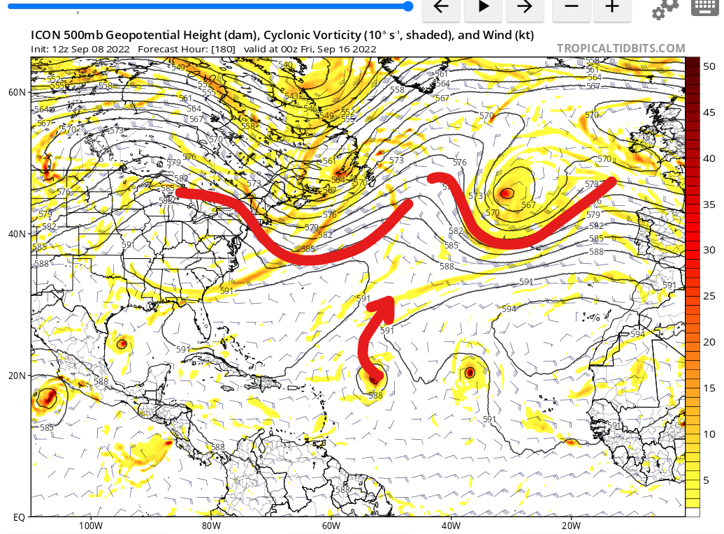
https://i.postimg.cc/L6ZSL4j6/icon.png
1. ICON is likely too aggressive based on its bullish bias. More likely this will just be at most a weak low near that region. If so, it could actually turn out to more dangerous.
2. With it already being mid Sept by then, progressive becomes pretty normal by that time. As far as the US is concerned, the main risk for the rest of the season is from anything forming in the W basin.
Last edited by
LarryWx on Thu Sep 08, 2022 12:22 pm, edited 1 time in total.
1 likes
Personal Forecast Disclaimer:
The posts in this forum are NOT official forecasts and should not be used as such. They are just the opinion of the poster and may or may not be backed by sound meteorological data. They are NOT endorsed by any professional institution or storm2k.org. For official information, please refer to the NHC and NWS products.


