94L Invest Comments Thread #2
Moderator: S2k Moderators
Forum rules

The posts in this forum are NOT official forecasts and should not be used as such. They are just the opinion of the poster and may or may not be backed by sound meteorological data. They are NOT endorsed by any professional institution or STORM2K. For official information, please refer to products from the National Hurricane Center and National Weather Service.
-
HouTXmetro

- Category 5

- Posts: 3949
- Joined: Sun Jun 13, 2004 6:00 pm
- Location: District of Columbia, USA
-
vbhoutex

- Storm2k Executive

- Posts: 29149
- Age: 74
- Joined: Wed Oct 09, 2002 11:31 pm
- Location: Cypress, TX
- Contact:
Extremeweatherguy wrote:I think it may start weak, then gradually work itself into a moderate or strong TS and then make landfall as a strong TS/minimal Hurricane. Really though, it is WAY to early to tell, I am going to let it develop first before getting real confident in that scenario. That just seems like the most plausible scenario right now.skysummit wrote:Extremeweatherguy wrote:
My scenario would be for this to move up along the TX coast, move inland near Matagorda and then turn NNE and eventually NE once inland. This scenario would drop lots of rain across SE Texas, but unfortunately I think it is the most likely scenario right now.
So you're saying your scenario is keeping it weak then?
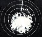
I think as far as this scenario is concerned the biggest probability is that your track is, unfortunately, probably close. Copius amounts of rainfall is also probable with this system along its' track. Unless the shear maps have some majic in them to make what they are depicting happen, this will not become anymore than a weak TD at most if it makes that. JMHO. The shear is still killer-look at the visibiles. There may be a swirl in the clouds, but there is nothing under the former blob right now that I can see.(Just in case, I am going to look at another visible quickly, in case I have to come back and quickly eat my words
Last edited by vbhoutex on Fri Jun 30, 2006 3:29 pm, edited 1 time in total.
0 likes
-
The Sandcrab
- Tropical Low

- Posts: 42
- Joined: Fri Jun 30, 2006 12:30 pm
- Location: Space City/Best Kept Secret on the Gulf Coast
-
HouTXmetro
- Category 5
- Posts: 3949
- Joined: Sun Jun 13, 2004 6:00 pm
- Location: District of Columbia, USA
The Sandcrab wrote:Hi y'all. I'm looking hard, but I don't see any spin, certainly not low level, and to me, it looks a little less organized over the past few frames, not more. However, some of that associated tropical moisture is moving over areas of Houston that were recently under water.
Welcome Sand Crab!!!!
0 likes
[Disclaimer: My Amateur Opinion, please defer to your local authorities or the NHC for Guidance.]
-
HouTXmetro
- Category 5
- Posts: 3949
- Joined: Sun Jun 13, 2004 6:00 pm
- Location: District of Columbia, USA
vbhoutex wrote:Extremeweatherguy wrote:I think it may start weak, then gradually work itself into a moderate or strong TS and then make landfall as a strong TS/minimal Hurricane. Really though, it is WAY to early to tell, I am going to let it develop first before getting real confident in that scenario. That just seems like the most plausible scenario right now.skysummit wrote:Extremeweatherguy wrote:
My scenario would be for this to move up along the TX coast, move inland near Matagorda and then turn NNE and eventually NE once inland. This scenario would drop lots of rain across SE Texas, but unfortunately I think it is the most likely scenario right now.
So you're saying your scenario is keeping it weak then?
I think as far as this scenario is concerned the biggest probability is that your track is, unfortunately, probably close. Copius amounts of rainfall is also probable with this system along its' track. Unless the shear maps have some majic in them to make what they are depicting happen, this will not become anymore than a weak TD at most if it makes that. JMHO. The shear is still killer-look at the visibiles. There may be a swirl in the clouds, but there is nothing under the former blob right now that I can see.(Just in case, I am going to look at another visible quickly, in case I have to come back and quickly eat my words) Edit: I stand by my words above.
Don't know what it means but you don't see the intensifying convection developing along the NE side of the circualtion?
0 likes
[Disclaimer: My Amateur Opinion, please defer to your local authorities or the NHC for Guidance.]
-
Matt-hurricanewatcher
HouTXmetro wrote:It was associated with a wave, how does such a system work it's way to the surface. I'm curious. What are the dynamics?
I'm not thinking very clearly still got the head cold.
Ok a low pressure area(Tropical area of low pressure) has the air moving into the area of low pressure. In which comes together then the warmer air(fast moving atoms/molc)rise into the Atmopshere. In which cool at 5.5 degrees per thousand feet. Once the temperature reachs it dew point=the air has expanded and forms cloud droplet on sand or something else. Then clouds form when many of these droplets come together.
As the heat forms into clouds which has mass. In which the earth at the equater moves at a thousand miles per hours...While the poles move only a few feet on a axis of 23.5 degrees. What this doe's is turn the winds across the globe to the right. In which is why the low pressure area's move counter-clockwise over the northern hem. This then as more heat/laten heat is released into the Atmosphere tightens the pressure grad forcing more air upwards=more convection and stronger winds.
Thats what I'v studied into it. Theres more.
0 likes
-
vbhoutex
- Storm2k Executive
- Posts: 29149
- Age: 74
- Joined: Wed Oct 09, 2002 11:31 pm
- Location: Cypress, TX
- Contact:
HouTXmetro wrote:vbhoutex wrote:Extremeweatherguy wrote:I think it may start weak, then gradually work itself into a moderate or strong TS and then make landfall as a strong TS/minimal Hurricane. Really though, it is WAY to early to tell, I am going to let it develop first before getting real confident in that scenario. That just seems like the most plausible scenario right now.skysummit wrote:Extremeweatherguy wrote:
My scenario would be for this to move up along the TX coast, move inland near Matagorda and then turn NNE and eventually NE once inland. This scenario would drop lots of rain across SE Texas, but unfortunately I think it is the most likely scenario right now.
So you're saying your scenario is keeping it weak then?
I think as far as this scenario is concerned the biggest probability is that your track is, unfortunately, probably close. Copius amounts of rainfall is also probable with this system along its' track. Unless the shear maps have some majic in them to make what they are depicting happen, this will not become anymore than a weak TD at most if it makes that. JMHO. The shear is still killer-look at the visibiles. There may be a swirl in the clouds, but there is nothing under the former blob right now that I can see.(Just in case, I am going to look at another visible quickly, in case I have to come back and quickly eat my words
Don't know what it means but you don't see the intensifying convection developing along the NE side of the circualtion?
Yes I see it and it is another developing complex of thunderstorms at this point and nothing else, imo. I'm not saying nothing can come of it, but I don't see anything at this point. Watch it? Most definitely!! Worry about it? Not yet.
0 likes
-
Extremeweatherguy

- Category 5
- Posts: 11095
- Joined: Mon Oct 10, 2005 8:13 pm
- Location: Florida
-
HouTXmetro
- Category 5
- Posts: 3949
- Joined: Sun Jun 13, 2004 6:00 pm
- Location: District of Columbia, USA
Matt-hurricanewatcher wrote:HouTXmetro wrote:It was associated with a wave, how does such a system work it's way to the surface. I'm curious. What are the dynamics?
I'm not thinking very clearly still got the head cold.
Ok a low pressure area(Tropical area of low pressure) has the air moving into the area of low pressure. In which comes together then the warmer air(fast moving atoms/molc)rise into the Atmopshere. In which cool at 5.5 degrees per thousand feet. Once the temperature reachs it dew point=the air has expanded and forms cloud droplet on sand or something else. Then clouds form when many of these droplets come together.
As the heat forms into clouds which has mass. In which the earth at the equater moves at a thousand miles per hours...While the poles move only a few feet on a axis of 23.5 degrees. What this doe's is turn the winds across the globe to the right. In which is why the low pressure area's move counter-clockwise over the northern hem. This then as more heat/laten heat is released into the Atmosphere tightens the pressure grad forcing more air upwards=more convection and stronger winds.
Thats what I'v studied into it. Theres more.
Thanks for the detailed analysis. I'm still a little lost though.
0 likes
[Disclaimer: My Amateur Opinion, please defer to your local authorities or the NHC for Guidance.]
-
Air Force Met
- Military Met

- Posts: 4372
- Age: 57
- Joined: Tue Jul 08, 2003 9:30 am
- Location: Roan Mountain, TN
Extremeweatherguy wrote:On the floater loop the spin is MUCH clearer.
http://www.ssd.noaa.gov/goes/flt/t2/loop-vis.html
That's cirrus spinning...nothing at the surface...not even close. It's much clearer on the GHCC high res than on the floater that that is what it is.
Not sure why you guys look at the floater from the SSD page for vis loops instead of the GHCC in the GOM...unless it is a bandwith problem. The images come in much more frequently and are of higher quality at the GHCC.
0 likes

-
Portastorm

- Storm2k Moderator

- Posts: 9955
- Age: 63
- Joined: Fri Jul 11, 2003 9:16 am
- Location: Round Rock, TX
- Contact:
-
HouTXmetro
- Category 5
- Posts: 3949
- Joined: Sun Jun 13, 2004 6:00 pm
- Location: District of Columbia, USA
Air Force Met wrote:Extremeweatherguy wrote:On the floater loop the spin is MUCH clearer.
http://www.ssd.noaa.gov/goes/flt/t2/loop-vis.html
That's cirrus spinning...nothing at the surface...not even close. It's much clearer on the GHCC high res than on the floater that that is what it is.
Not sure why you guys look at the floater from the SSD page for vis loops instead of the GHCC in the GOM...unless it is a bandwith problem. The images come in much more frequently and are of higher quality at the GHCC.
Do you have the link?
0 likes
[Disclaimer: My Amateur Opinion, please defer to your local authorities or the NHC for Guidance.]
-
Air Force Met
- Military Met
- Posts: 4372
- Age: 57
- Joined: Tue Jul 08, 2003 9:30 am
- Location: Roan Mountain, TN
Portastorm wrote:GHCC?
http://wwwghcc.msfc.nasa.gov/GOES/goeseastconus.html
Set to animate...at 100%...zoom factor high...as many frames as you want...15 or 20...even 30. Then click on the area in question.
0 likes

-
Portastorm
- Storm2k Moderator
- Posts: 9955
- Age: 63
- Joined: Fri Jul 11, 2003 9:16 am
- Location: Round Rock, TX
- Contact:
Air Force Met wrote:Portastorm wrote:GHCC?
http://wwwghcc.msfc.nasa.gov/GOES/goeseastconus.html
Set to animate...at 100%...zoom factor high...as many frames as you want...15 or 20...even 30. Then click on the area in question.
Nice ... very nice!
Thanks for the link, AFM.
0 likes
-
southerngale

- Retired Staff

- Posts: 27418
- Joined: Thu Oct 10, 2002 1:27 am
- Location: Southeast Texas (Beaumont area)
-
Extremeweatherguy
- Category 5
- Posts: 11095
- Joined: Mon Oct 10, 2005 8:13 pm
- Location: Florida
I'm not saying it is at the surface, but it is a spin though.Air Force Met wrote:Extremeweatherguy wrote:On the floater loop the spin is MUCH clearer.
http://www.ssd.noaa.gov/goes/flt/t2/loop-vis.html
That's cirrus spinning...nothing at the surface...not even close. It's much clearer on the GHCC high res than on the floater that that is what it is.
Not sure why you guys look at the floater from the SSD page for vis loops instead of the GHCC in the GOM...unless it is a bandwith problem. The images come in much more frequently and are of higher quality at the GHCC.
0 likes
-
southerngale
- Retired Staff
- Posts: 27418
- Joined: Thu Oct 10, 2002 1:27 am
- Location: Southeast Texas (Beaumont area)
Extremeweatherguy wrote:I'm not saying it is at the surface, but it is a spin though.Air Force Met wrote:Extremeweatherguy wrote:On the floater loop the spin is MUCH clearer.
http://www.ssd.noaa.gov/goes/flt/t2/loop-vis.html
That's cirrus spinning...nothing at the surface...not even close. It's much clearer on the GHCC high res than on the floater that that is what it is.
Not sure why you guys look at the floater from the SSD page for vis loops instead of the GHCC in the GOM...unless it is a bandwith problem. The images come in much more frequently and are of higher quality at the GHCC.
There's a spin in my toilet...still doesn't mean much.
Ok, I'm just kidding you know.
0 likes


Who is online
Users browsing this forum: chris_fit, WaveBreaking and 222 guests