Hurricane Ioke thread
Moderator: S2k Moderators
Forum rules

The posts in this forum are NOT official forecasts and should not be used as such. They are just the opinion of the poster and may or may not be backed by sound meteorological data. They are NOT endorsed by any professional institution or STORM2K. For official information, please refer to products from the National Hurricane Center and National Weather Service.
-
JonathanBelles
- Professional-Met

- Posts: 11430
- Age: 35
- Joined: Sat Dec 24, 2005 9:00 pm
- Location: School: Florida State University (Tallahassee, FL) Home: St. Petersburg, Florida
- Contact:
-
Matt-hurricanewatcher

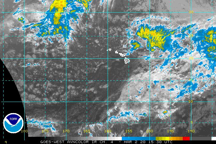
HurricaneHunter914 wrote:http://www.ssd.noaa.gov/goes/west/cpac/avn-l.jpg
This should have been named a TS a long time ago! DAMN!!!!!!!!!!!!!!!!!!!!!!!!!!!!!!!!!!!
This morning it looked like a strong system that was below depression strength. This afternoon it looked like a depression and now it still looks like a high-end depression.
0 likes


WTPA42 PHFO 200252
TCDCP2
TROPICAL DEPRESSION ONE-C DISCUSSION NUMBER 1
NWS CENTRAL PACIFIC HURRICANE CENTER HONOLULU HI CP012006
500 PM HST SAT AUG 19 2006
TROPICAL DEPRESSION ONE-C HAS FORMED NEAR 10N 158W AFTER BECOMING MORE ORGANIZED SINCE EARLY THIS MORNING. CONDITIONS SURROUNDING THE DEPRESSION LOOK FAVORABLE FOR FURTHER DEVELOPMENT...WARM SSTS NEAR 28 DEGREES C AND NONSHEARING UNTIL THE FIFTH DAY WHEN APPROACHING THE HIGH LEVEL WESTERLIES OF AN UPPER LEVEL LOW FAR NORTHWEST OF HAWAII. PRIOR TO THE SHEARING ONE-CS PATH SHOULD GRADUALLY TURN MORE NORTHWESTERLY AS IT APPROACHES THE LOW. SSTS WILL REMAIN WARM ALL ALONG ITS PROJECTED PATH.
FORECAST POSITIONS AND MAX WINDS
INITIAL 20/0300Z 10.1N 158.2W 25 KT
12HR VT 20/1200Z 10.5N 159.7W 30 KT
24HR VT 21/0000Z 11.2N 162.1W 35 KT
36HR VT 21/1200Z 11.9N 164.9W 45 KT
48HR VT 22/0000Z 13.3N 167.8W 50 KT
72HR VT 23/0000Z 16.4N 171.4W 65 KT
96HR VT 24/0000Z 19.4N 173.0W 65 KT
120HR VT 25/0000Z 22.6N 173.5W 60 KT
$$ FORECASTER MATSUDA
0 likes
-
JonathanBelles
- Professional-Met
- Posts: 11430
- Age: 35
- Joined: Sat Dec 24, 2005 9:00 pm
- Location: School: Florida State University (Tallahassee, FL) Home: St. Petersburg, Florida
- Contact:

-
Matt-hurricanewatcher
Matt-hurricanewatcher wrote:Looks like a tropical storm to me...
http://www.ssd.noaa.gov/goes/west/cpac/avn-l.jpg
Yes it does, the reason for this is the organization is improving quickly and you can really see that cyclonic turning in a loop. Looks like a very healthy tropical depression.
Is there a Floater for this system? I can't find one. I would think they would have one.
0 likes

-
AussieMark

- Category 5

- Posts: 5858
- Joined: Tue Sep 02, 2003 6:36 pm
- Location: near Sydney, Australia
-
P.K.

- Professional-Met
- Posts: 5149
- Joined: Thu Sep 23, 2004 5:57 pm
- Location: Watford, England
- Contact:
WTPA42 PHFO 200853
TCDCP2
TROPICAL STORM IOKE DISCUSSION NUMBER 2
NWS CENTRAL PACIFIC HURRICANE CENTER HONOLULU HI CP012006
1100 PM HST SAT AUG 19 2006
ONE-C CONTINUED TO ORGANIZE DURING THE EVENING AND APPEARS TO HAVE STRENGTHENED ENOUGH TO AQUIRE A NAME. THAT NAME IS IOKE AND IT IS THE FIRST NAMED SYSTEM IN THE CENTRAL PACIFIC SINCE HUKO BACK IN LATE 2002. IOKE IS ROUGHLY TRANSLATED INTO ENGLISH AS JOYCE.
THE UPGRADE WAS DUE TO DVORAK FIXES FROM CPHC...JTWC AND AIR FORCE GLOBAL ALL WITH A DT OF 2.5. THAT TRANSLATES INTO ROUGHLY 35KT. WE ALSO HAD A WELL TIMED QUIKSCAT PASS RIGHT OVER THE SYSTEM AND IT SHOWED A NUMBER OF 35KT WINDS WITH EVEN A FEW 40KTS THROWN IN FOR GOOD MEASURE. WAS A LITTLE SUPRISING THAT THE STRONGEST WINDS WERE GENERALLY ON THE SOUTHERN SIDE OF THE STORM...WOULD EXPECT THE OPPOSITE. STRONGER WINDS ON SOUTH SIDE LIKELY DUE TO A STEEP PRESSURE GRADIENT BETWEEN IOKE AND THE ITCZ TO THE SOUTH. THAT SHOULD CHANGE AS IT MOVES FARTHER AWAY FROM THE ITCZ. THE WINDS WERE ALSO IN RAIN FLAGGED AREAS...BUT TYPICALLY WITH WIND SPEEDS IN THE 30-40KT RANGE...THIS MEANS THE ACTUAL WINDS WERE A BIT STRONGER.
THE TD ONE-C SYSTEMS WE HAD IN 2003...04 AND 05 ONLY LASTED FOR A DAY AS THEY COULD NOT ESCAPE THE ITCZ AND WERE OVERWHELMED BY ITCZ CONVECTION. IOKE APPEARS TO BE OVERCOMING THE ITCZ AS THERE IS NO SUBSTANTIAL ITCZ CONVECTION WITHIN 10 DEGREES OF IOKE. IOKE ALSO APPEARS TO BE IN A PRIME SPOT FOR DEVELOPMENT. SHEAR ALOFT IS LESS THAN 10KT AND SSTS ARE OVER 28C. LAST HOUR OR TWO LOOKS LIKE CONVECTION DEVELOPING NEAR THE CENTER. IF THIS CAN DEVELOP MORE OVERNIGHT AND INTO THE MORNING WE COULD SEE A RAPIDLY DEVELOPING STORM...EVEN MORE SO THAN CURRENTLY FORECAST.
IOKE IS EMBEDDED IN A DEEP LAYER FLOW THAT SHOULD MOVE THE STORM OFF TO THE WEST-NORTHWEST THRU 48 HOURS. MODEL GUIDANCE IS ALSO TIGHTLY CLUSTERED ALONG SUCH A TRACK. SO HAVE MADE NO CHANGES IN THE FORECAST THRU THAT POINT. AFTER THAT TIME THERE IS MORE GUIDANCE SPREAD AS GLOBAL MODELS INDICATING A SUBSTANTIAL UPPER TROUGH TO DEVELOP NEAR 35N 175E AND START TO LIFT THE STORM IN A MORE NORTHERLY DIRECTION...HOWEVER THE STEERING FLOW WILL WEAKEN DOWN AROUND 20N WHERE IOKE SHOULD BE. 06Z GUIDANCE SHIFTS A LITTLE TO THE LEFT OR WEST AND SLOWER THAN 00Z APPARENTLY DUE TO SUBTLE DIFFERENCES IN HOW THAT UPPER TROUGH WILL EXACTLY FORM. IN THE 48 TO 120 HOUR RANGE...WE HAVE SLOWED THE SYSTEM SOME ALONG THE LINES OF GUIDANCE.
BIGGER QUESTIONS WITH INTENSITY. AS MENTIONED ABOVE...IOKE HAS THE POTENTIAL TO DEVELOP QUITE RAPIDLY AND STRONGER THAN WE CURRENTLY HAVE. MOST GUIDANCE BRINGS IOKE TO 65 TO 75KT HURRICANE BY 48 HOURS AND THEN STEADIES IT OFF AND EVEN SLOWLY DECREASES INTENSITY BY 120 HOURS. GFDL IS OUTLIER AND BRINGS IOKE TO 95KT AT 96HR TIME FRAME. WENT A LITTLE HIGHER ON INTENSITY THAN PREVIOUS FORECAST. CANT QUITE UNDERSTAND WHY MOST GUIDANCE WANTS TO START WEAKENING THE STORM AFTER 96 HRS GIVEN THAT STILL SHOULD BE IN AREA WITH PRETTY WARM SSTS AND LOW SHEAR. HOWEVER DONT WANT TO DEVIATE TOO MUCH FROM PREVIOUS FORECAST. INTENSITY FORECASTS ARE ALWAYS THE HARDEST PART.
ONE IMPORTANT ITEM TO NOTE...BASED ON CURRENT FORECAST...IOKE WILL PASS BY ABOUT 75 MILES TO THE SOUTHWEST OF JOHNSTON ISLAND MID DAY ON THE 22ND. THIS WOULD PUT THE ISLAND AND THE NATIONAL WILDLIFE REFUGE THERE INTO THE 50KT PLUS WINDS THREAT. JOHNSTON IS ALSO SUCCEPTIBLE TO HIGH SURF FROM THE SOUTH AND EAST AND IOKE HAS THE POTENTIAL TO BRING THAT AS WELL. INTERESTS IN AND AROUND JOHNSTON SHOULD PAY CLOSE ATTENTION TO LATER FORECASTS FROM CPHC.
FORECAST POSITIONS AND MAX WINDS
INITIAL 20/0900Z 10.6N 159.0W 35 KT
12HR VT 20/1800Z 11.0N 160.7W 40 KT
24HR VT 21/0600Z 11.7N 163.3W 50 KT
36HR VT 21/1800Z 12.8N 166.1W 60 KT
48HR VT 22/0600Z 13.9N 168.1W 65 KT
72HR VT 23/0600Z 16.7N 171.3W 70 KT
96HR VT 24/0600Z 19.3N 173.0W 70 KT
120HR VT 25/0600Z 22.4N 173.6W 65 KT
$$ FORECASTER NASH
0 likes
-
senorpepr

- Military Met/Moderator

- Posts: 12542
- Age: 43
- Joined: Fri Aug 22, 2003 9:22 pm
- Location: Mackenbach, Germany
- Contact:
btangy wrote:Derek Ortt wrote:I would not put much faith in JTWC, since many of the forecasters do not even have B.S. met degrees, which is not the case for CPHC
I would hope the ones making the actual forecasts have met degrees. Their forecasts do have skill I presume.
No... they don't have any degree whatsoever. Many really don't have the same "passion" for meteorology like most here on the board. Most are just "appointed" to the position. (I say this knowing several forecasters there...)
0 likes
-
senorpepr
- Military Met/Moderator
- Posts: 12542
- Age: 43
- Joined: Fri Aug 22, 2003 9:22 pm
- Location: Mackenbach, Germany
- Contact:
Derek Ortt wrote:Many of the JTWC forecasters do not have met degrees (is the case for many military mets). Instead, they receive met training from the military, not sure of the length, but I believe it is less than a 4 year degree (maybe one of the military mets can correct me if I am wrong)
Yes, I would say a large majority of enlisted (and even officers) military forecasters do not have a meteorology degree. They usually get several months of intense training (unlike a college where you attend a class for a few hours a few times a week, they go 9 hours a day all week long--worth about 40 college semester hours). Thereafter, they usually attended a three-week tropical course (same thing, 9 hours a day, all week long--worth about 12 hours). Of course, there is on-the-job training and correspondence courses as well.
0 likes
Who is online
Users browsing this forum: Hurricanehink, MGC, WaveBreaking, wwizard and 49 guests