
2023 Global Model Runs Discussion (Out thru day 16)
Moderator: S2k Moderators
Forum rules

The posts in this forum are NOT official forecasts and should not be used as such. They are just the opinion of the poster and may or may not be backed by sound meteorological data. They are NOT endorsed by any professional institution or STORM2K. For official information, please refer to products from the National Hurricane Center and National Weather Service.
-
cycloneye

- Admin

- Posts: 149703
- Age: 69
- Joined: Thu Oct 10, 2002 10:54 am
- Location: San Juan, Puerto Rico
Re: 2023 Global Model Runs Discussion (Out thru day 16)
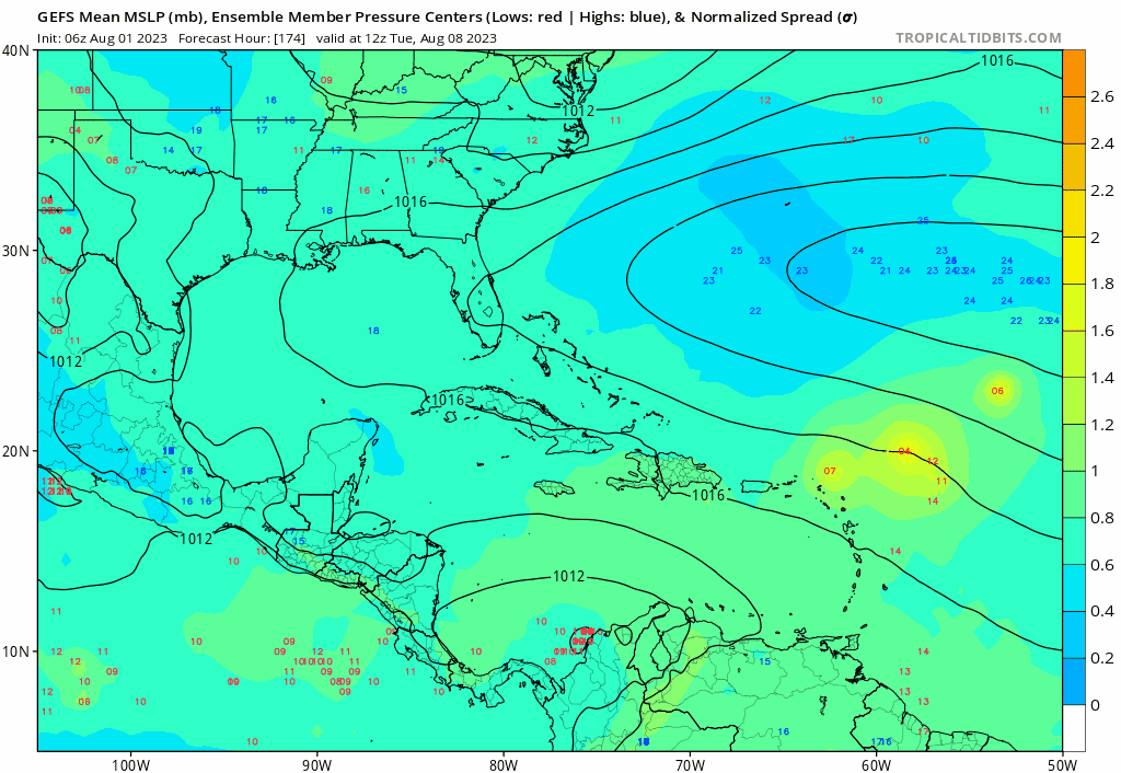
This is looong range. GFS with a hurricane making landfall in South Carolina on the 16th.
1 likes
Visit the Caribbean-Central America Weather Thread where you can find at first post web cams,radars
and observations from Caribbean basin members Click Here
and observations from Caribbean basin members Click Here
-
cycloneye
- Admin
- Posts: 149703
- Age: 69
- Joined: Thu Oct 10, 2002 10:54 am
- Location: San Juan, Puerto Rico
Re: 2023 Indicators (SST, SAL, MSLP, Wind shear, Steering, Instability) and Day 16+ Models
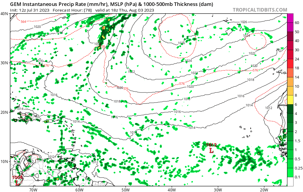
lsuhurricane wrote:Latest GFS (12z) in fantasyland range is modeling a similar setup to the Euro Ensembles.
https://www.tropicaltidbits.com/analysis/models/gfs/2023073112/gfs_mslp_pcpn_atl_62.png
https://i.ibb.co/wKFTmc1/Euro-Ensembles-0731.jpg
Second full week in August looks to be active.
To let you know that merged your post to this thread.
0 likes
Visit the Caribbean-Central America Weather Thread where you can find at first post web cams,radars
and observations from Caribbean basin members Click Here
and observations from Caribbean basin members Click Here
-
SFLcane

- S2K Supporter

- Posts: 10281
- Age: 48
- Joined: Sat Jun 05, 2010 1:44 pm
- Location: Lake Worth Florida
Re: 2023 Global Model Runs Discussion (Out thru day 16)
This wave is one to watch rolls of africa in 2- 3 days.
2 likes
Re: 2023 Indicators (SST, SAL, MSLP, Wind shear, Steering, Instability) and Day 16+ Models
lsuhurricane wrote:Latest GFS (12z) in fantasyland range is modeling a similar setup to the Euro Ensembles.
https://www.tropicaltidbits.com/analysis/models/gfs/2023073112/gfs_mslp_pcpn_atl_62.png
https://i.ibb.co/wKFTmc1/Euro-Ensembles-0731.jpg
Second full week in August looks to be active.
But with completely different origin. EPS has it formed from a tropical wave (CMC also shows this), while the GFS has it formed from a non tropical low.
0 likes
-
wxman57

- Moderator-Pro Met

- Posts: 23175
- Age: 68
- Joined: Sat Jun 21, 2003 8:06 pm
- Location: Houston, TX (southwest)
Re: 2023 Global Model Runs Discussion (Out thru day 16)
cycloneye wrote:This is looong range. GFS with a hurricane making landfall in South Carolina on the 16th.
https://i.imgur.com/UGYghGv.gif
It's a done deal, then. The GFS has never predicted a spurious U.S. hurricane hit at hour 384. Better evacuate the Carolinas now.
6 likes
-
Ivanhater

- Storm2k Moderator

- Posts: 11222
- Age: 39
- Joined: Fri Jul 01, 2005 8:25 am
- Location: Pensacola
Re: 2023 Global Model Runs Discussion (Out thru day 16)
wxman57 wrote:cycloneye wrote:This is looong range. GFS with a hurricane making landfall in South Carolina on the 16th.
https://i.imgur.com/UGYghGv.gif
It's a done deal, then. The GFS has never predicted a spurious U.S. hurricane hit at hour 384. Better evacuate the Carolinas now.
What do you think about activity in August?
0 likes
Michael
-
SFLcane
- S2K Supporter
- Posts: 10281
- Age: 48
- Joined: Sat Jun 05, 2010 1:44 pm
- Location: Lake Worth Florida
Re: 2023 Global Model Runs Discussion (Out thru day 16)
Ivanhater wrote:wxman57 wrote:cycloneye wrote:This is looong range. GFS with a hurricane making landfall in South Carolina on the 16th.
https://i.imgur.com/UGYghGv.gif
It's a done deal, then. The GFS has never predicted a spurious U.S. hurricane hit at hour 384. Better evacuate the Carolinas now.
What do you think about activity in August?
https://twitter.com/philklotzbach/status/766981155262300160
1 likes
-
rickcorvin
- Tropical Low

- Posts: 10
- Joined: Wed Jun 03, 2020 7:12 am
Re: 2023 Global Model Runs Discussion (Out thru day 16)
wxman57 wrote:cycloneye wrote:This is looong range. GFS with a hurricane making landfall in South Carolina on the 16th.
https://i.imgur.com/UGYghGv.gif
It's a done deal, then. The GFS has never predicted a spurious U.S. hurricane hit at hour 384. Better evacuate the Carolinas now.
I don’t think that’s what cycloneye was saying. On this thread in particular I think most cast a skeptical eye toward 16 day+ forecasts. As an amateur (non met), i don’t place much confidence in any particular model after 4 or 5 days, especially pre storm genesis. This thread, to me anyway, is about squinting for signals on the horizon.
9 likes
-
wxman57
- Moderator-Pro Met
- Posts: 23175
- Age: 68
- Joined: Sat Jun 21, 2003 8:06 pm
- Location: Houston, TX (southwest)
Re: 2023 Global Model Runs Discussion (Out thru day 16)
rickcorvin wrote:wxman57 wrote:cycloneye wrote:This is looong range. GFS with a hurricane making landfall in South Carolina on the 16th.
https://i.imgur.com/UGYghGv.gif
It's a done deal, then. The GFS has never predicted a spurious U.S. hurricane hit at hour 384. Better evacuate the Carolinas now.
I don’t think that’s what cycloneye was saying. On this thread in particular I think most cast a skeptical eye toward 16 day+ forecasts. As an amateur (non met), i don’t place much confidence in any particular model after 4 or 5 days, especially pre storm genesis. This thread, to me anyway, is about squinting for signals on the horizon.
I know that he wasn't saying that it would happen. Looks like landfall changed to Tampico, MX at 00Z and New Orleans at 06Z.
1 likes
-
jlauderdal
- S2K Supporter
- Posts: 7240
- Joined: Wed May 19, 2004 5:46 am
- Location: NE Fort Lauderdale
- Contact:
Re: 2023 Global Model Runs Discussion (Out thru day 16)
2nd time this season a GFS product has nailed sofla, sept oct should be good for at least 2 more model canes hitting below the lake.
1 likes
-
Blown Away

- S2K Supporter
- Posts: 10253
- Joined: Wed May 26, 2004 6:17 am
Re: 2023 Global Model Runs Discussion (Out thru day 16)
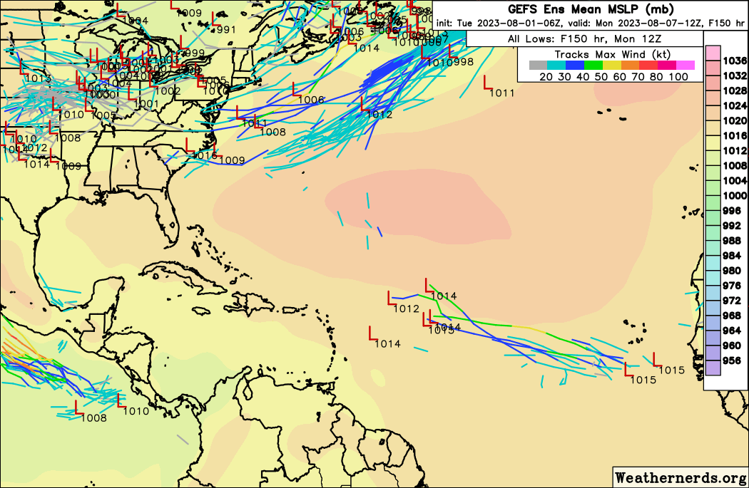
GEFS... Usually the safest place to be is the GFS/GEFS landfall point after 300 hours...
6 likes
Hurricane Eye Experience: David 79, Irene 99, Frances 04, Jeanne 04, Wilma 05… Hurricane Brush Experience: Andrew 92, Erin 95, Floyd 99, Matthew 16, Irma 17, Ian 22, Nicole 22…

Re: 2023 Global Model Runs Discussion (Out thru day 16)
Blown Away wrote:[url]https://i.postimg.cc/wvGGDLcD/32698870.gif [/url]
GEFS... Usually the safest place to be is the GFS/GEFS landfall point after 300 hours...
That did not work out well for Irma:(
I have noticed the CMC is even more bullish than the GFS on this one.
Until the wave is in the open water, any development is pure speculation of course. Guessing a potential landfall is exactly that.
3 likes
-
cycloneye
- Admin
- Posts: 149703
- Age: 69
- Joined: Thu Oct 10, 2002 10:54 am
- Location: San Juan, Puerto Rico
Re: 2023 Global Model Runs Discussion (Out thru day 16)
Does anyone has the wave pinpointed inside Africa to see when it will emerge?
0 likes
Visit the Caribbean-Central America Weather Thread where you can find at first post web cams,radars
and observations from Caribbean basin members Click Here
and observations from Caribbean basin members Click Here
Re: 2023 Global Model Runs Discussion (Out thru day 16)
Canadian chiming in with some activity after really being pro development of anything this season so far.


1 likes
-
Kingarabian

- S2K Supporter
- Posts: 16378
- Joined: Sat Aug 08, 2009 3:06 am
- Location: Honolulu, Hawaii
2023 Indicators (SST, SAL, MSLP, Wind shear, Steering, Instability) and Day 16+ Models
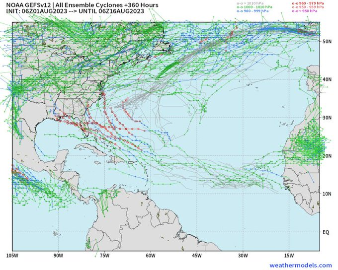
Global models are really bad right now. Check the Dora thread.
2 likes
RIP Kobe Bryant
-
USTropics
- Professional-Met

- Posts: 2739
- Joined: Sun Aug 12, 2007 3:45 am
- Location: Florida State University
Re: 2023 Global Model Runs Discussion (Out thru day 16)
cycloneye wrote:Does anyone has the wave pinpointed inside Africa to see when it will emerge?
The wave axis the CMC and some GFS ensembles are developing appears to be along 2W currently (highlighted in pink in below analysis):

The 12z CMC has the most organized vorticity (roughly highlighted in pink in the animation below) with the AEW emerging off the coast on Friday:

6 likes
-
Category5Kaiju

- Category 5

- Posts: 4345
- Joined: Thu Dec 24, 2020 12:45 pm
- Location: Seattle during the summer, Phoenix during the winter
Re: 2023 Global Model Runs Discussion (Out thru day 16)
00z CMC at it again with a compact, bona fide TC just north of Puerto Rico and the Virgin Islands by August 12.
2 likes
Unless explicitly stated, all information in my posts is based on my own opinions and observations. Tropical storms and hurricanes can be extremely dangerous. Refer to an accredited weather research agency or meteorologist if you need to make serious decisions regarding an approaching storm.
Who is online
Users browsing this forum: No registered users and 226 guests