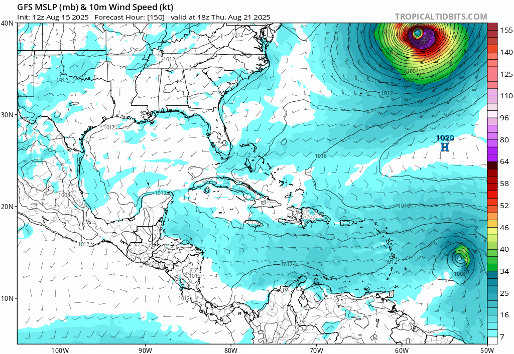
aspen wrote:18z Happy Hour GFS turns this wave behind Erin into a Cat 3 strike on the Lesser Antilles and Puerto Rico.
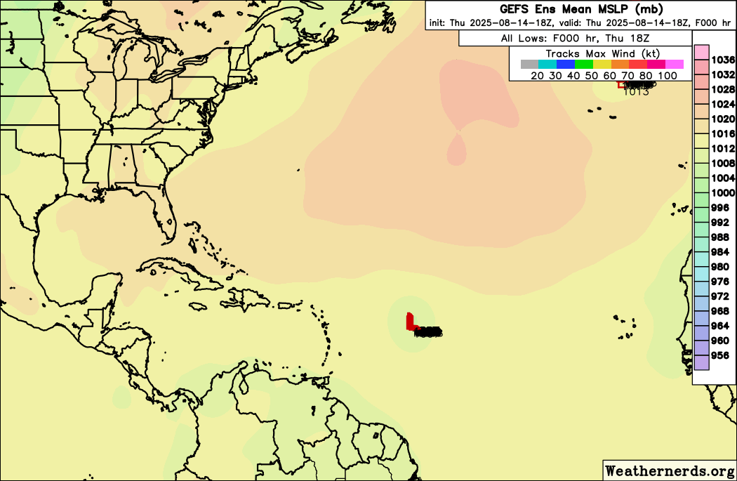
Pretty significant uptick in activity on the 18z GEFS as well. Quite a few members get into the Gulf.
Moderator: S2k Moderators

aspen wrote:18z Happy Hour GFS turns this wave behind Erin into a Cat 3 strike on the Lesser Antilles and Puerto Rico.
Cpv17 wrote:aspen wrote:18z Happy Hour GFS turns this wave behind Erin into a Cat 3 strike on the Lesser Antilles and Puerto Rico.
Pretty significant uptick in activity on the 18z GEFS as well. Quite a few members get into the Gulf.


Woofde wrote:6z GFS showing some love for the wave about to leave Africa. It develops two MDR systems following Erin.https://uploads.tapatalk-cdn.com/20250815/90cdd1866bf856a69bc018db14a6ea40.jpg

AutoPenalti wrote:GFS Ensembles drop this further south or they just no longer develop it.
LarryWx wrote:AutoPenalti wrote:GFS Ensembles drop this further south or they just no longer develop it.
I’m seeing the 6Z GEFS differently. It looks unsettlingly pretty active to me in/near the SE/Gulf coast of the US during Aug 26-30.
-During this active period, GEFS has the MJO in/near phase 5. It’s not either of the 2 most active phases for H hits per day during Jul-Sep since 1975 (phases 2 and 8), but phase 5 has had the 3rd highest ratio of hits/day.
- During phase 5, these 10 Hs hit the Conus: Francine (2024), Ike (2008), Humberto (2007), Ophelia (2005), Isabel (2003), Bertha (1996), Fran (1996), Bob (1991), Elena (1985), and Babe (1977). Two areas were most impacted by these 10: NC (Ophelia, Isabel, Bertha, Fran, and Bob) and upper TX to FL panhandle (Francine, Ike, Humberto, Elena, and Babe).


cycloneye wrote:12z GFS has wave behind Erin developing and moves thru the NE Caribbean islands including Puerto Rico. This is below 10 days.
https://i.imgur.com/UGw2128.gif
LarryWx wrote:0Z UKMET, which goes out to 168, has no followup TC to Erin unlike the prior runs.

BobHarlem wrote:post Erin wave run into the gulf
https://i.postimg.cc/KYjjZpCL/gfs-mslp-wind-watl-fh150-270.gif
Users browsing this forum: ljmac75, WaveBreaking and 136 guests