2022 Global Model Runs Discussion (Out thru day 16)
Moderator: S2k Moderators
Forum rules

The posts in this forum are NOT official forecasts and should not be used as such. They are just the opinion of the poster and may or may not be backed by sound meteorological data. They are NOT endorsed by any professional institution or STORM2K. For official information, please refer to products from the National Hurricane Center and National Weather Service.
-
cycloneye

- Admin

- Posts: 149419
- Age: 69
- Joined: Thu Oct 10, 2002 10:54 am
- Location: San Juan, Puerto Rico
Re: 2022 Global Model Runs Discussion (Out thru day 16)
I have a interesting take of the area GFS and now ICON develop off the Carolinas and that is this may break the ridge a little to then allow any CAG area to lift north.
0 likes
Visit the Caribbean-Central America Weather Thread where you can find at first post web cams,radars
and observations from Caribbean basin members Click Here
and observations from Caribbean basin members Click Here
-
wxman57

- Moderator-Pro Met

- Posts: 23174
- Age: 68
- Joined: Sat Jun 21, 2003 8:06 pm
- Location: Houston, TX (southwest)
Re: 2022 Global Model Runs Discussion (Out thru day 16)
If the GFS lacks support from other models, then this is almost certainly a modelcane. It tried to do the same thing the second week of May, predicting a hurricane into the northern Gulf around May 23-25. It did see increasing moisture in the East Pacific (eventual development of Agatha) but it focused development in the Caribbean, which was wrong. Looks like the same situation now. We will likely see development in the EPAC next week. If some of the moisture eventually makes it into the Gulf, then we'll have to keep an eye on it, but the current GFS solution of a major hurricane into Louisiana has a near zero chance of happening.
GFS on May 15th valid Sunday, May 22. That's Agatha that the Euro and Canadian are developing in the EPAC.

GFS on May 15th valid Sunday, May 22. That's Agatha that the Euro and Canadian are developing in the EPAC.
4 likes
-
skyline385

- Category 5

- Posts: 2728
- Age: 35
- Joined: Wed Aug 26, 2020 11:15 pm
- Location: Houston TX
Re: 2022 Global Model Runs Discussion (Out thru day 16)
cycloneye wrote:I have a interesting take of the area GFS and now ICON develop off the Carolinas and that is this may break the ridge a little to then allow any CAG area to lift north.
That would kinda explain the spread in the recent ensembles
2 likes
-
hurricane2025
- Category 1

- Posts: 254
- Joined: Thu Apr 08, 2021 10:36 am
-
DorkyMcDorkface

- Category 5
- Posts: 1006
- Age: 28
- Joined: Mon Sep 30, 2019 1:32 pm
- Location: Mid-Atlantic
Re: 2022 Global Model Runs Discussion (Out thru day 16)
South Texas Storms wrote:Stormcenter wrote:Something is going to develop in the next 10 days it’s a matter of how strong will it be. IMO
Yep, on the EPAC side. Development looks unlikely in the Atlantic over the next 10 days.
Maybe in the deep tropics but models have been subtly hinting at some sort of MCS/frontal disturbance emerging off the SE coast that could spin up into a (S)TC. So I wouldn't conclusively say Atlantic development won't occur the next 10 days.

https://twitter.com/webberweather/status/1535298989167214592
Last edited by DorkyMcDorkface on Fri Jun 10, 2022 11:50 am, edited 1 time in total.
2 likes
Please note the thoughts expressed by this account are solely those of the user and are from a hobbyist perspective. For more comprehensive analysis, consult an actual professional meteorologist or meteorological agency.
Floyd 1999 | Isabel 2003 | Hanna 2008 | Irene 2011 | Sandy 2012 | Isaias 2020
-
South Texas Storms

- Professional-Met

- Posts: 4257
- Joined: Thu Jun 24, 2010 12:28 am
- Location: Houston, TX
Re: 2022 Global Model Runs Discussion (Out thru day 16)
DorkyMcDorkface wrote:South Texas Storms wrote:Stormcenter wrote:Something is going to develop in the next 10 days it’s a matter of how strong will it be. IMO
Yep, on the EPAC side. Development looks unlikely in the Atlantic over the next 10 days.
Maybe in the deep tropics but models have been subtly hinting at some sort of MCS/frontal disturbance emerging off the SE coast that could spin up into a (S)TC. So I wouldn't conclusively say Atlantic development won't occur period over the next 10 days.
https://i.ibb.co/pRSq0cL/icon-mslp-pcpn-watl-60-1.png
https://i.ibb.co/XYXpmMV/gfs-mslp-pcpn-seus-25-1.png
https://twitter.com/webberweather/status/1535298989167214592
Yeah we certainly can't rule development out off the Southeast U.S. coast next week, but like Eric said in his tweet, chances are pretty low right now. Notice how I said "Development looks unlikely in the Atlantic over the next 10 days". I never speak in absolute terms when it comes to predicting the weather.
2 likes
-
DorkyMcDorkface
- Category 5
- Posts: 1006
- Age: 28
- Joined: Mon Sep 30, 2019 1:32 pm
- Location: Mid-Atlantic
Re: 2022 Global Model Runs Discussion (Out thru day 16)
South Texas Storms wrote:DorkyMcDorkface wrote:South Texas Storms wrote:
Yep, on the EPAC side. Development looks unlikely in the Atlantic over the next 10 days.
Maybe in the deep tropics but models have been subtly hinting at some sort of MCS/frontal disturbance emerging off the SE coast that could spin up into a (S)TC. So I wouldn't conclusively say Atlantic development won't occur period over the next 10 days.
https://i.ibb.co/pRSq0cL/icon-mslp-pcpn-watl-60-1.png
https://i.ibb.co/XYXpmMV/gfs-mslp-pcpn-seus-25-1.png
https://twitter.com/webberweather/status/1535298989167214592
Yeah we certainly can't rule development out off the Southeast U.S. coast next week, but like Eric said in his tweet, chances are pretty low right now. Notice how I said "Development looks unlikely in the Atlantic over the next 10 days". I never speak in absolute terms when it comes to predicting the weather.
Yeah sorry I misunderstood.
2 likes
Please note the thoughts expressed by this account are solely those of the user and are from a hobbyist perspective. For more comprehensive analysis, consult an actual professional meteorologist or meteorological agency.
Floyd 1999 | Isabel 2003 | Hanna 2008 | Irene 2011 | Sandy 2012 | Isaias 2020


-
cycloneye
- Admin
- Posts: 149419
- Age: 69
- Joined: Thu Oct 10, 2002 10:54 am
- Location: San Juan, Puerto Rico
Re: 2022 Global Model Runs Discussion (Out thru day 16)
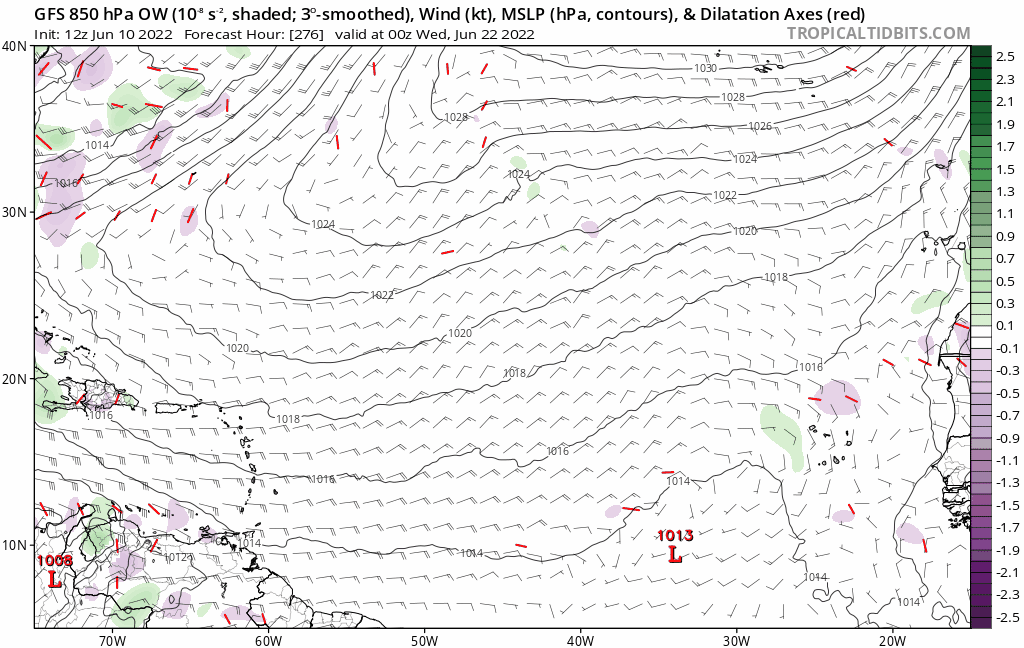
And then there is this. 

3 likes
Visit the Caribbean-Central America Weather Thread where you can find at first post web cams,radars
and observations from Caribbean basin members Click Here
and observations from Caribbean basin members Click Here
-
Kingarabian

- S2K Supporter

- Posts: 16357
- Joined: Sat Aug 08, 2009 3:06 am
- Location: Honolulu, Hawaii
Re: 2022 Global Model Runs Discussion (Out thru day 16)
Not surprising considering that some models show actual westerlies in the MDR at this time frame.
2 likes
RIP Kobe Bryant
-
Category5Kaiju

- Category 5
- Posts: 4332
- Joined: Thu Dec 24, 2020 12:45 pm
- Location: Seattle and Phoenix
Re: 2022 Global Model Runs Discussion (Out thru day 16)
0 likes
Unless explicitly stated, all info in my posts is based on my own opinions and observations. Tropical storms and hurricanes can be extremely dangerous. Refer to an accredited weather research agency or meteorologist if you need to make serious decisions regarding an approaching storm.
-
toad strangler

- S2K Supporter
- Posts: 4546
- Joined: Sun Jul 28, 2013 3:09 pm
- Location: Earth
- Contact:

-
MHC Tracking
- Tropical Storm

- Posts: 203
- Joined: Mon Mar 15, 2021 10:05 am
Re: 2022 Global Model Runs Discussion (Out thru day 16)
Rising motion over Africa modeled around this time, well-amplified waves shown in the long range should come as no huge surprise.
0 likes
-
skyline385
- Category 5
- Posts: 2728
- Age: 35
- Joined: Wed Aug 26, 2020 11:15 pm
- Location: Houston TX
2022 Global Model Runs Discussion (Out thru day 16)
Both GEFS and EPS showing activity in the Gulf, not much on the wave in the MDR except for a handful of members. GEFS is showing a lot of members for the MCS off NC.


2 likes

Re: 2022 Global Model Runs Discussion (Out thru day 16)
Both GFS and ECWMF are having a storm in the Atlantic near Bermuda next thursday. The vortices are stacked at 850, 700 and 500mb and the GFS has it in a low shear environment, looks like it could be a area to watch.


0 likes

Re: 2022 Global Model Runs Discussion (Out thru day 16)
18z GFS drops the MCS system.
0 likes
Irene '11 Sandy '12 Hermine '16 5/15/2018 Derecho Fay '20 Isaias '20 Elsa '21 Henri '21 Ida '21
I am only a meteorology enthusiast who knows a decent amount about tropical cyclones. Look to the professional mets, the NHC, or your local weather office for the best information.
I am only a meteorology enthusiast who knows a decent amount about tropical cyclones. Look to the professional mets, the NHC, or your local weather office for the best information.
-
DorkyMcDorkface
- Category 5
- Posts: 1006
- Age: 28
- Joined: Mon Sep 30, 2019 1:32 pm
- Location: Mid-Atlantic
Re: 2022 Global Model Runs Discussion (Out thru day 16)
0 likes
Please note the thoughts expressed by this account are solely those of the user and are from a hobbyist perspective. For more comprehensive analysis, consult an actual professional meteorologist or meteorological agency.
Floyd 1999 | Isabel 2003 | Hanna 2008 | Irene 2011 | Sandy 2012 | Isaias 2020
-
skyline385
- Category 5
- Posts: 2728
- Age: 35
- Joined: Wed Aug 26, 2020 11:15 pm
- Location: Houston TX
Re: 2022 Global Model Runs Discussion (Out thru day 16)
0Z GFS looks like a realistic solution based on climo, a Cat 1/2 in the BoC. Texas could be in play here as well as both GEFS and EPS have some members slightly more north.

0 likes
-
Category5Kaiju
- Category 5
- Posts: 4332
- Joined: Thu Dec 24, 2020 12:45 pm
- Location: Seattle and Phoenix
Re: 2022 Global Model Runs Discussion (Out thru day 16)
skyline385 wrote:0Z GFS looks like a realistic solution based on climo, a Cat 1/2 in the BoC. Texas could be in play here as well as both GEFS and EPS have some members slightly more north.
https://i.imgur.com/AcD825Y.png
Yeah, not sure about a Cat 3/4 hitting Louisiana or Florida at this time of the year...(I mean, I personally am not expecting something as anomalous as Audrey or Alma anyways)
0 likes
Unless explicitly stated, all info in my posts is based on my own opinions and observations. Tropical storms and hurricanes can be extremely dangerous. Refer to an accredited weather research agency or meteorologist if you need to make serious decisions regarding an approaching storm.
Who is online
Users browsing this forum: cycloneye, Europa non è lontana, mixedDanilo.E and 146 guests