NDG wrote:Going down down down. Things from this point on ain't no repeat of '83. By this time in '83 Nino 1+2 is nearing +3 deg C on its way up to a whopping +4.62 deg C in June.
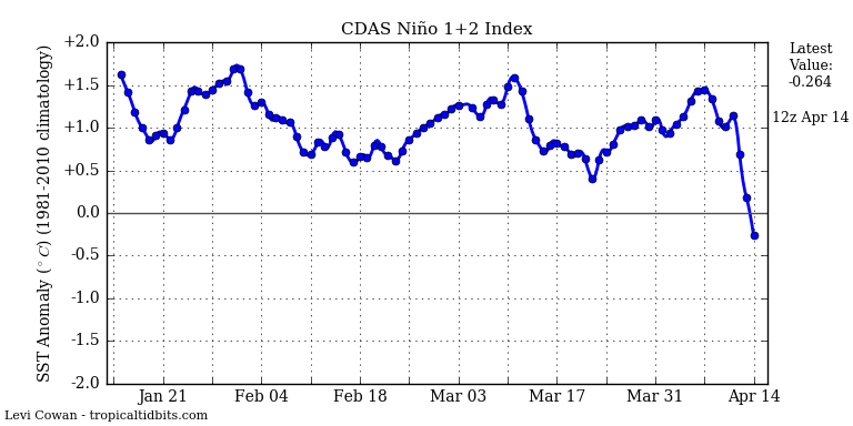
1+2 are volatile, don't forget.
Moderator: S2k Moderators


NDG wrote:Going down down down. Things from this point on ain't no repeat of '83. By this time in '83 Nino 1+2 is nearing +3 deg C on its way up to a whopping +4.62 deg C in June.
Kingarabian wrote:NDG wrote:Going down down down. Things from this point on ain't no repeat of '83. By this time in '83 Nino 1+2 is nearing +3 deg C on its way up to a whopping +4.62 deg C in June.
http://i20.photobucket.com/albums/b245/ ... oh4ste.png
1+2 are volatile, don't forget.


NDG wrote:I am thinking this year big time cooling from the Nino Regions is going to go from east to west starting at Nino 1+2, as we are seeing now. Unlike '83.
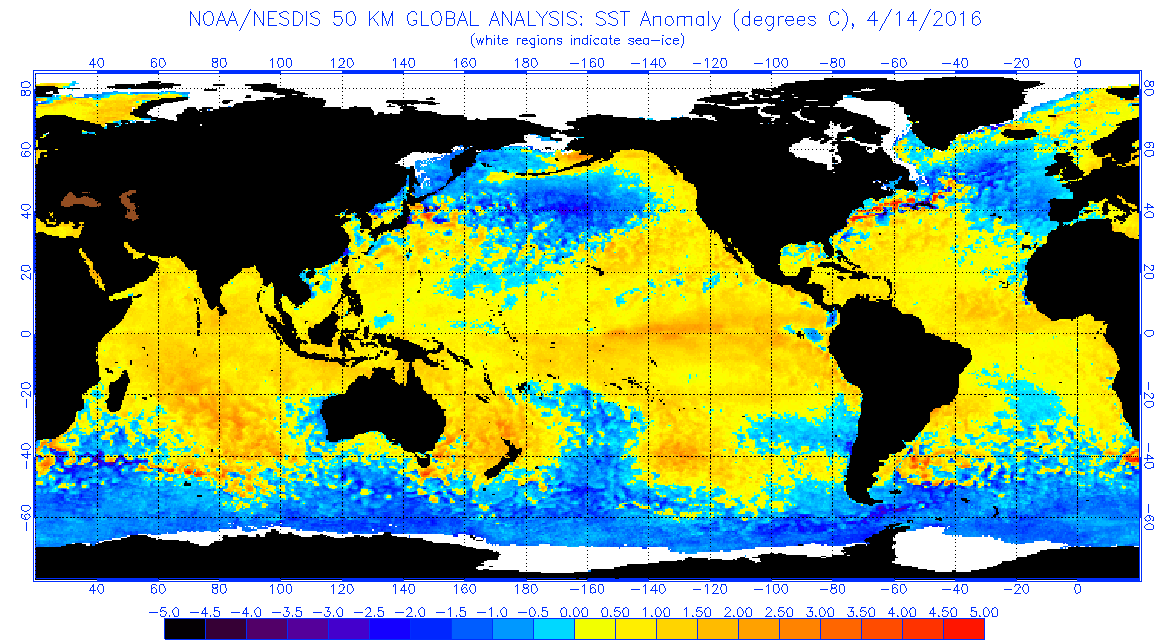
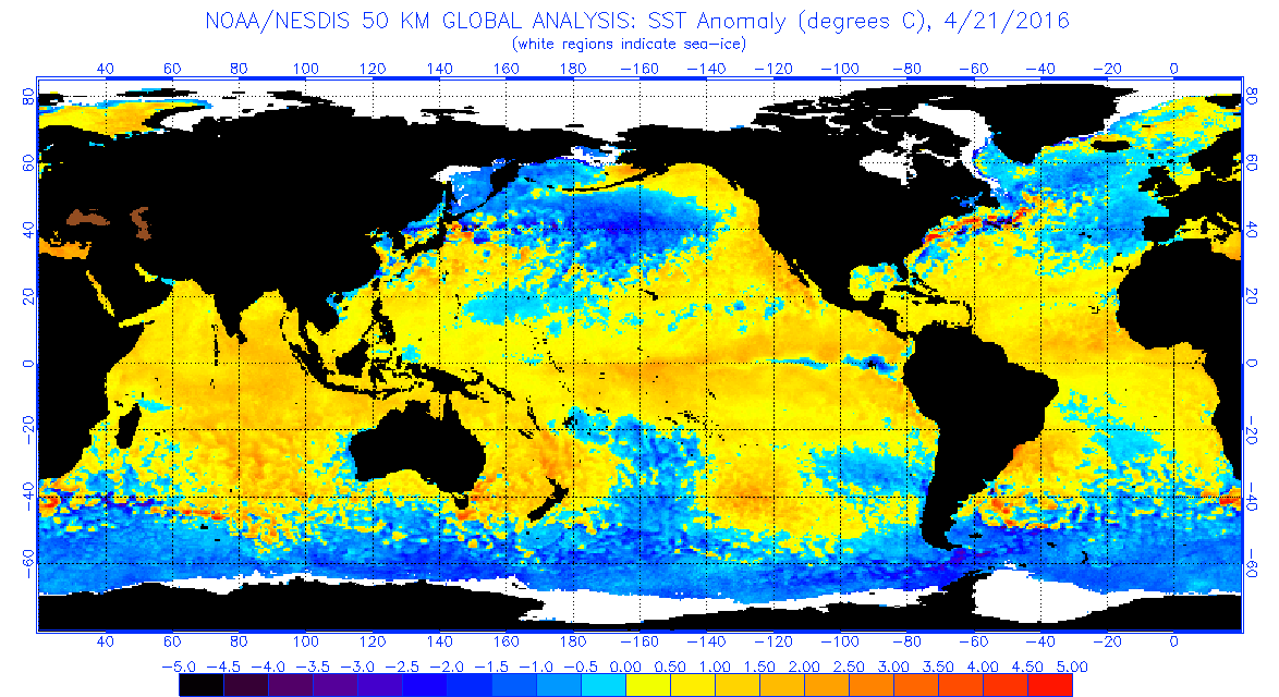
Ntxw wrote:+PDO is the slugger for 3.4 relative to the cooling of the other regions probably. 1+2 is heavily influenced by the southern hemisphere, and one of the reasons the Nino didn't go extreme in the east like in 97 or 83 is probably due to the southern hemisphere (off SA) not cooperating. It hasn't been since the failed 2012 NIno dud. It's almost the final half of April and we aren't at neutral yet. In 1998 this same update was 0.6C and 2010 was 0.7C
NDG wrote:One thing that I have noticed with today's ECMWF's update on its Nino 3 & 3.4 ENSO forecast is that it keeps trending colder for June-July Period, but as usual for this time of the year it does that uptick in temps towards the end of its forecast. So I will not doubt that over the next couple of months it will start trending colder for September.
NDG wrote:Ntxw wrote:+PDO is the slugger for 3.4 relative to the cooling of the other regions probably. 1+2 is heavily influenced by the southern hemisphere, and one of the reasons the Nino didn't go extreme in the east like in 97 or 83 is probably due to the southern hemisphere (off SA) not cooperating. It hasn't been since the failed 2012 NIno dud. It's almost the final half of April and we aren't at neutral yet. In 1998 this same update was 0.6C and 2010 was 0.7C
You are right about Nino 3.4 being at 0.6C by this same time in '98 but it went back up to +1.3C in early May, it did not go fully Neutral until the end of May then negative by early June. Meanwhile Nino 1+2 was boiling at +3.1C and continued going up to +3.9C by the end of May, the reason why I say that year the hurricane season took a while to get going and the reason why the EPAC produced 5 Major Hurricanes between June and August, IMO.


Users browsing this forum: pepecool20, zal0phus and 52 guests


