Global Model Runs for W.Caribbean Early Season Development

This is the general tropical discussion area. Anyone can take their shot at predicting a storms path.

Moderator: S2k Moderators

Forum rules

The posts in this forum are NOT official forecasts and should not be used as such. They are just the opinion of the poster and may or may not be backed by sound meteorological data. They are NOT endorsed by any professional institution or STORM2K. For official information, please refer to products from the National Hurricane Center and National Weather Service.

Help Support Storm2K
Message
Author
MiamiensisWx

#761 Postby MiamiensisWx » Mon May 26, 2008 6:29 pm

EVENING GRAPHICAL ANALYSIS

Image

Dark blue text over central Caribbean: "UPPER LEVEL SHEAR"
Last edited by MiamiensisWx on Mon May 26, 2008 7:43 pm, edited 2 times in total.
0 likes   

User avatar
cycloneye
Admin
Admin
Posts: 146070
Age: 69
Joined: Thu Oct 10, 2002 10:54 am
Location: San Juan, Puerto Rico

Re: Global Model Runs for W.Caribbean Early Season Development

#762 Postby cycloneye » Mon May 26, 2008 6:29 pm

Derek its not only GFS,also CMC is looking east.


http://moe.met.fsu.edu/cgi-bin/cmctc2.c ... =Animation
0 likes   

Ed Mahmoud

Re: Global Model Runs for W.Caribbean Early Season Development

#763 Postby Ed Mahmoud » Mon May 26, 2008 6:30 pm

GFS has company (not in exact location, with UK Met in the Pacific, for example) with most of the big long range models/several runs. So it can't just be ruled out based on a spurious cyclone in the Atlantic.


But the models aren't worth much other than a hint at development with the spread in their locations until a system does form and its location initialized in the models.
0 likes   

MiamiensisWx

Re: Global Model Runs for W.Caribbean Early Season Development

#764 Postby MiamiensisWx » Mon May 26, 2008 6:31 pm

cycloneye wrote:Derek its not only GFS,also CMC.


http://moe.met.fsu.edu/cgi-bin/cmctc2.c ... =Animation

...and it goes to the trash! There's the Canadian model again.

In total there are 97 users online :: 39 registered, 3 hidden and 55 guests
Most users ever online was 654 on Fri Aug 17, 2007 2:04 pm

Well, you do know we're getting closer to the annual start, based on the concentration of this forum's audience.
0 likes   

Derek Ortt

Re: Global Model Runs for W.Caribbean Early Season Development

#765 Postby Derek Ortt » Mon May 26, 2008 6:43 pm

cycloneye wrote:Derek its not only GFS,also CMC is looking east.


http://moe.met.fsu.edu/cgi-bin/cmctc2.c ... =Animation


That is why I am not hoping on board the development bandwagon yet. I am concerned about any of the off season model changes. If you make the smallest of changes to a model, the results can be dramatically different (I have learned this via some Katrina experiments I have recently been running and the changes are merely related to differences in blending radii after a vortex relocation... minor changes produce 2 very different storms)
0 likes   

User avatar
MGC
S2K Supporter
S2K Supporter
Posts: 5904
Joined: Sun Mar 23, 2003 9:05 pm
Location: Pass Christian MS, or what is left.

Re: Global Model Runs for W.Caribbean Early Season Development

#766 Postby MGC » Mon May 26, 2008 6:56 pm

Late May-early June CV storm? Throw that in the round file. I'm not sold on development in Caribbean yet. Just cause a few clouds have puffed up don't mean a TD is going to spin up. It has been fun watching the model runs though and yes, 100 miles will make a big difference if a low does indeed form......MGC
0 likes   

Opal storm

Re: Global Model Runs for W.Caribbean Early Season Development

#767 Postby Opal storm » Mon May 26, 2008 7:04 pm

Mobile AFD

.LONG TERM (FRIDAY THROUGH MONDAY)...DEEP LAYER RIDGING STRADDLES
THE GULF COAST ON FRIDAY THEN SHIFTS OFFSHORE SLIGHTLY ON SATURDAY
AS A PLAINS SYSTEM MOVES TOWARDS THE GREAT LAKES REGION. THE PLAINS
SYSTEM CONTINUES EASTWARD ACROSS THE NORTHEAST STATES AND BRINGS A
WEAK TRAILING FRONT/TROF INTO THE GULF COASTAL STATES ON MONDAY.
SMALL POPS MAINLY FOR THE DAYTIME PERIODS CONTINUE THROUGH MONDAY
WITH TEMPERATURES SLIGHTLY ABOVE SEASONABLE LEVELS. MEANWHILE...THE
LOW PRESSURE SYSTEM THAT THE LONG RANGE MODELS HAVE BEEN DEVELOPING
IN THE WESTERN CARIBBEAN IS MOVED ACROSS THE YUCATAN ON A WESTERLY
TRACK BY THE GFS AND ECMWF...ALTHOUGH THE CANADIAN GEM TAKES THE
SYSTEM INTO THE EASTERN GULF. THE GFS ENSEMBLES FAVOR THE WESTERLY
TRACK BUT ALL IN ALL WILL JUST NEED TO CONTINUE CLOSELY MONITORING.
/29
0 likes   

User avatar
Chacor
Category 5
Category 5
Posts: 10229
Joined: Mon Oct 02, 2006 10:43 pm
Location: Singapore

#768 Postby Chacor » Mon May 26, 2008 7:10 pm

EPac TWO:

A BROAD AREA OF LOW PRESSURE EXTENDS FROM CENTRAL AMERICA
WEST-SOUTHWESTWARD FOR SEVERAL HUNDRED MILES INTO THE EASTERN
PACIFIC. ASSOCIATED SHOWERS AND THUNDERSTORMS ARE DISORGANIZED AND
THERE ARE NO SIGNS OF DEVELOPMENT WITHIN THIS AREA. HOWEVER...SOME
SLOW DEVELOPMENT OF THIS SYSTEM IS POSSIBLE OVER THE NEXT COUPLE OF
DAYS AS IT REMAINS NEARLY STATIONARY OR DRIFTS EASTWARD.
REGARDLESS OF DEVELOPMENT...LOCALLY HEAVY RAINFALL IS POSSIBLE OVER
PORTIONS OF CENTRAL AMERICA DURING THE NEXT FEW DAYS...ESPECIALLY
IN PANAMA... COSTA RICA...AND NICARAGUA.
0 likes   

User avatar
hurricanetrack
HurricaneTrack.com
HurricaneTrack.com
Posts: 1781
Joined: Tue Dec 02, 2003 10:46 pm
Location: Wilmington, NC
Contact:

#769 Postby hurricanetrack » Mon May 26, 2008 7:10 pm

Did you all see this?

A BROAD AREA OF LOW PRESSURE EXTENDS FROM CENTRAL AMERICA
WEST-SOUTHWESTWARD FOR SEVERAL HUNDRED MILES INTO THE EASTERN
PACIFIC. ASSOCIATED SHOWERS AND THUNDERSTORMS ARE DISORGANIZED AND
THERE ARE NO SIGNS OF DEVELOPMENT WITHIN THIS AREA. HOWEVER...SOME
SLOW DEVELOPMENT OF THIS SYSTEM IS POSSIBLE OVER THE NEXT COUPLE OF
DAYS AS IT REMAINS NEARLY STATIONARY OR DRIFTS EASTWARD.
REGARDLESS OF DEVELOPMENT...LOCALLY HEAVY RAINFALL IS POSSIBLE OVER
PORTIONS OF CENTRAL AMERICA DURING THE NEXT FEW DAYS...ESPECIALLY
IN PANAMA... COSTA RICA...AND NICARAGUA.

Hmm....it got "outlooked" in the east Pacific and the mention was made of it moving eastward. We'll see soon enough!
0 likes   

User avatar
Blown Away
S2K Supporter
S2K Supporter
Posts: 10162
Joined: Wed May 26, 2004 6:17 am

Re: Global Model Runs for W.Caribbean Early Season Development

#770 Postby Blown Away » Mon May 26, 2008 7:11 pm

NATIONAL WEATHER SERVICE MIAMI FL
252 PM EDT MON MAY 26 2008

.SYNOPSIS...A RIDGE OF HIGH PRESSURE EAST OF THE MID ATLANTIC
STATES WILL CONTINUE TO MOVE EASTWARD TONIGHT WHILE THE COLD FRONT
THAT MOVED THROUGH SOUTH FLORIDA DURING SUNDAY MORNING REMAINS
OVER THE SOUTHERN BAHAMAS TO JUST NORTH OF JAMAICA. ALSO... A M/U
LVL RIDGE IS EXPECTED TO REMAIN ACROSS THE SOUTHEASTERN STATES
INTO WED. THESE SYSTEMS WILL CONTINUE TO CONTROL AREA WEATHER
INTO MID WEEK AS AN INVERSION REMAINS IN PLACE... AND LOWER
LEVEL TEMPS, ESPECIALLY OVER THE ATLANTIC, REMAIN RELATIVELY COOL. THIS
WILL CREATE A FEW SHRA OVER THE ATLANTIC, MAINLY AT NIGHT AND
DURING THE MORNING HOURS, THAT WILL AT TIMES MOVE INTO THE EAST
COAST METROS. FARTHER WEST OVER INTERIOR AND WEST COAST LOCATIONS,
LITTLE IF ANY PRECIP IS EXPECTED FOR THE REST OF TODAY OR TUES,
HOWEVER, BY WED AFTERNOON THE M/U LEVEL RIDGE IS EXPECTED TO
SLOWLY SHIFT WESTWARD. THIS WESTWARD SHIFT MAY WEAKEN THE INVERSION
ENOUGH TO ALLOW A FEW TSRA ALONG THE SEA BREEZE.

WEDNESDAY NIGHT INTO THURSDAY... THE PATTERN WILL BEGIN TO SHIFT
BACK TO A MORE SUMMER LIKE PATTERN. THE FRONT THAT IS CURRENTLY
OVER THE SOUTHERN BAHAMAS AND JUST NORTH OF JAMAICA IS EXPECTED TO
RETURN NORTHWARD WITH MOISTURE INCREASING BEHIND THE BOUNDARY AND PRECIP
CHANCES WILL BEGIN TO RETURN TO AROUND CLIMO LEVELS. A E TO SE
FLOW IS EXPECTED ACROSS S FL THURS INTO SAT WHICH WOULD FAVOR THE
WEST COAST AND INTERIOR LOCATIONS, BUT SCT SHRA AND TS WOULD
LIKELY OCCUR ACROSS MOST IF NOT ALL OF MAINLAND S FL.

ALSO... LATE IN THE FORECAST PERIOD, DAY 6+, MODEL GUIDANCE
CONTINUES TO HINT AT A POSSIBLE LOW DEVELOPING IN THE CARIBBEAN
THAT MAY MOVE INTO THE GULF, OR STAY IN THE CARIBBEAN. ATTM, GUIDANCE
BOUNCES GREATLY FROM RUN TO RUN AND MODEL TO MODEL. OVERALL
CONFIDENCE IN ANY INFLUENCE OUTSIDE SCT THUNDERSTORMS IS LOW.


0 likes   

User avatar
cycloneye
Admin
Admin
Posts: 146070
Age: 69
Joined: Thu Oct 10, 2002 10:54 am
Location: San Juan, Puerto Rico

Re: Global Model Runs for W.Caribbean=EPAC TWO Posted

#771 Postby cycloneye » Mon May 26, 2008 7:15 pm

0 likes   

RL3AO
Moderator-Pro Met
Moderator-Pro Met
Posts: 16308
Joined: Thu Jun 14, 2007 10:03 pm
Location: NC

#772 Postby RL3AO » Mon May 26, 2008 7:15 pm

ITS FINALLY USED!

Image


EDIT: CYCLONEYE BEAT ME AGAIN! :D :grr:
0 likes   

User avatar
tailgater
S2K Supporter
S2K Supporter
Posts: 3339
Joined: Sun Jul 11, 2004 9:13 pm
Location: St. Amant La.

Re: Global Model Runs for W.Caribbean=EPAC TWO Posted

#773 Postby tailgater » Mon May 26, 2008 7:16 pm

Latest TAFB
http://www.nhc.noaa.gov/tafb_latest/atl ... testBW.gif
2 weak lows headed for Central America. Maybe a lopsided TD in the BOC later?
0 likes   

RL3AO
Moderator-Pro Met
Moderator-Pro Met
Posts: 16308
Joined: Thu Jun 14, 2007 10:03 pm
Location: NC

#774 Postby RL3AO » Mon May 26, 2008 7:18 pm

Image
0 likes   

User avatar
KatDaddy
Category 5
Category 5
Posts: 2815
Joined: Mon Oct 21, 2002 6:23 pm
Location: League City, Texas

#775 Postby KatDaddy » Mon May 26, 2008 7:23 pm

Interesting indeed now that is has been outlooked and there is convection in the E PAC. As the AFDs have menitioned.....bears watch.
0 likes   

User avatar
Evil Jeremy
S2K Supporter
S2K Supporter
Posts: 5463
Age: 32
Joined: Mon Apr 10, 2006 2:10 pm
Location: Los Angeles, CA

Re: Global Model Runs for W.Caribbean Early Season Development

#776 Postby Evil Jeremy » Mon May 26, 2008 7:27 pm

So let me get this right: Even though the NHC is currently saying that the EPAC sis the area to watch right now, it is really the Caribbean that will be the focus with this system over the next few days?
0 likes   

User avatar
hurricanefloyd5
Category 5
Category 5
Posts: 1659
Age: 44
Joined: Sun May 02, 2004 10:53 am
Location: Spartanburg
Contact:

Re: Global Model Runs for W.Caribbean Early Season Development

#777 Postby hurricanefloyd5 » Mon May 26, 2008 7:34 pm

well what ever happens with this so called system,I hope it will bring florida the heavy rain that we reallyreally need!!!!!!
0 likes   

User avatar
Thunder44
Category 5
Category 5
Posts: 5922
Age: 44
Joined: Mon Jun 09, 2003 7:53 pm
Location: New York City

Re: Global Model Runs for W.Caribbean Early Season Development

#778 Postby Thunder44 » Mon May 26, 2008 7:39 pm

They are actually putting out probabilities on systems being outlooked this year. This is one is less than 20%.
0 likes   

Cyclone1
Category 5
Category 5
Posts: 2739
Age: 33
Joined: Tue Jun 12, 2007 12:03 pm
Location: Florida

Re: Global Model Runs for W.Caribbean Early Season Development

#779 Postby Cyclone1 » Mon May 26, 2008 7:42 pm

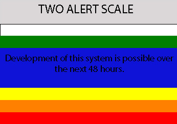
Thunder44 wrote:They are actually putting out probabilities on systems being outlooked this year. This is one is less than 20%.


Well, keep in mind, this is the Epac TWO for a primarily Atlantic threat.
0 likes   

User avatar
Vortex
S2K Supporter
S2K Supporter
Posts: 4644
Age: 53
Joined: Fri Aug 01, 2003 9:34 pm
Location: Hilton Head, SC

#780 Postby Vortex » Mon May 26, 2008 7:42 pm

18Z Nogaps pretty much a carbon copy of the 00z and 12z prior run.

https://www.fnmoc.navy.mil/wxmap_cgi/cg ... 2008052618
0 likes   


Return to “Talkin' Tropics”

Who is online

Users browsing this forum: dl20415, wzrgirl1 and 45 guests