

18z GFS is totally blind to anything that is supposed to be favorable.
Shows nada pretty much the whole run.
2019 Tropics: Global Model Runs Discussion (Out to day 16)
Moderator: S2k Moderators
Forum rules

The posts in this forum are NOT official forecasts and should not be used as such. They are just the opinion of the poster and may or may not be backed by sound meteorological data. They are NOT endorsed by any professional institution or STORM2K. For official information, please refer to products from the National Hurricane Center and National Weather Service.
-
gatorcane

- S2K Supporter

- Posts: 23703
- Age: 47
- Joined: Sun Mar 13, 2005 3:54 pm
- Location: Boca Raton, FL
Re: 2019 Tropics: Global Model Runs Discussion (Out to day 16)
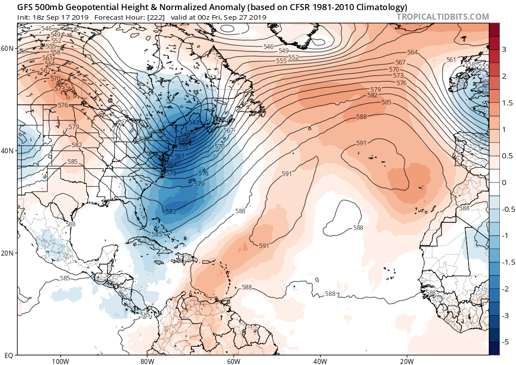
What the GFS is showing is a deep trough along the EC and if that comes to fruition anything coming from the east would recurve away from the CONUS. On the flip side, maybe some fall weather heading for the EC! 
0 likes
-
gatorcane
- S2K Supporter
- Posts: 23703
- Age: 47
- Joined: Sun Mar 13, 2005 3:54 pm
- Location: Boca Raton, FL
Re: 2019 Tropics: Global Model Runs Discussion (Out to day 16)
Big trough over the Western Atlantic on the GFS waiting to turn any of these Cape Verde storms away from the CONUS:
2 likes
-
GeneratorPower

- S2K Supporter
- Posts: 1648
- Age: 46
- Joined: Sun Dec 18, 2005 11:48 pm
- Location: Huntsville, AL
Re: 2019 Tropics: Global Model Runs Discussion (Out to day 16)
MetroMike wrote:18z GFS is totally blind to anything that is supposed to be favorable.
Shows nada pretty much the whole run.
Or maybe it’s doing its job and telling us that conditions aren’t favorable and don’t expect development.
1 likes
Re: 2019 Tropics: Global Model Runs Discussion (Out to day 16)
GeneratorPower wrote:MetroMike wrote:18z GFS is totally blind to anything that is supposed to be favorable.
Shows nada pretty much the whole run.
Or maybe it’s doing its job and telling us that conditions aren’t favorable and don’t expect development.
Suppose to be with the Favorable MJO traversing the basin so they say.
Seems off for the conditions.
But tonights GFS (Wednesday PM) is more realistic imo.
0 likes
-
GeneratorPower
- S2K Supporter
- Posts: 1648
- Age: 46
- Joined: Sun Dec 18, 2005 11:48 pm
- Location: Huntsville, AL
Re: 2019 Tropics: Global Model Runs Discussion (Out to day 16)
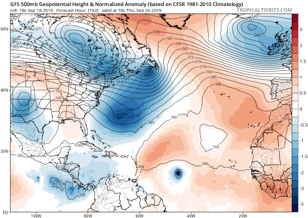
gatorcane wrote:Big trough over the Western Atlantic on the GFS waiting to turn any of these Cape Verde storms away from the CONUS:
https://i.postimg.cc/kGXrR6m1/gfs-z500a-Norm-atl-33.png

0 likes

Re: 2019 Tropics: Global Model Runs Discussion (Out to day 16)
Euro ensembles starting to hint at lowering pressures in the western Caribbean in early October. Something to watch over the next several days on future model runs.
https://www.tropicaltidbits.com/analysis/models/?model=ecmwf-ens®ion=watl&pkg=mslpa&runtime=2019092100&fh=240
https://www.tropicaltidbits.com/analysis/models/?model=ecmwf-ens®ion=watl&pkg=mslpa&runtime=2019092100&fh=240
3 likes

Re: 2019 Tropics: Global Model Runs Discussion (Out to day 16)
ronjon wrote:Euro ensembles starting to hint at lowering pressures in the western Caribbean in early October. Something to watch over the next several days on future model runs.
https://www.tropicaltidbits.com/analysis/models/?model=ecmwf-ens®ion=watl&pkg=mslpa&runtime=2019092100&fh=240
Yep, and its long 46 day range forecast shows below average MSLPs hanging around through most of October along with above average rainfall fall across the western Caribbean and GOM..
1 likes

Re: 2019 Tropics: Global Model Runs Discussion (Out to day 16)
NDG wrote:ronjon wrote:Euro ensembles starting to hint at lowering pressures in the western Caribbean in early October. Something to watch over the next several days on future model runs.
https://www.tropicaltidbits.com/analysis/models/?model=ecmwf-ens®ion=watl&pkg=mslpa&runtime=2019092100&fh=240
Yep, and its long 46 day range forecast shows below average MSLPs hanging around through most of October along with above average rainfall fall across the western Caribbean and GOM..
Yeah. Unlike the GFS, CMC and EC build a strong ass ridge across the western Atlantic after Jerry so that in 10 days, CMC has a storm coming back SW in the W Atl where as the EC has something in the SE Gulf. GFs does make sense in that Jerry and the storm immediately behind it would erode the western side of the ridge. But it never handles follow up patterns right. Expect that if a big cold high comes down next weekend or so that you have to look underneath it. That should be the next US threat. I’d place my money in the foreign models being closer to reality.
1 likes

Re: 2019 Tropics: Global Model Runs Discussion (Out to day 16)
The Euro has a system in the BOC heading north towards Texas from days 7-10.
2 likes
Re: 2019 Tropics: Global Model Runs Discussion (Out to day 16)
Cpv17 wrote:The Euro has a system in the BOC heading north towards Texas from days 7-10.
Another unorthodox track if it sticks, doubt it will.
1 likes

Re: 2019 Tropics: Global Model Runs Discussion (Out to day 16)
18Z GFS has strengthening vorticity in the central/western Caribbean around H216 that moves northwest and then in the extremely long range turns north east and passes over Cuba and just south of Florida as a TS/Cat 1.
0 likes
The posts in this forum are NOT official forecast and should not be used as such. They are just the opinion of the poster and may or may not be backed by sound meteorological data. They are NOT endorsed by any professional institution or STORM2K. For official information, refer to products from the National Hurricane Center and National Weather Service.
-
CYCLONE MIKE
- Category 5

- Posts: 2183
- Joined: Tue Aug 31, 2004 6:04 pm
- Location: Gonzales, LA
Re: 2019 Tropics: Global Model Runs Discussion (Out to day 16)
MetroMike wrote:Cpv17 wrote:The Euro has a system in the BOC heading north towards Texas from days 7-10.
Another unorthodox track if it sticks, doubt it will.
I don’t think that track is unreasonable at all for the first week of October, doesn’t take much of a weakness or too strong of a trough to pull a system north out of there. Actually what I find so unusual is how quiet the BOC has been so far this season.
0 likes
-
Kingarabian

- S2K Supporter
- Posts: 16294
- Joined: Sat Aug 08, 2009 3:06 am
- Location: Honolulu, Hawaii
Re: 2019 Tropics: Global Model Runs Discussion (Out to day 16)
GFS has a large CAG in the superl ong range.
1 likes
RIP Kobe Bryant
-
gatorcane
- S2K Supporter
- Posts: 23703
- Age: 47
- Joined: Sun Mar 13, 2005 3:54 pm
- Location: Boca Raton, FL
Re: 2019 Tropics: Global Model Runs Discussion (Out to day 16)
WxEp wrote:18Z GFS has strengthening vorticity in the central/western Caribbean around H216 that moves northwest and then in the extremely long range turns north east and passes over Cuba and just south of Florida as a TS/Cat 1.
1 likes
Re: 2019 Tropics: Global Model Runs Discussion (Out to day 16)
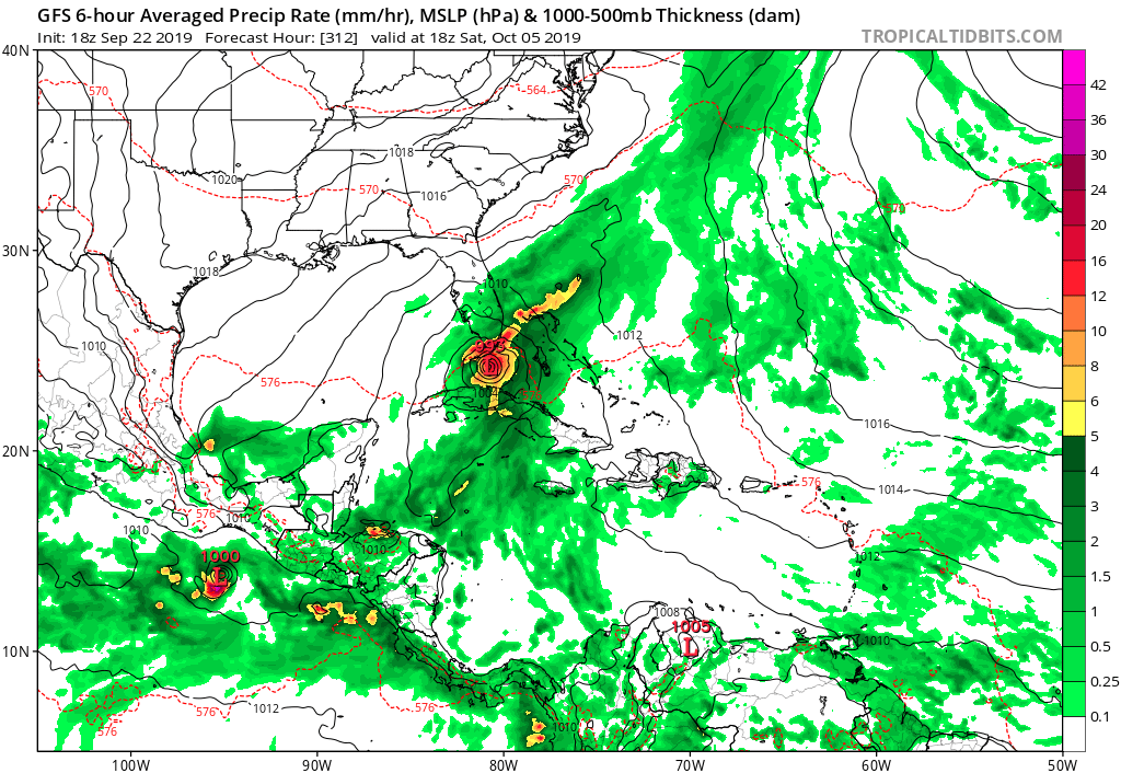
Surprised nobody posted today's 12z GFS - quite the mega storm in the western caribbean (size wise not intensity).
https://www.tropicaltidbits.com/analysis/models/?model=gfs®ion=watl&pkg=mslp_pcpn&runtime=2019092312&fh=300
https://www.tropicaltidbits.com/analysis/models/?model=gfs®ion=watl&pkg=mslp_pcpn&runtime=2019092312&fh=300
0 likes
-
Hurricaneman

- Category 5
- Posts: 7404
- Age: 45
- Joined: Tue Aug 31, 2004 3:24 pm
- Location: central florida
Re: 2019 Tropics: Global Model Runs Discussion (Out to day 16)
ronjon wrote:Surprised nobody posted today's 12z GFS - quite the mega storm in the western caribbean (size wise not intensity).
https://www.tropicaltidbits.com/analysis/models/?model=gfs®ion=watl&pkg=mslp_pcpn&runtime=2019092312&fh=300
If that’s is 100miles farther east this would be another Mitch but thankfully it’s in fantasy range
0 likes

Re: 2019 Tropics: Global Model Runs Discussion (Out to day 16)
GFS trying it's best to convince us that an extremely active Caribbean October is on the way
0 likes
-
blazess556
- Professional-Met

- Posts: 250
- Joined: Mon Aug 31, 2009 10:51 pm
- Location: Germantown, MD
Re: 2019 Tropics: Global Model Runs Discussion (Out to day 16)
Looks there are some indications for the West Pacific to perk up a bit with a typhoon in the medium-range.
1 likes
-
Astromanía
- Category 2

- Posts: 792
- Age: 27
- Joined: Sat Aug 25, 2018 10:34 pm
- Location: Monterrey, N.L, México

Who is online
Users browsing this forum: No registered users and 65 guests