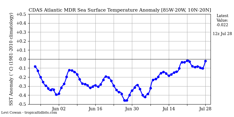
Shell Mound wrote:The warming has already stopped and cooling has resumed, according to the
latest CDAS data. Additionally, the ongoing WWB is
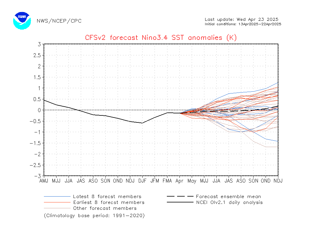
expected to be short-lived and migrate westward, so it is related to the CCKW/MJO passage rather than the ASW. So far there are absolutely no indicators of a substantial long-term warmup, and even the ASW will be insufficient to totally negate the -AMM signature and Atlantic Niño. We will need to see significant, sustained, continuous low-level westerlies to ensure a hyperactive Atlantic season that meets CSU’s call for ACE of ≥ 150. At this point ACE of ≤ 130 seems most plausible.
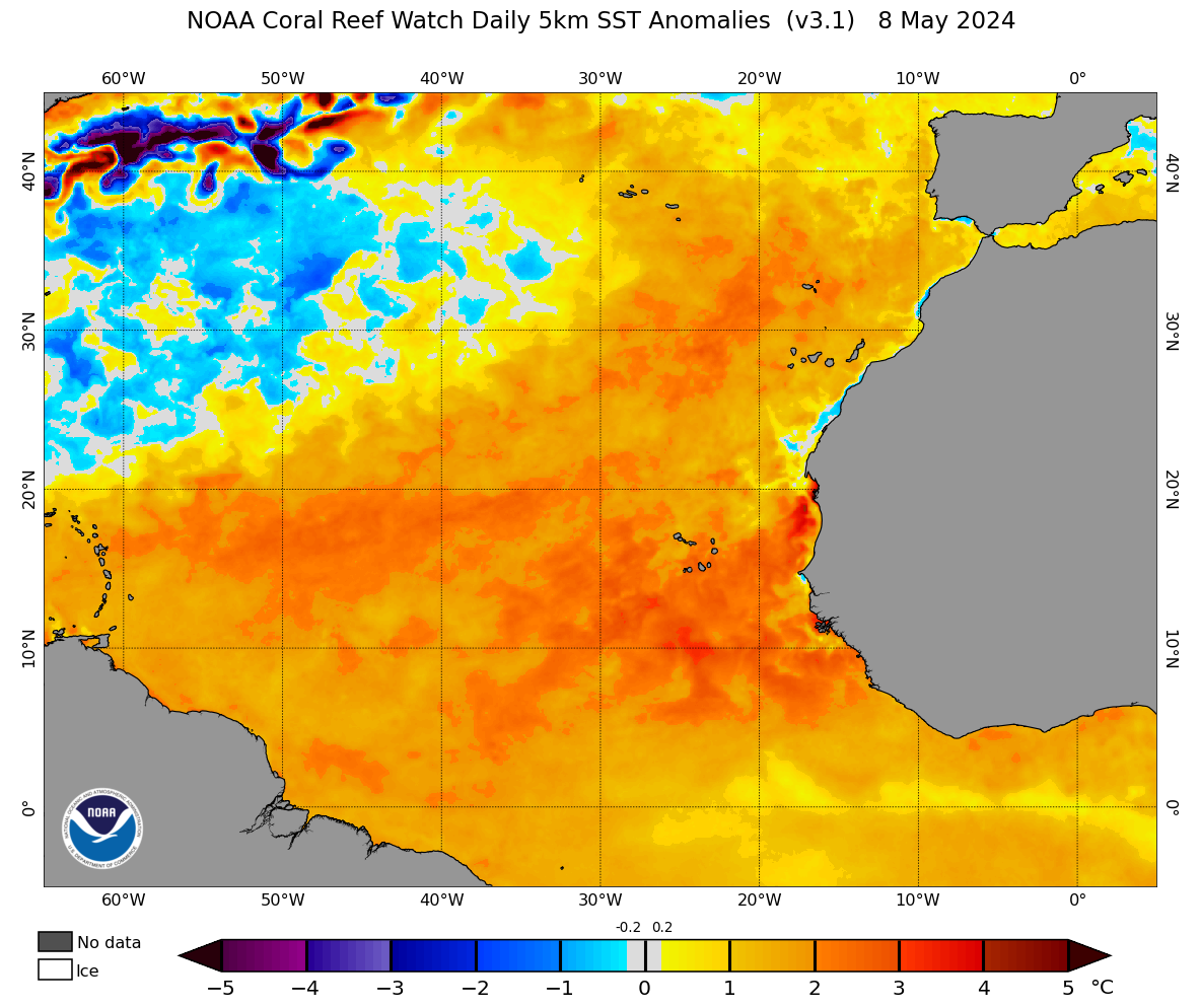
The MDR
is still warming, at least for now.
3 day change in SST:

Really, there's more to activity than a 1C difference in sea surface profile, 2+ months before peak season. For Gulf and Caribbean systems SST is almost never an inhibiting factor. A very active WAM, below avg shear, and favorable velocities through ASO look to have a much more profound impact. We might see not see a hyperactive season per se, but above average looks very likely.
Slightly OT, but every year people look at all the 'struggling' systems and start downcasting hard. Struggling systems are not a sign of inactivity - they can be the exact opposite. If climo for a time/place is 30 kt of shear and intense subsidence, you would not expect storms to form at all. 15 kt of shear would be FAR below average and could even allow a storm to form. It would be struggling, of course, but it wouldn't exist in the first place with average conditions.


