2023 Global Model Runs Discussion (Out thru day 16)
Moderator: S2k Moderators
Forum rules

The posts in this forum are NOT official forecasts and should not be used as such. They are just the opinion of the poster and may or may not be backed by sound meteorological data. They are NOT endorsed by any professional institution or STORM2K. For official information, please refer to products from the National Hurricane Center and National Weather Service.
Re: 2023 Global Model Runs Discussion (Out thru day 16)
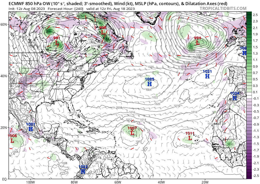
The 12Z GEFS is still another run with strong E US 500 mb ridging late in the run that would open the door especially to Florida to anything that might then exist off the SE US. In fact, this run actually shows 2H and 1TS strike Florida 8/20-1. Bears watching. This would represent a different H5 pattern from the bulk of the summer to date. SFLcane pointed this out yesterday on the GEFS.
1 likes
Personal Forecast Disclaimer:
The posts in this forum are NOT official forecasts and should not be used as such. They are just the opinion of the poster and may or may not be backed by sound meteorological data. They are NOT endorsed by any professional institution or storm2k.org. For official information, please refer to the NHC and NWS products.
The posts in this forum are NOT official forecasts and should not be used as such. They are just the opinion of the poster and may or may not be backed by sound meteorological data. They are NOT endorsed by any professional institution or storm2k.org. For official information, please refer to the NHC and NWS products.
-
SFLcane

- S2K Supporter

- Posts: 10281
- Age: 48
- Joined: Sat Jun 05, 2010 1:44 pm
- Location: Lake Worth Florida
Re: 2023 Global Model Runs Discussion (Out thru day 16)
LarryWx wrote:The 12Z GEFS is still another run with strong E US 500 mb ridging late in the run that would open the door especially to Florida to anything that might then exist off the SE US. In fact, this run actually shows 2H and 1TS strike Florida 8/20-1. Bears watching. This would represent a different H5 pattern from the bulk of the summer to date. SFLcane pointed this out yesterday on the GEFS.
Surely a dangerous pattern for the Conus if there were to be a tc out there.
1 likes
Re: 2023 Global Model Runs Discussion (Out thru day 16)
While the GFS has, indeed, generally been very quiet for it so far this month, this Tweet of NO fantasy hurricanes so far this month isn't accurate:
-7/31 12Z run had a H hit SC 8/16
-8/3 6Z run had a H hit MX/TX border 8/16
-8/6 0Z run had an MDR H 8/18-21
4 likes
Personal Forecast Disclaimer:
The posts in this forum are NOT official forecasts and should not be used as such. They are just the opinion of the poster and may or may not be backed by sound meteorological data. They are NOT endorsed by any professional institution or storm2k.org. For official information, please refer to the NHC and NWS products.
The posts in this forum are NOT official forecasts and should not be used as such. They are just the opinion of the poster and may or may not be backed by sound meteorological data. They are NOT endorsed by any professional institution or storm2k.org. For official information, please refer to the NHC and NWS products.

Re: 2023 Global Model Runs Discussion (Out thru day 16)
I'm in SWFL. Do you think we have a shot from the east in this pattern? I love hurricanes just not the storm surge.
1 likes
-
wxman57

- Moderator-Pro Met

- Posts: 23175
- Age: 68
- Joined: Sat Jun 21, 2003 8:06 pm
- Location: Houston, TX (southwest)
Re: 2023 Global Model Runs Discussion (Out thru day 16)
Ianswfl wrote:
I'm in SWFL. Do you think we have a shot from the east in this pattern? I love hurricanes just not the storm surge.
It's a bad pattern for the NE Caribbean, Bahamas, S. Florida, and the Carolinas. It was fun getting out of school and going through hurricanes in S. Louisiana in the 1960s/1970s. We were far enough inland so that no surge could affect us. However, I've now seen enough hurricanes (and own a home) such that I don't ever want to see one again. A TS with a bit of rain would be nice about now.
8 likes
Re: 2023 Global Model Runs Discussion (Out thru day 16)
wxman57 wrote:Ianswfl wrote:
I'm in SWFL. Do you think we have a shot from the east in this pattern? I love hurricanes just not the storm surge.
It's a bad pattern for the NE Caribbean, Bahamas, S. Florida, and the Carolinas. It was fun getting out of school and going through hurricanes in S. Louisiana in the 1960s/1970s. We were far enough inland so that no surge could affect us. However, I've now seen enough hurricanes (and own a home) such that I don't ever want to see one again. A TS with a bit of rain would be nice about now.
We are dry here on the coast in SWFL too. Btw this dry summer pattern is reminding me a lot of 1998. I live in Punta Gorda now but lived in Naples in the 90s. That summer was dry like this, all the rain inland then we got Georges late Sept. I wonder if this is another late peaking season. Mark Suddith made a good point in his videos about how it seems peak hurricane season is being pushed back a couple weeks due to warming oceans. What is your take? Looks like this pattern might break down and get a strong bermuda high and return to our typical weather, BUT this is also hitting at the right time for long track threats.
With the warm Bahamas waters have to worry about something like an Andrew or Katrina staying weak and then exploding in the Bahamas. If we can get a fast moving system like a Charley from the Caribbean moving up my way things are going to explode fast. Waters 25 miles offshore of Venice are 91 degrees today. Hotter in the Keys.
3 likes
-
Bob R

- S2K Supporter
- Posts: 30
- Age: 74
- Joined: Mon May 30, 2005 5:18 am
- Location: Palm Beach Gardens, Florida
Re: 2023 Global Model Runs Discussion (Out thru day 16)
wxman57 wrote:Ianswfl wrote:
I'm in SWFL. Do you think we have a shot from the east in this pattern? I love hurricanes just not the storm surge.
It's a bad pattern for the NE Caribbean, Bahamas, S. Florida, and the Carolinas. It was fun getting out of school and going through hurricanes in S. Louisiana in the 1960s/1970s. We were far enough inland so that no surge could affect us. However, I've now seen enough hurricanes (and own a home) such that I don't ever want to see one again. A TS with a bit of rain would be nice about now.
I'm not a fan of TS. Francis and Jeanne were TS in 2004 at my location, and I had $60,000 worth of damage not covered by insurance.
1 likes
-
Hypercane_Kyle

- Category 5

- Posts: 3465
- Joined: Sat Mar 07, 2015 7:58 pm
- Location: Cape Canaveral, FL
Re: 2023 Global Model Runs Discussion (Out thru day 16)
Looks like the models are finally seeing some life, as expected this time of year. Euro and GFS both have systems in the long-range.
0 likes
My posts are my own personal opinion, defer to the National Hurricane Center (NHC) and other NOAA products for decision making during hurricane season.

-
cycloneye

- Admin

- Posts: 149708
- Age: 69
- Joined: Thu Oct 10, 2002 10:54 am
- Location: San Juan, Puerto Rico
Re: 2023 Global Model Runs Discussion (Out thru day 16)
12z ICON. Things are slowly heating up in MDR among the models.

1 likes
Visit the Caribbean-Central America Weather Thread where you can find at first post web cams,radars
and observations from Caribbean basin members Click Here
and observations from Caribbean basin members Click Here
-
SFLcane
- S2K Supporter
- Posts: 10281
- Age: 48
- Joined: Sat Jun 05, 2010 1:44 pm
- Location: Lake Worth Florida
Re: 2023 Global Model Runs Discussion (Out thru day 16)
cycloneye wrote:12z ICON. Things are slowly heating up in MDR among the models.
https://i.imgur.com/MSTBhy5.gif
0 likes
-
AutoPenalti
- Category 5
- Posts: 4091
- Age: 29
- Joined: Mon Aug 17, 2015 4:16 pm
- Location: Ft. Lauderdale, Florida
Re: 2023 Global Model Runs Discussion (Out thru day 16)
cycloneye wrote:12z ICON. Things are slowly heating up in MDR among the models.
https://i.imgur.com/MSTBhy5.gif
That is a massive wave.
0 likes
The posts in this forum are NOT official forecasts and should not be used as such. They are just the opinion of the poster and may or may not be backed by sound meteorological data. They are NOT endorsed by any professional institution or STORM2K. For official information, please refer to products from the NHC and NWS.
Model Runs Cheat Sheet:
GFS (5:30 AM/PM, 11:30 AM/PM)
HWRF, GFDL, UKMET, NAVGEM (6:30-8:00 AM/PM, 12:30-2:00 AM/PM)
ECMWF (1:45 AM/PM)
TCVN is a weighted averaged
Re: 2023 Global Model Runs Discussion (Out thru day 16)
AutoPenalti wrote:cycloneye wrote:12z ICON. Things are slowly heating up in MDR among the models.
https://i.imgur.com/MSTBhy5.gif
That is a massive wave.
12z canadian has this also.
0 likes
Re: 2023 Global Model Runs Discussion (Out thru day 16)
Euro, CMC and Icon all show something in the MDR in day 7-10 range. When the GFS is an outlier, don't trust it.
0 likes
-
gatorcane

- S2K Supporter
- Posts: 23708
- Age: 48
- Joined: Sun Mar 13, 2005 3:54 pm
- Location: Boca Raton, FL
Re: 2023 Global Model Runs Discussion (Out thru day 16)
The GFS only has EPAC development, nothing in the Altantic through the next 10 days. The wave some of the other models are developing is exiting Africa on that image:

0 likes
-
AutoPenalti
- Category 5
- Posts: 4091
- Age: 29
- Joined: Mon Aug 17, 2015 4:16 pm
- Location: Ft. Lauderdale, Florida
Re: 2023 Global Model Runs Discussion (Out thru day 16)
gatorcane wrote:The GFS only has EPAC development, nothing in the Altantic through the next 10 days. The wave some of the other models are developing is exiting Africa on that image:
https://i.postimg.cc/26fFwBB7/gfs-mslp-pcpn-atl-28.png
GFS seems like the more realistic scenario here, but it's also over estimating the amount of dry air in the MDR.
0 likes
The posts in this forum are NOT official forecasts and should not be used as such. They are just the opinion of the poster and may or may not be backed by sound meteorological data. They are NOT endorsed by any professional institution or STORM2K. For official information, please refer to products from the NHC and NWS.
Model Runs Cheat Sheet:
GFS (5:30 AM/PM, 11:30 AM/PM)
HWRF, GFDL, UKMET, NAVGEM (6:30-8:00 AM/PM, 12:30-2:00 AM/PM)
ECMWF (1:45 AM/PM)
TCVN is a weighted averaged
-
wxman57
- Moderator-Pro Met
- Posts: 23175
- Age: 68
- Joined: Sat Jun 21, 2003 8:06 pm
- Location: Houston, TX (southwest)
Re: 2023 Global Model Runs Discussion (Out thru day 16)
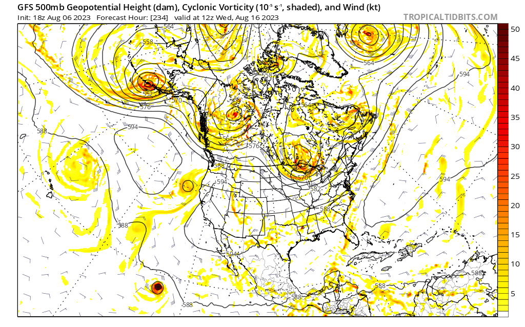
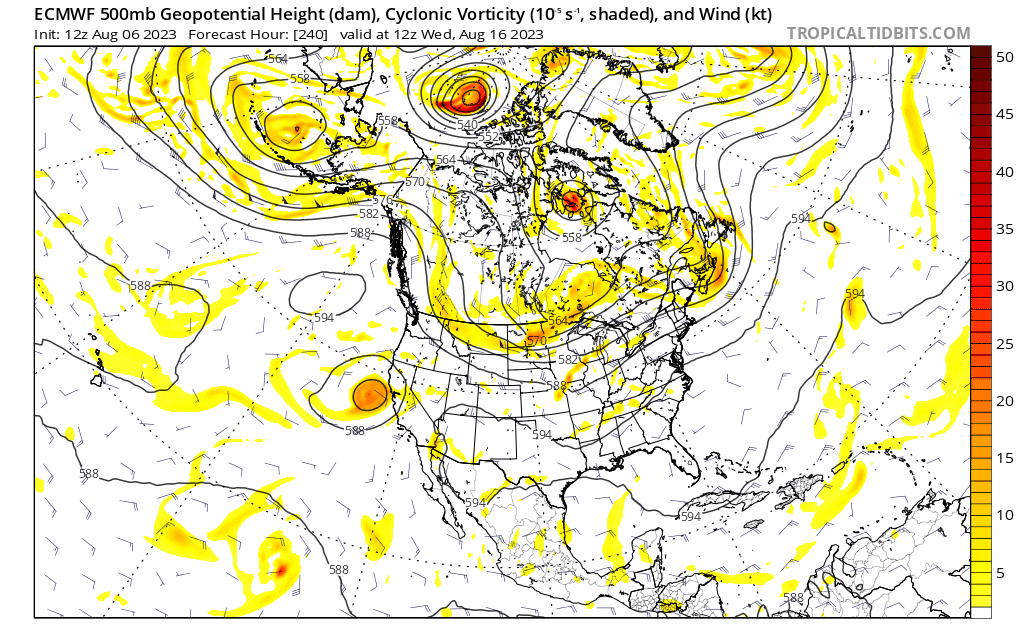
Here's something fun to do with the GFS. Set it on the North America region (Tropical Tidbits), go to upper-level and set it to Z500, Vort, and wind. Now go out about 10 days then at the bottom, click the arrow to look at the previous run. Now, Notice that every single run has a completely different 500mb pattern across the U.S. The pattern should be somewhat similar from run to run.
8 likes
-
rickcorvin
- Tropical Low

- Posts: 10
- Joined: Wed Jun 03, 2020 7:12 am
Re: 2023 Global Model Runs Discussion (Out thru day 16)
That is a fun thing to do! I used the Trend GIF button to compare GFS and Euro runs on the same date. This is less than 10 days out because the Euro only goes out 10 days (at least on Tropical Tidbits).wxman57 wrote:Here's something fun to do with the GFS. Set it on the North America region (Tropical Tidbits), go to upper-level and set it to Z500, Vort, and wind. Now go out about 10 days then at the bottom, click the arrow to look at the previous run. Now, Notice that every single run has a completely different 500mb pattern across the U.S. The pattern should be somewhat similar from run to run.
GFS, valid at 12z August 16:
Euro, valid at 12z August 16:
0 likes
-
Spacecoast

- Category 2

- Posts: 773
- Joined: Thu Aug 31, 2017 2:03 pm

Who is online
Users browsing this forum: No registered users and 227 guests