

TheStormExpert wrote::uarrow: 2006 wasn't a Modoki El Niño, or was it?
2006 was not a modoki during it's lifetime
Moderator: S2k Moderators

TheStormExpert wrote::uarrow: 2006 wasn't a Modoki El Niño, or was it?


TheStormExpert wrote::uarrow: 2006 wasn't a Modoki El Niño, or was it?


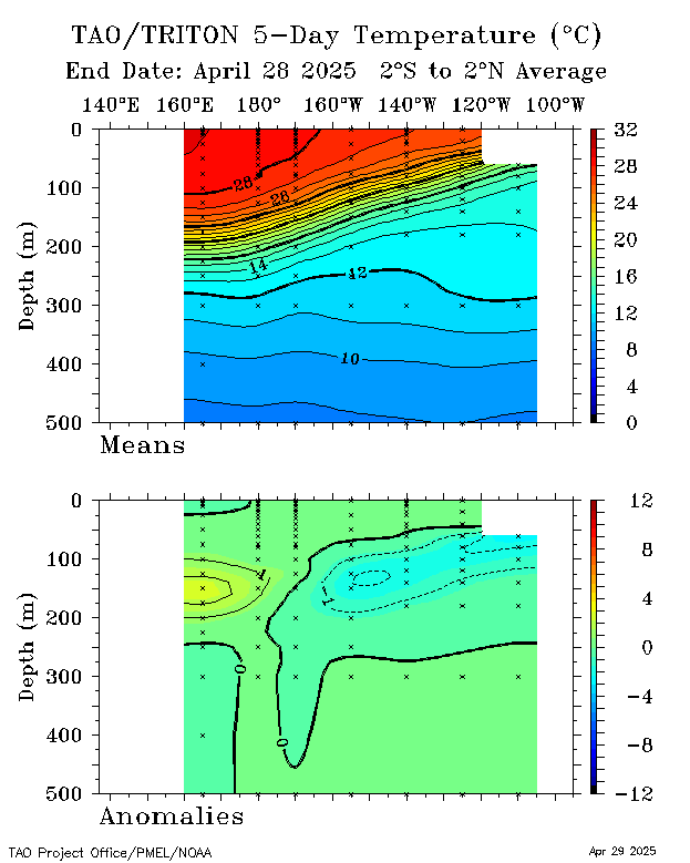
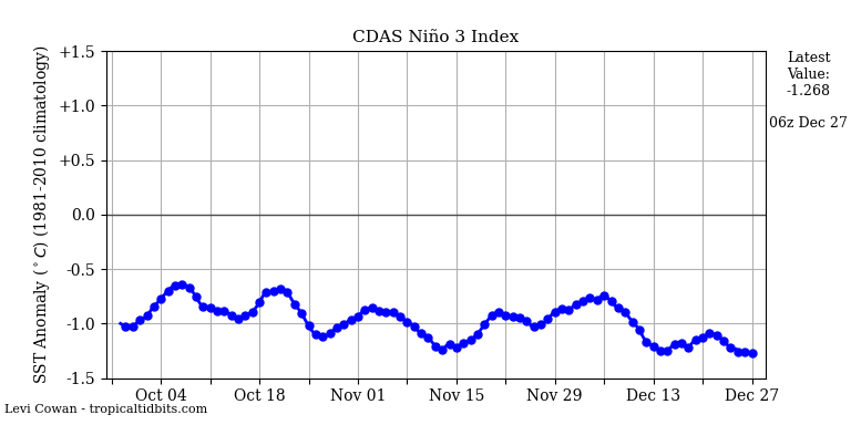
NDG wrote:Big time cool down this week for Niño 1+2 & Niño 3 if CDAS is correct.
http://www.tropicaltidbits.com/analysis ... obal_1.png


Kazmit_ wrote:What a drop.

Kingarabian wrote:Kazmit_ wrote:What a drop.
.com/m83gwj.png[/img]
I'm not seeing glaring cool anomalies at the subsurface of 1+2 and the other Nino regions, and the easterlies have yet to reach these regions. So I'm not sure if these drops hold any water.

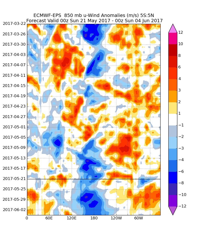
weathaguyry wrote:Could those winds support warming in the Atlantic?
NDG wrote:NDG wrote:Kingarabian wrote:
Good to see you posting on here again Larry.
As we get out of MJO phase 2 and into phase 3, I think we'll see the SOI flip back negative by this weekend.
Before it flips back to negative wouldn't the MJO have to get to at least phase 4 if not phase 5?
Edit: More like phase 5 if not phase 6.
As I thought, it will take a little while longer for the SOI to go back to negative, at least another 7-10 days if the Euro is correct with its MJO forecast.
20 May 2017 1013.29 1009.50 17.33 -3.18


LarryWx wrote:weathaguyry wrote:Could those winds support warming in the Atlantic?
Those strong trade winds aren't directly related to the Atlantic. (I suppose, however, that this could POSSIBLY have an indirect significant effect on the Atlantic.)
weathaguyry wrote:LarryWx wrote:weathaguyry wrote:Could those winds support warming in the Atlantic?
Those strong trade winds aren't directly related to the Atlantic. (I suppose, however, that this could POSSIBLY have an indirect significant effect on the Atlantic.)
Sorry, I wasn't being clear enough, I meant that patch of Orange and Red east of 60W, is that the type of wind that promotes warming?


