Possible Gulf System next week (Is invest 94L)

This is the general tropical discussion area. Anyone can take their shot at predicting a storms path.

Moderator: S2k Moderators

Forum rules

The posts in this forum are NOT official forecasts and should not be used as such. They are just the opinion of the poster and may or may not be backed by sound meteorological data. They are NOT endorsed by any professional institution or STORM2K. For official information, please refer to products from the National Hurricane Center and National Weather Service.

Help Support Storm2K
Message
Author
User avatar
ROCK
Category 5
Category 5
Posts: 9484
Age: 54
Joined: Tue Aug 17, 2004 7:30 am
Location: Kemah, Texas

Re: Possible Gulf System next week

#81 Postby ROCK » Sun Aug 08, 2010 1:15 am

AJC3 wrote:
ROCK wrote:If the UKMET sends it that far south more time for the ridge to build and more west. If its crosses Tampa ala CMC then NO seems a good bet....


EDIT the 12Z EURO is into Western LA to TX/LA border..crosses Miami area ala Katrina works its way under LA then inland then makes a circle ala IVAN.....nice... :lol:

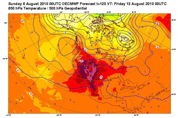
http://www.ecmwf.int/products/forecasts ... 712!!step/


At H72, the 00Z NAM, GFS, and UKM, as well as the 12Z ECM are all in pretty much the same place with the surface-H85 low centers (roughly near 27N 85.5W). Apart from the NAM's 1003MB, they're showing a MCP between 1008 and 1010MB. The UKM is about a degree (~60mi) father south with the H50 low than the ECM, and about 2 degs (120mi) than the GFS.

There's almost no doubt that a surface low will form as the mid to upper low east of FL retrogrades westward over the state. Interestingly enough, we will likely see a boatload of convection over the FL peninsula the next two afternoons, which will release a bunch of latent heat in the general area of where the surface low is forecast to form.


which sucks as I have a plane to catch into Miami tomorrow night and fly back Monday morning......wonderful
0 likes   

User avatar
Steve
S2K Supporter
S2K Supporter
Posts: 9620
Joined: Sat Apr 05, 2003 11:41 pm
Location: Not a state-caster

Re: Possible Gulf System next week

#82 Postby Steve » Sun Aug 08, 2010 1:20 am

Based on the GFS & CMC (shown on current WV and IR loops), I think the upper feature the models are tracking is the upper low currently spinning in the Bahamas. The surface feature looks to originate out of the boundary across FL and in the SW Atlantic.
Last edited by Steve on Sun Aug 08, 2010 1:33 am, edited 1 time in total.
0 likes   

StormClouds63
Category 2
Category 2
Posts: 583
Age: 62
Joined: Tue May 13, 2008 11:56 am
Location: Southwest Louisiana

Re: Possible Gulf System next week

#83 Postby StormClouds63 » Sun Aug 08, 2010 1:23 am

From the Lake Charles NWS Discussion earlier this afternoon. Looks like a wait-and-see scenario:

EXTENDED GUIDANCE HAS DIFFERENCES IN HANDLING INVERTED
TROF/EASTERLY WAVE THAT WILL MOVE AROUND THE UPPER RIDGE LATER IN THE WEEK. TIMING FOR THIS FEATURE NEARING THE FORECAST AREA LOOKS LIKE THURSDAY NOW. STRENGTH OF THIS FEATURE IS ALSO NOT HANDLED WELL AT THIS TIME. WILL JUST MENTION CHANCE POPS...WITH A SLIGHT LOWERING OF THE HIGH TEMPERATURES FROM THURSDAY INTO NEXT WEEKEND...AND SEE HOW LATER MODEL RUNS HANDLE THE EVOLUTION OF THIS FEATURE.
0 likes   

Wx_Warrior
Category 5
Category 5
Posts: 2718
Joined: Thu Aug 03, 2006 3:58 pm
Location: Beaumont, TX

Re: Possible Gulf System next week

#84 Postby Wx_Warrior » Sun Aug 08, 2010 2:05 am

0z EURO very weak.....SETX/SWLA

Image
0 likes   

SETXWXLADY
Tropical Storm
Tropical Storm
Posts: 216
Joined: Wed May 20, 2009 3:26 pm
Location: SE TX Orange County

Re: Possible Gulf System next week

#85 Postby SETXWXLADY » Sun Aug 08, 2010 3:15 am

Wx_Warrior wrote:0z EURO very weak.....SETX/SWLA

Image


From Houston NWS

NAM DEVELOPS A DISTINCT SURFACE LOW PRESSURE AREA IN THE NORTHERN
GULF AND PUSHES IT OFF TO THE WEST TOWARDS THE LA AND UPPER TEXAS
COAST BY THE MIDDLE OF THE WEEK. WILL HAVE TO KEEP AN EYE OUT IF
THIS FEATURE DOES IN FACT DEVELOP AS IT WOULD HAVE AN IMPACT ON
POPS DURING THAT TIME PERIOD.
FOR NOW WILL STICK WITH ISOLATED
DEVELOPMENT ASSOCIATED WITH SEABREEZE CIRCULATION MAINLY DURING
THE NEXT SEVERAL AFTERNOONS. OTHERWISE HOT AND HUMID CONDITIONS
WILL BE THE NORM AS HIGH PRESSURE RIDGE REMAINS IN CONTROL ACROSS
THE CENTRAL U.S.

From New Orleans NWS

HEADING INTO NEXT WEEK...THE BROAD AREA
OF HIGH PRESSURE WILL SHIFT MORE TOWARD THE CENTRAL GULF OF
MEXICO...AS A WEAK AREA OF LOW PRESSURE DEVELOPS ALONG A WASHED OUT
FRONTAL BOUNDARY OVER SOUTHERN FLORIDA. THIS LOW WILL THEN SLIDE TO
THE WEST BENEATH A STRONG MID-UPPER LEVEL RIDGE CENTERED OVER THE
MID-SOUTH. THIS WEAK AND BROAD AREA OF LOW PRESSURE WILL TRACK
THROUGH THE EASTERN GULF AND INTO THE NORTHERN GULF OF MEXICO BY
WEDNESDAY. WINDS WILL TURN EASTERLY ON MONDAY AND REMAIN SO THROUGH
WEDNESDAY. THESE WINDS SHOULD ALSO INCREASE TO AROUND 10-15 KNOTS
AS THE PRESSURE GRADIENT BETWEEN THE LOW AND A HIGH OVER THE
SOUTHEAST GROWS. AS THE LOW PASSES TO THE WEST AND MOVES TOWARD
TEXAS...WINDS WILL TURN BACK TO THE SOUTHWEST. HOWEVER...A DECENT
GRADIENT BETWEEN THE LOW AND THE OTHER RIDGE OVER THE CENTRAL GULF
WILL KEEP WINDS UP AROUND 10-15 KNOTS THROUGH THE END OF THE
WORKWEEK. SEAS WILL RISE TO AROUND 2 TO 3 FEET DUE TO THESE
PROLONGED 10-15 KNOT WINDS. 32
0 likes   

User avatar
DTWright
Tropical Low
Tropical Low
Posts: 37
Age: 65
Joined: Sun Jun 27, 2010 4:48 pm
Location: ( AKA Sabanic ) Mobile, AL
Contact:

Re: Possible Gulf System next week

#86 Postby DTWright » Sun Aug 08, 2010 5:52 am

From Mobile NWS this morning . . . .

.MARINE...SURFACE HIGH PRESSURE OVER THE GULF OF MEXICO WILL PERSIST
INTO TONIGHT...THEN GRADUALLY WEAKEN ON MONDAY AS A WEAK TROF/FRONT
DRIFTS SOUTH INTO THE NORTHEASTERN GULF. MODELS (GFS, ECMWF, NAM)
ARE THEN ALL IN FAIRLY GOOD AGREEMENT IN DEVELOPING AN AREA OF LOW
PRESSURE ALONG OR JUST SOUTH OF THIS FRONTAL BOUNDARY OVER THE
EASTERN GULF BY 12Z TUESDAY. THE GFS AND ECMWF BOTH MOVE THE LOW UP
TOWARD THE MOUTH OF THE MISSISSIPPI RIVER BY AROUND 00Z
THURSDAY...WHILE THE NAM POSITIONS IT OFFSHORE SOUTH OF THE MOUTH
OF THE MISSISSIPPI RIVER BY A HUNDRED MILES OR SO BY 00Z THURSDAY
.
WILL HAVE TO KEEP AN EYE ON THIS AS THIS TYPE OF LOW CAN SOMETIMES
ACQUIRE TROPICAL CHARACTERISTICS.
REGARDLESS OF WHETHER THE LOW
BECOMES TROPICAL OR NOT...EXPECT AN INCREASING EASTERLY FLOW ALONG
WITH BUILDING SEAS TUESDAY AND WEDNESDAY AS THE DISTURBANCE MOVES
SOUTH OF THE MARINE AREA. BY THURSDAY...WINDS WILL LIKELY DECREASE
SLIGHTLY...BUT WILL LIKELY BE MORE SOUTHERLY AS THE LOW PASSES OFF
TO OUR WEST. SCATTERED SHOWERS AND THUNDERSTORMS ARE ALSO EXPECTED
TO CONTINUE OVER THE MARINE AREA THROUGH MOST OF THIS
WEEK...BECOMING NUMEROUS AT TIMES ON WEDNESDAY WITH THE PASSAGE OF
THE LOW PRESSURE TO THE SOUTH OF THE MARINE AREA. 12/DWS
0 likes   

User avatar
ronjon
Category 5
Category 5
Posts: 4822
Joined: Fri Aug 19, 2005 5:17 pm
Location: Hernando Beach, FL

Re: Possible Gulf System next week

#87 Postby ronjon » Sun Aug 08, 2010 6:17 am

06Z NAM:

Image
0 likes   

User avatar
ronjon
Category 5
Category 5
Posts: 4822
Joined: Fri Aug 19, 2005 5:17 pm
Location: Hernando Beach, FL

Re: Possible Gulf System next week

#88 Postby ronjon » Sun Aug 08, 2010 6:46 am

0 likes   

User avatar
Flakeys
Tropical Depression
Tropical Depression
Posts: 75
Age: 66
Joined: Fri Jul 22, 2005 4:34 pm
Location: Homosassa, Fl.
Contact:

Re: Possible Gulf System next week

#89 Postby Flakeys » Sun Aug 08, 2010 9:01 am

Here in Citrus County we've been getting tropical downpours all night and this morning. Water temps at the beach are almost 90.
0 likes   

User avatar
HURAKAN
Professional-Met
Professional-Met
Posts: 46086
Age: 38
Joined: Thu May 20, 2004 4:34 pm
Location: Key West, FL
Contact:

#90 Postby HURAKAN » Sun Aug 08, 2010 9:03 am

Image

Latest
0 likes   

User avatar
cycloneye
Admin
Admin
Posts: 145276
Age: 68
Joined: Thu Oct 10, 2002 10:54 am
Location: San Juan, Puerto Rico

Re: Possible Gulf System next week (Is Invest 94L)

#91 Postby cycloneye » Sun Aug 08, 2010 9:26 am

Is invest 94L so the thread is closed. Go to Active Storms forum to continue the discussions.
0 likes   
Visit the Caribbean-Central America Weather Thread where you can find at first post web cams,radars
and observations from Caribbean basin members Click Here


Return to “Talkin' Tropics”

Who is online

Users browsing this forum: LadyBug72 and 43 guests