AREA FORECAST DISCUSSION
NATIONAL WEATHER SERVICE SAN JUAN PR
254 PM AST FRI JUL 27 2012
MODELS SEEM TO HAVE TRENDED FASTER WITH SECOND TROPICAL WAVE
CURRENTLY ALONG 40W. ASSOCIATED WEATHER LOOKS TO ARRIVE BY
DAYBREAK MON ACROSS THE EAST...USVI AND ANEGADA PASSAGE. TC
DEVELOPMENT IS NOT EXPECTED BUT REGARDLESS OF DEVELOPMENT...WAVE
WILL BRING VERY ACTIVE WEATHER MON-TUE WITH HEAVY RAIN POTENTIAL.
DEEP MOISTURE LINGERS FOR SVRL DAYS AFTER WAVE PASSAGE WITH WET
PATTERN EXPECTED TO PERSIST THRU FRI WITH SIG IMPROVEMENT TO THE
WX EXPECTED BY NEXT WEEKEND.
Tropical Wave in Central Caribbean
Moderator: S2k Moderators
Forum rules

The posts in this forum are NOT official forecasts and should not be used as such. They are just the opinion of the poster and may or may not be backed by sound meteorological data. They are NOT endorsed by any professional institution or STORM2K. For official information, please refer to products from the National Hurricane Center and National Weather Service.
-
cycloneye

- Admin

- Posts: 148730
- Age: 69
- Joined: Thu Oct 10, 2002 10:54 am
- Location: San Juan, Puerto Rico
Re: High Amplitude Wave (Pouch 07L) East of Lesser Antilles
0 likes
Visit the Caribbean-Central America Weather Thread where you can find at first post web cams,radars
and observations from Caribbean basin members Click Here
and observations from Caribbean basin members Click Here
-
Blown Away

- S2K Supporter

- Posts: 10253
- Joined: Wed May 26, 2004 6:17 am
Re: High Amplitude Wave (Pouch 07L) East of Lesser Antilles
12z Euro seems to bring a weak storm to SFL and GFS keeps 07L as a wave as it continues to move it over all the big islands. Still think this wave could develop if it can miss the big island mountains.
http://raleighwx.americanwx.com/models/ ... _loop.html
http://raleighwx.americanwx.com/models/ ... _loop.html
0 likes
Hurricane Eye Experience: David 79, Irene 99, Frances 04, Jeanne 04, Wilma 05… Hurricane Brush Experience: Andrew 92, Erin 95, Floyd 99, Matthew 16, Irma 17, Ian 22, Nicole 22…
-
floridasun78
- Category 5

- Posts: 3755
- Joined: Sun May 17, 2009 10:16 pm
- Location: miami fl
Re: High Amplitude Wave (Pouch 07L) East of Lesser Antilles
my question is models picking up afica dust well? because you can see dry air front of it
0 likes

Re: High Amplitude Wave (Pouch 07L) East of Lesser Antilles
Blown Away wrote:12z Euro seems to bring a weak storm to SFL and GFS keeps 07L as a wave as it continues to move it over all the big islands. Still think this wave could develop if it can miss the big island mountains.
http://raleighwx.americanwx.com/models/ ... _loop.html
This ECMWF run shows that it will be an open strong wave with a good vorticity, not a weak storm.
0 likes
-
Blown Away
- S2K Supporter
- Posts: 10253
- Joined: Wed May 26, 2004 6:17 am
Re: High Amplitude Wave (Pouch 07L) East of Lesser Antilles
Amazing how consistent the GFS/Euro have been moving this wave over PR, DR, and Cuba and pushing it towards SFL/SE GOM area. 18z GFS no different, keeps this system as a strong wave and interacts w/ all the big islands, does appear like the low wants to deepen as it nears the tip of Florida. 18z GFS has a second system that develops into a weak storm then gets torn apart following the same track as Pouch 07 over the big islands, but does end up moving into the central Gulf coast. America's heartland could use a tropical system bringing some rain!!
http://raleighwx.americanwx.com/models/ ... SLoop.html
Little blow up of convection from our wave, let's see if it can sustain??

http://www.ssd.noaa.gov/goes/east/tatl/loop-avn.html
 http://www.ssd.noaa.gov/goes/east/tatl/loop-wv.html
Fighting dry air for sure.
http://www.ssd.noaa.gov/goes/east/tatl/loop-wv.html
http://raleighwx.americanwx.com/models/ ... SLoop.html
Little blow up of convection from our wave, let's see if it can sustain??
http://www.ssd.noaa.gov/goes/east/tatl/loop-avn.html
http://www.ssd.noaa.gov/goes/east/tatl/loop-wv.htmlFighting dry air for sure.
http://www.ssd.noaa.gov/goes/east/tatl/loop-wv.html
Last edited by Blown Away on Fri Jul 27, 2012 7:35 pm, edited 3 times in total.
0 likes
Hurricane Eye Experience: David 79, Irene 99, Frances 04, Jeanne 04, Wilma 05… Hurricane Brush Experience: Andrew 92, Erin 95, Floyd 99, Matthew 16, Irma 17, Ian 22, Nicole 22…
-
Aric Dunn
- Category 5
- Posts: 21238
- Age: 43
- Joined: Sun Sep 19, 2004 9:58 pm
- Location: Ready for the Chase.
- Contact:
Thats a sign there is increasing convergence. it will likely collapse and rebuild many times until the mid levels dry air/ sal improve from the convection.
0 likes
Note: If I make a post that is brief. Please refer back to previous posts for the analysis or reasoning. I do not re-write/qoute what my initial post said each time.
If there is nothing before... then just ask
Space & Atmospheric Physicist, Embry-Riddle Aeronautical University,
I believe the sky is falling...
If there is nothing before... then just ask
Space & Atmospheric Physicist, Embry-Riddle Aeronautical University,
I believe the sky is falling...
-
Blown Away
- S2K Supporter
- Posts: 10253
- Joined: Wed May 26, 2004 6:17 am
Re: High Amplitude Wave (Pouch 07L) East of Lesser Antilles
12z Nogaps likes Pouch 07 and has it go over PR and miss the big islands just to the North and deepens the low in the SE Bahamas.
http://raleighwx.americanwx.com/models/ ... sLoop.html
http://raleighwx.americanwx.com/models/ ... sLoop.html
0 likes
Hurricane Eye Experience: David 79, Irene 99, Frances 04, Jeanne 04, Wilma 05… Hurricane Brush Experience: Andrew 92, Erin 95, Floyd 99, Matthew 16, Irma 17, Ian 22, Nicole 22…
This is the largest TW in size so far this season, IMO, though it lacks convection it has a good structure, it just needs to get into a better environment, and if it can end up north of the greater Antilles, it will raise our eyebrows up.
http://tropic.ssec.wisc.edu/real-time/m ... t72hrs.gif
http://tropic.ssec.wisc.edu/real-time/m ... t72hrs.gif
0 likes
-
Blown Away
- S2K Supporter
- Posts: 10253
- Joined: Wed May 26, 2004 6:17 am
Re: High Amplitude Wave (Pouch 07L) East of Lesser Antilles
I know it's Nogaps, but the 12z run goes WNW over PR and misses the big islands then seems to find better conditions and begins to deepen at the end of the run. Also, Nogaps likes our next wave in the Central Atlantic! 

0 likes
Hurricane Eye Experience: David 79, Irene 99, Frances 04, Jeanne 04, Wilma 05… Hurricane Brush Experience: Andrew 92, Erin 95, Floyd 99, Matthew 16, Irma 17, Ian 22, Nicole 22…
-
cycloneye
- Admin
- Posts: 148730
- Age: 69
- Joined: Thu Oct 10, 2002 10:54 am
- Location: San Juan, Puerto Rico
Re: High Amplitude Wave (Pouch 07L) East of Lesser Antilles
Aric,if convection persists they may tag it.
0 likes
Visit the Caribbean-Central America Weather Thread where you can find at first post web cams,radars
and observations from Caribbean basin members Click Here
and observations from Caribbean basin members Click Here
-
Blown Away
- S2K Supporter
- Posts: 10253
- Joined: Wed May 26, 2004 6:17 am
Re: High Amplitude Wave (Pouch 07L) East of Lesser Antilles

JB still watching and tweeting about our wave.
Last edited by Blown Away on Fri Jul 27, 2012 7:54 pm, edited 1 time in total.
0 likes
Hurricane Eye Experience: David 79, Irene 99, Frances 04, Jeanne 04, Wilma 05… Hurricane Brush Experience: Andrew 92, Erin 95, Floyd 99, Matthew 16, Irma 17, Ian 22, Nicole 22…
-
Aric Dunn
- Category 5
- Posts: 21238
- Age: 43
- Joined: Sun Sep 19, 2004 9:58 pm
- Location: Ready for the Chase.
- Contact:
Yeah if convection can build enough tonight and maintain at least somewhat intact they might tag it tomorrow morning. then given its current structure it would not take to long to organize at the surface.
0 likes
Note: If I make a post that is brief. Please refer back to previous posts for the analysis or reasoning. I do not re-write/qoute what my initial post said each time.
If there is nothing before... then just ask
Space & Atmospheric Physicist, Embry-Riddle Aeronautical University,
I believe the sky is falling...
If there is nothing before... then just ask
Space & Atmospheric Physicist, Embry-Riddle Aeronautical University,
I believe the sky is falling...
-
SFLcane

- S2K Supporter
- Posts: 10281
- Age: 48
- Joined: Sat Jun 05, 2010 1:44 pm
- Location: Lake Worth Florida
Re: High Amplitude Wave (Pouch 07L) East of Lesser Antilles
Dont really see this large TW doing much with all this dry/stable air just about everywere.
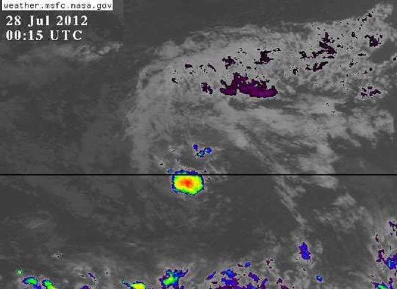
Great loop here shows some increase t-storms this evening. http://hoot.metr.ou.edu/satellite/GOES-E/Trop/IR
Great loop here shows some increase t-storms this evening. http://hoot.metr.ou.edu/satellite/GOES-E/Trop/IR
0 likes
-
Fego

- S2K Supporter
- Posts: 767
- Age: 65
- Joined: Sun Apr 18, 2004 7:58 pm
- Location: San Juan, Puerto Rico
- Contact:
Re: High Amplitude Wave (Pouch 07L) East of Lesser Antilles
http://rammb.cira.colostate.edu/ramsdis ... _floater_1
RAMDIS shows a very clear an updated loop of this tropical wave. Looking at it, no wonder the 8:00pm TWD mention again that it has a llc.
RAMDIS shows a very clear an updated loop of this tropical wave. Looking at it, no wonder the 8:00pm TWD mention again that it has a llc.
0 likes
Go Giants! Go Niners! Go Warriors!
-
Fego
- S2K Supporter
- Posts: 767
- Age: 65
- Joined: Sun Apr 18, 2004 7:58 pm
- Location: San Juan, Puerto Rico
- Contact:
Re: High Amplitude Wave (Pouch 07L) East of Lesser Antilles
SFLcane wrote:Dont really see this large TW doing much with all this dry/stable air just about everywere.
Great loop here shows some increase t-storms this evening. http://hoot.metr.ou.edu/satellite/GOES-E/Trop/IR
That's a very good loop. Look how some clouds begin to grow in the upper left side around the new convection.
0 likes
Go Giants! Go Niners! Go Warriors!
-
USTropics
- Professional-Met

- Posts: 2734
- Joined: Sun Aug 12, 2007 3:45 am
- Location: Florida State University
Re:
Hurricane Andrew wrote:What's a high-amplitude wave?
In essence a high amplitude wave has an enhanced structural presence, with a sharper, well-defined, and more elongated wave axis. Typically a high amplitude wave will have an enhanced moisture envelope that accompanies it. When observing a high amplitude wave from satellite images, distinct inverted V patterns in the cloud formation are evident. Contrary to this would be a low amplitude wave, which is structurally weak, typically void of any moisture, and can be difficult to discern on satellite.
Easterly waves start out as small amplitude waves, producing only mild rain showers during their conception. As these waves traverse over Africa and emerge off the coast, high-altitude winds will aid in amplifying the waves when atmospheric conditions are favorable (i.e. at certain locations in the easterly wave, wind speeds up or slows down causing stretching (divergence) or piling up (convergence) of the air parcels in the wave), forming powerful thunderstorms and gale force winds.

0 likes
-
christchurchguy
- Tropical Low

- Posts: 43
- Joined: Sat Sep 19, 2009 10:31 am
Re: High Amplitude Wave (Pouch 07L) East of Lesser Antilles
It seems to be moving quite fast
0 likes

Re: High Amplitude Wave (Pouch 07L) East of Lesser Antilles
I see the LLC but its got a rough road ahead with all the stable air around it.
0 likes
-
floridasun78
- Category 5
- Posts: 3755
- Joined: Sun May 17, 2009 10:16 pm
- Location: miami fl
Re: High Amplitude Wave (Pouch 07L) East of Lesser Antilles
but models are picking on this area to get invest upgrade soon
0 likes
Who is online
Users browsing this forum: Google Adsense [Bot] and 86 guests