Development off SE U.S coast?
Moderator: S2k Moderators
Forum rules

The posts in this forum are NOT official forecasts and should not be used as such. They are just the opinion of the poster and may or may not be backed by sound meteorological data. They are NOT endorsed by any professional institution or STORM2K. For official information, please refer to products from the National Hurricane Center and National Weather Service.

Re: Development off SE U.S coast?
I might be speaking too soon, but I doubt it, but the Euro proved the be the too aggressive model compared tithe GFS. Good job by the GFS.
I doubt much will come out of this, there is still too much northerly shear with dry air pushing in with no UL divergence present.
I doubt much will come out of this, there is still too much northerly shear with dry air pushing in with no UL divergence present.

0 likes
-
TheStormExpert
-
wxman57

- Moderator-Pro Met

- Posts: 23175
- Age: 68
- Joined: Sat Jun 21, 2003 8:06 pm
- Location: Houston, TX (southwest)
Re: Development off SE U.S coast?
I still think there's a good chance "Danny" will form this week. 00Z Euro has it developing off the East U.S. Coast in a couple of days and heading past Bermuda and out to sea. It's a 40kt TS NE of Bermuda on Wednesday evening. There's a larger are of 35 & 40kt winds as it approaches Newfoundland on Friday.


0 likes
-
OuterBanker
- S2K Supporter

- Posts: 1761
- Joined: Wed Feb 26, 2003 10:53 am
- Location: Nags Head, NC
- Contact:
Re: Development off SE U.S coast?
To tie what Hammy and wxman said. The 0z European sendstyle a weak system OTS near Bermuda then after that it sends a elongated low along the seus coast. In other words it shifted back east and along coast as it did several days ago but considerably weaker.
0 likes
Based on wishy washy model runs, it being a strong El Niño, and the end of July still being pretty quiet climowise (though not as quiet as earlier in July), my educated guess is that no named storm forms before July ends. Aside: July is already above average for a strong Niño with one named storm. Many have had zero. 1997's July was a major anomaly.
Last edited by LarryWx on Sun Jul 26, 2015 10:32 am, edited 1 time in total.
0 likes
Personal Forecast Disclaimer:
The posts in this forum are NOT official forecasts and should not be used as such. They are just the opinion of the poster and may or may not be backed by sound meteorological data. They are NOT endorsed by any professional institution or storm2k.org. For official information, please refer to the NHC and NWS products.
The posts in this forum are NOT official forecasts and should not be used as such. They are just the opinion of the poster and may or may not be backed by sound meteorological data. They are NOT endorsed by any professional institution or storm2k.org. For official information, please refer to the NHC and NWS products.
-
wxman57
- Moderator-Pro Met
- Posts: 23175
- Age: 68
- Joined: Sat Jun 21, 2003 8:06 pm
- Location: Houston, TX (southwest)
Re: Development off SE U.S coast?
El Nino is not a factor in the subtropics, nor is it much of a factor in the Gulf of Mexico. El Nino's impact is mostly in the deep tropics.
0 likes
Re: Development off SE U.S coast?
wxman57 wrote:El Nino is not a factor in the subtropics, nor is it much of a factor in the Gulf of Mexico. El Nino's impact is mostly in the deep tropics.
Wxman,
Regarding the Gulf, I don't entirely agree once past June. If you look back at past El Nino (especially nonweak) seasons once past June, Gulf activity is reduced on average quite a bit in terms of the number of major Gulf hurricanes and the number of seasons with more than one Gulf hurricane. I've analyzed the historical stats to discover this. OTOH, June activity, itself, has been enhanced on average.
July of 1997 was a major anomaly. I don't count 1983 as El Niño.
Last edited by LarryWx on Sun Jul 26, 2015 10:44 am, edited 5 times in total.
0 likes
Personal Forecast Disclaimer:
The posts in this forum are NOT official forecasts and should not be used as such. They are just the opinion of the poster and may or may not be backed by sound meteorological data. They are NOT endorsed by any professional institution or storm2k.org. For official information, please refer to the NHC and NWS products.
The posts in this forum are NOT official forecasts and should not be used as such. They are just the opinion of the poster and may or may not be backed by sound meteorological data. They are NOT endorsed by any professional institution or storm2k.org. For official information, please refer to the NHC and NWS products.
-
TheStormExpert


Re: Development off SE U.S coast?
wxman57 wrote:El Nino is not a factor in the subtropics, nor is it much of a factor in the Gulf of Mexico. El Nino's impact is mostly in the deep tropics.
I don't know about statistics of it, I'm sure you and Larry has input on that. One question though, of course you cannot associated El Nino with everything/or lack of on a smaller scale for different areas as it is a longer term background influence. My question is, the background state though does decrease the odds of tropical waves that survive the trip into the subtropics and/or gulf. Would that be a factor in reduction? At this point we still haven't really seen anything survive even in weakened state. Everything has been local convection.
0 likes
The above post and any post by Ntxw is NOT an official forecast and should not be used as such. It is just the opinion of the poster and may or may not be backed by sound meteorological data. It is NOT endorsed by any professional institution including Storm2k. For official information, please refer to NWS products.
Help support Storm2K!
-
gatorcane

- S2K Supporter
- Posts: 23708
- Age: 48
- Joined: Sun Mar 13, 2005 3:54 pm
- Location: Boca Raton, FL
Looks like the models are back to developing a low off the East coast around where the NHC originally had the shading on Friday. Latest GFS is close to the ECMWF. So looks like still a good chance of something forming off the east coast and moving away from the U.S.
Latest GFS, 60 hours racing away from the U.S. near Bermuda:

Latest GFS, 60 hours racing away from the U.S. near Bermuda:
Last edited by gatorcane on Sun Jul 26, 2015 11:35 am, edited 2 times in total.
0 likes
-
NCSTORMMAN
Re:
gatorcane wrote:Looks like the models are back to developing a low off the East coast around where the NHC originally had the shading on Friday. Latest GFS is close to the ECMWF. So looks like still a good chance of something forming off the east coast and moving away from the U.S.
Right now I do not know if I speak for everyone but I do not trust the models at all. They even have the NHC bouncing around at where something is going to develop. I am no weatherman but if I was I wouldn't trust what they show no matter what. At least with this situation.
0 likes
-
tropicwatch

- Category 5

- Posts: 3426
- Age: 62
- Joined: Sat Jun 02, 2007 10:01 am
- Location: The Villages, Florida
- Contact:
Wouldn't write off the trough in the Gulf or Atlantic just yet. But the low in the area of Jacksonville appears to be moving inland.
0 likes
Tropicwatch
Agnes 72', Eloise 75, Elena 85', Kate 85', Charley 86', Florence 88', Beryl 94', Dean 95', Erin 95', Opal 95', Earl 98', Georges 98', Ivan 2004', Arlene 2005', Dennis 2005', Ida 2009' Debby 2012' Irma 2017' Michael 2018'
Agnes 72', Eloise 75, Elena 85', Kate 85', Charley 86', Florence 88', Beryl 94', Dean 95', Erin 95', Opal 95', Earl 98', Georges 98', Ivan 2004', Arlene 2005', Dennis 2005', Ida 2009' Debby 2012' Irma 2017' Michael 2018'
-
gatorcane
- S2K Supporter
- Posts: 23708
- Age: 48
- Joined: Sun Mar 13, 2005 3:54 pm
- Location: Boca Raton, FL
Re: Re:
NCSTORMMAN wrote:gatorcane wrote:Looks like the models are back to developing a low off the East coast around where the NHC originally had the shading on Friday. Latest GFS is close to the ECMWF. So looks like still a good chance of something forming off the east coast and moving away from the U.S.
Right now I do not know if I speak for everyone but I do not trust the models at all. They even have the NHC bouncing around at where something is going to develop. I am no weatherman but if I was I wouldn't trust what they show no matter what. At least with this situation.
Difference now is that all the global models from what I can see are showing this system now. So we seem to be converging on a solution - storm developing off the East Coast of the US and accelerating ENE near Bermuda and out to sea. Wxman's graphics above picture this nicely.
NHC may shade yellow again near where they had it and showing the out to sea scenario.
0 likes
-
stormlover2013
Re: Development off SE U.S coast?
Yeah I see nothing coming out of this, more than likely a fish storm, will give us something to talk about but i still think some gulf moisture is the place to watch end of this week if anything is going to spin up
Code: Select all
*edited by Ntxw delete duplicate post
0 likes
-
NCSTORMMAN
Re: Re:
gatorcane wrote:NCSTORMMAN wrote:gatorcane wrote:Looks like the models are back to developing a low off the East coast around where the NHC originally had the shading on Friday. Latest GFS is close to the ECMWF. So looks like still a good chance of something forming off the east coast and moving away from the U.S.
Right now I do not know if I speak for everyone but I do not trust the models at all. They even have the NHC bouncing around at where something is going to develop. I am no weatherman but if I was I wouldn't trust what they show no matter what. At least with this situation.
Difference now is that all the global models from what I can see are showing this system now. So we seem to be converging on a solution - storm developing off the East Coast of the US and accelerating ENE near Bermuda and out to sea. Wxman's graphics above picture this nicely.
NHC may shade yellow again near where they had it and showing the out to sea scenario.
I am still thinking the Gulf of Mexico. It seems like convection is wrapping around a center unlike yesterday where the convection was below the CoC. I am not a weatherman so would like opinions.
0 likes
-
tolakram
- Admin

- Posts: 20186
- Age: 62
- Joined: Sun Aug 27, 2006 8:23 pm
- Location: Florence, KY (name is Mark)
Re: Development off SE U.S coast?
Euro has a very weak low in 48 hours moving NE out to sea.
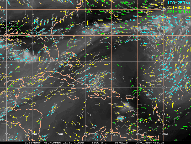
Live visible loop: http://wwwghcc.msfc.nasa.gov/cgi-bin/get-goes?satellite=GOES-E%20CONUS&lat=31&lon=-77&info=vis&zoom=1&width=1000&height=800&quality=92&type=Animation&palette=ir1.pal&numframes=5&mapcolor=gray
Live visible loop: http://wwwghcc.msfc.nasa.gov/cgi-bin/get-goes?satellite=GOES-E%20CONUS&lat=31&lon=-77&info=vis&zoom=1&width=1000&height=800&quality=92&type=Animation&palette=ir1.pal&numframes=5&mapcolor=gray
0 likes
M a r k
- - - - -
Join us in chat: Storm2K Chatroom Invite. Android and IOS apps also available.
The posts in this forum are NOT official forecasts and should not be used as such. Posts are NOT endorsed by any professional institution or STORM2K.org. For official information and forecasts, please refer to NHC and NWS products.
Re: Development off SE U.S coast?
0 likes
-
gatorcane
- S2K Supporter
- Posts: 23708
- Age: 48
- Joined: Sun Mar 13, 2005 3:54 pm
- Location: Boca Raton, FL
I posted this in the GOM thread as that is where the low may originate, but I still think there is a decent chance we will get some development here from something along this trough and if something does develop, it will be off the S.E. United States coast. NAVGEM and UKMET are very bullish so model support is there.
NAVGEM:


NAVGEM:
0 likes