2026 ENSO Updates
Moderator: S2k Moderators
Forum rules

The posts in this forum are NOT official forecasts and should not be used as such. They are just the opinion of the poster and may or may not be backed by sound meteorological data. They are NOT endorsed by any professional institution or STORM2K. For official information, please refer to products from the National Hurricane Center and National Weather Service.
-
Yellow Evan

- Professional-Met

- Posts: 16222
- Age: 27
- Joined: Fri Jul 15, 2011 12:48 pm
- Location: Henderson, Nevada/Honolulu, HI
- Contact:
Re: 2026 ENSO Updates: CPC January update= 75% Chance Neutral JFM through May
Dateline or near dateline WWBs aren’t that unheard of this time of year (or even in the December before) in budding El Niños. 1982, 1997, 2002 and 2014 all had them. Definitely a sign of things to come but it isn’t unprecedented like Eric’s tweet implies.
Last edited by Yellow Evan on Thu Jan 08, 2026 12:24 pm, edited 1 time in total.
2 likes
-
cycloneye

- Admin

- Posts: 149214
- Age: 69
- Joined: Thu Oct 10, 2002 10:54 am
- Location: San Juan, Puerto Rico
Re: 2026 ENSO Updates: CPC January update= 75% Chance Neutral JFM through May
CPC mentions some uncertainty because of the spring barrier in terms of El Niño.
0 likes
Visit the Caribbean-Central America Weather Thread where you can find at first post web cams,radars
and observations from Caribbean basin members Click Here
and observations from Caribbean basin members Click Here
-
Kingarabian

- S2K Supporter

- Posts: 16342
- Joined: Sat Aug 08, 2009 3:06 am
- Location: Honolulu, Hawaii
Re: 2026 ENSO Updates: CPC January update= 75% Chance Neutral JFM through May
Yellow Evan wrote:Dateline or near dateline WWBs aren’t that unheard of this time of year (or even in the December before) in budding El Niños. 1982, 1997, 2002 and 2014 all had them. Definitely a sign of things to come but it isn’t unprecedented like Eric’s tweet implies.
It's really hard to get a dateline WWB this strong this early. Usually they come in during Feb-May. If this materializes you could call for a strong El Nino this year if the trade pattern/SOI cooperates in MAM.
4 likes
RIP Kobe Bryant
-
Kingarabian
- S2K Supporter
- Posts: 16342
- Joined: Sat Aug 08, 2009 3:06 am
- Location: Honolulu, Hawaii
Re: 2026 ENSO Updates: CPC January update= 75% Chance Neutral JFM through May
GFS trending stronger with this upcoming MJO.
0 likes
RIP Kobe Bryant
-
Kingarabian
- S2K Supporter
- Posts: 16342
- Joined: Sat Aug 08, 2009 3:06 am
- Location: Honolulu, Hawaii
Re: 2026 ENSO Updates: CPC January update= 75% Chance Neutral JFM through May
cycloneye wrote:The PDO data for december is down to -84 from the november one that was at -1.21.
https://oceanview.pfeg.noaa.gov/erddap/ ... e?time,PDO
Let's see if it finally switches to positive this spring.
1 likes
RIP Kobe Bryant
-
Yellow Evan
- Professional-Met
- Posts: 16222
- Age: 27
- Joined: Fri Jul 15, 2011 12:48 pm
- Location: Henderson, Nevada/Honolulu, HI
- Contact:
Re: 2026 ENSO Updates: CPC January update= 75% Chance Neutral JFM through May
Kingarabian wrote:Yellow Evan wrote:Dateline or near dateline WWBs aren’t that unheard of this time of year (or even in the December before) in budding El Niños. 1982, 1997, 2002 and 2014 all had them. Definitely a sign of things to come but it isn’t unprecedented like Eric’s tweet implies.
It's really hard to get a dateline WWB this strong this early. Usually they come in during Feb-May. If this materializes you could call for a strong El Nino this year if the trade pattern/SOI cooperates in MAM.
I think this current WWB locks in an El Niño even if it’s 2014 esque. Another WWB in the spring would push us towards the stronger camp even if I’m a little cautious just because our last strong El Niño was a mere 3 years ago, but that was also a very unorthodox El Niño.
1 likes


Re: 2026 ENSO Updates: CPC January update= 75% Chance Neutral JFM through May
The only period where two fairly significant El Nino's I can see in the ONI index was 1963-1964 (moderate) and 1965-1966 (strong) that were relatively close to each other. It would be pretty rare to have two big ones so close. Even more odd (I know the RONI says differently; I still have debate if we are even using this index correctly/interpretation in terms of identifying its interaction with ENSO via other SSTa outside of it) but I digress, is that by ONI we never achieved official Nina for 2024-2025 and 2025-2026, technically cold-neutral.
To have two solid Ninos in theory with two cold neutrals during a deep -PDO, odd indeed.
To have two solid Ninos in theory with two cold neutrals during a deep -PDO, odd indeed.
7 likes
The above post and any post by Ntxw is NOT an official forecast and should not be used as such. It is just the opinion of the poster and may or may not be backed by sound meteorological data. It is NOT endorsed by any professional institution including Storm2k. For official information, please refer to NWS products.
Help support Storm2K!
-
Kingarabian
- S2K Supporter
- Posts: 16342
- Joined: Sat Aug 08, 2009 3:06 am
- Location: Honolulu, Hawaii
Re: 2026 ENSO Updates: CPC January update= 75% Chance Neutral JFM through May
Ntxw wrote:The only period where two fairly significant El Nino's I can see in the ONI index was 1963-1964 (moderate) and 1965-1966 (strong) that were relatively close to each other. It would be pretty rare to have two big ones so close. Even more odd (I know the RONI says differently; I still have debate if we are even using this index correctly/interpretation in terms of identifying its interaction with ENSO via other SSTa outside of it) but I digress, is that by ONI we never achieved official Nina for 2024-2025 and 2025-2026, technically cold-neutral.
To have two solid Ninos in theory with two cold neutrals during a deep -PDO, odd indeed.
If we get another stout El Nino and the PDO remains negative then something is definitely broken. Even during -PDO regimes the PDO still manages to briefly flip positive when an El Nino forms.
3 likes
RIP Kobe Bryant
-
USTropics
- Professional-Met
- Posts: 2736
- Joined: Sun Aug 12, 2007 3:45 am
- Location: Florida State University
Re: 2026 ENSO Updates: CPC January update=75% Neutral between Jan-Mar / Lasts until late spring
Kingarabian wrote:Ntxw wrote:The only period where two fairly significant El Nino's I can see in the ONI index was 1963-1964 (moderate) and 1965-1966 (strong) that were relatively close to each other. It would be pretty rare to have two big ones so close. Even more odd (I know the RONI says differently; I still have debate if we are even using this index correctly/interpretation in terms of identifying its interaction with ENSO via other SSTa outside of it) but I digress, is that by ONI we never achieved official Nina for 2024-2025 and 2025-2026, technically cold-neutral.
To have two solid Ninos in theory with two cold neutrals during a deep -PDO, odd indeed.
If we get another stout El Nino and the PDO remains negative then something is definitely broken. Even during -PDO regimes the PDO still manages to briefly flip positive when an El Nino forms.
This is definitely interesting and something I've looked into recently. Similar to how revisionists will likely see our current state as La Nina when the new climatology period updates, there is some background GW signature not being accounted for here. It's important to also note -PDO doesn't determine El Nino generation, but does determine amplitude (particularly zonally). In other words, a strongly negative PDO modifies the Pacific mean state by enhancing the zonal SST gradient and steepening the thermocline tilt, favoring a more CPAC ENSO expression while suppressing EPAC cooling.
I think one of the important keys here is that La Nina does require stronger coupling than El Nino. This is why we can get super Ninos to begin with via WWBs, MJO propagation, Indo-Pacific Walker circulation shifts, and even Atlantic SST forcing (something I believe has really kicked into gear since the early 2000s and needs more research).
Some food for thought, are we seeing a more permanent thermocline tilt and a shift in ENSO-PDO covariance? That is, are we heading towards a future where the WPAC and CPAC become the dominant ENSO regions (instead of 3.4)? It's definitely to early/not enough data to quantify that, but the persistence of a negative PDO, while not indicating a breakdown of ENSO physics, is causing a 'decoupling' between ENSO dynamics and the SST pattern that project onto the current PDO index.
The main takeaway
Historically, El Nino often projects positively onto the PDO, but that's because PDO is heavily weighted toward EPAC SSTs. If El Nino expression becomes more CPAC/WPAC dominant (or zonally confined), the PDO may not flip even though ENSO discharge-recharge dynamics are active. Thus, this implies a shift in ENSO-PDO covariance (again, to early to confidently state that).
5 likes
Re: 2026 ENSO Updates: CPC January update=75% Neutral between Jan-Mar / Lasts until late spring
USTropics wrote:This is definitely interesting and something I've looked into recently. Similar to how revisionists will likely see our current state as La Nina when the new climatology period updates, there is some background GW signature not being accounted for here. It's important to also note -PDO doesn't determine El Nino generation, but does determine amplitude (particularly zonally). In other words, a strongly negative PDO modifies the Pacific mean state by enhancing the zonal SST gradient and steepening the thermocline tilt, favoring a more CPAC ENSO expression while suppressing EPAC cooling.
I think one of the important keys here is that La Nina does require stronger coupling than El Nino. This is why we can get super Ninos to begin with via WWBs, MJO propagation, Indo-Pacific Walker circulation shifts, and even Atlantic SST forcing (something I believe has really kicked into gear since the early 2000s and needs more research).
Some food for thought, are we seeing a more permanent thermocline tilt and a shift in ENSO-PDO covariance? That is, are we heading towards a future where the WPAC and CPAC become the dominant ENSO regions (instead of 3.4)? It's definitely to early/not enough data to quantify that, but the persistence of a negative PDO, while not indicating a breakdown of ENSO physics, is causing a 'decoupling' between ENSO dynamics and the SST pattern that project onto the current PDO index.
The main takeaway
Historically, El Nino often projects positively onto the PDO, but that's because PDO is heavily weighted toward EPAC SSTs. If El Nino expression becomes more CPAC/WPAC dominant (or zonally confined), the PDO may not flip even though ENSO discharge-recharge dynamics are active. Thus, this implies a shift in ENSO-PDO covariance (again, to early to confidently state that).
Something to consider, the extratropics is warming rapidly. Probably faster than the typical 30 year averages can keep up with. So the way PDO, AMO etc is considered it's all likely changed. What happens if the entire north Pacific or Atlantic is warm all the time and getting warmer? How do we differentiate it from a decadal cycle? The difference between one part of the basin to another is losing that gradient.
On another hand in the equatorial Pacific convection is effected, in an El Nino there is typically movement of the convection eastward due to warmer waters able to sustain it shifting eastward. What happens if the west remains well above normal and you have split forcing, continued MC convection despite not in a La Nina while the east is also warm enough to support it? What do we have? El nino? La Nina? La Nino? 2023 was a prime example of this type of split. We lost behaviors of the traditional strong Nino, but the ocean was clearly warm just like one but the atmosphere couldn't follow that tradition thus the RONI said otherwise. So to say the El Nino was weaker, I don't think is correct the ocean clearly noted that it was a strong event, the walker circulation just didn't flow the way we expected.


6 likes
The above post and any post by Ntxw is NOT an official forecast and should not be used as such. It is just the opinion of the poster and may or may not be backed by sound meteorological data. It is NOT endorsed by any professional institution including Storm2k. For official information, please refer to NWS products.
Help support Storm2K!
Help support Storm2K!
-
Yellow Evan
- Professional-Met
- Posts: 16222
- Age: 27
- Joined: Fri Jul 15, 2011 12:48 pm
- Location: Henderson, Nevada/Honolulu, HI
- Contact:
Re: 2026 ENSO Updates: CPC January update=75% Neutral between Jan-Mar / Lasts until late spring
USTropics wrote:Kingarabian wrote:Ntxw wrote:The only period where two fairly significant El Nino's I can see in the ONI index was 1963-1964 (moderate) and 1965-1966 (strong) that were relatively close to each other. It would be pretty rare to have two big ones so close. Even more odd (I know the RONI says differently; I still have debate if we are even using this index correctly/interpretation in terms of identifying its interaction with ENSO via other SSTa outside of it) but I digress, is that by ONI we never achieved official Nina for 2024-2025 and 2025-2026, technically cold-neutral.
To have two solid Ninos in theory with two cold neutrals during a deep -PDO, odd indeed.
If we get another stout El Nino and the PDO remains negative then something is definitely broken. Even during -PDO regimes the PDO still manages to briefly flip positive when an El Nino forms.
This is definitely interesting and something I've looked into recently. Similar to how revisionists will likely see our current state as La Nina when the new climatology period updates, there is some background GW signature not being accounted for here. It's important to also note -PDO doesn't determine El Nino generation, but does determine amplitude (particularly zonally). In other words, a strongly negative PDO modifies the Pacific mean state by enhancing the zonal SST gradient and steepening the thermocline tilt, favoring a more CPAC ENSO expression while suppressing EPAC cooling.
I think one of the important keys here is that La Nina does require stronger coupling than El Nino. This is why we can get super Ninos to begin with via WWBs, MJO propagation, Indo-Pacific Walker circulation shifts, and even Atlantic SST forcing (something I believe has really kicked into gear since the early 2000s and needs more research).
Some food for thought, are we seeing a more permanent thermocline tilt and a shift in ENSO-PDO covariance? That is, are we heading towards a future where the WPAC and CPAC become the dominant ENSO regions (instead of 3.4)? It's definitely to early/not enough data to quantify that, but the persistence of a negative PDO, while not indicating a breakdown of ENSO physics, is causing a 'decoupling' between ENSO dynamics and the SST pattern that project onto the current PDO index.
The main takeaway
Historically, El Nino often projects positively onto the PDO, but that's because PDO is heavily weighted toward EPAC SSTs. If El Nino expression becomes more CPAC/WPAC dominant (or zonally confined), the PDO may not flip even though ENSO discharge-recharge dynamics are active. Thus, this implies a shift in ENSO-PDO covariance (again, to early to confidently state that).
Traditionally, the PDO is defined as a EOF1 of NPAC SSTs but as time has gone on, the EOF2 (Victoria Mode) has become prominent (and appears to be present right now). See Ji. et al (2024) for more.
2 likes
-
USTropics
- Professional-Met
- Posts: 2736
- Joined: Sun Aug 12, 2007 3:45 am
- Location: Florida State University
Re: 2026 ENSO Updates: CPC January update=75% Neutral between Jan-Mar / Lasts until late spring
Ntxw wrote:USTropics wrote:This is definitely interesting and something I've looked into recently. Similar to how revisionists will likely see our current state as La Nina when the new climatology period updates, there is some background GW signature not being accounted for here. It's important to also note -PDO doesn't determine El Nino generation, but does determine amplitude (particularly zonally). In other words, a strongly negative PDO modifies the Pacific mean state by enhancing the zonal SST gradient and steepening the thermocline tilt, favoring a more CPAC ENSO expression while suppressing EPAC cooling.
I think one of the important keys here is that La Nina does require stronger coupling than El Nino. This is why we can get super Ninos to begin with via WWBs, MJO propagation, Indo-Pacific Walker circulation shifts, and even Atlantic SST forcing (something I believe has really kicked into gear since the early 2000s and needs more research).
Some food for thought, are we seeing a more permanent thermocline tilt and a shift in ENSO-PDO covariance? That is, are we heading towards a future where the WPAC and CPAC become the dominant ENSO regions (instead of 3.4)? It's definitely to early/not enough data to quantify that, but the persistence of a negative PDO, while not indicating a breakdown of ENSO physics, is causing a 'decoupling' between ENSO dynamics and the SST pattern that project onto the current PDO index.
The main takeaway
Historically, El Nino often projects positively onto the PDO, but that's because PDO is heavily weighted toward EPAC SSTs. If El Nino expression becomes more CPAC/WPAC dominant (or zonally confined), the PDO may not flip even though ENSO discharge-recharge dynamics are active. Thus, this implies a shift in ENSO-PDO covariance (again, to early to confidently state that).
Something to consider, the extratropics is warming rapidly. Probably faster than the typical 30 year averages can keep up with. So the way PDO, AMO etc is considered it's all likely changed. What happens if the entire north Pacific or Atlantic is warm all the time and getting warmer? How do we differentiate it from a decadal cycle? The difference between one part of the basin to another is losing that gradient.
On another hand in the equatorial Pacific convection is effected, in an El Nino there is typically movement of the convection eastward due to warmer waters able to sustain it shifting eastward. What happens if the west remains well above normal and you have split forcing, continued MC convection despite not in a La Nina while the east is also warm enough to support it? What do we have? El nino? La Nina? La Nino? 2023 was a prime example of this type of split. We lost behaviors of the traditional strong Nino, but the ocean was clearly warm just like one but the atmosphere couldn't follow that tradition thus the RONI said otherwise. So to say the El Nino was weaker, I don't think is correct the ocean clearly noted that it was a strong event, the walker circulation just didn't flow the way we expected.
Yellow Evan wrote:USTropics wrote:Kingarabian wrote:
If we get another stout El Nino and the PDO remains negative then something is definitely broken. Even during -PDO regimes the PDO still manages to briefly flip positive when an El Nino forms.
This is definitely interesting and something I've looked into recently. Similar to how revisionists will likely see our current state as La Nina when the new climatology period updates, there is some background GW signature not being accounted for here. It's important to also note -PDO doesn't determine El Nino generation, but does determine amplitude (particularly zonally). In other words, a strongly negative PDO modifies the Pacific mean state by enhancing the zonal SST gradient and steepening the thermocline tilt, favoring a more CPAC ENSO expression while suppressing EPAC cooling.
I think one of the important keys here is that La Nina does require stronger coupling than El Nino. This is why we can get super Ninos to begin with via WWBs, MJO propagation, Indo-Pacific Walker circulation shifts, and even Atlantic SST forcing (something I believe has really kicked into gear since the early 2000s and needs more research).
Some food for thought, are we seeing a more permanent thermocline tilt and a shift in ENSO-PDO covariance? That is, are we heading towards a future where the WPAC and CPAC become the dominant ENSO regions (instead of 3.4)? It's definitely to early/not enough data to quantify that, but the persistence of a negative PDO, while not indicating a breakdown of ENSO physics, is causing a 'decoupling' between ENSO dynamics and the SST pattern that project onto the current PDO index.
The main takeaway
Historically, El Nino often projects positively onto the PDO, but that's because PDO is heavily weighted toward EPAC SSTs. If El Nino expression becomes more CPAC/WPAC dominant (or zonally confined), the PDO may not flip even though ENSO discharge-recharge dynamics are active. Thus, this implies a shift in ENSO-PDO covariance (again, to early to confidently state that).
Traditionally, the PDO is defined as a EOF1 of NPAC SSTs but as time has gone on, the EOF2 (Victoria Mode) has become prominent (and appears to be present right now). See Ji. et al (2024) for more.
I'll respond to both these posts because I think they go hand in hand.
First, thanks for sharing this article and noting these EOF modes! Actually have not seen this article yet and will dive in deeper on the methods later, but the discussion definitely highlights some of my suspicions.
- PDO variability significantly declined around ~1990-2000
- GW + increased ocean stratification at the surface reduces some of this coupling (thus alters thermocline)
- CPAC becomes more of the dominant driver/feature of ENSO events now
Ntxw makes some really important points here, and I think it actually reinforces the idea that our traditional indices are struggling to separate structure from background state due to rather rapid changes (where 30 year climatology periods can't even keep up). No doubt, the poles are warming significantly faster than the equator, and this inherently complicates traditional PDO (and even AMV imo) as true decadal modes versus evolving mean-state patterns. That is, the SST/ONI pattern screams El Nino, but our traditional atmospheric/oceanic connections have been altered.
Another important aspect to look at is the latitudinal gradient SST shift and how this allows the ITCZ to move further north (i.e., convection can sustain further north).
So do we think this is just more variability, or do we have to eventually redefine ENSO ocean-atmospheric coupling signals? Do CPAC SSTs allow for convection to still dominate there, despite other region's SST variability?
My assumptions are we've permanently altered SST/convection gradients and the thermocline -> enhances CPAC ability to generate convection -> this shifts ITCZ position -> Walker circulation shifts and traditional ocean-atmospheric ENSO coupling is altered.
3 likes
-
cycloneye
- Admin
- Posts: 149214
- Age: 69
- Joined: Thu Oct 10, 2002 10:54 am
- Location: San Juan, Puerto Rico
Re: 2026 ENSO Updates: CPC January update= 75% Chance Neutral JFM through May
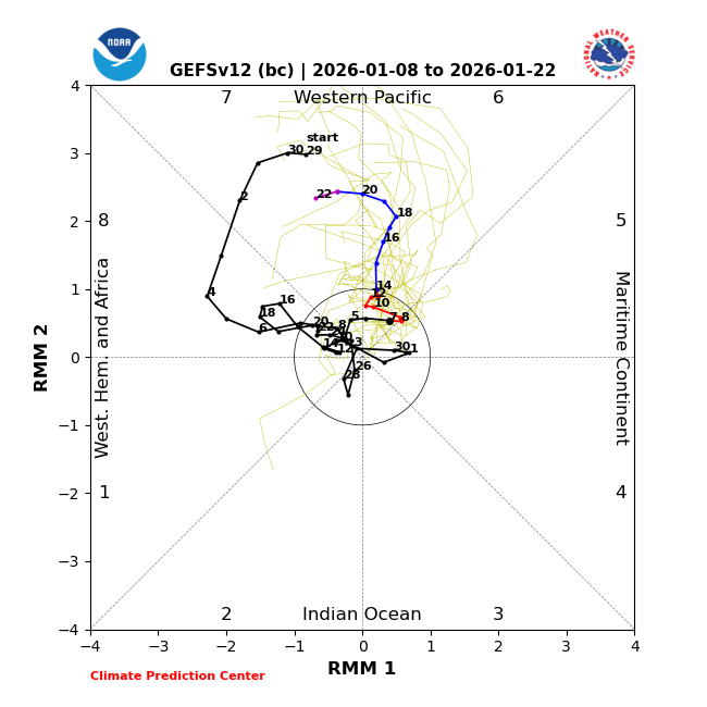
The WWB continues to look impressive.

1 likes
Visit the Caribbean-Central America Weather Thread where you can find at first post web cams,radars
and observations from Caribbean basin members Click Here
and observations from Caribbean basin members Click Here
-
cycloneye
- Admin
- Posts: 149214
- Age: 69
- Joined: Thu Oct 10, 2002 10:54 am
- Location: San Juan, Puerto Rico
Re: 2026 ENSO Updates: CPC January update= 75% Chance Neutral JFM through May
0 likes
Visit the Caribbean-Central America Weather Thread where you can find at first post web cams,radars
and observations from Caribbean basin members Click Here
and observations from Caribbean basin members Click Here


Re: 2026 ENSO Updates: CPC January update= 75% Chance Neutral JFM through May
You know that an El Nino is expected when the ENSO thread is buzzing 8 days into the new year. 
2 likes
TC naming lists: retirements and intensity
Most aggressive Advisory #1's in North Atlantic (cr. kevin for starting the list)
Most aggressive Advisory #1's in North Atlantic (cr. kevin for starting the list)
-
cycloneye
- Admin
- Posts: 149214
- Age: 69
- Joined: Thu Oct 10, 2002 10:54 am
- Location: San Juan, Puerto Rico
Re: 2026 ENSO Updates: CPC January update= 75% Chance Neutral JFM through May
Teban54 wrote:You know that an El Nino is expected when the ENSO thread is buzzing 8 days into the new year.
That is why started the thread more earlier than usual, on november 10th, as I knew this was going to be the most busy one, more than the indicators thread as the buzz around the net has been about the development of El Niño.
1 likes
Visit the Caribbean-Central America Weather Thread where you can find at first post web cams,radars
and observations from Caribbean basin members Click Here
and observations from Caribbean basin members Click Here
-
cycloneye
- Admin
- Posts: 149214
- Age: 69
- Joined: Thu Oct 10, 2002 10:54 am
- Location: San Juan, Puerto Rico
Re: 2026 ENSO Updates: CPC January update= 75% Chance Neutral JFM through May
I encourage the members to read the whole article. Link below.
https://www.severe-weather.eu/long-rang ... europe-fa/
https://x.com/severeweatherEU/status/2009526090709000375
https://www.severe-weather.eu/long-rang ... europe-fa/
https://x.com/severeweatherEU/status/2009526090709000375
1 likes
Visit the Caribbean-Central America Weather Thread where you can find at first post web cams,radars
and observations from Caribbean basin members Click Here
and observations from Caribbean basin members Click Here
-
cycloneye
- Admin
- Posts: 149214
- Age: 69
- Joined: Thu Oct 10, 2002 10:54 am
- Location: San Juan, Puerto Rico
Re: 2026 ENSO Updates
0 likes
Visit the Caribbean-Central America Weather Thread where you can find at first post web cams,radars
and observations from Caribbean basin members Click Here
and observations from Caribbean basin members Click Here
-
Kingarabian
- S2K Supporter
- Posts: 16342
- Joined: Sat Aug 08, 2009 3:06 am
- Location: Honolulu, Hawaii
Re: 2026 ENSO Updates
Remains a potent WWB on the models. Looks like it'll start this week and likely continue until the end of the month.
1 likes
RIP Kobe Bryant
-
cycloneye
- Admin
- Posts: 149214
- Age: 69
- Joined: Thu Oct 10, 2002 10:54 am
- Location: San Juan, Puerto Rico
Re: 2026 ENSO Updates
Kingarabian wrote:Remains a potent WWB on the models. Looks like it'll start this week and likely continue until the end of the month.
0 likes
Visit the Caribbean-Central America Weather Thread where you can find at first post web cams,radars
and observations from Caribbean basin members Click Here
and observations from Caribbean basin members Click Here
Who is online
Users browsing this forum: Google Adsense [Bot] and 100 guests