Low Pressure near Northern Leewards

This is the general tropical discussion area. Anyone can take their shot at predicting a storms path.

Moderator: S2k Moderators

Forum rules

The posts in this forum are NOT official forecasts and should not be used as such. They are just the opinion of the poster and may or may not be backed by sound meteorological data. They are NOT endorsed by any professional institution or STORM2K. For official information, please refer to products from the National Hurricane Center and National Weather Service.

Help Support Storm2K
Message
Author
User avatar
cycloneye
Admin
Admin
Posts: 143863
Age: 68
Joined: Thu Oct 10, 2002 10:54 am
Location: San Juan, Puerto Rico

Re: Models hinting at tropical development near PR

#81 Postby cycloneye » Wed Oct 24, 2007 9:25 am

Image

Image

Image

What image photo is missing? The invest photo.Will they put it up soon? By saying soon,I mean this afternoon,tonight or tommorow.
0 likes   

User avatar
wxman57
Moderator-Pro Met
Moderator-Pro Met
Posts: 22951
Age: 67
Joined: Sat Jun 21, 2003 8:06 pm
Location: Houston, TX (southwest)

Re:

#82 Postby wxman57 » Wed Oct 24, 2007 9:29 am

Derek Ortt wrote:I think it would depend where the shear is located.

If we have stronger upper winds than we had with Wilma, but it is north of the core, all that will do is enhance the outflow and create a monster hurricane (assuming we have a TC to begin with). However, if the strong shear hits the core, bye bye TC

That is what makes these trough cases so very difficult. The shear was expected to weaken Wilma before landfall. However, the shear was in the wrong place, and Wilma intnsified quickly


Right, it's the relative shear that counts. Wilma accelerated enough such that the relative shear was reduced.

I was taking a closer look at the latest GFS runs. When I track the 850mb vorticity I see that it actually steers the vorticity center WSW into Belize (sort of like the NOGAPS is suggesting). Might be a good chance of that. The low the GFS develops in the SE Gulf is NOT the vorticity center east of PR, it's a frontal low.
0 likes   

User avatar
cycloneye
Admin
Admin
Posts: 143863
Age: 68
Joined: Thu Oct 10, 2002 10:54 am
Location: San Juan, Puerto Rico

Re: Models hinting at tropical development near PR

#83 Postby cycloneye » Wed Oct 24, 2007 9:44 am

Antigua Observations

Antigua which is at 17.0n-61.0w is reporting winds from the WNW and 1011 mbs.
0 likes   

User avatar
wxman57
Moderator-Pro Met
Moderator-Pro Met
Posts: 22951
Age: 67
Joined: Sat Jun 21, 2003 8:06 pm
Location: Houston, TX (southwest)

Re: Models hinting at tropical development near PR

#84 Postby wxman57 » Wed Oct 24, 2007 9:55 am

cycloneye wrote:Antigua Observations

Antigua which is at 17.0n-61.0w is reporting winds from the WNW and 1011 mbs.


Possibly just local effects, but there is a weak low-level swirl evident on visible imagery 80 miles northeast of Antigua. Strong westerly wind shear is keeping all squalls well to the east (between 250 and 350 miles to the east). Something to keep an eye on.

Here's a surface plot to better-show the observations:

Image
0 likes   

Sanibel
Category 5
Category 5
Posts: 10375
Joined: Mon Aug 30, 2004 11:06 pm
Location: Offshore SW Florida

Re: Models hinting at tropical development near PR

#85 Postby Sanibel » Wed Oct 24, 2007 10:02 am

Detecting surface spiral at 18N-61.5W
0 likes   

User avatar
cycloneye
Admin
Admin
Posts: 143863
Age: 68
Joined: Thu Oct 10, 2002 10:54 am
Location: San Juan, Puerto Rico

Re: Models hinting at tropical development near PR

#86 Postby cycloneye » Wed Oct 24, 2007 10:12 am

000
ABNT20 KNHC 241508
TWOAT
TROPICAL WEATHER OUTLOOK
NWS TPC/NATIONAL HURRICANE CENTER MIAMI FL
1130 AM EDT WED OCT 24 2007

FOR THE NORTH ATLANTIC...CARIBBEAN SEA AND THE GULF OF MEXICO...

A WEAK AREA OF LOW PRESSURE CENTERED ABOUT 100 MILES EAST-NORTHEAST
OF THE NORTHERN LEEWARD ISLANDS IS PRODUCING A LARGE AREA OF
CLOUDINESS AND SHOWERS. WHILE THIS SYSTEM HAS A WELL-DEFINED
LOW-LEVEL CIRCULATION...SHOWERS AND THUNDERSTORMS REMAIN POORLY
ORGANIZED AND PRIMARILY DISPLACED TO THE EAST. UPPER-LEVEL WINDS
ARE EXPECTED TO REMAIN UNFAVORABLE FOR SIGNIFICANT DEVELOPMENT OF
THIS SYSTEM AS IT MOVE SLOWLY WESTWARD DURING THE NEXT COUPLE OF
DAYS.

$$

FORECASTER RHOME
0 likes   

User avatar
Vortex
S2K Supporter
S2K Supporter
Posts: 4644
Age: 53
Joined: Fri Aug 01, 2003 9:34 pm
Location: Hilton Head, SC

Re: Models hinting at tropical development near PR

#87 Postby Vortex » Wed Oct 24, 2007 10:53 am

Convection slowly increasing near LLC...Should be an invest by this evening if not this afternoon...
0 likes   

tolakram
Admin
Admin
Posts: 19990
Age: 61
Joined: Sun Aug 27, 2006 8:23 pm
Location: Florence, KY (name is Mark)

Re: Models hinting at tropical development near PR

#88 Postby tolakram » Wed Oct 24, 2007 11:30 am

Way way too much shear and my amateur eyes can't see how any favorable environment is going to develop any time soon.

Image
0 likes   

User avatar
cycloneye
Admin
Admin
Posts: 143863
Age: 68
Joined: Thu Oct 10, 2002 10:54 am
Location: San Juan, Puerto Rico

Re: Models hinting at tropical development near PR

#89 Postby cycloneye » Wed Oct 24, 2007 11:35 am

Dr Jeff Masters latest discussion about this complex area.

A surface low pressure area has developed near 17.5N, 60.5W, about 150 miles east-northeast of the northernmost Lesser Antilles Islands. This morning's QuickSCAT pass showed an elongated circulation that is not well organized. Top winds were about 25 mph to the northeast of the circulation center. Winds in the northern Lesser Antilles Islands were less than 10 mph this morning, but pressures have been falling for the past two days. Satellite loops show little heavy thunderstorm activity--less than yesterday. However, this activity appears to be increasing just north of the circulation center this morning.

Wind shear has dropped to 10-20 knots in the region, and some slow development of this system is possible as it moves to the west at about 5 mph. This westward motion is forecast to bring the low over Puerto Rico Thursday night and Friday morning, then to a point between Haiti and Jamaica on Saturday. All of these islands can expect heavy rains during passage of this system. Both the ECMWF and NOGAPS models develop the disturbance into a tropical depression on Saturday near the southern coast of Haiti. The GFS models does not, because of high wind shear. All of the models forecast falling pressures and low wind shear over the Western Caribbean late this week and early next week, and it would not be a surprise to see a tropical depression form in the region. Today is the 2nd anniversary of Wilma's strike on South Florida, so powerful hurricanes are still a concern at this point in the season.

Heavy thunderstorm activity has increased in the central Caribbean south of Haiti this morning, but QuikSCAT showed no evidence of a surface circulation in this morning's pass. Activity in the western Caribbean between the Yucatan Peninsula and Cuba is associated with a cold front.


http://www.weatherunderground.com/blog/ ... amp=200710
0 likes   

User avatar
cycloneye
Admin
Admin
Posts: 143863
Age: 68
Joined: Thu Oct 10, 2002 10:54 am
Location: San Juan, Puerto Rico

Re: Models hinting at tropical development near PR

#90 Postby cycloneye » Wed Oct 24, 2007 12:37 pm

Image

Visible Image Loop

The low pressure is small but well defined.Convection is to the north and east of it.
0 likes   

User avatar
boca
Category 5
Category 5
Posts: 6365
Age: 60
Joined: Mon Dec 15, 2003 8:49 am
Location: Boca Raton,FL

Re: Models hinting at tropical development near PR

#91 Postby boca » Wed Oct 24, 2007 12:40 pm

It looks stationary to me it would have to start moving west for the model progs to be right.
0 likes   

User avatar
wxman57
Moderator-Pro Met
Moderator-Pro Met
Posts: 22951
Age: 67
Joined: Sat Jun 21, 2003 8:06 pm
Location: Houston, TX (southwest)

Re: Models hinting at tropical development near PR

#92 Postby wxman57 » Wed Oct 24, 2007 12:56 pm

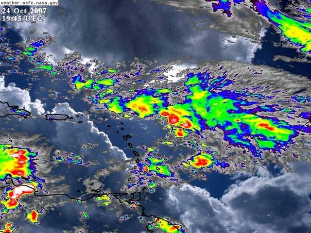
boca wrote:It looks stationary to me it would have to start moving west for the model progs to be right.


For perspective, the current location near 18.3N/61W is about 230 miles east of where yesterday's 12Z NOGAPS predicted it would be. It's almost directly over where yesterday's 12Z Canadian predicted. Yesterday's 12Z Euro showed nothing in/near the NE Caribbean. It's 200 miles west of where yesterday's 12Z GFS had it at 18Z today. So, about a 400 mile spread in yesterday's projections with Canadian closest. Today's models don't move it much until tonight and Thursday.

Wind shear on WV satellite loops looks stronger than the wind shear maps are indicating. I trust my eyes over a model projection.
0 likes   

User avatar
HURAKAN
Professional-Met
Professional-Met
Posts: 46086
Age: 38
Joined: Thu May 20, 2004 4:34 pm
Location: Key West, FL
Contact:

#93 Postby HURAKAN » Wed Oct 24, 2007 2:19 pm

Image
0 likes   

User avatar
cycloneye
Admin
Admin
Posts: 143863
Age: 68
Joined: Thu Oct 10, 2002 10:54 am
Location: San Juan, Puerto Rico

Re: Models hinting at tropical development near PR

#94 Postby cycloneye » Wed Oct 24, 2007 2:29 pm

If the trend towards organization continues (Albeit Slowly),the invest tag is not too far for this.
0 likes   

User avatar
msbee
S2K Supporter
S2K Supporter
Posts: 3027
Joined: Wed Jun 11, 2003 10:11 am
Location: St. Maarten

Re: Models hinting at tropical development near PR

#95 Postby msbee » Wed Oct 24, 2007 2:53 pm

current conditions on St. Maarten
18.1 N 63.1 W

3 PM (19) Oct 24 Temp 82 (28)
Dew Point 69 (21)
Pressure 29.83 (1010) ( that's dropped from 1013 this morning)
wind NNE 6 light rain showers
0 likes   

User avatar
Vortex
S2K Supporter
S2K Supporter
Posts: 4644
Age: 53
Joined: Fri Aug 01, 2003 9:34 pm
Location: Hilton Head, SC

#96 Postby Vortex » Wed Oct 24, 2007 3:11 pm

should be tagged shortly...LLC is now tucking itself under deeper convection....It should fan out this evening except restricted in the sw quad as modest shear remains over developing TC. Here we go....
0 likes   

User avatar
cycloneye
Admin
Admin
Posts: 143863
Age: 68
Joined: Thu Oct 10, 2002 10:54 am
Location: San Juan, Puerto Rico

Re: Models hinting at tropical development near PR

#97 Postby cycloneye » Wed Oct 24, 2007 3:12 pm

From the NWS in San Juan:

000
FZCA52 TJSJ 241941
CWFSJU

COASTAL WATERS FORECAST
NATIONAL WEATHER SERVICE SAN JUAN PR
341 PM AST WED OCT 24 2007

PUERTO RICO AND U.S. VIRGIN ISLANDS WATERS

AMZ700-251045-
SYNOPSIS FOR PUERTO RICO AND THE U.S. VIRGIN ISLANDS WATERS
341 PM AST WED OCT 24 2007

.SYNOPSIS...A DEVELOPING SURFACE LOW CENTERED NEAR 18 NORTH 60
WEST THIS AFTERNOON...WITH AN ASSOCIATED ELONGATED TROUGH EXTENDS
SOUTHWEST ACROSS THE NORTHERN WINDWARD ISLANDS INTO THE SOUTHEAST
CARIBBEAN. THIS LOW AND ASSOCIATED TROUGH WILL SLOWLY DRIFT WEST
SOUTHWEST ACROSS THE NORTHERN LEEWARDS ISLANDS OVERNIGHT...THEN
INTO THE NORTHEAST CARIBBEAN AND EASTERN REGIONAL WATERS BY
FRIDAY. THE APPROACHING LOW WILL AID IN INCREASING THE WINDS AND
SEAS...AS WELL AS MAINTAIN ACTIVE AND SQUALLY WEATHER CONDITIONS
ACROSS THE REGIONAL WATERS ON THURSDAY THROUGH THE END OF THE
WEEK

000
AWCA82 TJSJ 242014
RWSPR

WEATHER SUMMARY FOR PUERTO RICO
NATIONAL WEATHER SERVICE SAN JUAN PR
414 PM AST WED OCT 24 2007

HEAVY SHOWERS AND THUNDERSTORMS DEVELOPED THIS AFTERNOON COVERING
THE ENTIRE SOUTHWESTERN QUARTER OF THE ISLAND AND PROMPTING THE
ISSUANCE OF SEVERAL FLOOD ADVISORIES AND WEATHER STATEMENTS. THIS
ACTIVITY HAS SINCE BEGAN TO DISSIPATE LEAVING THE FOCUS ON MORE
SHOWER ACTIVITY EXPECTED TO APPROACH THE ISLAND FROM THE NORTH AND
EAST TONIGHT.

A SURFACE LOW PRESSURE SYSTEM IS FORMING EAST OF THE NORTHERN
LEEWARD ISLANDS THIS AFTERNOON. THIS SYSTEM IS FORECAST TO MOVE
WEST AND THEN SOUTHWEST...TRACKING JUST SOUTH OF PUERTO RICO BY
FRIDAY. ABUNDANT TROPICAL MOISTURE WILL WORK ITS WAY INTO THE AREA
STARTING WITH THE NORTHERN COAST OF PUERTO RICO THURSDAY MORNING.
EXPECT HEAVY SHOWERS AND THUNDERSTORMS...GUSTY WINDS...AND
INCREASED SEAS ASSOCIATED WITH THIS LOW PRESSURE SYSTEM TO AFFECT THE
ISLAND THURSDAY THROUGH THE WEEKEND.

MODERATE TRADE WIND FLOW AND SEAS ARE EXPECTED ACROSS THE COASTAL
WATERS THIS EVENING...BUT WINDS AND SEAS WILL INCREASE SUBSTANTIALLY
THURSDAY AND REMAIN HIGH INTO THE WEEKEND...SMALL CRAFT ADVISORIES
WILL BE ISSUED FOR ALL LOCAL WATERS.


http://www.srh.noaa.gov/sju/forecast.html
0 likes   

Frank2
Category 5
Category 5
Posts: 4061
Joined: Mon Jul 25, 2005 12:47 pm

Re: Models hinting at tropical development near PR

#98 Postby Frank2 » Wed Oct 24, 2007 3:20 pm

Whatever forms will likely be confined to the area it's currently over (or, is likely to move little or will remain nearly stationary) - very strong southwesterlies ahead of the front over Florida at this time...
0 likes   

User avatar
ronjon
Category 5
Category 5
Posts: 4811
Joined: Fri Aug 19, 2005 5:17 pm
Location: Hernando Beach, FL

Re: Models hinting at tropical development near PR

#99 Postby ronjon » Wed Oct 24, 2007 3:25 pm

From NWS Melbourne AFD:

HEMISPHERIC MODELS CONSISTENT WITH SCENARIO OF SLOWLY LOWERING
PRESSURES AND CONSOLIDATION OF SURFACE LOW OVER NW
CARIBBEAN/YUCATAN REGION THROUGH THE EXTENDED PERIOD...FAVORING
EVENTUAL N/NW MOVEMENT. MUCH TO EARLY TO DETERMINE ANY POSSIBLE
IMPACT TO CWA...HOWEVER PROSPECT FOR PROLONGED MOISTURE FEED FROM THE
TROPICS LOOKS REASONABLE. STAY TUNED.
0 likes   

User avatar
HURAKAN
Professional-Met
Professional-Met
Posts: 46086
Age: 38
Joined: Thu May 20, 2004 4:34 pm
Location: Key West, FL
Contact:

#100 Postby HURAKAN » Wed Oct 24, 2007 3:27 pm

Image
0 likes   


Return to “Talkin' Tropics”

Who is online

Users browsing this forum: Ulf and 88 guests