Eastern Pacific Convection

This is the general tropical discussion area. Anyone can take their shot at predicting a storms path.

Moderator: S2k Moderators

Forum rules

The posts in this forum are NOT official forecasts and should not be used as such. They are just the opinion of the poster and may or may not be backed by sound meteorological data. They are NOT endorsed by any professional institution or STORM2K. For official information, please refer to products from the National Hurricane Center and National Weather Service.

Help Support Storm2K
Message
Author
User avatar
Meso
Category 5
Category 5
Posts: 1609
Age: 38
Joined: Mon Aug 09, 2004 12:14 pm
Location: South Africa
Contact:

Eastern Pacific Convection

#1 Postby Meso » Thu Jun 12, 2008 3:50 am

A small flare up of convection around 117W 10N has appeared and while development is unlikely,MM5 has shown something in that area forming soon and the other models show something in the Eastern Pacific forming within the next 5 days or so.Just something to watch until it goes 'poof' I guess,it's still attached to the ITCZ too.

Image

Loop

Edit : Interesting,new GFS run shows something in that general area in 42 hours
0 likes   

Cyclone1
Category 5
Category 5
Posts: 2739
Age: 33
Joined: Tue Jun 12, 2007 12:03 pm
Location: Florida

#2 Postby Cyclone1 » Thu Jun 12, 2008 9:09 am

Looks like it has potential.
0 likes   

tolakram
Admin
Admin
Posts: 20017
Age: 62
Joined: Sun Aug 27, 2006 8:23 pm
Location: Florence, KY (name is Mark)

Re: Eastern Pacific Convection

#3 Postby tolakram » Thu Jun 12, 2008 2:09 pm

Different blob got tagged. :)

Image

ZCZC MIATWOEP ALL
TTAA00 KNHC DDHHMM
TROPICAL WEATHER OUTLOOK
NWS TPC/NATIONAL HURRICANE CENTER MIAMI FL
1100 AM PDT THU JUN 12 2008

FOR THE EASTERN NORTH PACIFIC...EAST OF 140 DEGREES WEST LONGITUDE..

1. AN AREA OF DISTURBED WEATHER IS LOCATED ABOUT 700 MILES SOUTH OF THE
GULF OF TEHUANTEPEC. ANY DEVELOPMENT IS EXPECTED TO BE SLOW TO
OCCUR AS THIS SYSTEM MOVES SLOWLY TO THE WEST OR WEST-NORTHWEST.

ELSEWHERE...TROPICAL CYCLONE FORMATION IS NOT EXPECTED DURING THE
NEXT 48 HOURS.

FORECASTER FRANKLIN
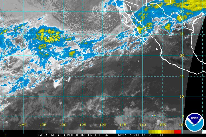
0 likes   

User avatar
Chacor
Category 5
Category 5
Posts: 10229
Joined: Mon Oct 02, 2006 10:43 pm
Location: Singapore

#4 Postby Chacor » Fri Jun 13, 2008 7:54 am

ABPZ20 KNHC 131132
TWOEP
TROPICAL WEATHER OUTLOOK
NWS TPC/NATIONAL HURRICANE CENTER MIAMI FL
500 AM PDT FRI JUN 13 2008

FOR THE EASTERN NORTH PACIFIC...EAST OF 140 DEGREES WEST LONGITUDE..

A DISORGANIZED AREA OF DISTURBED WEATHER IS LOCATED ABOUT 700 MILES
SOUTH-SOUTHWEST OF THE GULF OF TEHUANTEPEC. ANY DEVELOPMENT IS
EXPECTED TO BE SLOW TO OCCUR AS THIS SYSTEM MOVES SLOWLY TO THE
WEST OR WEST-NORTHWEST.

ELSEWHERE...TROPICAL CYCLONE FORMATION IS NOT EXPECTED DURING THE
NEXT 48 HOURS.

FORECASTER BROWN
0 likes   

User avatar
KWT
Category 5
Category 5
Posts: 31415
Joined: Tue Aug 17, 2004 11:02 am
Location: UK!!!

#5 Postby KWT » Fri Jun 13, 2008 7:56 am

Looks to me that the orgnial area that they were watching has decayed quite a bit on the northern side and now the best looking portion is probably attached to the ITCZ anyway.
0 likes   

User avatar
Tampa_God
Category 1
Category 1
Posts: 333
Age: 35
Joined: Wed May 31, 2006 7:27 pm
Location: New Port Richey/Trinity, FL

Re: Eastern Pacific Convection

#6 Postby Tampa_God » Sat Jun 14, 2008 8:13 pm

Anything on that nice area of convention and rotation out there? Invest maybe?
0 likes   

User avatar
Meso
Category 5
Category 5
Posts: 1609
Age: 38
Joined: Mon Aug 09, 2004 12:14 pm
Location: South Africa
Contact:

#7 Postby Meso » Sun Jun 15, 2008 4:45 am

Not yet,but almost all the models are showing something developing soon..Including the euro
0 likes   

User avatar
KWT
Category 5
Category 5
Posts: 31415
Joined: Tue Aug 17, 2004 11:02 am
Location: UK!!!

#8 Postby KWT » Wed Jun 18, 2008 12:49 pm

Well I think this thread needs to be bumped because the ITCZ has come alive in the EPAC, plenty of deep convection present between 10-15N at the moment which may need watching eventually. Not being watched by the TWO yet but if anywhere becomes better established it may need to be watched.
0 likes   

tolakram
Admin
Admin
Posts: 20017
Age: 62
Joined: Sun Aug 27, 2006 8:23 pm
Location: Florence, KY (name is Mark)

Re: Eastern Pacific Convection

#9 Postby tolakram » Wed Jun 18, 2008 12:53 pm

Yea, Northwest of 10,100 and under very low shear.

Image
0 likes   

User avatar
KWT
Category 5
Category 5
Posts: 31415
Joined: Tue Aug 17, 2004 11:02 am
Location: UK!!!

#10 Postby KWT » Wed Jun 18, 2008 12:56 pm

Low shear is very interesting, if anything can get going then no reason why it wouldn't strengthen. ECM showing a system forming in about 120-144hrs in the EPAC, maybe out of the ITCZ mess we have at the moment.
0 likes   

User avatar
Meso
Category 5
Category 5
Posts: 1609
Age: 38
Joined: Mon Aug 09, 2004 12:14 pm
Location: South Africa
Contact:

#11 Postby Meso » Wed Jun 18, 2008 2:36 pm

There was stacks of model support for developement yesterday and the day before but most models seem to be backing down.Euro does show something developing around 200 hours now though
0 likes   

User avatar
Meso
Category 5
Category 5
Posts: 1609
Age: 38
Joined: Mon Aug 09, 2004 12:14 pm
Location: South Africa
Contact:

#12 Postby Meso » Thu Jun 19, 2008 1:59 am

The models are back to liking this idea
Image
0 likes   

User avatar
KWT
Category 5
Category 5
Posts: 31415
Joined: Tue Aug 17, 2004 11:02 am
Location: UK!!!

#13 Postby KWT » Thu Jun 19, 2008 4:42 am

It seems like the models want to try and develop something in the EPAC but hasn't really focused on one area for development any time soon. Still just a mess of convection out there.
0 likes   

User avatar
Meso
Category 5
Category 5
Posts: 1609
Age: 38
Joined: Mon Aug 09, 2004 12:14 pm
Location: South Africa
Contact:

#14 Postby Meso » Fri Jun 20, 2008 4:04 pm

Image
Image
0 likes   

User avatar
KWT
Category 5
Category 5
Posts: 31415
Joined: Tue Aug 17, 2004 11:02 am
Location: UK!!!

#15 Postby KWT » Fri Jun 20, 2008 5:01 pm

Still quite a while out but the ECM has been pretty consitant in developing a EPAC system so we shall see eventually.
0 likes   

User avatar
Meso
Category 5
Category 5
Posts: 1609
Age: 38
Joined: Mon Aug 09, 2004 12:14 pm
Location: South Africa
Contact:

#16 Postby Meso » Fri Jun 20, 2008 5:16 pm

Image

000
ABPZ20 KNHC 201730
TWOEP
TROPICAL WEATHER OUTLOOK
NWS TPC/NATIONAL HURRICANE CENTER MIAMI FL
1100 AM PDT FRI JUN 20 2008

FOR THE EASTERN NORTH PACIFIC...EAST OF 140 DEGREES WEST LONGITUDE..

TROPICAL CYCLONE FORMATION IS NOT EXPECTED DURING THE NEXT 48 HOURS.

AN AREA OF DISTURBED WEATHER IS LOCATED ABOUT 750 MILES SOUTH-
SOUTHWEST OF THE SOUTHERN TIP OF BAJA CALIFORNIA. DEVELOPMENT...IF
ANY...OF THIS SYSTEM IS EXPECTED TO BE SLOW TO OCCUR.

$$
FORECASTER PASCH
0 likes   

User avatar
Thunder44
Category 5
Category 5
Posts: 5922
Age: 44
Joined: Mon Jun 09, 2003 7:53 pm
Location: New York City

Re: Eastern Pacific Convection

#17 Postby Thunder44 » Sat Jun 21, 2008 6:57 am

93E.Invest is up:

Image

http://www.nrlmry.navy.mil/tc_pages/tc_home.html

ZCZC MIATWOEP ALL
TTAA00 KNHC DDHHMM
TROPICAL WEATHER OUTLOOK
NWS TPC/NATIONAL HURRICANE CENTER MIAMI FL
500 AM PDT SAT JUN 21 2008

FOR THE EASTERN NORTH PACIFIC...EAST OF 140 DEGREES WEST LONGITUDE..

1. THUNDERSTORM ACTIVITY CONTINUES IN ASSOCIATION WITH THE SMALL AREA
OF LOW PRESSURE LOCATED ABOUT 800 MILES SOUTH-SOUTHWEST OF THE
SOUTHERN TIP OF BAJA CALIFORNIA. ALTHOUGH SOME LIMITED DEVELOPMENT
IS POSSIBLE OVER THE NEXT DAY OR TWO...THE SYSTEM IS EXPECTED TO
MOVE WEST-NORTHWESTWARD OVER THE NEXT FEW DAYS INTO AN AREA LESS
FAVORABLE FOR TROPICAL CYCLONE DEVELOPMENT.

ELSEWHERE...TROPICAL CYCLONE FORMATION IS NOT EXPECTED DURING THE
NEXT 48 HOURS.

$$
FORECASTER FRANKLIN
0 likes   

User avatar
Meso
Category 5
Category 5
Posts: 1609
Age: 38
Joined: Mon Aug 09, 2004 12:14 pm
Location: South Africa
Contact:

#18 Postby Meso » Sat Jun 21, 2008 2:06 pm

Image
Chooochoooo All aboard
0 likes   

User avatar
Meso
Category 5
Category 5
Posts: 1609
Age: 38
Joined: Mon Aug 09, 2004 12:14 pm
Location: South Africa
Contact:

#19 Postby Meso » Sun Jun 22, 2008 1:33 pm

Image

Again with the train
0 likes   

User avatar
KWT
Category 5
Category 5
Posts: 31415
Joined: Tue Aug 17, 2004 11:02 am
Location: UK!!!

#20 Postby KWT » Sun Jun 22, 2008 2:15 pm

Yep whilst 93E didn't do anything I woulsn't be surprised if we see another area of intrest given there is still some fairly deep convection present out there in the EPAC.
0 likes   


Return to “Talkin' Tropics”

Who is online

Users browsing this forum: No registered users and 37 guests