The next Cape Verde system
Moderator: S2k Moderators
Forum rules

The posts in this forum are NOT official forecasts and should not be used as such. They are just the opinion of the poster and may or may not be backed by sound meteorological data. They are NOT endorsed by any professional institution or STORM2K. For official information, please refer to products from the National Hurricane Center and National Weather Service.
-
x-y-no

- Category 5

- Posts: 8359
- Age: 65
- Joined: Wed Aug 11, 2004 12:14 pm
- Location: Fort Lauderdale, FL
The next Cape Verde system
Exiting the Africa coast today. The 12Z GFS develops this over the next few days, moving it WNW. Has it at approx. 16N 39W by day 6. I'm a little mystified that it doesn't take the track more northerly, since it has a mid-level low situated over it for much of the track. Seems it's influenced almost entirely by the low-level steering.
0 likes
-
Weatherfreak000
Re: The next Cape Verde system
Early September sure...but late September? Not a shot...anything that develops here at this time of the year is a Bermuda threat at best unless it sneaks into the Caribbean.
After looking at satellite im certainly not too impressed with the system...not seeing where the models are liking it and the Eastern Atlantic has been exceptionally harsh to all convective activity that has emerged off the ITCZ. A simple infrared loop will show you all convective activity immediately dissipates.
I suppose given that...if there is anything at all left of this wave when it reaches 20N i'll hop aboard. A very hostile Atlantic after Hurricane Ike...as of today we have fallen 2 storms behind 2004...7 behind 2005.
Of course it's worth noting everything changes quickly in the tropics...we've been in a Negative MJO and certainly that has contributed.
0 likes

-
cycloneye

- Admin

- Posts: 149777
- Age: 69
- Joined: Thu Oct 10, 2002 10:54 am
- Location: San Juan, Puerto Rico
Re: The next Cape Verde system
Looks good but lets see when it gets fully out and see what kind of favorable conditions it will have.

0 likes

-
captain east

- Tropical Storm

- Posts: 213
- Joined: Thu Aug 28, 2008 2:53 pm
- Location: South East Florida
Re: The next Cape Verde system
Ya, I noticed this one didn't instantly just go poof, though it could looking at what's been happening to all this tropical waves coming off the African coast recently. Anyways, the environment will come more favorable and this could do just about anything from a fish to a GOM monster to that Carolina hit JB has been stiring about.
0 likes
-
Gustywind

- Category 5
- Posts: 12334
- Joined: Mon Sep 03, 2007 7:29 am
- Location: Baie-Mahault, GUADELOUPE
Re:
HURAKAN wrote:
Shear should be low if it remains at a low latitude.
Absolutely and a decreasing trend seems on tape, at near term maybe?...given the latest shear map:
http://cimss.ssec.wisc.edu/tropic/real- ... g8sht.html
0 likes
-
cycloneye
- Admin
- Posts: 149777
- Age: 69
- Joined: Thu Oct 10, 2002 10:54 am
- Location: San Juan, Puerto Rico
Re: The next Cape Verde system
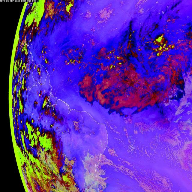
Convection has waned,but if you look closely,there is a hint of a tiny circulation in the low to mid level clouds around 20w and below 10n.

0 likes
-
cycloneye
- Admin
- Posts: 149777
- Age: 69
- Joined: Thu Oct 10, 2002 10:54 am
- Location: San Juan, Puerto Rico
Re: The next Cape Verde system
Wow,that is very far sourh where ssd has the weak low.
20/1145 UTC 4.3N 20.8W TOO WEAK INVEST -- Atlantic Ocean
http://www.ssd.noaa.gov/PS/TROP/positions.html
20/1145 UTC 4.3N 20.8W TOO WEAK INVEST -- Atlantic Ocean
http://www.ssd.noaa.gov/PS/TROP/positions.html
0 likes

-
Gustywind
- Category 5
- Posts: 12334
- Joined: Mon Sep 03, 2007 7:29 am
- Location: Baie-Mahault, GUADELOUPE
Re: The next Cape Verde system
cycloneye wrote:Wow,that is very far sourh where ssd has the weak low.
20/1145 UTC 4.3N 20.8W TOO WEAK INVEST -- Atlantic Ocean
http://www.ssd.noaa.gov/PS/TROP/positions.html

0 likes
-
Weatherfreak000

-
Weatherfreak000
-
Gustywind
- Category 5
- Posts: 12334
- Joined: Mon Sep 03, 2007 7:29 am
- Location: Baie-Mahault, GUADELOUPE
Re:
HURAKAN wrote:20/1745 UTC 3.9N 22.1W TOO WEAK INVEST
Further south!
It's a mistake, or a joke?
http://cimss.ssec.wisc.edu/tropic/real-tim e/atlantic/winds/wg8sht.html
At this latitude if this continues with convection or not, difficult to find the power of Coriolis, or it could be a future Ivan?
0 likes


-
HURAKAN

- Professional-Met

- Posts: 46084
- Age: 39
- Joined: Thu May 20, 2004 4:34 pm
- Location: Key West, FL
- Contact:
TROPICAL WEATHER DISCUSSION
NWS TPC/NATIONAL HURRICANE CENTER MIAMI FL
805 PM EDT SAT SEP 20 2008
...TROPICAL WAVES...
TROPICAL WAVE IS ALONG 21W/22W S OF 10N MOVING W NEAR 10-15 KT
BASED ON THE SATELLITE IMAGERY AND A RECENT PASS OF QUIKSCAT. A
MID LEVEL LOW IS ALONG THE WAVE AXIS NEAR 5N. A BROAD AREA OF
CLOUDINESS WITH EMBEDDED SHOWERS COVERS THE AREA FROM THE
EQUATOR TO 14N BETWEEN 16W-27W. SCATTERED MODERATE CONVECTION IS FROM 8N-11N BETWEEN 21W-24W.
0 likes
-
Category 5

- Category 5
- Posts: 10074
- Age: 36
- Joined: Sun Feb 11, 2007 10:00 pm
- Location: New Brunswick, NJ
- Contact:
Re: The next Cape Verde system
Can whoever is posting images causing this box to pop up on my screen please not post them.
The server http://www.sat.dundee.ac.uk at Dundee Satellite Receiving Station requires a username and password.
Warning: This server is requesting that your username and password be sent in an insecure manner (basic authentication without a secure connection).
The server http://www.sat.dundee.ac.uk at Dundee Satellite Receiving Station requires a username and password.
Warning: This server is requesting that your username and password be sent in an insecure manner (basic authentication without a secure connection).
0 likes
Who is online
Users browsing this forum: OuterBanker, wwizard and 165 guests