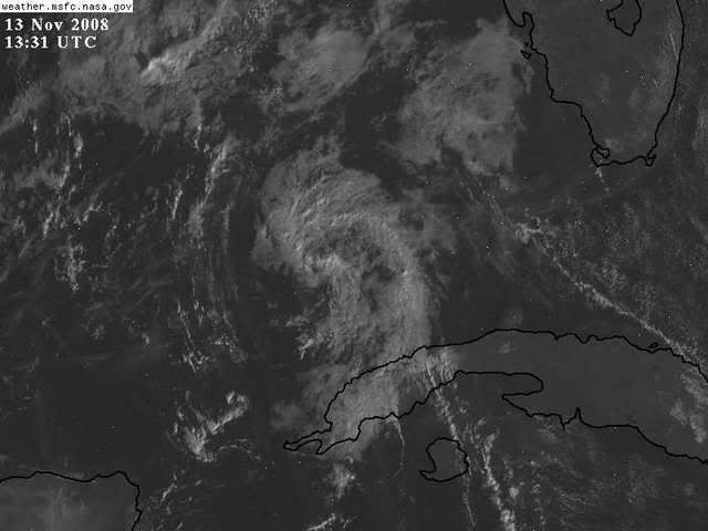
Moving WNW towards the Gulf of Mexico
The low level wind flow and approaching front will pull this into
the southern gulf of mexico, allowing it to enhance rain along the front.
I am posting this because Last Year Olga's remnants combined with a
front and brought hurricane force winds to the Tampa Bay Area. I am
not expected that as of yet, but with the horizontal temperature gradient
of 25 degrees about the front, rapid intense baroclinic enhancement is likely which
may lead to future deepening of a combined Paloma-remnant circulation
and squall line this weekend for the Eastern Gulf. GFS runs indicate numerous
isobars close to each other about the front, indicative of the potential
for damaging winds in the squalls of the frontal passage, and of a very deep
baroclinic winter storm over the Southeast US, that may briefly start off as a hybrid
subtropical or winter storm in the Gulf.


http://moe.met.fsu.edu/cgi-bin/gfstc2.c ... =Animation