The posts in this forum are NOT official forecasts and should not be used as such. They are just the opinion of the poster and may or may not be backed by sound meteorological data. They are NOT endorsed by any professional institution or STORM2K. For official information, please refer to products from the National Hurricane Center and National Weather Service.
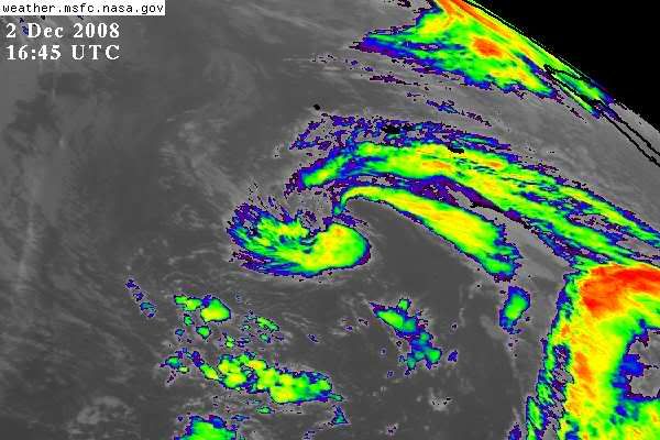
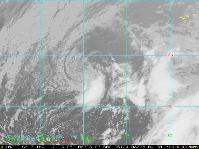
A LARGE-SCALE DEEP LAYER TROUGH COVERS THE CENTRAL ATLC WITH AN UPPER LOW CENTERED NEAR 29N38W. BROAD CYCLONIC SURFACE FLOW IS OBSERVED BETWEEN 25W-47W WITH ONE 1013 MB SURFACE LOW NEAR 29N40W AND ANOTHER 1012 MB SURFACE LOW N OF THE AREA NEAR 34N33W. A SURFACE TROUGH CURVES FROM THIS LOW TO 32N31W TO 27N30W AND SW TO NEAR 11N47W. SCATTERED SHOWERS AND POSSIBLE ISOLATED TSTMS ARE WITHIN 250 NM ON EITHER SIDE OF THE TROUGH