Development between Africa and Lesser Antilles (6/28 - 7/4)

This is the general tropical discussion area. Anyone can take their shot at predicting a storms path.

Moderator: S2k Moderators

Forum rules

The posts in this forum are NOT official forecasts and should not be used as such. They are just the opinion of the poster and may or may not be backed by sound meteorological data. They are NOT endorsed by any professional institution or STORM2K. For official information, please refer to products from the National Hurricane Center and National Weather Service.

Help Support Storm2K
Message
Author
User avatar
cycloneye
Admin
Admin
Posts: 145604
Age: 68
Joined: Thu Oct 10, 2002 10:54 am
Location: San Juan, Puerto Rico

Development between Africa and Lesser Antilles (6/28 - 7/4)

#1 Postby cycloneye » Wed Jun 24, 2009 8:08 am

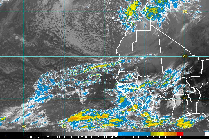
If you are following the Long / Medium Range models thread,some models especially GFS are showing some sort of Tropical Development in the Tropical Atlantic or (MDR) area between Africa and the Lesser Antilles.Lets see what happens,first if more models join the GFS and second,if there is an actual strong tropical wave in the charts to follow it.For now is a wait and see situation.

Some talk about this by the NWS San Juan office.

NO SIGNIFICANT TROPICAL WAVES IN SIGHT OR IS EXPECTED
TO AFFECT LOCAL AREA AT LEAST UNTIL THE BEGINNING OF NEXT MONTH...
WHEN THE LONG TERM GFS MODEL GUIDANCE SUGGEST AN ACTIVE TROPICAL
WAVE TO ENTER THE EASTERN CARIBBEAN AND APPROACH THE REGION. THIS
HOWEVER IS A LONG WAYS OFF...AND DUE TO THE LONG TERM INCONSISTENCIES
OF THE MODEL GUIDANCE WILL HAVE TO WAIT AND SEE HOW THIS UNFOLDS WITH
TIME.

http://forecast.weather.gov/product.php ... glossary=1

Image
0 likes   

Ed Mahmoud

Re: Maybe an early Tropical Atlantic development next week?

#2 Postby Ed Mahmoud » Wed Jun 24, 2009 8:25 am

Image

Might be the blob on the South Coast of whatever they call the extension of Africa.

If you're keeping score at home, 12Z, 0Z and 6Z GFS all show something, NoGaps looks like it tries to develop something, but maybe not from this wave, but a wave a couple of days behind, Canadian and Euro don't seem to be enthusiastic.


GFS seems to suggest shear becomes rather favorable, and the screaming Westerlies to the North may help provide outflow.

Image
0 likes   

User avatar
WeatherLovingDoc
S2K Supporter
S2K Supporter
Posts: 453
Joined: Fri Sep 05, 2008 10:08 pm
Location: Washington D.C.

Re: Maybe an early Tropical Atlantic development next week?

#3 Postby WeatherLovingDoc » Wed Jun 24, 2009 8:27 am

Would that be the more ominous-looking wave which will come off at 10N that is of concern, rather than the current wave coming off at 20N?

My spouse is leaving for St. Kitts this weekend for most of the summer, so I have personal interest in the Caribbean. I'll be at home managing two driving age teens. :eek: Got to learn how to start up the generator too, as we have an electric sump pump and tend to loose electricity easily.
0 likes   

User avatar
cycloneye
Admin
Admin
Posts: 145604
Age: 68
Joined: Thu Oct 10, 2002 10:54 am
Location: San Juan, Puerto Rico

Re: Maybe an early Tropical Atlantic development next week?

#4 Postby cycloneye » Wed Jun 24, 2009 8:40 am

WeatherLovingDoc wrote:Would that be the more ominous-looking wave which will come off at 10N that is of concern, rather than the current wave coming off at 20N?

My spouse is leaving for St. Kitts this weekend for most of the summer, so I have personal interest in the Caribbean. I'll be at home managing two driving age teens. :eek: Got to learn how to start up the generator too, as we have an electric sump pump and tend to loose electricity easily.


You dont have to start to worry about this as,first,there is no tropical wave to track now,second,only GFS is the only model that has been agressive with this.Until we see a consensus of the global models,we can discount that model scenario.And third,climatology doesnt favor development in that part of the Atlantic at this time of the year.But as we know,the tropics many times brings surprises so the only thing to do at this point is to monitor the models and see if a wave emerges Africa in a strong way,in other words a wait and see game for now.
0 likes   

Ed Mahmoud

Re: Development between Africa and Lesser Antilles next week?

#5 Postby Ed Mahmoud » Wed Jun 24, 2009 8:44 am

Yeah, I wouldn't get too worried yet. I'm not even certain which wave the GFS latches on to, and either the NoGaps moves it much slower, or is seeing a different wave.

If anything interesting looks on the horizon, the professional mets will start contributing.
0 likes   

User avatar
cycloneye
Admin
Admin
Posts: 145604
Age: 68
Joined: Thu Oct 10, 2002 10:54 am
Location: San Juan, Puerto Rico

Re: Development between Africa and Lesser Antilles next week?

#6 Postby cycloneye » Wed Jun 24, 2009 9:11 am

GFS builds a anticyclone over this wave as it moves westward both in tandem.See loop below.

http://moe.met.fsu.edu/cgi-bin/gfstc2.c ... =Animation
0 likes   

User avatar
Macrocane
Category 5
Category 5
Posts: 4218
Age: 36
Joined: Sun May 24, 2009 5:35 pm
Location: El Salvador

Re: Development between Africa and Lesser Antilles next week?

#7 Postby Macrocane » Wed Jun 24, 2009 9:37 am

GFS develops that low between Africa and Antilles in about 7-8 days and Euro shows something in the caribbean in 9 to 10 days. Maybe it's the same system, but it is still on a unreliable long range. I agree we'll have to wait and see.
0 likes   

Ed Mahmoud

Re: Development between Africa and Lesser Antilles next week?

#8 Postby Ed Mahmoud » Wed Jun 24, 2009 11:35 am

No surface closed low at 168 hours, but a healthy looking low level vort max on new 12Z GFS


Image
0 likes   

User avatar
cycloneye
Admin
Admin
Posts: 145604
Age: 68
Joined: Thu Oct 10, 2002 10:54 am
Location: San Juan, Puerto Rico

Re: Development between Africa and Lesser Antilles next week?

#9 Postby cycloneye » Wed Jun 24, 2009 11:57 am

As I see the 12z GFS,its more reasonable in terms of no development east of 40w.But as the ssts warm west of 50w,that is where things may turn interesting.

It looks like a wet 4th of July weekend for the NE Caribbean.The question is,if there will be more than only wet?
0 likes   

User avatar
MGC
S2K Supporter
S2K Supporter
Posts: 5899
Joined: Sun Mar 23, 2003 9:05 pm
Location: Pass Christian MS, or what is left.

Re: Development between Africa and Lesser Antilles next week?

#10 Postby MGC » Wed Jun 24, 2009 12:30 pm

I doubt it. Just look at the sat picture of Africa, little if any waves are moving across the continent. Plus, a load of dust is blanketing the Atlantic. Tropical storm formation is not expected......MGC
0 likes   

Ed Mahmoud

Re: Development between Africa and Lesser Antilles next week?

#11 Postby Ed Mahmoud » Wed Jun 24, 2009 12:37 pm

Canadian, which develops almost everything, is quiet.


I believe the GFS wave in question just crossed 0º longitude at very low latitude.
0 likes   

User avatar
Gustywind
Category 5
Category 5
Posts: 12334
Joined: Mon Sep 03, 2007 7:29 am
Location: Baie-Mahault, GUADELOUPE

Re: Maybe an early Tropical Atlantic development next week?

#12 Postby Gustywind » Wed Jun 24, 2009 12:37 pm

cycloneye wrote:
WeatherLovingDoc wrote:Would that be the more ominous-looking wave which will come off at 10N that is of concern, rather than the current wave coming off at 20N?

My spouse is leaving for St. Kitts this weekend for most of the summer, so I have personal interest in the Caribbean. I'll be at home managing two driving age teens. :eek: Got to learn how to start up the generator too, as we have an electric sump pump and tend to loose electricity easily.


You dont have to start to worry about this as,first,there is no tropical wave to track now,second,only GFS is the only model that has been agressive with this.Until we see a consensus of the global models,we can discount that model scenario.And third,climatology doesnt favor development in that part of the Atlantic at this time of the year.But as we know,the tropics many times brings surprises so the only thing to do at this point is to monitor the models and see if a wave emerges Africa in a strong way,in other words a wait and see game for now.

Excellent analysis as usual Luis, 100% agree, and for my part you're right. Hey one word like : wait and see what happens, way too early for any speculation! Whereas i want to see more consistency about all the models...after that we should have a better idea about this possible " feature".
0 likes   

Ed Mahmoud

Re: Development between Africa and Lesser Antilles next week?

#13 Postby Ed Mahmoud » Wed Jun 24, 2009 12:50 pm

NOGAPS, I think, is seeing the same feature exiting Africa, and not only seems to build an anticyclone over it, has a mini-jet streak on the Northwest side of the anticyclone that should enhance upward motion.

Image


Anybody got the link to the Navy website's display of the NoGaps?
0 likes   

User avatar
cycloneye
Admin
Admin
Posts: 145604
Age: 68
Joined: Thu Oct 10, 2002 10:54 am
Location: San Juan, Puerto Rico

Re: Development between Africa and Lesser Antilles next week?

#14 Postby cycloneye » Wed Jun 24, 2009 1:51 pm

It looks like what GFS is trying to show some development is from that convection area in Western Africa.

Image
0 likes   

floridasun78
Category 5
Category 5
Posts: 3755
Joined: Sun May 17, 2009 10:16 pm
Location: miami fl

Re: Development between Africa and Lesser Antilles next week?

#15 Postby floridasun78 » Wed Jun 24, 2009 2:16 pm

let see if it right gfs we could have strong wave in central altantic by sunday so let see if wave make it off afica ok and donot get kill by shear by than
0 likes   

Ed Mahmoud

Re: Development between Africa and Lesser Antilles next week?

#16 Postby Ed Mahmoud » Wed Jun 24, 2009 2:32 pm

Looking at the ECMWF site for Africa and North America, not seeing much.

Looks like an impressive trade wind surge in the SW Caribbean on July 3rd, likely an affect of the South American heat low, but nothing tropical cyclone-ish looking.

Image
0 likes   

User avatar
cycloneye
Admin
Admin
Posts: 145604
Age: 68
Joined: Thu Oct 10, 2002 10:54 am
Location: San Juan, Puerto Rico

Re: Development between Africa and Lesser Antilles next week?

#17 Postby cycloneye » Wed Jun 24, 2009 2:37 pm

Ed,you had to look at the SouthAmerica section to see all the Tropical Atlantic towards Africa.The EURO has two impulses,the first one weakens at around 40w,and the second one mantains by the end of run.Both are more north in latitud than what GFS shows.See loop below.

12z ECMWF
0 likes   

User avatar
KWT
Category 5
Category 5
Posts: 31415
Joined: Tue Aug 17, 2004 11:02 am
Location: UK!!!

#18 Postby KWT » Wed Jun 24, 2009 3:29 pm

I'll be very surprised if anything comes of this, still too early for anything like this to be of any threat, may get a decent wave but I'll be surprised if it becomes anything else.
0 likes   

Ed Mahmoud

Re: Development between Africa and Lesser Antilles next week?

#19 Postby Ed Mahmoud » Wed Jun 24, 2009 3:41 pm

If it does stay near or South of 10ºN, it would over water warm enough.

Image

The SAL looks pretty robust, however. Maybe the first little wave can clear it out.

Image

Low level convergence looks pretty muddled, but shear is fairly light between 0 and 10ºN (of course, Mr. Coriolis doesn't work well too close to 0º) and there is upper divergence.

Image


I am officially, in an unofficial way, interested, but not excited yet.
0 likes   

User avatar
MGC
S2K Supporter
S2K Supporter
Posts: 5899
Joined: Sun Mar 23, 2003 9:05 pm
Location: Pass Christian MS, or what is left.

Re: Development between Africa and Lesser Antilles next week?

#20 Postby MGC » Wed Jun 24, 2009 7:25 pm

That SAL over the Atlantic will eat anything that comes off Africa....MGC
0 likes   


Return to “Talkin' Tropics”

Who is online

Users browsing this forum: jhpigott, JtSmarts, weatherwindow and 76 guests