The Best of LBAR 2008

This is the general tropical discussion area. Anyone can take their shot at predicting a storms path.

Moderator: S2k Moderators

Forum rules

The posts in this forum are NOT official forecasts and should not be used as such. They are just the opinion of the poster and may or may not be backed by sound meteorological data. They are NOT endorsed by any professional institution or STORM2K. For official information, please refer to products from the National Hurricane Center and National Weather Service.

Help Support Storm2K
Message
Author
User avatar
Category 5
Category 5
Category 5
Posts: 10074
Age: 35
Joined: Sun Feb 11, 2007 10:00 pm
Location: New Brunswick, NJ
Contact:

The Best of LBAR 2008

#1 Postby Category 5 » Mon Aug 03, 2009 9:29 pm

the 4th annual, its late, very late, very very late, but while I was tied up with my first semester it slipped my mind until just now.

Also due to starting college, my time collecting them was very limited so I only have 2, feel free to add some.

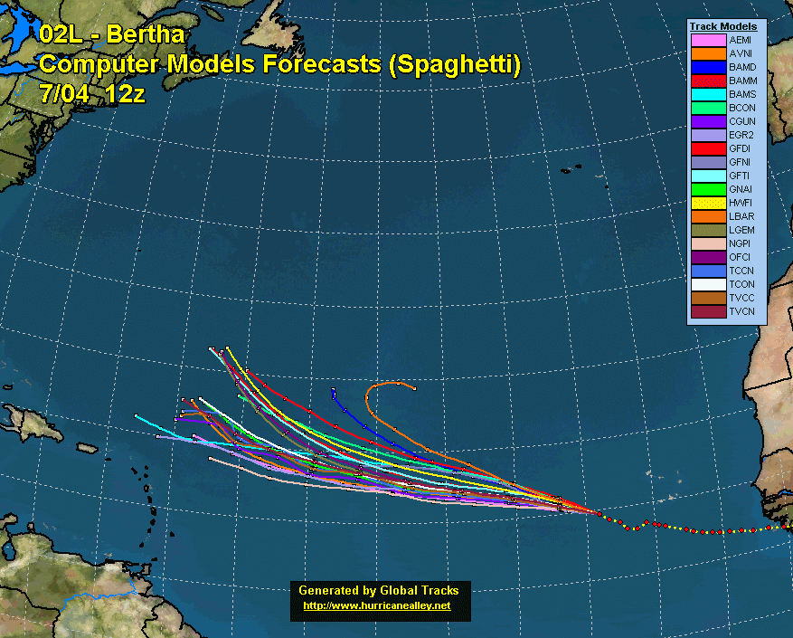
Image

Image
0 likes   

User avatar
wxman57
Moderator-Pro Met
Moderator-Pro Met
Posts: 22984
Age: 67
Joined: Sat Jun 21, 2003 8:06 pm
Location: Houston, TX (southwest)

Re: The Best of LBAR 2008

#2 Postby wxman57 » Tue Aug 04, 2009 2:55 pm

Or this one. Yeah, right, Ike is going to hit the upper TX coast. All the good models say south TX:

http://euler.atmos.colostate.edu/~vigh/ ... _early.png
Last edited by wxman57 on Tue Aug 04, 2009 4:33 pm, edited 1 time in total.
0 likes   

User avatar
Ptarmigan
Category 5
Category 5
Posts: 5316
Joined: Wed Aug 16, 2006 9:06 pm

Re: The Best of LBAR 2008

#3 Postby Ptarmigan » Tue Aug 04, 2009 3:54 pm

wxman57 wrote:Or this one. Yeah, right, Ike is going to hit the upper TX coast. All the good models say south TX:

Image


Yeah, that Ike. It ended in the Houston area. :eek:
0 likes   


Return to “Talkin' Tropics”

Who is online

Users browsing this forum: jhpigott, JtSmarts, weatherwindow and 78 guests