
This sudden activity spike is reminding me of 2005.
Moderator: S2k Moderators


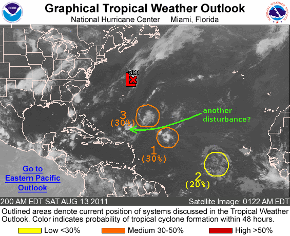
 . What interests me is the Caribbean wave that's interacting with the monsoon trough. Major convection firing down there, especially this morning and looks like it is lifting more W/NW than earlier. Probably slam into Nicaragua/Honduras, but think chances of a Caribbean brew are growing better and better as the month wears on.
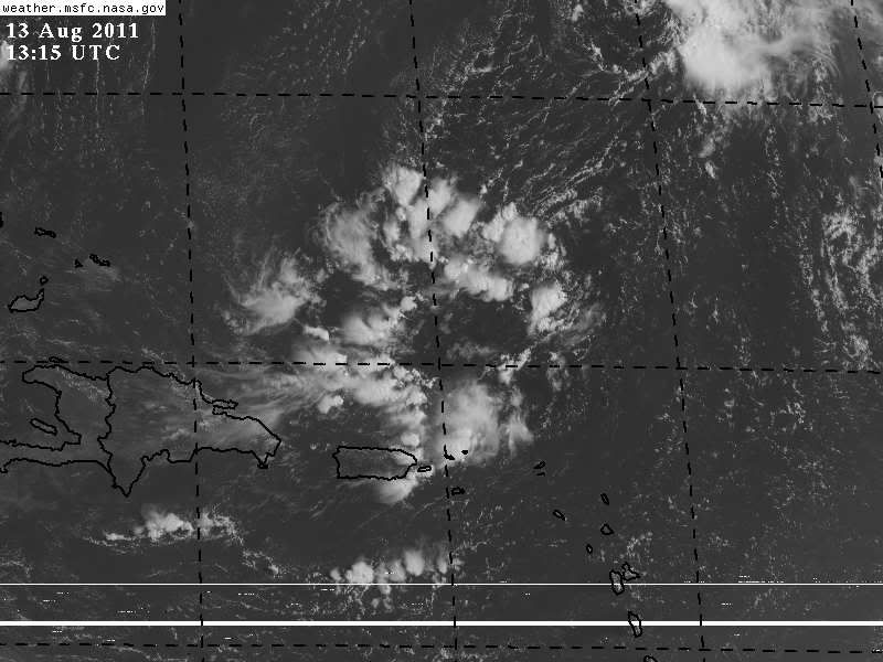


SouthDadeFish wrote:I think this should be tagged 96L. Starting to see some more rotation on visible imagery:
http://rammb.cira.colostate.edu/ramsdis ... _floater_2
I see N winds on the west side and S winds on the E side. Gotta keep an eye out for west winds.

scotto wrote:SouthDadeFish wrote:I think this should be tagged 96L. Starting to see some more rotation on visible imagery:
http://rammb.cira.colostate.edu/ramsdis ... _floater_2
I see N winds on the west side and S winds on the E side. Gotta keep an eye out for west winds.
I have been staring at this thing for quite some time and cannot see a rotation. Could you give me an idea of where you are seeing a spin. Thanks.
GCANE wrote:Something is developing maybe just above the surface.
Latest ASCAT doesn't show a surface low, but can see a well defined trough on that loop.
850mb vorticity continues to show this breaking off 94L.
SouthDadeFish wrote:Definitely seems worthy of being tagged invest 96L to me. GCANE, do you have any forecasts on this system?

Users browsing this forum: Ulf and 209 guests