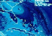
This shows it going thru the islands then GOM!
Moderator: S2k Moderators
Forum rules
The posts in this forum are NOT official forecasts and should not be used as such. They are just the opinion of the poster and may or may not be backed by sound meteorological data. They are NOT endorsed by any professional institution or STORM2K. For official information, please refer to products from the National Hurricane Center and National Weather Service.
- charleston_hugo_veteran
- S2K Supporter

- Posts: 1590
- Joined: Thu Sep 04, 2003 12:47 pm
- Location: Charleston, S.C.
This shows it going thru the islands then GOM!
deleted
Last edited by charleston_hugo_veteran on Sun Sep 07, 2003 4:45 pm, edited 1 time in total.
0 likes
-
ColdFront77
Charleston Hugo Veteran, what is it that you are referring to that the ETA model 48 hours out is indicating?
For the record: Hurricane Isabel was 2,747 miles from Miami, Florida as of the 5:00 PM EDT advisory.
One particular model shouldn't be used more than any other one, no matter how reliable it has been for a certain amount of time. Weather forecast models are used for guidance.
For the record: Hurricane Isabel was 2,747 miles from Miami, Florida as of the 5:00 PM EDT advisory.
One particular model shouldn't be used more than any other one, no matter how reliable it has been for a certain amount of time. Weather forecast models are used for guidance.
Last edited by ColdFront77 on Sun Sep 07, 2003 11:21 pm, edited 1 time in total.
0 likes
- charleston_hugo_veteran
- S2K Supporter

- Posts: 1590
- Joined: Thu Sep 04, 2003 12:47 pm
- Location: Charleston, S.C.
- wxman57
- Moderator-Pro Met

- Posts: 23120
- Age: 68
- Joined: Sat Jun 21, 2003 8:06 pm
- Location: Houston, TX (southwest)
Re: This shows it going thru the islands then GOM!
charleston_hugo_veteran wrote:http://weather.unisys.com/eta/4panel/eta_pres_4panel.html
Is this reliable?
That link is to the 48-hr ETA model showing Henri off the southeast U.S. coast. There's no Isabel in any frame. Did you post the wrong link?
0 likes
-
ColdFront77
charleston_hugo_veteran wrote:I was referring to the picture. I am not an expert and I am not trying to be! I was simply asking a question. Excuse me!
My sincere apologizes Charleston Hugo Veteran. I was kindly answering your question.
I by no means was intending to be rude, I am not like that; trust me. I want to better understand what you were looking at in that region. Thanks.
0 likes
Who is online
Users browsing this forum: No registered users and 92 guests


